Interoperability is a characteristic of a product or system to work with other products or systems. While the term was initially defined for information technology or systems engineering services to allow for information exchange, a broader definition takes into account social, political, and organizational factors that impact system-to-system performance.
The Organization for the Advancement of Structured Information Standards is a nonprofit consortium that works on the development, convergence, and adoption of projects - both open standards and open source - for Computer security, blockchain, Internet of things (IoT), emergency management, cloud computing, legal data exchange, energy, content technologies, and other areas.

The interplanetary Internet is a conceived computer network in space, consisting of a set of network nodes that can communicate with each other. These nodes are the planet's orbiters and landers, and the Earth ground stations. For example, the orbiters collect the scientific data from the Curiosity rover on Mars through near-Mars communication links, transmit the data to Earth through direct links from the Mars orbiters to the Earth ground stations via the NASA Deep Space Network, and finally the data routed through Earth's internal internet.
SpaceWire is a spacecraft communication network based in part on the IEEE 1355 standard of communications. It is coordinated by the European Space Agency (ESA) in collaboration with international space agencies including NASA, JAXA, and RKA.
In computer networking, out-of-band data is the data transferred through a stream that is independent from the main in-band data stream. An out-of-band data mechanism provides a conceptually independent channel, which allows any data sent via that mechanism to be kept separate from in-band data. The out-of-band data mechanism should be provided as an inherent characteristic of the data channel and transmission protocol, rather than requiring a separate channel and endpoints to be established. The term "out-of-band data" probably derives from out-of-band signaling, as used in the telecommunications industry.
The term Open Archival Information System refers to the ISO OAIS Reference Model for an OAIS. This reference model is defined by recommendation CCSDS 650.0-B-2 of the Consultative Committee for Space Data Systems; this text is identical to = 57284 ISO 14721:2012. The CCSDS's purview is space agencies, but the OAIS model it developed has proved useful to other organizations and institutions with digital archiving needs. OAIS, known as ISO 14721:2003, is widely accepted and utilized by various organizations and disciplines, both national and international, and was designed to ensure preservation. The OAIS standard, published in 2005, is considered the optimum standard to create and maintain a digital repository over a long period of time.
The Satellite Control and Operation System 2000 (SCOS-2000) is the generic satellite Mission Control System (MCS) software infrastructure developed and maintained by the European Space Agency (ESA/ESOC) in collaboration with European industry and deployed for missions such as Radarsat 2, XMM-Newton, INTEGRAL, Cryosat, Mars Express, Venus Express, GOCE, Herschel, Planck, Rosetta, Cryosat-2, Galileo, MetOp, LISA Pathfinder, SWARM, Gaia, SENTINEL spacecraft, EXOMARS orbiters, METEOSAT Third Generation, Aeolus, BepiColombo, SOLO or EUCLID. Upcoming missions that will deploy SCOS-2000 include MetOp-SG and EarthCARE.
The Spacecraft Monitoring & Control (SM&C) Working Group of the Consultative Committee for Space Data Systems (CCSDS), which sees the active participation of the main http://www.space.bas.bg/bg/procurement/files/pravilnik%20OP.PDF agencies, is defining a service-oriented architecture consisting of a set of standard end-to-end services between functions resident on board a spacecraft or based on the ground, that are responsible for mission operations.
The Spacecraft Monitoring & Control (SM&C) Working Group of the Consultative Committee for Space Data Systems, which sees the active participation of 10 space agencies and of the Space Domain Task Force of the Object Management Group, is defining a service-oriented architecture consisting of a set of standard end-to-end services between functions resident on board a spacecraft or based on the ground, that are responsible for mission operations.
Proximity-1 Space Link Protocol is a short haul delivery communications protocol designed to establish a two-way communications link between a lander and an orbiter, negotiate data rate and communications mode, and reliably deliver data during short orbiter-to-surface contacts.

Indian Deep Space Network (IDSN) is a network of large antennas and communication facilities operated by the Indian Space Research Organisation to support the interplanetary spacecraft missions of India. Its hub is located at Byalalu, Ramanagara in the state of Karnataka in India. It was built under the leadership of S K Shivakumar, the then ISTRAC Director and inaugurated on 17 October 2008 by the former ISRO chairman G. Madhavan Nair.
The beacon mode service is a Consultative Committee for Space Data Systems (CCSDS) telecommunications service aimed at spacecraft which are not communicated with via NASA's Deep Space Network. It is primarily designed to relay a spacecraft's "health" information, and secondarily its telecommunications status, using a simple signal that can be detected with a moderately-sized antenna. Beacon mode also enables spacecraft to communicate with one another on a daily basis, allowing for one spacecraft to act as a data proxy for another.

Svalbard Satellite Station or SvalSat is a satellite ground station located on Platåberget near Longyearbyen in Svalbard, Norway. Opened in 1997, it is operated by Kongsberg Satellite Services (KSAT), a joint venture between Kongsberg Defence & Aerospace and the Norwegian Space Centre (NSC). SvalSat and KSAT's Troll Satellite Station (TrollSat) in Antarctica are the only ground stations that can see a low altitude polar orbiting satellite on every revolution as the Earth rotates. As of 2021, the facility consists of 100 multi-mission and customer-dedicated antennas which operate in the C, L, S, X and K bands. The station provides ground services to more satellites than any other facility in the world.
The Spacecraft Monitoring & Control (SM&C) Working Group of the Consultative Committee for Space Data Systems, which sees the active participation of 10 space agencies and of the Space Domain Task Force of the Object Management Group, is defining a service oriented architecture consisting of a set of standard end-to-end services between functions resident on board a spacecraft or based on the ground, that are responsible for mission operations.
CCSDS File Delivery Protocol (CFDP) is a file transfer protocol for use in space, e.g. between Earth and spacecraft in Earth orbit or between Earth and spacecraft on interplanetary missions.

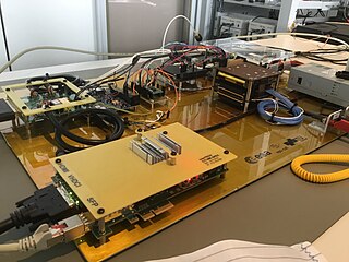
OPS-SAT was a CubeSat by the European Space Agency (ESA), intended to demonstrate the improvements in mission control capabilities that will arise when satellites can fly more powerful on-board computers. The mission had the objective to break the cycle of "has never flown, will never fly" in the area of satellite control. It was the first CubeSat operated directly by ESA.

A ground segment consists of all the ground-based elements of a space system used by operators and support personnel, as opposed to the space segment and user segment. The ground segment enables management of a spacecraft, and distribution of payload data and telemetry among interested parties on the ground. The primary elements of a ground segment are:

XTCE is an XML based data exchange format for spacecraft telemetry and command meta-data. Using XTCE the format and content of a space systems command and telemetry links can be readily exchanged between spacecraft operators and manufacturers. XTCE was originally standardized by the OMG. In April 2007 the OMG released revision 1.1 of XTCE as an OMG available specification. Version 1.0 of the XTCE specification is a CCSDS green-book specification and version 1.1 has been adopted as a CCSDS blue-book specification.
The NanoSat MO Framework (NMF) is an open-source software framework for small satellites based on CCSDS Mission Operations services.
Adrian Hooke was an aerospace telecommunications engineer, and a cofounder of the Consultative Committee for Space Data Systems.


