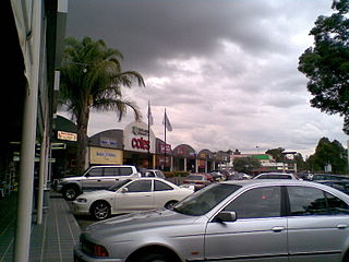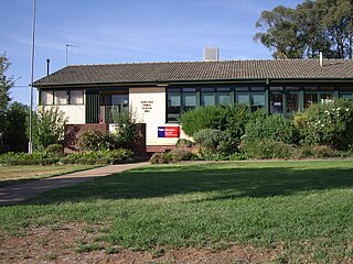
Tea Gardens is a locality in the Mid-Coast Council local government area, located near the southern extremity of the Mid North Coast and the northern extremity of the Hunter Region in New South Wales, Australia.

Baulkham Hills is a suburb in the Hills District of Greater Western Sydney, in the state of New South Wales, Australia. It is 31 kilometres north-west of the Sydney central business district within the local government area of The Hills Shire, with a small portion south of the M2 Motorway in the City of Parramatta. Baulkham Hills is the administrative seat of The Hills Shire, an outer metropolitan shire within Greater Sydney. The suburb is also the most populous within the Hills Shire. It is known colloquially as “Baulko”.

Kings Langley is a suburb of Sydney, in the state of New South Wales, Australia. Kings Langley is located 28.3 kilometres north-west in a straight line from the Sydney central business district. Kings Langley is part of Blacktown City local government area. Kings Langley is part of the Greater Western Sydney region and is sometimes referred to as part of the Hills District.

Denistone West is a suburb in Northern Sydney, in the state of New South Wales, Australia. Denistone West is located 16 kilometres north-west of the Sydney central business district in the local government area of the City of Ryde. Denistone and Denistone East are separate suburbs; Denistone West was gazetted as a suburb in its own right on 5 February 1999.

Collingullie is a village 26 kilometres (16 mi) north-west of Wagga Wagga in the Riverina region of New South Wales, Australia. The village is located on the Sturt Highway, between Wagga Wagga and Narrandera, at the crossroads with the road to Lockhart.

Glenworth Valley is a suburb of the Central Coast Council local government area in the Central Coast region of New South Wales, Australia. About 73 km (45 mi) north of Sydney and 20 km (12 mi) west of Gosford, at the 2016 census it had a population of 10 people. Popran Creek runs through the entire valley and rises in the locality of Central Mangrove and then flows for approximately 24 km in a mostly southern direction till it reaches Mangrove Creek.

Bowna is a locality in the South East part of the Riverina, New South Wales, Australia.

Kapooka is a suburb in the south-west of Wagga Wagga, New South Wales, Australia.

Tomago is a combined industrial/semi-rural suburb of the Port Stephens local government area in the Hunter Region of New South Wales, Australia. It is located just north of the Hunter River and west of the body of water known as Fullerton Cove. Tomago means "sweet water" in the local Aboriginal language. In 2016 277 lived in Tomago with a median age of 55, 72.7% born in Australia and 80.4% only speaking English at home.

Breeza is a locality in New South Wales, Australia. It is about 43 kilometres south of Gunnedah, in the Liverpool Plains agricultural region. The area around Breeza in particular is called the "Breeza Plains". The name "Breeza" may be derived from an Aboriginal word meaning "one hill".

Cullerin is a small township in the Southern Tablelands of New South Wales, Australia. It is on the Old Hume Highway and Main South railway line in Upper Lachlan Shire. The Cullerin railway station opened in 1880 and closed in 1973. At the 2016 census, it had a population of 38.

Nelsons Plains is a primarily rural suburb of the Port Stephens local government area in the Hunter Region of New South Wales, Australia. It is situated on Seaham Road between the Hunter and Williams rivers. At the 2016 census the suburb had a population of 362.
The Cordeaux River, a perennial river of the Hawkesbury-Nepean catchment, is located in the Southern Highlands and Macarthur regions of New South Wales, Australia.

Cleveland is a suburb of the City of Wollongong to the west of Dapto. At the 2016 census, it had a population of 21.

Huntley is a suburb of the City of Wollongong to the west of Dapto. At the 2016 census, it had a population of 50.

Queanbeyan West is a suburb of Queanbeyan, New South Wales, Australia. Queanbeyan West is located west of the central business district (CBD) and also borders the Australian Capital Territory, it is located south of Crestwood and Canberra Avenue and west of Tharwa Road. At the 2016 census, it had a population of 3,136.

Fernhill is a suburb west of Towradgi, in the City of Wollongong. At the 2016 census, it had a population of 1,023.

West Nowra is a suburb of Nowra in the City of Shoalhaven in New South Wales, Australia. It lies west of Nowra. At the 2016 census, it had a population of 1,406.

Rose Valley is a locality in the Municipality of Kiama, in the Illawarra region of New South Wales, Australia. It lies west of the Princes Highway to the west of Gerringong about 130 km south of Sydney. At the 2016 census, it had a population of 76. It had a public school from 1868 to 1877 and 1884 to 1904.

North Macquarie is a suburb of Wollongong in the City of Shellharbour in New South Wales, Australia, 4 km west of Albion Park.


