Cypress Park, Los Angeles

Last updated
Cypress Park
Map of Cypress Park neighborhood, Los Angeles, California.jpg
Boundaries of Cypress Park as drawn by the Los Angeles Times
Location map Los Angeles.png
Red pog.svg
Cypress Park
Location within Central Los Angeles
Coordinates: 34°05′35″N118°13′30″W / 34.09293°N 118.22504°W / 34.09293; -118.22504
Government
   City Council Eunisses Hernandez
   State Assembly Jesse Gabriel (D)
   State Senate Maria Elena Durazo (D)
   U.S. House Jimmy Gomez (D)

Cypress Park is a densely populated neighborhood of 10,000+ residents in Northeast Los Angeles, California. Surrounded by hills on three sides, it sits in the valley created by the Los Angeles River and the Arroyo Seco. It is the site of the Rio de Los Angeles State Park, the Los Angeles River Bike Path and other recreational facilities. It hosts one private and four public schools.

Contents

The area was settled as a Spanish rancho which, after the Mexican–American War, became the property of an American landowner. After his death, Cypress Park was subdivided and established as a community in 1882.

There are four Los Angeles Historic-Cultural Monuments in Cypress Park.

The area is currently[ as of? ] undergoing rapid to moderate gentrification due to its close proximity to Highland Park, Downtown and various transportation hubs.

Population

The 2000 U.S. census counted 9,764 residents in the 0,72-square-mile Cypress Park neighborhood—or 13,478 people per square mile, among the highest population densities for the city and the county. In 2008, the city estimated that the population had increased to 10,854. In 2000 the median age for residents was 27, considered young for city and county neighborhoods. [1]

The neighborhood was "not especially diverse" ethnically within Los Angeles, with the number of Latino people considered to be high compared to the city at large—82.1% of the population. Following were Asians, 11.1%; whites, 4.9%; blacks, 0.6%; and others, 1.3%. Mexico (73.2%) and China (6.3%) were the most common places of birth for the 52.5% of the residents who were born abroad—which was a high percentage compared to Los Angeles as a whole. [1]

The median yearly household income in 2008 dollars was $42,615, considered average for the city. Renters occupied 58.3% of the housing stock, and house- or apartment-owners held 41.7%. The average household size of 3.7 people was high for Los Angeles. The percentage of never-married females (51.8%) was among the county's highest. [1]

Geography

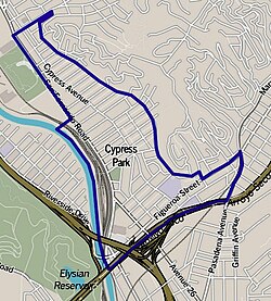
The neighborhood is situated at the confluence of the Los Angeles River and Arroyo Seco, less than 2.5 miles north of Downtown Los Angeles. It lies within a historic alluvial floodplain shared with the Elysian Valley neighborhood, which is bounded by Elysian Park and Mt. Washington.

History

The land on which Cypress Park currently occupies was first settled by the Tongva tribe of the Shoshone Native Americans. When Gaspar de Portolà and his expedition first encountered the Los Angeles River in August 1769 and described the area of the confluence of the Arroyo Seco as "a very lush green valley". The Pueblo de Los Angeles was later founded adjacent to this location.

The area was granted as Rancho San Rafael to Jose Maria Verdugo in October 1784. In 1859, Julio Verdugo sold the southern tip of the rancho to Jessie D. Hunter, who had first arrived in Los Angeles in 1847 as a Captain in the Mormon Battalion during the Mexican–American War. Hunter had previously acquired the Rancho Cañada de Los Nogales, which contains most of present-day Glassell Park. Hunter had established the first kiln-fired brickyard in Los Angeles, but sold it and took up farming when he acquired the rancho land.

After Hunter's death the land was subdivided as the Hunter Tract and, in 1882, Cypress Park became the first of the Arroyo Seco communities to come into existence, predating Highland Park by three years. [2]

Transportation

Lincoln/Cypress A Line (formerly Gold Line) station Lincoln Heights-Cypress Park Station LACMTA.jpg
Lincoln/Cypress A Line (formerly Gold Line) station

Cypress Park is served by two metro stations on the A Line (formerly Gold Line), the Lincoln Heights/Cypress Park Station located at W. Avenue 26/Lacy St. and Heritage Square/Arroyo Station located at French Ave./Marmion Way. It is also served by Metro Local bus lines 81, 90, 94, 182, & 251.

The neighborhood's main thoroughfares are Cypress Ave., San Fernando Rd., and North Figueroa St., and is served by the Golden State Freeway (Interstate 5) and Arroyo Seco Parkway (Highway 110), also known as the Pasadena Freeway.

In addition, Cypress Park has access to the southern end of the LA River Bike Path at the intersection of Figueroa and Interstate 5. The bike path follows the course of the river up to Burbank.

Parks

The neighborhood of Cypress Park sits at the river valley created by the confluence of the Los Angeles River and the Arroyo Seco. As a result, it's surrounded by hills on all sides with Elysian Park to the southwest, Mt Washington to the northeast, and Ernest E. Debs Park at the southeast side. Elysian Park is a city park that includes Dodger Stadium, hiking trails, view points and picnic areas. Ernest Debs Park is a regional park that includes picnic areas, hiking trails and the man-made Peanut Lake at the top of the hill. Mount Washington is a separate neighborhood with residential homes built around its winding hill sides.

The Rio de Los Angeles State Park is one of only two California State Recreation Areas in Los Angeles County. This 40-acre park included restored natural river wetlands, one of the first steps toward revitalization of the Los Angeles River. During the rainy season this part of the park floods, and during spring it becomes a prime location, in the City of Los Angeles, for wildflower viewing. Through a partnership with the City of Los Angeles Department of Parks and Recreation, the park also includes numerous sports fields, a children's playground and a recreation building. [3]

Los Angeles River Center and Gardens is located at the former site of Lawry's California Center. With over 6 acres (2.4 ha) of mission-style buildings and gardens, this complex is operated by the Santa Monica Mountains Conservancy and is host to numerous environmental non-profits, such as: Friends of the Los Angeles River, Northeast Trees, the Los Angeles Conservation Corps, LA Works, and the National Park Service Rivers, Trails and Conservation Assistance Program. The River Center gardens, as well as the adjacent River Garden Park, are open to the public during daylight hours; 570 W. Avenue 26. [4]

Cypress Park Recreation Center, at 2630 Pepper Avenue, is a public park with a baseball field, basketball courts, children's playground, and auditorium.

Cypress Park, Los Angeles- LA River Bike Path Entrance Cypress Park, Los Angeles- LA River Bike Path Entrance.jpg
Cypress Park, Los Angeles- LA River Bike Path Entrance

Greayer's Oak Park is a pocket park, named after World War I aviator Greayer Clover, located at the corner of N. Figueroa St. and Marmion Way.

Education

Just 8.4% of Cypress Park residents aged 25 and older had earned a four-year degree by 2000, a low figure for the city and the county. The percentage of residents with less than a high school diploma was high for the county. [1]

Schools within the Cypress Park borders are: [5]

Public

Private

Landmarks

Cypress Park has several historic-cultural monuments.

The Huron Substation Huron Substation.jpg
The Huron Substation

These include the Huron Substation (HCM No.404),a Los Angeles Railway traction power substation, built in 1906 and used until 1958 for the Yellow Car system. The Jeffries House (HCM No. 735) was built in 1911 for the brother of James J. Jeffries, boxing heavyweight Champion of the World, and is the last remaining house of this prominent family.

Cypress Park also includes the Nickel-Leong Mansion (HCM No.849), a large Antebellum-style, Greek Revival Mansion at Isabel Street and Thorpe Avenue. This house was built in 1905 for restaurateur Max Nickel and later owned by the Leong family of Chinatown. The house was designed by John C. Austin, a Los Angeles architect, who was one of the designers of Los Angeles City Hall, Griffith Observatory, and the Arroyo Seco Bank Building at Figueroa Street and York Boulevard.

Additionally, the Richard Henry Dana Branch (3320 Pepper Avenue, HCM No.1004), a former branch library of the Los Angeles Public Library, is #47 on the National Register of Historic Places in Los Angeles.

In the media

Cypress Park and businesses within it are frequently used as filming locations in feature films and music videos. The movies The Fast and the Furious , Catwoman , and Date Night as well as the television series Heroes filmed scenes in the Huron Substation. [6] Local bar Footsie's was used for the music video to the song "Live Your Life" by T.I., featuring Rihanna. [7] as well as the movie Bad Santa and the HBO series Barry.

Cypress Park branch, LAPL Cypress Park Branch Library, Los Angeles Public Library, California.jpg
Cypress Park branch, LAPL

Future

Cypress Park is in the beginning stages[ as of? ] of economic revitalization, having been noted by the Los Angeles City Council and Community Redevelopment Agency of Los Angeles (CRA/LA) to have potential for economic growth. The CRA/LA has included Cypress Park in two of its proposed redevelopment plans, the Northeast Los Angeles River Project and the Cornfield Arroyo Seco Redevelopment Project. [8] [9]

Cypress Park is becoming closely associated with the movement to revitalize the Los Angeles River, due to the Los Angeles River Center and Gardens and the Rio de Los Angeles State Park within its boundaries. [10]

To stem economic blight, the City Council in January 2010 approved an ordinance that banned any new auto-related businesses from opening in Cypress Park and Glassell Park. [11]

Related Research Articles

<span class="mw-page-title-main">Los Angeles River</span> River in Los Angeles County, California, US

The Los Angeles River, historically known as Paayme Paxaayt by the Tongva and the Porciúncula River by the Spanish, is a major river in Los Angeles County, California. Its headwaters are in the Simi Hills and Santa Susana Mountains, and it flows nearly 51 miles (82 km) from Canoga Park through the San Fernando Valley, Downtown Los Angeles, and the Gateway Cities to its mouth in Long Beach, where it flows into San Pedro Bay. While the river was once free-flowing and frequently flooding, forming alluvial flood plains along its banks, it is currently notable for flowing through a concrete channel on a fixed course, which was built after a series of devastating floods in the early 20th century.

<span class="mw-page-title-main">Arroyo Seco Parkway</span> Highway in California

The Arroyo Seco Parkway, also known as the Pasadena Freeway, is one of the oldest freeways built in the United States. It connects Los Angeles with Pasadena alongside the Arroyo Seco seasonal river. It is notable not only for being an early freeway, mostly opened in 1940, but for representing the transitional phase between early parkways and modern freeways. It conformed to modern standards when it was built, but is now regarded as a narrow, outdated roadway. A 1953 extension brought the south end to the Four Level Interchange in downtown Los Angeles and a connection with the rest of the freeway system.

<span class="mw-page-title-main">Interstate 110 and State Route 110 (California)</span> Interstate and state highway in California

Route 110, consisting of State Route 110 (SR 110) and Interstate 110 (I-110), is a state and auxiliary Interstate Highway in the Los Angeles metropolitan area of the US state of California. The entire route connects San Pedro and the Port of Los Angeles with Downtown Los Angeles and Pasadena. The southern segment from San Pedro to I-10 in downtown Los Angeles is signed as I-110, while the northern segment to Pasadena is signed as SR 110. The entire length of I-110, as well as SR 110 south of the Four Level Interchange with US Route 101 (US 101), is the Harbor Freeway, and SR 110 north from US 101 to Pasadena is the historic Arroyo Seco Parkway, the first freeway in the western United States.

<span class="mw-page-title-main">Highland Park, Los Angeles</span> Neighborhood of Los Angeles in California, United States

Highland Park is a neighborhood in Los Angeles, California, located in the city's Northeast region. It was one of the first subdivisions of Los Angeles and is inhabited by a variety of ethnic and socioeconomic groups.

<span class="mw-page-title-main">Colorado Boulevard</span> Major east–west street in Los Angeles County, Southern California

Colorado Boulevard is a major east–west street in Southern California. It runs from Griffith Park in Los Angeles east through Glendale, the Eagle Rock section of Los Angeles, Pasadena, and Arcadia, ending in Monrovia. The full route was once various state highways but is now locally maintained in favor of the parallel Ventura Freeway and Foothill Freeway (I-210).

<span class="mw-page-title-main">Arroyo Seco (Los Angeles County)</span> Seasonal watercourse and human settlement in US

The Arroyo Seco, meaning "dry stream" in Spanish, is a 24.9-mile-long (40.1 km) seasonal river, canyon, watershed, and cultural area in Los Angeles County, California. The area was explored by Gaspar de Portolà who named the stream Arroyo Seco as this canyon had the least water of any he had seen. During this exploration he met the Chief Hahamog-na (Hahamonga) of the Tongva Indians.

<span class="mw-page-title-main">Glassell Park, Los Angeles</span> Neighborhood of Los Angeles in California, USA

Glassell Park is a neighborhood of Northeast Los Angeles, California, in the San Rafael Hills.

<span class="mw-page-title-main">Elysian Park, Los Angeles</span> Neighborhood of Los Angeles in California, United States

Elysian Park is a neighborhood in Central Los Angeles, California. The city park, Elysian Park, and Dodger Stadium are within the neighborhood, as are an all-boys Catholic high school and an elementary school.

<span class="mw-page-title-main">Montecito Heights, Los Angeles</span> Neighborhood of Los Angeles in California, United States

Montecito Heights is a neighborhood in the Northeast Los Angeles region of Los Angeles, California. The population in 2000 was estimated at 16,768.

<span class="mw-page-title-main">Figueroa Street Tunnels</span> Series of freeway tunnels in Los Angeles, California

The Figueroa Street Tunnels are a set of four four-lane tunnels that carry northbound traffic on State Route 110 through Elysian Park in Los Angeles, California, United States. From south to north, the four tunnels measure 755, 461, 130, and 405 feet in length, 46.5 feet in width, and 28.3 ft in height.

<span class="mw-page-title-main">Figueroa Street</span> Street in Los Angeles County, California

Figueroa Street is a major north-south street in Los Angeles County, California, spanning from the Los Angeles neighborhood of Wilmington north to Eagle Rock. A short, unconnected continuation of Figueroa Street runs just south of Marengo Drive in Glendale to Chevy Chase Drive in La Cañada Flintridge.

<span class="mw-page-title-main">Hermon, Los Angeles</span> Neighborhood of Los Angeles in California, United States

Hermon is a neighborhood in the northeast area of Los Angeles. It was established in 1903 and became part of Los Angeles in 1912.

<span class="mw-page-title-main">San Fernando Road</span> Major street in the City and County Los Angeles

San Fernando Road is a major street in the City of Los Angeles and Los Angeles County. Within the Burbank city limits it is signed as San Fernando Boulevard, and north of Newhall Pass it is signed as The Old Road. It was previously designated as Business Loop 5 in the 1970s.

<span class="mw-page-title-main">Elysian Valley, Los Angeles</span> Neighborhood of Los Angeles in California, United States of America

Elysian Valley, commonly known as Frogtown, is a neighborhood in Central Los Angeles, California, adjoining the Los Angeles River. It has two parks, both maintained by the Mountains Recreation and Conservation Authority (MRCA). The Frogtown Art Walk is a biennial event managed by the Elysian Valley Arts Collective to celebrate local area artists. Knightsbridge Theatre is a repertory theater company located in the neighborhood.

<span class="mw-page-title-main">Southwest Museum station</span> Los Angeles Metro Rail station

Southwest Museum station is an at-grade light rail station on the A Line of the Los Angeles Metro Rail system. It is located near the intersection of Marmion Way at Museum Drive in the Mount Washington neighborhood of Los Angeles. The station opened on July 26, 2003, as part of the original Gold Line, then known as the "Pasadena Metro Blue Line" project.

<span class="mw-page-title-main">Garvanza, Los Angeles</span> Neighborhood of Los Angeles in California, United States

Garvanza is a neighborhood in northeast Los Angeles. Fourteen Los Angeles Historic-Cultural Monuments are located in the neighborhood.

<span class="mw-page-title-main">Riverside Drive (Los Angeles)</span>

Riverside Drive is a northeast–southwest road connecting the San Fernando Valley and Downtown Los Angeles, California. It follows the course of the Los Angeles River.

<span class="mw-page-title-main">Northeast Los Angeles</span> District in Los Angeles, California, United States

Northeast Los Angeles is a 17.18 sq mi (44.5 km2) region of Los Angeles County, comprising seven neighborhoods within the City of Los Angeles. The area is home to Occidental College located in Eagle Rock.

Lummis Day is a signature community arts and music event in the neighborhoods of Northeast Los Angeles, showcasing the community's considerable pool of musicians, poets, artists, dancers and restaurants representing a kaleidoscope of ethnicities and cultural traditions. Since 2014, Occidental College's Institute for the Study of Los Angeles has partnered with the Lummis Day Community Foundation to support cultural programming.

<span class="mw-page-title-main">Los Angeles River bicycle path</span> Cycling route in California, USA

The Los Angeles River bicycle path is a Class I bicycle and pedestrian path in the Greater Los Angeles area running from north to east along the Los Angeles River through Griffith Park in an area known as the Glendale Narrows. The 7.4 mile section of bikeway through the Glendale Narrows is known as the Elysian Valley Bicycle & Pedestrian Path. The bike path also runs from the city of Vernon to Long Beach, California. This section is referred to as LARIO, or more formally, the Los Angeles River Bikeway.

References

  1. 1 2 3 4 "Cypress Park," Mapping L.A., Los Angeles Times
  2. "Historic Cypress Park Archived 2011-07-25 at the Wayback Machine ." Charles J. Fisher, Highland Park Heritage Trust - Volume XIV, Issue 1. Retrieved 2010-12-01.
  3. "California State Parks" . Retrieved 2010-12-01.
  4. "LA River Center & Gardens". Archived from the original on 2010-11-25. Retrieved 2010-12-01.
  5. "Cypress Park Schools," Mapping L.A., Los Angeles Times
  6. "Huron Substation About Us". Archived from the original on 2013-01-25. Retrieved 2010-12-01.
  7. "Amoeba Music Neighborhood Blog" . Retrieved 2010-12-01.
  8. "CRA/LA NELA River Plan". Archived from the original on 2011-07-25. Retrieved 2010-12-01.
  9. "CRA/LA Cornfield Arroyo Seco Plan". Archived from the original on 2010-12-09. Retrieved 2010-12-01.
  10. "Los Angeles River Revitalization". The Los Angeles Times. Archived from the original on 2010-11-23. Retrieved 2010-12-01.
  11. "The Eastsider LA" . Retrieved 2010-12-01.

34°05′35″N118°13′30″W / 34.09293°N 118.22504°W / 34.09293; -118.22504