Rose Hills, Los Angeles

Last updated
Rose Hills
Rose Hills Neighborhood Sign.jpg
Rose Hills neighborhood sign
located at the intersection of
Huntington Drive and Collis Avenue
Location map Los Angeles.png
Red pog.svg
Rose Hills
Location within Central Los Angeles
Coordinates: 34°05′09″N118°11′27″W / 34.085943°N 118.190907°W / 34.085943; -118.190907
Country United States
State California
County Los Angeles
City Los Angeles
Government
   City Council José Huizar
   State Assembly Wendy Carrillo (D)
   State Senate Kevin de Leon (D)
   U.S. House Xavier Becerra (D)
Time zone UTC-8 (PST)
  Summer (DST) UTC-7 (PDT)
ZIP code
90032
Area code 323

Rose Hills is a neighborhood on the Eastside of Los Angeles.

Contents

History

The Rose Hills area is located near the original site of the Tongva village of Ochuunga, whose name derives from the Tongva language word for "wild rose." [1] [2]

The portions of the neighborhood west of Boundary Avenue lay in the land granted to the Pueblo de Los Angeles, but the portions east of Boundary did not. Historical reports and maps in archives indicate that Rose Hills was part of an 1839 Mexican land grant named "Rancho Rosa Castilla". The first recorded owner of the Rancho was Juan Ballesteros, registrar of the pueblo. After statehood, land claim #309 SD was filed in 1852 to confirm it. By the late 1850s the land had been transferred twice, and was owned by Anacleto Lestrade, priest at La Iglesia de Nuestra Señora la Reina de los Ángeles, the mission church of the Pueblo de Los Ángeles. One of the original 36 adobes in California stood on Rancho Rosa Castilla.

In 1902, the streetcars came to the neighborhood, running along what is now Huntington Drive. Many of the homes and buildings in the neighborhood were constructed between 1902 and 1930, including Huntington Drive School, originally built in 1909. The streets of Rose Hill north and west of Huntington bear the names of jewels, such as Amethyst, Tourmaline and Sardonyx.

Geography

In 2006, The Rose Hills Neighborhood and Community Alliance gathered signatures on a petition stating "the community of Rose Hills is requesting that our representative of the 14th District Council Office initiate a motion to request the City Council of Los Angeles to support the installation of additional community signs for recognition". [3] Letters of support were submitted by state senator Ed Hernandez, Our Lady of Guadalupe Church, the Los Angeles Public Library and others. [4] Historic newspaper articles using the Rose Hills name were also submitted. [5]

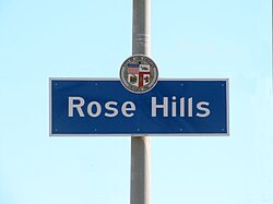
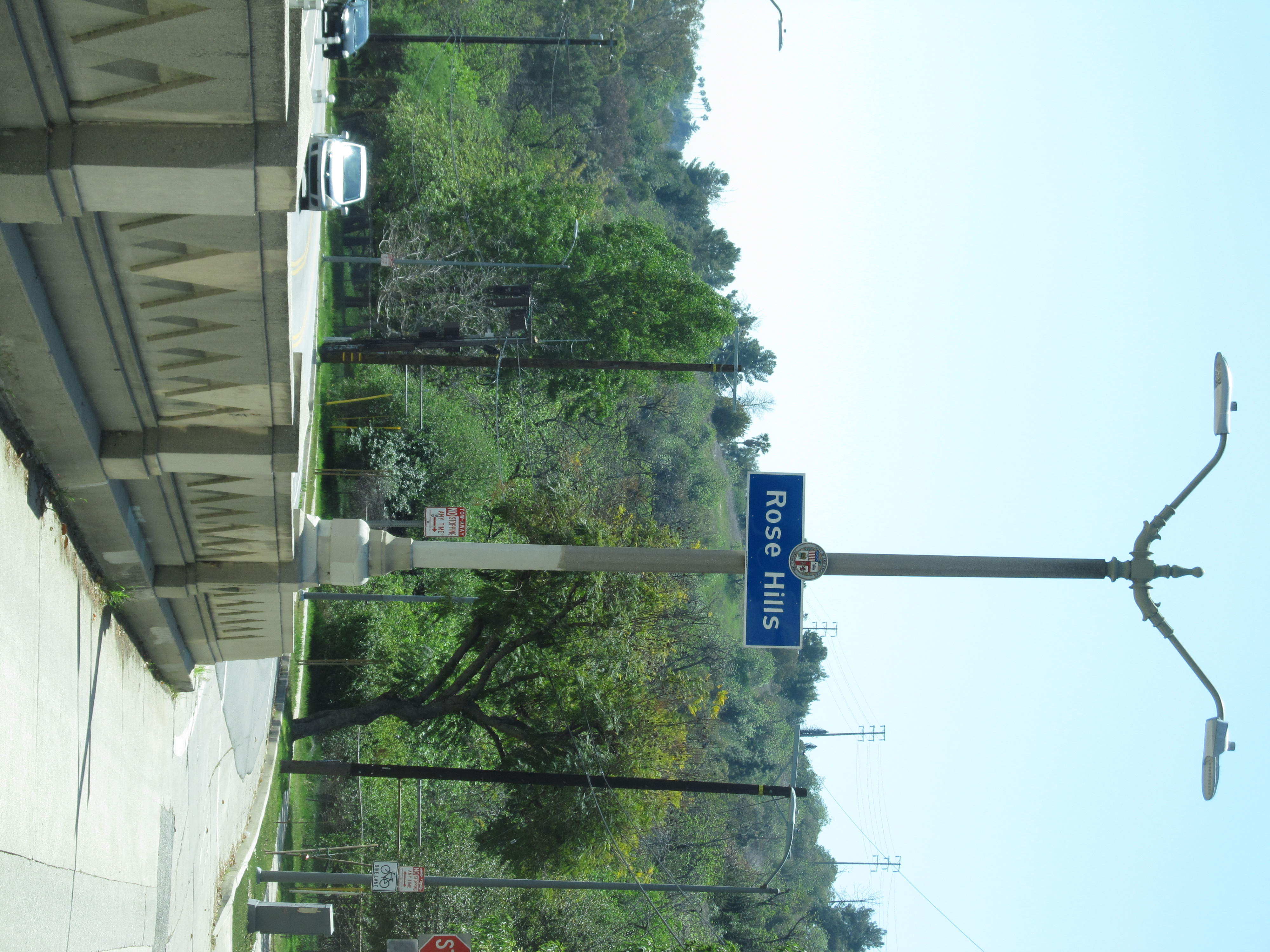
On September 12, 2013, city council issued a motion stating that "the community of Rose Hills has been in existence for hundreds of years". It noted that Rose Hills was among several communities surrounding El Sereno [6] and instructed the Department of Transportation to install five signs at the following locations: Monterey Road at the Monterey Road Pass, [7] Huntington Drive North and Collis Avenue, Soto Street and Mission Road, before the Soto Street Bridge, Mission Road and Broadway Place, and Mercury Avenue and Reynolds Avenue. [8]

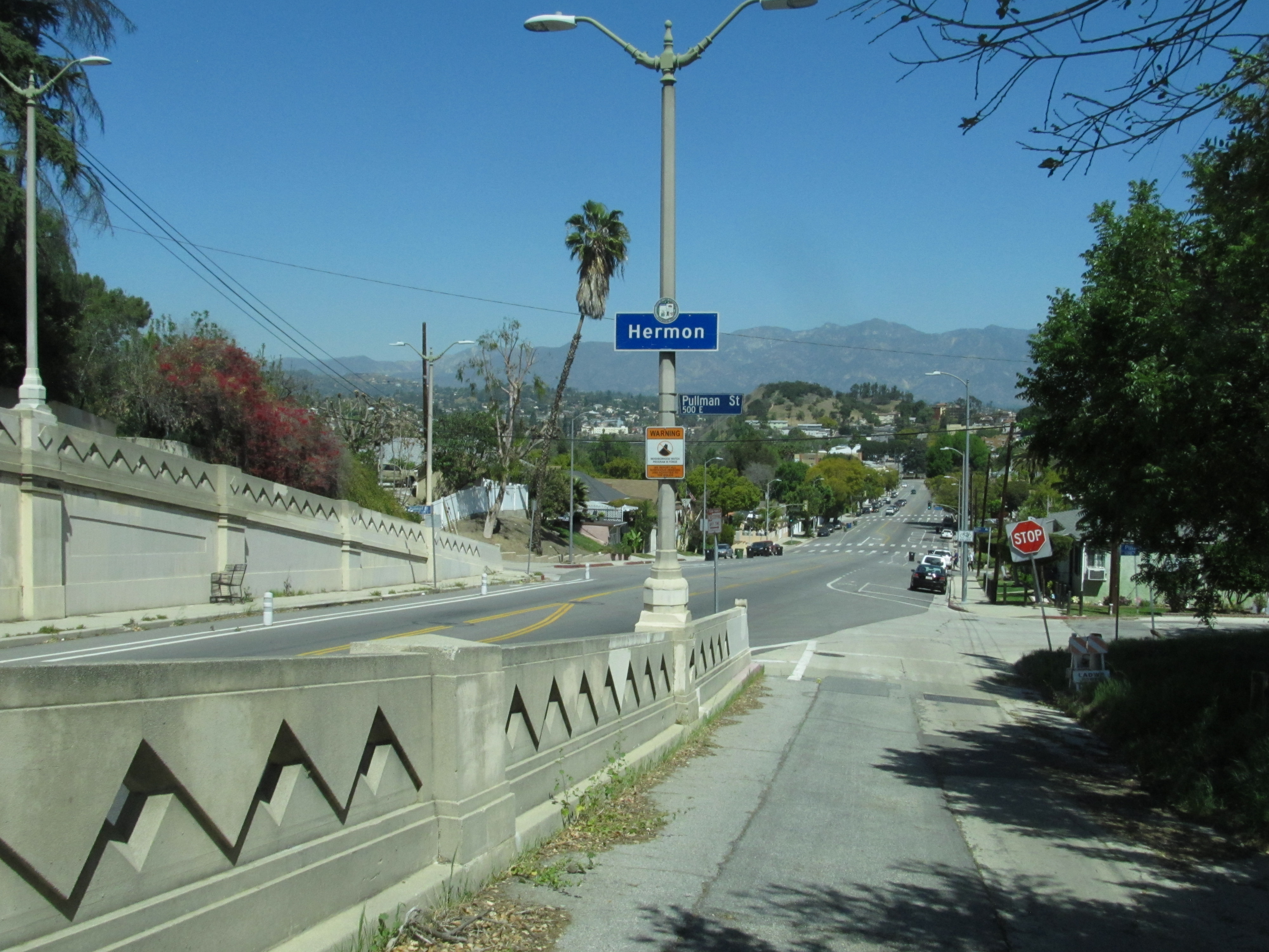
The neighborhood of Hermon is located to the north, with signage installed on the north side of the Monterey Road Pass [9]

Education

Parks and recreation

Related Research Articles

<span class="mw-page-title-main">Canoga Park, Los Angeles</span> Neighborhood of Los Angeles

Canoga Park is a neighborhood in the San Fernando Valley region of the City of Los Angeles, California. Before the Mexican–American War, the district was part of a rancho, and after the American victory it was converted into wheat farms and then subdivided, with part of it named Owensmouth as a town founded in 1912. It joined Los Angeles in 1917 and was renamed Canoga Park on March 1, 1931, after Canoga, New York.

<span class="mw-page-title-main">Eagle Rock, Los Angeles</span> Neighborhood of Los Angeles in California, United States of America

Eagle Rock is a neighborhood of Northeast Los Angeles, abutting the San Rafael Hills in Los Angeles County, California. The community is named after Eagle Rock, a large boulder whose shadow resembles an eagle. Eagle Rock was once part of the Rancho San Rafael under Spanish and Mexican governorship. In 1911, Eagle Rock was incorporated as a city, and in 1923 it was annexed by Los Angeles.

<span class="mw-page-title-main">Los Feliz, Los Angeles</span> Neighborhood of Los Angeles in California, United States

Los Feliz is a hillside neighborhood in the greater Hollywood area of Los Angeles, California, abutting Hollywood and encompassing part of the Santa Monica Mountains. The neighborhood is named after the Feliz family of Californios who had owned the area since 1795, when José Vicente Féliz was granted Rancho Los Feliz.

<span class="mw-page-title-main">San Gabriel Valley</span> Populated valley in Southern California, United States

The San Gabriel Valley, often referred to by its initials as SGV, is one of the principal valleys of Southern California, lying immediately to the east of the eastern limits of the city of Los Angeles and occupying the vast majority of the southeastern part of Los Angeles County. Surrounding landforms and other features include the following:

<span class="mw-page-title-main">West Hills, Los Angeles</span> Neighborhood in Los Angeles, California, United States

West Hills is a suburban/residential community in the western San Fernando Valley region of the City of Los Angeles, California. The percentage of residents aged 35 and older is among the highest in Los Angeles County.

<span class="mw-page-title-main">Eastside Los Angeles</span> Eastside Los Angeles

The Eastside is an urban region in Los Angeles County, California. It includes the Los Angeles City neighborhoods east of the Los Angeles River—that is, Boyle Heights, El Sereno, and Lincoln Heights—as well as unincorporated East Los Angeles.

<span class="mw-page-title-main">Baldwin Hills, Los Angeles</span> Neighborhood of Los Angeles in California, United States

Baldwin Hills is a neighborhood within the South Los Angeles region of Los Angeles, California. It is often referred to as the Black Beverly Hills.

<span class="mw-page-title-main">Arroyo Seco (Los Angeles County)</span> Seasonal watercourse and human settlement in US

The Arroyo Seco, meaning "dry stream" in Spanish, is a 24.9-mile-long (40.1 km) seasonal river, canyon, watershed, and cultural area in Los Angeles County, California. The area was explored by Gaspar de Portolà who named the stream Arroyo Seco as this canyon had the least water of any he had seen. During this exploration he met the Chief Hahamog-na (Hahamonga) of the Tongva Indians.

<span class="mw-page-title-main">University Hills, Los Angeles</span> Neighborhood of Los Angeles in California, United States

University Hills is a neighborhood on the East Side of Los Angeles, California. It consists of the residential areas surrounding California State University, Los Angeles.

<span class="mw-page-title-main">Carthay Circle, Los Angeles</span> Neighborhood of Los Angeles in California, United States of America

Carthay Circle is a neighborhood in the Mid-City West region of Central Los Angeles, California. Originally named Carthay Center, the neighborhood was later renamed after the famed Carthay Circle Theatre.

<span class="mw-page-title-main">El Sereno, Los Angeles</span> Neighborhood of Los Angeles in California, United States

El Sereno is a Los Angeles neighborhood in the Eastside Los Angeles region of Los Angeles County, California.

<span class="mw-page-title-main">Monterey Hills, Los Angeles</span> Neighborhood of Los Angeles in California, United States

Monterey Hills is a neighborhood in Los Angeles, California.

<span class="mw-page-title-main">Montecito Heights, Los Angeles</span> Neighborhood of Los Angeles in California, United States

Montecito Heights is a neighborhood in the Northeast Los Angeles region of Los Angeles, California. The population in 2000 was estimated at 16,768.

<span class="mw-page-title-main">Hermon, Los Angeles</span> Neighborhood of Los Angeles in California, United States

Hermon is a neighborhood in the northeast area of Los Angeles. It was established in 1903 and became part of Los Angeles in 1912.

<span class="mw-page-title-main">Garvanza, Los Angeles</span> Neighborhood of Los Angeles in California, United States

Garvanza is a neighborhood in northeast Los Angeles. Fourteen Los Angeles Historic-Cultural Monuments are located in the neighborhood.

Soto Street is a major north-south thoroughfare in Los Angeles, California, connecting the southernmost neighborhoods of the Eastside, as well as the southeastern suburbs of Vernon and Huntington Park.

Pasadena is a city in Los Angeles County, California, United States. Founded in 1874 and incorporated in 1886, the city is famous for its colorful history and for the hosting of both the Tournament of Roses Parade and the annual Rose Bowl game football game. It is also the home of the world-renowned California Institute of Technology (Caltech) and Jet Propulsion Laboratory (JPL)

<span class="mw-page-title-main">Los Angeles's 14th City Council district</span> American legislative district

Los Angeles's 14th City Council district is one of the fifteen districts in the Los Angeles City Council. The district, which has a large Latin American population, includes the neighborhoods of Boyle Heights, Downtown Los Angeles and parts of Northeast Los Angeles. It is currently represented by Democrat Kevin de León since 2020. He replaced José Huizar after winning outright in the special election held during the 2020 California primaries; he was officially appointed on October 15, 2020. Huizar had vacated the seat earlier in the year due to bribery and corruption allegations.

<span class="mw-page-title-main">Mission Road</span> United States street in Los Angeles

Mission Road is a major north-east south-west arterial street in the city of Los Angeles. It serves primarily as an alternative route to get to and from the Downtown Los Angeles area and the San Gabriel Valley. Part of the road is considered a portion of El Camino Real.

References

  1. "An Indigenous Peoples Vision for Reclaiming our Community". www.dignidad.org. Retrieved 2023-04-22.
  2. Hernández, Kelly Lytle (2017-02-15). City of Inmates: Conquest, Rebellion, and the Rise of Human Caging in Los Angeles, 1771–1965. UNC Press Books. p. 18. ISBN   978-1-4696-3119-6.
  3. Anthony Manzano. "Archived History of Rose Hills" (PDF). LACity.org. p. 32.
  4. Anthony Manzano. "Archived History of Rose Hills" (PDF). LACity.org. pp. 4, 5, 13, 15.
  5. Anthony Manzano. "Archived History of Rose Hills" (PDF). LACity.org. pp. 52–64.
  6. Council File 11-2057 Motion (PDF). December 9, 2011. p. 1. Retrieved 10 March 2021. Rose Hills ... . . among several communities surrounding the El Sereno area.
  7. "Rose Hills Neighborhood Sign on the southern end of the Monterey Road Pass" . Retrieved 30 March 2021.
  8. "Council File File No. 11-2057" (PDF). LACity.org. Retrieved 10 September 2020.
  9. "Hermon Signage on the northern end of the Monterey Road Pass" . Retrieved 30 March 2021.
  10. Anthony Manzano. "Archived History of Rose Hills" (PDF). LACity.org. p. 85.
  11. "ROSE HILL RECREATION CENTER". LAParks.org. 31 July 2014. Retrieved 10 September 2020.
  12. "Rose Hill Park". LAParks.org. 2 September 2014. Retrieved 10 September 2020.