Garrett County (gərɛt) is the westernmost county of the U.S. state of Maryland. As of the 2010 census, the population was 30,097, making it the third-least populous county in Maryland. Its county seat is Oakland. The county was named for John Work Garrett (1820–1884), president of the Baltimore and Ohio Railroad. Created from Allegany County, Maryland in 1872, it was the last Maryland county to be formed.

Glades County is a county located in the U.S. state of Florida. As of the 2010 census, the population was 12,884, making it the fourth-least populous county in Florida. Its county seat is Moore Haven.

Hendry County is a county located in the U.S. state of Florida. As of the 2010 census, the population was 39,140. Its county seat is LaBelle.

Marshall County is a county in the U.S. state of West Virginia. At the 2010 census, the population was 33,107. Its county seat is Moundsville. With its southern border at the Mason-Dixon line, it forms the base of the Northern Panhandle of West Virginia.

Wilson County is a county located in the U.S. state of Tennessee. As of the 2010 census, the population was 113,993. Its county seat is Lebanon. The largest city is Mt. Juliet.
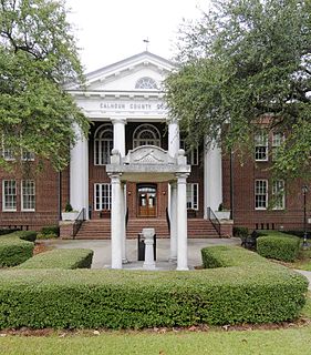
Calhoun County is a county in the U.S. state of South Carolina. As of the 2010 census, its population was 15,175, making it the third-least populous county in the state. Its county seat is St. Matthews.

Golden Glades is a census-designated place (CDP) in Miami-Dade County, Florida, United States. The population was 33,145 at the 2010 census.

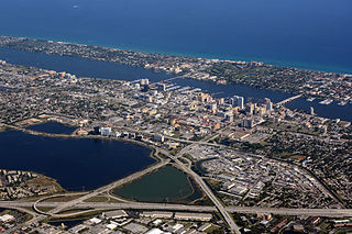
Belle Glade is a city in Palm Beach County, Florida, United States on the southeastern shore of Lake Okeechobee. According to the 2010 U.S. Census, the city had a population of 17,467.

Belle Glade Camp was a census-designated place (CDP) in Palm Beach County, Florida, United States. The population was 1,141 at the 2000 census.
Fairfield Glade is a resort, retirement community and census-designated place (CDP) in Cumberland County, Tennessee, United States. The population was 6,989 at the 2010 census.

Belle Plaine is a town in Shawano County, Wisconsin, United States. The population was 1,867 at the 2000 census. The unincorporated communities of Adams Beach and Belle Plaine are located in the town. The former unincorporated community of Hunting was located partially in the town.
Muse, misspelled on federal maps as Muce, is an unincorporated community in Glades County, Florida, United States.

Florida's 23rd congressional district is an electoral district for the U.S. Congress, located outside Miami, Florida. The district stretches from Weston to the City of Miami Beach.

Florida's 20th congressional district is an electoral district for the U.S. Congress, located in southeast Florida. The district includes most of the majority-black precincts in and around Fort Lauderdale and West Palm Beach. It also includes a vast area inland to the southeastern shores of Lake Okeechobee, including the community of Belle Glade.
Belle Glade State Municipal Airport is a public-use airport located 1 mile (1.6 km) northeast of the central business district of the city of Belle Glade in Palm Beach County, Florida, United States. The airport is publicly owned.

Okeelanta is an unincorporated community in Palm Beach County, Florida, United States, located approximately 4 miles (7 km) south of South Bay on U.S. Route 27 at County Road 827. The name is a blend of Lake Okeechobee and Atlantic Ocean.
Pelican Lake is the former name of a small unincorporated community in Palm Beach County, Florida, United States, located north of Belle Glade, south-southeast of Canal Point, and east of Pahokee. Pelican Lake is on the south side of State Road 717.
LaBelle is a city in and the county seat of Hendry County, Florida, United States. The population was 4,640 at the 2010 census, up from 4,210 at the 2000 census. It was named for Laura June Hendry and Carrie Belle Hendry, daughters of pioneer cattleman Francis Asbury Hendry.
The Glades Correctional Institution was a Florida Department of Corrections state prison for men in unincorporated Palm Beach County, Florida, near Belle Glade.
The Lake Okeechobee Scenic Trail (LOST) is a 109-mile multi-use path around Lake Okeechobee, the seventh largest lake in the United States and the largest in the state of Florida. The trail began as the Okeechobee Segment of the Florida National Scenic Trail (FNST), a 1,000 mile trail that runs from Miami to Pensacola. The USDA and National Forest Service dedicated the Okeechobee Segment as part of the FNST in 1993. Most of the trail is atop the 35-feet tall Herbert Hoover Dike. The trail crosses five counties, Hendry, Glades, Okeechobee, Martin and Palm Beach. Many stretches run along state and county highways, including Florida State Road 78.