
Box Elder County is a county at the northwestern corner of Utah, United States. At the 2020 census, the population was 57,666, up from the 2010 figure of 49,975. Its county seat and largest city is Brigham City. The county was named for the box elder trees that abound in the county.
Cedar Grove is a town in Highland Township, Franklin County, Indiana, United States. The population was 156 at the 2010 census.

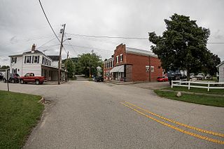
Cedar Rapids is a village in Boone County, Nebraska, United States. The population was 382 at the 2010 census.
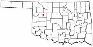
Taloga is a town in Dewey County, Oklahoma, United States. The population was 288 at the time of the 2020 census.

Deweyville is a census-designated place (CDP) in Newton County, on the central eastern border of Texas, United States. The population was 571 at the 2020 census, down from 1,023 at the 2010 census.

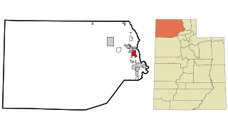
Elwood is a town in Box Elder County, Utah, United States. The population was 1,173 at the 2020 census, up from the 2010 figure of 1,034.

Garland is a city in northeastern Box Elder County, Utah, United States. The population was 2,589 at the 2020 census.
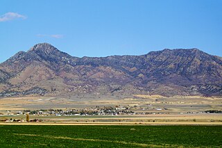
Honeyville is a city near the eastern edge of Box Elder County, Utah, United States. The population was 1,606 as of the 2020 census.

Perry is a city in Box Elder County, Utah, United States. The population was 4,512 at the 2010 census.
Plymouth is a town in Box Elder County, Utah, United States. The population was 414 at the 2010 census.

Portage is a town in Box Elder County, Utah, United States. The population was 245 at the 2010 census. The town received its name from Lorenzo Snow, an apostle of the Church of Jesus Christ of Latter-day Saints. He named it Portage after his birthplace of Portage County, Ohio.

Willard is a city in Box Elder County, Utah, United States. The population was 1,978 at the 2020 census.

Fruit Heights is a city in eastern Davis County, Utah, United States. It is part of the Ogden–Clearfield, Utah Metropolitan Statistical Area. It lies along the Wasatch Front adjacent to the larger cities of Farmington and Kaysville. Its population was 4,987 at the 2010 census, with an estimated population of 6,234 in 2018.

Mona is a city in Juab County, Utah, United States. As of the 2010 census it had a population of 1,547. It is part of the Provo–Orem metropolitan area.

Nephi is a city in Juab County, Utah, United States. It is part of the Provo–Orem metropolitan area. The population was 6,443 at the 2020 census. It is the county seat of Juab County. It was settled by Mormon pioneers in 1851 as Salt Creek, and it acquired its current name in 1882. It is the principal city in the Juab Valley, an agricultural area. Nephi was named after Nephi, son of Lehi, from the Book of Mormon.

Alpine is a city on the northeastern edge of Utah County, Utah, United States. The population was 10,251 at the time of the 2020 census. Alpine has been one of the many quickly-growing cities of Utah since the 1970s, especially in the 1990s. This city is thirty-two miles southeast of Salt Lake City. It is located on the slopes of the Wasatch Range north of Highland and American Fork. The west side of the city runs above the Wasatch Fault.

Cedar Fort is a town in Utah County, Utah, United States. It is part of the Provo–Orem Metropolitan Statistical Area. The population was 368 at the 2010 census.

Charleston is a town in Wasatch County, Utah, United States. The population was 436 at the 2020 census.

Midway is a city in northwestern Wasatch County, Utah, United States. It is located in the Heber Valley, approximately 3 miles (4.8 km) west of Heber City and 28 miles (45 km) southeast of Salt Lake City, on the opposite side of the Wasatch Mountains. The population was 6,003 at the 2020 census.

Uintah is a city in Weber County, Utah, United States. The population was 1,322 at the 2010 census. It is part of the Ogden–Clearfield, Utah Metropolitan Statistical Area. Although Uintah was a town in 2000, it has since been classified as a fifth-class city by state law.


