ESSA-8

Last updated

ESSA-8
Essa 8.jpg
Mission type Weather satellite
Operator ESSA/NASA [1]
COSPAR ID 1968-114A OOjs UI icon edit-ltr-progressive.svg
SATCAT no. 3615
Spacecraft properties
Manufacturer RCA Astro
Launch mass297 kilograms (655 lb) [2]
Start of mission
Launch dateDecember 15, 1968, 17:21:04 (1968-12-15UTC17:21:04Z) UTC [3]
Rocket Delta N
Launch site Vandenberg SLC-2E
End of mission
DisposalDecommissioned
DeactivatedMarch 12, 1976 (1976-03-13)
Orbital parameters
Reference system Geocentric
Regime Low Earth
Semi-major axis 7,816.70 kilometers (4,857.07 mi)
Eccentricity 0.0031481
Perigee altitude 1,421 kilometers (883 mi)
Apogee altitude 1,470 kilometers (910 mi)
Inclination 101.31 degrees
Period 114.63 minutes
Epoch December 7, 2013, 13:01:30 UTC [4]
TOS
  ESSA-7
ESSA-9  
 

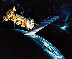
ESSA-8 was a weather satellite launched by the National Aeronautics and Space Administration (NASA) on December 15, 1968, from Vandenberg Air Force Base, California. Its name was derived from that of its oversight agency, the Environmental Science Services Administration (ESSA).

ESSA-8 was an 18-sided polygon. It measured 42 inches (110 cm) in diameter by 22 inches (56 cm) in height, with a mass of 130 kilograms (290 lb). It was made of aluminum alloy and stainless steel covered with 10,020 solar cells. The cells charged 63 nickel–cadmium batteries, which served as a power source. The satellite could take 8 to 10 pictures every 24 hours. Each photo covered a 2,000-square-mile (5,200 km2) area at a resolution of 2 miles (3.2 km) per pixel.

ESSA-8's mission was to replace ESSA-6, and provide detailed cloud pattern photography to ground stations worldwide. Partners in the project included NASA, ESSA, RCA, the National Weather Service, and the National Centers for Environmental Prediction (NMC).

ESSA-8 operated for 2,644 days until it was deactivated on March 12, 1976.

Related Research Articles

<span class="mw-page-title-main">TIROS-1</span>

TIROS-1 was the first full-scale weather satellite, the first of a series of Television Infrared Observation Satellites placed in low Earth orbit.

<span class="mw-page-title-main">Weather satellite</span> Type of satellite designed to record the state of the Earths atmosphere

A weather satellite or meteorological satellite is a type of Earth observation satellite that is primarily used to monitor the weather and climate of the Earth. Satellites can be polar orbiting, or geostationary.

<span class="mw-page-title-main">Nimbus program</span> Second-generation U.S. robotic spacecraft

The Nimbus satellites were second-generation U.S. robotic spacecraft launched between 1964 and 1978 used for meteorological research and development. The spacecraft were designed to serve as stabilized, Earth-oriented platforms for the testing of advanced systems to sense and collect atmospheric science data. Seven Nimbus spacecraft have been launched into near-polar, Sun-synchronous orbits beginning with Nimbus 1 on August 28, 1964. On board the Nimbus satellites are various instrumentation for imaging, sounding, and other studies in different spectral regions. The Nimbus satellites were launched aboard Thor-Agena rockets and Delta rockets.

<span class="mw-page-title-main">LAGEOS</span>

LAGEOS, Laser Geodynamics Satellite or Laser Geometric Environmental Observation Survey, are a series of two scientific research satellites designed to provide an orbiting laser ranging benchmark for geodynamical studies of the Earth. Each satellite is a high-density passive laser reflector in a very stable medium Earth orbit (MEO).

<span class="mw-page-title-main">Defense Meteorological Satellite Program</span> Monitoring program for the department of defense

The Defense Meteorological Satellite Program (DMSP) monitors meteorological, oceanographic, and solar-terrestrial physics for the United States Department of Defense. The program is managed by the United States Space Force with on-orbit operations provided by the National Oceanic and Atmospheric Administration (NOAA). The mission of the satellites was revealed in March 1973. They provide cloud cover imagery from polar orbits that are Sun-synchronous at nominal altitude of 830 km (520 mi).

<span class="mw-page-title-main">Apollo command and service module</span> Component of the Apollo spacecraft

The Apollo command and service module (CSM) was one of two principal components of the United States Apollo spacecraft, used for the Apollo program, which landed astronauts on the Moon between 1969 and 1972. The CSM functioned as a mother ship, which carried a crew of three astronauts and the second Apollo spacecraft, the Apollo Lunar Module, to lunar orbit, and brought the astronauts back to Earth. It consisted of two parts: the conical command module, a cabin that housed the crew and carried equipment needed for atmospheric reentry and splashdown; and the cylindrical service module which provided propulsion, electrical power and storage for various consumables required during a mission. An umbilical connection transferred power and consumables between the two modules. Just before reentry of the command module on the return home, the umbilical connection was severed and the service module was cast off and allowed to burn up in the atmosphere.

<span class="mw-page-title-main">Television Infrared Observation Satellite</span> Series of early American weather satellites

TIROS, or Television InfraRed Observation Satellite, is a series of early weather satellites launched by the United States, beginning with TIROS-1 in 1960. TIROS was the first satellite that was capable of remote sensing of the Earth, enabling scientists to view the Earth from a new perspective: space. The program, promoted by Harry Wexler, proved the usefulness of satellite weather observation, at a time when military reconnaissance satellites were secretly in development or use. TIROS demonstrated at that time that "the key to genius is often simplicity". TIROS is an acronym of "Television InfraRed Observation Satellite" and is also the plural of "tiro" which means "a young soldier, a beginner".

<span class="mw-page-title-main">Environmental Science Services Administration</span> Former U.S. government scientific agency

The Environmental Science Services Administration (ESSA) was a United States Federal executive agency created in 1965 as part of a reorganization of the United States Department of Commerce. Its mission was to unify and oversee the meteorological, climatological, hydrographic, and geodetic operations of the United States. It operated until 1970, when it was replaced by the new National Oceanic and Atmospheric Administration (NOAA).

<span class="mw-page-title-main">TIROS-2</span>

TIROS 2 was a spin-stabilized meteorological satellite. It was the second in a series of Television Infrared Observation Satellites. It re-entered in May 2014.

<span class="mw-page-title-main">ESSA-1</span> Former American weather satellite

ESSA-1 was a spin-stabilized operational meteorological satellite. Its name was derived from that of its oversight agency, the Environmental Science Services Administration (ESSA).

<span class="mw-page-title-main">GOES 13</span> U.S. Space Force weather satellite

EWS-G1 is a weather satellite of the U.S. Space Force, formerly GOES-13 and part of the National Oceanic and Atmospheric Administration's Geostationary Operational Environmental Satellite system. On 14 April 2010, GOES-13 became the operational weather satellite for GOES-East. It was replaced by GOES-16 on 18 December 2017 and on 8 January 2018 its instruments were shut off and it began its three-week drift to an on-orbit storage location at 60.0° West longitude, arriving on 31 January 2018. It remained there as a backup satellite in case one of the operational GOES satellites had a problem until early July 2019, when it started to drift westward and was being transferred to the U.S. Air Force, and then the U.S. Space Force.

<span class="mw-page-title-main">ESSA-9</span> Meteorological satellite

ESSA-9, also known as TOS-G, was a meteorological satellite. Its name was derived from that of its oversight agency, the Environmental Science Services Administration (ESSA). ESSA-9 replaced the ESSA-7 satellite.

<span class="mw-page-title-main">Joint Polar Satellite System</span> Constellation of American meteorology satellites

The Joint Polar Satellite System (JPSS) is the latest generation of U.S. polar-orbiting, non-geosynchronous, environmental satellites. JPSS will provide the global environmental data used in numerical weather prediction models for forecasts, and scientific data used for climate monitoring. JPSS will aid in fulfilling the mission of the U.S. National Oceanic and Atmospheric Administration (NOAA), an agency of the Department of Commerce. Data and imagery obtained from the JPSS will increase timeliness and accuracy of public warnings and forecasts of climate and weather events, thus reducing the potential loss of human life and property and advancing the national economy. The JPSS is developed by the National Aeronautics and Space Administration (NASA) for the National Oceanic and Atmospheric Administration (NOAA), who is responsible for operation of JPSS. Three to five satellites are planned for the JPSS constellation of satellites. JPSS satellites will be flown, and the scientific data from JPSS will be processed, by the JPSS – Common Ground System (JPSS-CGS).

<span class="mw-page-title-main">ATS-1</span> Communications and weather satellite

ATS-1 was an experimental geostationary satellite, launched in 1966. Though intended as a communications satellite rather than as a weather satellite, it carried the Spin Scan Cloud Camera developed by Verner E. Suomi and Robert Parent at the University of Wisconsin. After entering an orbit at 23,000 mi (37,000 km) above Earth, initially in orbit over Ecuador, it transmitted weather images from the Western Hemisphere, as well as other data, to ground stations, including well as video feeds for television broadcasting. It took one of the first pictures of the Earth's full-disk, on December 11, 1966.

"For the first time," historians would note later, "rapid-imaging of nearly an entire hemisphere was possible. We could watch, fascinated, as storm systems developed and moved and were captured in a time series of images. Today such images are an indispensable part of weather analysis and forecasting."

<span class="mw-page-title-main">TIROS-6</span>

TIROS 6 was a spin-stabilized meteorological satellite. It was the sixth in a series of Television Infrared Observation Satellites.

<span class="mw-page-title-main">TIROS-7</span>

TIROS-7 was a spin-stabilized meteorological satellite. It was the seventh in a series of Television Infrared Observation Satellites.

<span class="mw-page-title-main">TIROS-8</span>

TIROS-8 was a spin-stabilized meteorological satellite. It was the eighth in a series of Television Infrared Observation Satellites.

<span class="mw-page-title-main">ESSA-2</span>

ESSA-2 was a spin-stabilized operational meteorological satellite. Its name was derived from that of its oversight agency, the Environmental Science Services Administration (ESSA).

<span class="mw-page-title-main">ESSA-4</span>

ESSA-4 was a spin-stabilized operational meteorological satellite. Its name was derived from that of its oversight agency, the Environmental Science Services Administration (ESSA).

<span class="mw-page-title-main">TIROS-M</span> Deactivated weather satellite

TIROS-M, also known as ITOS-1 was a weather satellite operated by the Environmental Science Services Administration (ESSA). It was part of a series of satellites called ITOS, or improved TIROS. TIROS-M was launched on a Delta rocket on January 23, 1970. The launch carried one other satellite, Australis-OSCAR 5. It was deactivated on June 18, 1971.

References

  1. "ESSA". NASA Science. Archived from the original on December 11, 2013. Retrieved December 8, 2013.
  2. "ESSA 8". National Space Science Data Center. Retrieved December 8, 2013.
  3. McDowell, Jonathan. "Launch Log". Jonathan's Space Page. Retrieved December 8, 2013.
  4. "ESSA 8 (TOS-F) Satellite details 1968-114A NORAD 3615". N2YO. December 7, 2013. Retrieved December 8, 2013.