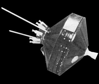
Pioneer 1 was an American space probe, the first under the auspices of NASA, which was launched by a Thor-Able rocket on 11 October 1958. It was intended to orbit the Moon and make scientific measurements, but due to a guidance error failed to achieve lunar orbit and was ultimately destroyed upon reentering Earth's atmosphere. The flight, which lasted 43 hours and reached an apogee of 113,800 km, was the second and most successful of the three Thor-Able space probes.

Mars 1, also known as 1962 Beta Nu 1, Mars 2MV-4 and Sputnik 23, was an automatic interplanetary station launched in the direction of Mars on November 1, 1962, the first of the Soviet Mars probe program, with the intent of flying by the planet at a distance of about 11,000 km (6,800 mi). It was designed to image the surface and send back data on cosmic radiation, micrometeoroid impacts and Mars' magnetic field, radiation environment, atmospheric structure, and possible organic compounds.

Surveyor 5 is the fifth lunar lander of the American uncrewed Surveyor program sent to explore the surface of the Moon. Surveyor 5 landed on Mare Tranquillitatis in 1967. A total of 19,118 images were transmitted to Earth.

Television InfraRed Observation Satellite (TIROS) is a series of early weather satellites launched by the United States, beginning with TIROS-1 in 1960. TIROS was the first satellite that was capable of remote sensing of the Earth, enabling scientists to view the Earth from a new perspective: space. The program, promoted by Harry Wexler, proved the usefulness of satellite weather observation, at a time when military reconnaissance satellites were secretly in development or use. TIROS demonstrated at that time that "the key to genius is often simplicity". TIROS is an acronym of "Television InfraRed Observation Satellite" and is also the plural of "tiro" which means "a young soldier, a beginner".
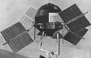
Explorer 6, or S-2, was a NASA satellite, launched on 7 August 1959, at 14:24:20 GMT. It was a small, spherical satellite designed to study trapped radiation of various energies, galactic cosmic rays, geomagnetism, radio propagation in the upper atmosphere, and the flux of micrometeorites. It also tested a scanning device designed for photographing the Earth's cloud cover. On 14 August 1959, Explorer 6 took the first photos of Earth from a satellite.
The Automatic Picture Transmission (APT) system is an analog image transmission system developed for use on weather satellites. It was introduced in the 1960s and over four decades has provided image data to relatively low-cost user stations at locations in most countries of the world. A user station anywhere in the world can receive local data at least twice a day from each satellite as it passes nearly overhead.

ESSA-1 was a spin-stabilized operational meteorological satellite. Its name was derived from that of its oversight agency, the Environmental Science Services Administration (ESSA).

ESSA-9, also known as TOS-G, was a meteorological satellite. Its name was derived from that of its oversight agency, the Environmental Science Services Administration (ESSA). ESSA-9 replaced the ESSA-7 satellite.

Kosmos 122, launched on 25 June 1966, Meteor No.5L, and was one of eleven weather satellites put into orbit between 1964 and 1969.
Kosmos 144, was launched on 28 February 1967, Meteor No.6L, and was one of eleven weather satellites launched by the Soviet Union between 1964 and 1969. Kosmos 144 was the second announced Russian meteorological satellite and the first interim operational weather satellite in the experimental Kosmos satellite 'Meteor' system. It was also the first launch of the semi-operational weather satellite from the Plesetsk site into a near-polar, near-circular orbit. Unlike U.S. weather satellites, however, the orbit was prograde because, as a result of geographic limitations, a retrograde orbit was not possible. Kosmos 144 was orbited to test, in a semi-operational mode, meteorological instruments designed for obtaining images of cloud cover, snow cover, and ice fields on the day and night sides of the Earth and for measuring fluxes of outgoing radiation reflected and radiated by the Earth-atmosphere system.
Kosmos 156 was a Soviet weather satellite launched on 27 April 1967, one of eleven weather satellites launched by the Soviet Union between 1964 and 1969. It formed part of the experimental "Meteor" weather satellite system. In 1969, the Kosmos satellite series was scrapped for the more modern and updated Meteor satellite.

TIROS-3 was a spin-stabilized meteorological satellite. It was the third in a series of Television Infrared Observation Satellites.

TIROS 5 was a spin-stabilized meteorological satellite. It was the fifth in a series of Television Infrared Observation Satellites.

TIROS 6 was a spin-stabilized meteorological satellite. It was the sixth in a series of Television Infrared Observation Satellites.

TIROS-8 was a spin-stabilized meteorological satellite. It was the eighth in a series of Television Infrared Observation Satellites.

TIROS-10 was a spin-stabilized meteorological satellite. It was the tenth and last in a series of Television Infrared Observation Satellites.
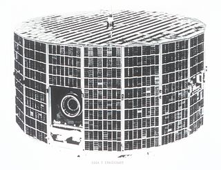
ESSA-2 was a spin-stabilized operational meteorological satellite. Its name was derived from that of its oversight agency, the Environmental Science Services Administration (ESSA).

ESSA 3 was a spin-stabilized operational meteorological satellite. Its name was derived from that of its oversight agency, the Environmental Science Services Administration (ESSA).
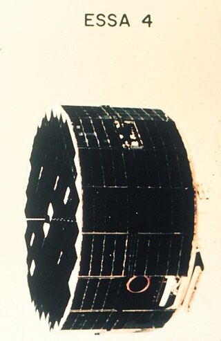
ESSA-4 was a spin-stabilized operational meteorological satellite. Its name was derived from that of its oversight agency, the Environmental Science Services Administration (ESSA).

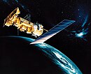
NOAA-1, also known as ITOS-A was a weather satellite operated by the National Oceanic and Atmospheric Administration (NOAA). It was part of a series of satellites called ITOS, or improved TIROS.


