Eightmile Creek (Tenmile Creek tributary)

Last updated
Eightmile Creek
Country United States
State New York
County Albany
Towns Rensselaerville
Villages Medusa
Physical characteristics
Source 
 - location Westerlo, New York
 - coordinates 42°32′27″N74°05′33″W / 42.54083°N 74.09250°W / 42.54083; -74.09250
River mouth Tenmile Creek
 - location Medusa, New York, Rensselaerville, New York
 - coordinates 42°25′53″N74°07′52″W / 42.43139°N 74.13111°W / 42.43139; -74.13111 Coordinates: 42°25′53″N74°07′52″W / 42.43139°N 74.13111°W / 42.43139; -74.13111
 - elevation0 ft (0 m)

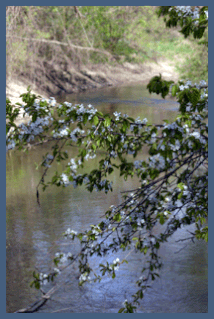
Eightmile Creek [1] is an 11.8-mile-long (19.0 km) [2] tributary of Tenmile Creek in Albany County, New York. Via Tenmile Creek and Catskill Creek, it is part of the Hudson River watershed. Eightmile Creek runs through the town of Westerlo into the town of Rensselaerville, where it joins Tenmile Creek at the hamlet of Medusa. The creek's source is near Onderdonk Lake by Snyders Corners in Westerlo.

Albany County, New York County in the United States

Albany County is a county in the state of New York, in the United States. Its northern border is formed by the Mohawk River, at its confluence with the Hudson River, which is on the east. As of the 2010 census, the population was 304,204. The county seat is Albany, the state capital of New York. As originally established by the English government in the colonial era, Albany County had an indefinite amount of land, but has had an area of 530 square miles (1,400 km2) since March 3, 1888. The county is named for the Duke of York and of Albany, who became James II of England.

Catskill Creek river in the United States of America

Catskill Creek is a 46.0-mile-long (74.0 km) tributary of the Hudson River that drains the northeastern Catskill Mountains of the U.S. State of New York. From its source at Franklinton Vlaie in Schoharie County it flows southeast through parts of Albany County and Greene County to its mouth at the village of Catskill on the Hudson River.

Hudson River river in New York State, draining into the Atlantic at New York City

The Hudson River is a 315-mile (507 km) river that flows from north to south primarily through eastern New York in the United States. The river originates in the Adirondack Mountains of Upstate New York, flows southward through the Hudson Valley to the Upper New York Bay between New York City and Jersey City. It eventually drains into the Atlantic Ocean at New York Harbor. The river serves as a political boundary between the states of New Jersey and New York at its southern end. Further north, it marks local boundaries between several New York counties. The lower half of the river is a tidal estuary, deeper than the body of water into which it flows, occupying the Hudson Fjord, an inlet which formed during the most recent period of North American glaciation, estimated at 26,000 to 13,300 years ago. Tidal waters influence the Hudson's flow from as far north as the city of Troy.

See also

Related Research Articles

Rensselaerville, New York Town in New York, United States

Rensselaerville is a town in Albany County, New York, United States. The population was 1,843 at the 2010 census. The town is named after Stephen Van Rensselaer. The "official" hamlets are Cooksburg, Medusa, Potter Hollow, Preston Hollow, and Rensselaerville.

Ottawa River (Lake Erie) river in Ohio and Michigan, United States

The Ottawa River, also known as Ottawa Creek, is a short river, approximately 20 miles (32 km) long, in northwest Ohio and southeast Michigan in the United States. It drains an area on the Ohio-Michigan border along the eastern and northern fringes of the city of Toledo, goes through Ottawa Hills, and empties directly into Lake Erie. It is one of two rivers in northwestern Ohio that share the same name, along with the Ottawa River that is a tributary of the Auglaize River. The upper 4 miles (6 km) of the river in Michigan north of Sylvania, Ohio is called North Tenmile Creek on federal maps, while another branch rising in Fulton County, Ohio, is called Tenmile Creek.

Ten Mile River (Housatonic River tributary) river in New York, United States of America

The Ten Mile River is a 15.4-mile-long (24.8 km) river that flows through Dutchess County, New York, into westernmost Connecticut. The river is formed in the town of Amenia, New York, at the confluence of Webatuck Creek and Wassaic Creek. The Ten Mile River runs south through the town of Dover, New York before turning east and crossing into Connecticut, where it forms the boundary between the towns of Kent and Sherman for one-half mile before flowing into the Housatonic River. This is a popular whitewater paddling destination with mostly quickwater and a few whitewater areas reaching up to Class III.

Little Seneca Creek stream in Montgomery County, Maryland

Little Seneca Creek is an 14.0-mile-long (22.5 km) stream in Montgomery County, Maryland, roughly 18 miles (29 km) northwest of Washington, D.C.

The Tenmile River is an 8.6-mile-long (13.8 km) river in the towns of Hiram and Brownfield in western Maine in the United States. It is a tributary of the Saco River, which flows to the Atlantic Ocean.

The West Branch Tenmile River is a 5.0-mile-long (8.0 km) tributary of the Tenmile River in western Maine. It is part of the Saco River watershed, flowing to the Atlantic Ocean.

Icicle Creek river in the United States of America

Icicle Creek is a stream in the U.S. state of Washington. It originates at Josephine Lake near the crest of the Cascade Range and flows generally east to join the Wenatchee River near Leavenworth. Icicle Creek's drainage basin is mountainous and mostly undeveloped land within the Wenatchee National Forest and the Alpine Lakes Wilderness. The final 6 miles (10 km) of the creek are moderately developed with scattered homes and pasture, a golf course, children's camp, a small housing development called Icicle Island Club, and the Leavenworth National Fish Hatchery. Some water is diverted from the creek for municipal use by the City of Leavenworth at Icicle Creek river mile 5.6. Near Leavenworth, the wheelchair-accessible Icicle Creek Nature Trail, a National Recreation Trail designated in 2005, runs 1.0 mile (1.6 km) along a historic creek channel.

Tenmile Creek is a 15.0-mile-long (24.1 km) tributary of Catskill Creek in Albany County, New York. Via Catskill Creek, it is part of the Hudson River watershed.

Lake Creek is a 5.8-mile-long (9.3 km) tributary of Catskill Creek in Albany and Schoharie counties, New York, in the United States. Via Catskill Creek, it is part of the Hudson River watershed. Lake Creek runs from the Rensselaerville State Forest in the town of Rensselaerville to Catskill Creek at Livingstonville in the town of Broome.

Hannacrois Creek river in the United States of America

Hannacrois Creek is a 20.9-mile-long (33.6 km) tributary to the Hudson River in the U.S. state of New York. From its source in Westerlo it flows through Dunbar Hollows and over Dickinson Falls to the Alcove Reservoir. It then passes through Coeymans Hollow and just into Greene County to its mouth at the Hudson River in Coeymans, New York.

Coxsackie Creek is a 9.8-mile-long (15.8 km) tributary to the Hudson River in the towns of Coxsackie and New Baltimore, New York in the United States.

Taghkanic Creek is a 30.1-mile-long (48.4 km) tributary to Claverack Creek in Columbia County, New York, in the United States. Via Claverack Creek and Stockport Creek, it is part of the Hudson River watershed. Its source is in the town of Hillsdale, and it passes through the towns of Copake, Taghkanic, and Livingston before terminating at Claverack Creek in the town of Greenport.

Tenmile Creek (Coos County, Oregon) river in United States of America

Tenmile Creek is the outlet for a chain of lakes ending at Tenmile Lake near Lakeside in Coos County in the U.S. state of Oregon. The creek flows generally west for about 3 miles (5 km) from the lake to the Pacific Ocean. The stream's name stems from its approximate distance from Winchester Bay, the earliest pioneer village along this part of the coast.

Eightmile Creek or Eight Mile Creek may refer to:

Eightmile Creek (Fifteenmile Creek) river in United States of America

Eightmile Creek is a stream in Wasco County and Hood River County, Oregon, in the United States. It is a tributary of Fifteenmile Creek.

Eightmile Creek is a stream in the U.S. state of Minnesota. It is a tributary of Minnesota River.

Tenmile Creek is a stream in the U.S. state of West Virginia. It is a tributary of Buckhannon River.

Tenmile Creek is a stream in the U.S. state of Pennsylvania. It is a tributary of the Monongahela River.

References

  1. U.S. Geological Survey Geographic Names Information System: Eightmile Creek (Tenmile Creek tributary)
  2. U.S. Geological Survey. National Hydrography Dataset high-resolution flowline data. The National Map Archived 2012-04-05 at WebCite , accessed October 3, 2011