European route E01

Last updated

Coordinates: 40°26′40″N8°30′59″W / 40.4444°N 8.5165°W / 40.4444; -8.5165

Geographic coordinate system Coordinate system

A geographic coordinate system is a coordinate system that enables every location on Earth to be specified by a set of numbers, letters or symbols. The coordinates are often chosen such that one of the numbers represents a vertical position and two or three of the numbers represent a horizontal position; alternatively, a geographic position may be expressed in a combined three-dimensional Cartesian vector. A common choice of coordinates is latitude, longitude and elevation. To specify a location on a plane requires a map projection.

Contents

Tabliczka E01.svg

E01
Blank map of Europe cropped - E1.svg
Major junctions
North end Larne, United Kingdom
South end Seville, Spain
Location
CountriesFlag of the United Kingdom.svg  United Kingdom
Flag of Ireland.svg  Ireland
Flag of Spain.svg  Spain
Flag of Portugal.svg  Portugal
Highway system
International E-road network

The European route E 01 is a series of roads in Europe, part of the United Nations International E-road network, running from Larne, United Kingdom to Seville, Spain. There is a sea crossing between Rosslare Harbour, in Ireland, and Ferrol, but no ferry service. The road also passes through Portugal – past the city of Porto, through the capital, Lisbon, and then south to the Algarve, passing Faro before reaching the Spanish border west of Huelva.

Road A demarcated land route with a suitable surface between places

A road is a thoroughfare, route, or way on land between two places that has been paved or otherwise improved to allow travel by foot or some form of conveyance, including a motor vehicle, cart, bicycle, or horse.

Europe Continent in the Northern Hemisphere and mostly in the Eastern Hemisphere

Europe is a continent located entirely in the Northern Hemisphere and mostly in the Eastern Hemisphere. It is bordered by the Arctic Ocean to the north, the Atlantic Ocean to the west and the Mediterranean Sea to the south. It comprises the westernmost part of Eurasia.

United Nations Intergovernmental organization

The United Nations (UN) is an intergovernmental organization that was tasked to maintain international peace and security, develop friendly relations among nations, achieve international co-operation and be a centre for harmonizing the actions of nations. The headquarters of the UN is in Manhattan, New York City, and is subject to extraterritoriality. Further main offices are situated in Geneva, Nairobi, and Vienna. The organization is financed by assessed and voluntary contributions from its member states. Its objectives include maintaining international peace and security, protecting human rights, delivering humanitarian aid, promoting sustainable development and upholding international law. The UN is the largest, most familiar, most internationally represented and most powerful intergovernmental organization in the world. In 24 October 1945, at the end of World War II, the organization was established with the aim of preventing future wars. At its founding, the UN had 51 member states; there are now 193. The UN is the successor of the ineffective League of Nations.

United Kingdom

Larne civil parish in County Antrim, Northern Ireland

Larne is a seaport and industrial market town, as well as a civil parish, on the east coast of County Antrim, Northern Ireland, with a population of 18,323 people in the 2008 Estimate. The Larne Local Government District had a population of 32,180 in 2011. It has been used as a seaport for over 1,000 years, and is today a major passenger and freight roll-on roll-off port. Larne is administered by Mid and East Antrim Borough Council. Together with parts of the neighbouring districts of Antrim and Newtownabbey and Causeway Coast and Glens, it forms the East Antrim constituency for elections to the Westminster Parliament and Northern Ireland Assembly. The civil parish is situated in the historic barony of Glenarm Upper.

Belfast City in the United Kingdom, capital of Northern Ireland

Belfast is the capital city of Northern Ireland, standing on the banks of the River Lagan on the east coast of Ireland. It is the largest city in Northern Ireland and second-largest on the island of Ireland. It had a population of 333,871 as of 2015.

Lisburn City in Northern Ireland

Lisburn is a city in Northern Ireland. It is 8 mi (13 km) southwest of Belfast city centre, on the River Lagan, which forms the boundary between County Antrim and County Down. Lisburn is part of the Belfast Metropolitan Area. It had a population of 71,465 people in the 2011 Census.

As with all E-roads in the United Kingdom, the E 01 is not signed. It begins in Larne, County Antrim as the A8. A short section of the A8 at Newtownabbey is under motorway regulations and is signed as the A8(M) motorway. This motorway joins the much longer M2 motorway to Belfast. At Belfast, the road becomes the A12 Westlink, a dual carriageway which links to the M1 motorway. The A1 leaves the motorway near Lisburn and continues south as a dual carriageway. This takes the road over the border into Ireland.

United Kingdom Country in Europe

The United Kingdom, officially the United Kingdom of Great Britain and Northern Ireland but more commonly known as the UK or Britain, is a sovereign country lying off the north-western coast of the European mainland. The United Kingdom includes the island of Great Britain, the north-eastern part of the island of Ireland and many smaller islands. Northern Ireland is the only part of the United Kingdom that shares a land border with another sovereign state‍—‌the Republic of Ireland. Apart from this land border, the United Kingdom is surrounded by the Atlantic Ocean, with the North Sea to the east, the English Channel to the south and the Celtic Sea to the south-west, giving it the 12th-longest coastline in the world. The Irish Sea lies between Great Britain and Ireland. With an area of 242,500 square kilometres (93,600 sq mi), the United Kingdom is the 78th-largest sovereign state in the world. It is also the 22nd-most populous country, with an estimated 66.0 million inhabitants in 2017.

County Antrim Place in Antrim, Northern Ireland

County Antrim is one of six counties that form Northern Ireland. Adjoined to the north-east shore of Lough Neagh, the county covers an area of 3,046 square kilometres (1,176 sq mi) and has a population of about 618,000. County Antrim has a population density of 203 people per square kilometre or 526 people per square mile. It is also one of the thirty-two traditional counties of Ireland, as well as part of the historic province of Ulster.

Newtownabbey suburb of Belfast, Northern Ireland

Newtownabbey is a large settlement north of Belfast in County Antrim, Northern Ireland. Sometimes considered to be a suburb of Belfast, it is separated from the rest of the city by Cavehill and Fortwilliam golf course. At the 2001 Census, Newtownabbey Urban Area had a population of 62,056, making it the fourth largest settlement in Northern Ireland. It is part of Antrim and Newtownabbey Borough Council.

Ireland

Main article: European route E01 in Ireland

Dundalk Town in Leinster, Ireland

Dundalk is the county town of County Louth, Ireland. It is on the Castletown River, which flows into Dundalk Bay, and is near the border with Northern Ireland, halfway between Dublin and Belfast. It has associations with the mythical warrior hero Cú Chulainn.

Dublin capital and largest city in Ireland

Dublin is the capital and largest city of Ireland. It is on the east coast of Ireland, in the province of Leinster, at the mouth of the River Liffey, and is bordered on the south by the Wicklow Mountains. It has an urban area population of 1,173,179, while the population of the Dublin Region, as of 2016, was 1,347,359, and the population of the Greater Dublin area was 1,904,806.

Wexford Place in Leinster, Ireland

Wexford is the county town of County Wexford, Ireland. Wexford lies on the south side of Wexford Harbour, the estuary of the River Slaney near the southeastern corner of the island of Ireland. The town is linked to Dublin by the M11/N11 National Primary Route; and to Rosslare Europort, Cork and Waterford by the N25. The national rail network connects it to Dublin and Rosslare Europort. It had a population of 20,188 according to the 2016 census.

The dual carriageway continues in Ireland as the N1, which from Ballymascanlon in County Louth onwards is under motorway regulations and signed as the M1 motorway. The road follows the M1 south to Dublin, where, in the northern suburbs, it meets Dublin's ring road, the M50 motorway. It follows the M50 through the outer suburbs of Dublin until it meets the short M11 motorway near Shankill. The M11 continues as a dual carriageway, the N11, south of Bray in County Wicklow. This section passes through the Glen of the Downs Nature Reserve. This section of the road is dual carriageway or motorway to south of Gorey in County Wexford. Following this, the remainder of the route in Ireland is single carriageway and passes through several towns and villages. The N11 continues to Wexford, where at a junction outside the town it meets the N25 road from Cork. The route follows the N25 to its final destination in Ireland of Rosslare Europort.

Republic of Ireland Ireland, a country in north-western Europe, occupying 5/6 of the island of Ireland; succeeded the Irish Free State (1937)

Ireland, also known as the Republic of Ireland, is a country in north-western Europe occupying 26 of 32 counties of the island of Ireland. The capital and largest city is Dublin, which is located on the eastern part of the island, and whose metropolitan area is home to around a third of the country's over 4.8 million inhabitants. The sovereign state shares its only land border with Northern Ireland, a part of the United Kingdom. It is otherwise surrounded by the Atlantic Ocean, with the Celtic Sea to the south, St George's Channel to the south-east, and the Irish Sea to the east. It is a unitary, parliamentary republic. The legislature, the Oireachtas, consists of a lower house, Dáil Éireann, an upper house, Seanad Éireann, and an elected President who serves as the largely ceremonial head of state, but with some important powers and duties. The head of government is the Taoiseach, who is elected by the Dáil and appointed by the President; the Taoiseach in turn appoints other government ministers.

County Louth County in the Republic of Ireland

County Louth is a county in the Republic of Ireland. It is in the province of Leinster and is part of the Mid-East Region. It is named after the village of Louth. Louth County Council is the local authority for the county. According to the 2016 census, the population of the county was 128,884.

M50 motorway (Ireland) motorway in Ireland

The M50 motorway is a C-shaped orbital motorway in Dublin and the busiest motorway in Ireland. The current route was built in various sections over the course of 27 years, from 1983 to 2010. It begins at Dublin Port, running northward through the Dublin Port Tunnel and along a portion of the Airport Motorway. It then turns west at its junction with the M1, circling the northern, western and southern suburbs of Dublin, before merging with the M11 at Shankill in South East Dublin. The road forms part of European route E01.

All remaining sections of the N11 (and therefore E01) outside of Dublin are due to be replaced by motorways or dual carriageways. [1] [2] [3]

Spain

E01 near Vigo, Spain. Puente de Rande - Atardecer.jpg
E01 near Vigo, Spain.

The E 01 has two sections in Spain. The northern section is between Ferrol and Tui at the Portuguese border. It follows the motorway AP-9, a.k.a. The Atlantic Axis, which connects the Galician cities of Ferrol, A Coruña, Santiago de Compostela, Pontevedra and Vigo, continuing south towards Tui. The E 01 follows the motorway A-55 near the city of Tui to the Portuguese border at the river Minho.

Portugal

E01 passing at Ponte do Freixo, Porto. Ponte do Freixo - Porto.jpg
E01 passing at Ponte do Freixo, Porto.

In Portugal, the route is composed of the following sections, always as a motorway (called auto-estrada in Portuguese):

In the section Aveiro Norte - Lisbon of the A1, the E01 follows the same route as the E80. In that section the E80 signage prevails over the E01 signage, the latter rarely appearing.

Spain

The second Spanish section is between Ayamonte at the Portuguese border and Sevilla. It follows the motorway A-49, and passes near the city of Huelva. The border is at the Guadiana river.

Related Research Articles

A1 road (Northern Ireland) major route in Northern Ireland

The A1 is a major route in Northern Ireland. It runs from Belfast via Lisburn and Banbridge to the border with the Republic of Ireland south of Newry, from where the road continues to Dublin, becoming the N1 road and M1 motorway. Between Sprucefield and Carrickcarnan the road forms part of the European route E01.

M1 motorway (Republic of Ireland) motorway in Ireland connecting Dublin and the Northern Ireland border towards Belfast

The M1 motorway is a motorway in Ireland. It forms the large majority of the N1 national primary road connecting Dublin towards Belfast along the east of the island of Ireland. The route heads north via Swords, Drogheda and Dundalk to the Northern Irish border just south of Newry in County Armagh, where it joins the A1 road and further on, the M1 motorway in Northern Ireland. It also forms a significant part of the road connection between Dublin and the Northern Irish cities of Newry, and Lisburn. The route is part of European route E01.

Roads in Ireland

The island of Ireland, comprising Northern Ireland and the Republic of Ireland, has an extensive network of tens of thousands of kilometres of public roads, usually surfaced. These roads have been developed and modernised over centuries, from trackways suitable only for walkers and horses, to surfaced roads including modern motorways. The major routes were established before Irish independence and consequently take little cognisance of the border other than a change of identification number and street furniture. Northern Ireland has had motorways since 1962, and has a well-developed network of primary, secondary and local routes. The Republic started work on its motorway network in the early 1980s; and historically, the road network there was once somewhat less well developed. However, the Celtic Tiger economic boom and an influx of European Union structural funding, saw national roads and regional roads in the Republic come up to international standard quite quickly. In the mid-1990s, for example, the Republic went from having only a few short sections of motorway to a network of motorways, dual carriageways and other improvements on most major routes as part of a National Development Plan. Road construction in Northern Ireland now tends to proceed at a slower pace than in the Republic, although a number of important bypasses and upgrades to dual carriageway have recently been completed or are about to begin.

N11 road (Ireland) National primary road in Ireland

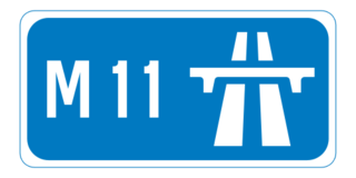
The N11 road is a national primary road in Ireland, running for 129 km (80 mi) along the east side of Ireland from Dublin to Wexford. It passes close to Bray, Greystones, Wicklow, Arklow and Gorey and also passes through Enniscorthy, amongst others. Beyond Wexford, the route continues to Rosslare as the N25. The road forms part of European route E01. As of 2015 the N11/M11 is of dual carriageway or motorway standard from Dublin as far as Gorey in County Wexford.

N4 road (Ireland) road in Ireland

The N4 road is a national primary road in Ireland, running from Dublin to the northwest of Ireland and Sligo town. The M6 to Galway diverges from this route after Kinnegad, while the N5 to Westport diverges at Longford town. The section of the N4 that is motorway-standard is designated the M4 motorway.

The N3 road is a national primary road in Ireland, running between Dublin, Cavan and the border with County Fermanagh. The A509 and A46 roads in Northern Ireland form part of an overall route connecting to Enniskillen, and northwest to the border again where the N3 reappears to serve Ballyshannon in County Donegal.

The N2 road is a national primary road in Ireland, running from Dublin to the border with Northern Ireland at Moy Bridge near Aughnacloy, County Tyrone to connect Dublin with Derry via the A5. A section of the route near Dublin forms the M2 motorway.

M1 motorway (Northern Ireland) motorway in Northern Ireland connecting Belfast and Dungannon

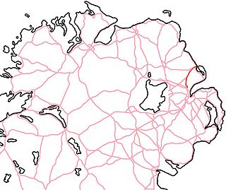
The M1 is a motorway in Northern Ireland. It is the longest motorway in Northern Ireland and runs for 38 miles (61 km) from Belfast to Dungannon through County Antrim, County Down, County Armagh and County Tyrone. It forms part of the route via the A1 in Northern Ireland between Belfast and Dublin as well as being a part of the unsigned European E01 and E18 routes.

European route E20 road in Europe

The European route E 20 is part of the United Nations International E-road network.

European route E18 road in Europe

European route E18 runs from Craigavon in Northern Ireland to Saint Petersburg in Russia, passing through Scotland, Norway, Sweden, and Finland. It is about 1,890 kilometres in length.

N18 road (Ireland) national primary road in Ireland

The N18 road is a national primary road in Ireland, connecting the cities of Limerick and Galway. Ennis and Gort are two major towns on the route, and Shannon Airport is reached via the connecting N19. The west coast route continues on to Sligo as the N17. The section from Limerick to the N19 junction forms part of European route E20, and the entire route is part of the proposed Atlantic Corridor. The section of motorway from Shannon to Claregalway is designated the M18 motorway. The tolled Limerick Tunnel forms part of the route.

N25 road (Ireland) national primary road in Ireland

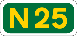
The N25 road is a national primary road in Ireland, forming the route from Cork to Rosslare Europort via Waterford City. The road is part of the E30 European route and a short section is also part of the E01 European route. It forms part of the proposed Atlantic Corridor route.

National primary road Ireland

A national primary road is a road classification in Ireland. National primary roads form the major routes between the major urban centres. There are 2649 km of national primary roads. This category of road has the prefix "N" followed by one or two digits. Motorways are prefixed "M" followed by one or two digits.

High-quality dual carriageway

A High-quality dual carriageway (HQDC) is a category of road in Ireland. It is an all-purpose dual carriageway road type built to near motorway standards, but without motorway classification or motorway restrictions. High-quality dual carriageways have full grade-separated access and do not have junctions with minor roads. Such roads in the Republic of Ireland have been built as part of the 2000-2006 and 2007-2013 National Development Plans, including interurban routes from Dublin to other cities.

A26 road (Northern Ireland) road in Northern Ireland

The A26 is a road in Northern Ireland. It travels in a North-South direction from Coleraine, County Londonderry to Banbridge, County Down.

A8 road (Northern Ireland) road in Northern Ireland

The A8 in Northern Ireland is a 26.1 km route connecting the city of Belfast with the harbour town of Larne. One of the busiest routes in the region, the road forms part of the unsigned European routes E01 and E18.

Motorways in the Republic of Ireland Wikimedia list article

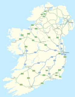
In Ireland, the highest category of road is a motorway, indicated by the prefix M followed by a one- or two-digit number. The motorway network predominantly consists of two-lane dual carriageways and is primarily focused upon Dublin, although there are a few three-lane motorways and the M50 has four lanes at some points.

History of roads in Ireland

There have been routes and trackways in Ireland connecting settlements and facilitating trade since ancient times and the country now has an extensive network of public roads connecting all parts of the island.

The European route E01 in the United Kingdom is a series of roads, part of the International E-road network running completely in the province of Northern Ireland from Larne, by the capital Belfast to the Irish border at Newry. Eventually the route goes to the Republic of Ireland, Spain and Portugal.

The European route E01 in the Republic of Ireland is a serie of roads, part of the International E-road network running in an north south axis on the Irish east coast. It runs through five counties starting on the British border with the province of Northern Ireland at Dundalk, coming from Belfast and Larne. It passes the capital Dublin until it stops at Rosslare Harbour in Southern Ireland. From there the E01 crosses the Celtic Sea and the Bay of Biscay on a non-existent ferry towards Spain and Portugal.

References

  1. "Archived copy". Archived from the original on 26 July 2011. Retrieved 2011-09-02.
  2. "Archived copy". Archived from the original on 26 July 2011. Retrieved 2011-09-02.
  3. "Archived copy". Archived from the original on 26 July 2011. Retrieved 2011-09-02.