Feura Bush, New York

Last updated

Feura Bush
Etymology: From Dutch vurenbosch
meaning fir woods [1]
USA New York location map.svg
Red pog.svg
Feura Bush
Location of Feura Bush within the state of New York
Coordinates: 42°35′N73°53′W / 42.583°N 73.883°W / 42.583; -73.883
Country United States
State New York
Region Capital District
County Albany
Elevation
266 ft (81 m)
Time zone UTC-5 (EST)
  Summer (DST) UTC-4 (EDT)
ZIP Code
12067
Area code 518

Feura Bush is a hamlet in the town of New Scotland, Albany County, New York, United States. It is in the southeastern corner of the town, along the Bethlehem town-line, eight miles south of Albany. The Feura Bush ZIP Code (12067) includes parts of the town of Bethlehem. It is in the Onesquethaw Volunteer Fire Company fire protection district. The 2020 Census showed 28 employer establishments in the hamlet. [2]

Contents

History

Feura Bush was originally called Moaksville, after an early family in the vicinity, and later called Jerusalem after the Jerusalem Reformed Church. Harmon Van Der Zee was a major landowner in the area during the mid-18th century. [3] At that time, Jerusalem was a part of the town of Bethlehem; in 1832, New Scotland was erected as a separate town. [4] In 1790, the Jerusalem Dutch Reformed Church was established halfway between Union (Unionville) and Jerusalem (Feura Bush). This was the first church in the area immediately south of Albany. In 1825, the church was moved to Jerusalem. [5]

In the 1920s, part of the Van Der Zee homestead over the town-line in Bethlehem was taken for the West Shore Railroad's Selkirk rail yard. [3] The yard was originally referred to as being in Feura Bush, being closer to this hamlet than to Selkirk; however, it is located in the Selkirk ZIP Code. [6] In 1854, a plank road was established to run through Feura Bush to Houcks Corners, this section is today New York State Route 32; and then from the corners to Bethlehem Center, which today is New York State Route 910A. [7] This road was also made an official post road by the US Congress. [8]

The Feura Bush School (Bethlehem School District Number 5) was a one-room school house built in 1885. In 1929, the school was abandoned, and was put to different uses over time until 1987, when the Feura Bush Neighborhood Association converted it to a library. [9] In 1929, a large brick school for kindergarten through eighth grade was built replacing the one-room school house. This building would be in service until circa 1950. [10] The West Shore Railroad established a station here in approximately 1870 and it was used to ferry students to Ravena for high school. Around 1940, the station was discontinued. [11]

The Jerusalem (later Feura Bush) post office was once located in the Mathias Store until it moved to the hamlet's hotel in 1946, when the store was sold and converted into a residence. [12] A new post office was built in 1989. [3]

Geography

Feura Bush is situated along Indian Fields Road (New York Route 32) at the town border with neighboring Delmar and extends to other borders with Clarksville, Voorheesville, New Salem, South Bethlehem, and Coeymans.

Location

Architecture

The hamlet has mostly Victorian and Colonial residences with some modern styles as well. Several are historic buildings from the mid-18th century. [3]

Education

The majority of Feura Bush is part of the Ravena-Coeymans-Selkirk Central School District (R-C-S). Children attend A.W. Becker Elementary School for kindergarten through fifth grade, R-C-S Middle School for sixth through eighth grade, and R-C-S High for ninth through twelfth grade. Small pockets of the hamlet are within the Bethlehem Central School District. Feura Bush also has a library, situated in a former one room school house adjacent to Jerusalem Reformed Church. [3]

Related Research Articles

<span class="mw-page-title-main">Albany County, New York</span> County in New York, United States

Albany County is a county in the state of New York, United States. Its northern border is formed by the Mohawk River, at its confluence with the Hudson River, which is to the east. As of the 2020 United States Census, the population was 314,848. The county seat and largest city is Albany, which is also the state capital of New York. As originally established by the English government in the colonial era, Albany County had an indefinite amount of land, but has had an area of 530 square miles (1,400 km2) since March 3, 1888. The county is named for the Duke of York and of Albany, who became James II of England.

<span class="mw-page-title-main">Bethlehem, New York</span> Town in New York, United States

Bethlehem is a town in Albany County, New York, United States. The town's population was 35,034 at the 2020 census. Bethlehem is located immediately to the south of the City of Albany. Bethlehem includes the following hamlets: Delmar, Elsmere, Glenmont, North Bethlehem, Selkirk, Slingerlands, and South Bethlehem. U.S. Route 9W passes through the town. The town is named after the biblical Bethlehem.

Delmar is a hamlet in the Town of Bethlehem, in Albany County, New York, United States. It is a suburb of the neighboring city of Albany. The community is bisected by NY Route 443, a major thoroughfare, main street, and route to Albany.

<span class="mw-page-title-main">Ravena, New York</span> Village in New York, United States

Ravena is a village in Albany County, New York, United States. The population was 3,271 in the 2020 census an increase of 3 over the 2010 census. The village is in the southeast part of the town of Coeymans.

<span class="mw-page-title-main">Coeymans, New York</span> Town in New York, United States

Coeymans is a town in Albany County, New York, United States. The population was 7,256 in the 2020 census, a decline from 7,418 at the 2010 census. The town is named after an early settler, who was the patent-holder for the area. The town is in the southeastern part of the county, south of Albany.

Slingerlands is a hamlet in the town of Bethlehem, Albany County, New York, United States. It is located immediately west of Delmar and near the New Scotland town-line and south of the Albany city-limits, and is thus a suburb of Albany. The Slingerlands ZIP Code (12159) includes parts of the towns of New Scotland and Guilderland.

<span class="mw-page-title-main">New York State Route 144</span> State highway in New York, US

New York State Route 144 (NY 144) is a state highway in the Capital District of New York in the United States. The highway runs for 14.74 miles (23.72 km) as a two-lane road from an intersection with U.S. Route 9W (US 9W) in the Greene County town of New Baltimore to a junction with NY 32 in the town of Bethlehem just south of the Albany city limits. NY 144 closely parallels the New York State Thruway and the west bank of the Hudson River as it heads across Albany County. The Thruway and NY 144 connect at exit 22 about 6 miles (9.7 km) south of Albany in Bethlehem.

<span class="mw-page-title-main">New York State Route 143</span> State highway in Albany County, New York, US

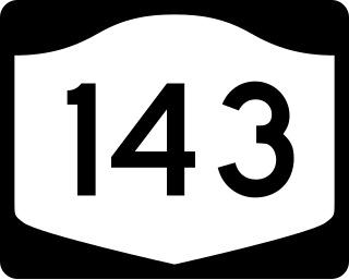
New York State Route 143 (NY 143) is a 18.82-mile-long (30.29 km) state highway in Albany County, New York, in the United States. The highway runs from an intersection with NY 85 in the town of Westerlo to a junction with NY 144 in the hamlet of Coeymans. The entire route is two lanes wide. NY 143 follows the path of the Coeymans and Westerlo Plank Road, a plank road that operated from 1850 to the early 20th century. The road became a state highway by 1915 and was designated NY 143 as part of the 1930 renumbering of state highways in New York.

<span class="mw-page-title-main">New York State Route 396</span> State highway in Albany County, New York, US

New York State Route 396 (NY 396) is a 6.58-mile-long (10.59 km) east–west state highway in Albany County, New York, in the United States. The route is functionally a spur route as it connects to another signed state highway at only one end. The western terminus of NY 396 is at an intersection with County Route 103 (CR 103) in Callanans Corners, a small hamlet situated just south of the Bethlehem–Coeymans town line in the town of Coeymans. Its eastern terminus is at a junction with NY 144 in Bethlehem east of the hamlet of Selkirk. West of Callanans Corners, the road continues northwestward to NY 443 in New Scotland as CR 301. NY 396 was assigned as part of the 1930 renumbering of state highways in New York.

The Ravena-Coeymans-Selkirk Central Schools are located in Albany County, New York. There are four schools in the district: Albertus W. Becker Elementary, Pieter B. Coeymans Elementary, R.C.S. Middle School, and Ravena-Coeymans-Selkirk High School. Albertus W. Becker Elementary is located in Selkirk, Pieter B. Coeymans is located in Coeymans, and R.C.S. Middle School and R.C.S. High School are located in Ravena.

Ravena-Coeymans-Selkirk High School is a small high school in Ravena, New York, about 9 miles south of Albany, New York on U.S. Route 9W.

<span class="mw-page-title-main">Alcove, New York</span> Hamlet in the state of New York, United States

Alcove is a hamlet in the town of Coeymans, Albany County, New York, United States. It is a prime example of a 19th-century mill town located at a rural intersection, and as such it is listed on the National Register of Historic Places in the Albany area as the Alcove Historic District. The city of Albany's Alcove Reservoir lies to the west of the hamlet.

Guilderland is a hamlet of the town of the same name in Albany County, New York, United States.

Fullers is a hamlet in the town of Guilderland, Albany County, New York, United States. The hamlet lies along U.S. Route 20.

Kenwood was a hamlet in the Town of Bethlehem, New York. The hamlet spanned both sides of the Normans Kill near the area where the Normans Kill flows into the Hudson River. In 1870, and again in 1910, northern portions of Kenwood were annexed by the City of Albany, New York.

South Bethlehem is a hamlet in the town of Bethlehem, Albany County, New York, United States. The hamlet sits on New York State Route 396 and lies southwest of the Selkirk Rail Yard and just north of the Coeymans town line.

New Salem is a hamlet in the town of New Scotland, Albany County, New York, United States. It is located in a valley at the foot of the Helderberg Escarpment along New York State Route 85. A local fair and car show is held every year in this small hamlet. It is also home to the town of New Scotland's community center and museum.

Clarksville is a hamlet in the town of New Scotland, Albany County, New York, United States. It is situated along Delaware Turnpike in the southern part of the town at the foot of the Helderberg Escarpment. It is the site of the Clarksville Cave and has an annual Clarksville Heritage Day and Car Show. It is in the Onesquethaw Volunteer Fire Company fire protection district.

The Port of Coeymans is a relatively new marine terminal located about ten miles south of Albany, New York and the Port of Albany-Rensselaer in the town of Coeymans, United States. The port is located on the site of the former Powell & Minnock Brick Company, and is sometimes referred to as the P&M Brick Marine Terminal. The port's large open spaces, as well as access to the Hudson River and New York State Thruway, have led to its use in prefabrication projects, including the Willis Avenue and 145th Street Bridges in New York City. The port owners Carver have invested more than $30 Million to update the facilities. The Port of Coeymans also supported the building of the Tappan Zee Bridge on the Hudson River. Spans of the new bridge were built at the port and floated down the river. The old bridge spans were brought back to the Port, disassembled, reused or recycled.

Coeymans Hollow is a hamlet in Albany County, New York, United States. The community is located along New York State Route 143 4 miles (6.4 km) west of Ravena. Coeymans Hollow has a post office with ZIP code 12046.

References

  1. John M. Clarke (November 1, 1914). "Tenth Report of the Director of the State Museum and Science Department:The Place Names of Albany County". University of the State of New York Bulletin. University of the State of New York. 173 (578): 49. Retrieved March 14, 2010.
  2. 2020 Census, US Census Bureau, https://www.census.gov/search-results.html?searchType=web&cssp=SERP&q=ZIP%2012067%20(Feura%20Bush,%20NY)
  3. 1 2 3 4 5 Frances Ingraham (December 27, 1992). "Rural Hamlet: the Private Life of Feura Bush". p. G1. Retrieved March 9, 2010.[ permanent dead link ]
  4. B.F. Butler and J.C. Spencer (1836). The Revised Statutes of the State of New York, as Altered by the Legislature; Including the Statutory Provisions of a General Nature, Passed From 1828 to 1835 Inclusive. Vol. III. State of New York/Packard and Van Benthuysen. p. 47. Retrieved March 9, 2010.
  5. George Howell and Jonathan Tenney (1886). Bi-Centennial History of Albany: History of the County of Albany from 1609-1886; Volume II. W.W. Munsell and Company. p. 898. Retrieved March 9, 2010.
  6. "Railway and Industrial Section of the Commercial & Financial Chronicle". The Financial Review. William B. Dana Company. 98 (2540): 5. February 28, 1914. Retrieved March 9, 2010.
  7. George Howell and Jonathan Tenney (1886). Bi-Centennial History of Albany: History of the County of Albany from 1609-1886; Volume II. W.W. Munsell and Company. p. 791. Retrieved March 9, 2010.
  8. George Minot, ed. (1855). The Statutes at Large and Treaties of the United States of America. From December 1, 1851, to March 3, 1855. Vol. X. Little, Brown and Company. p. 368. Retrieved March 9, 2010.
  9. New Scotland Historical Association (2000). New Scotland Township. Arcadia Publishing. p. 86. ISBN   0-7385-0420-3 . Retrieved March 9, 2010.
  10. New Scotland Historical Association (2000). New Scotland Township. Arcadia Publishing. p. 88. ISBN   0-7385-0420-3 . Retrieved March 9, 2010.
  11. New Scotland Historical Association (2000). New Scotland Township. Arcadia Publishing. p. 72. ISBN   0-7385-0420-3 . Retrieved March 9, 2010.
  12. New Scotland Historical Association (2000). New Scotland Township. Arcadia Publishing. p. 49. ISBN   0-7385-0420-3 . Retrieved March 9, 2010.