Normansville, New York

Last updated
Normansville
Former hamlet
Etymology: Normansville was situated in the ravine created by the Normans Kill Creek.
USA New York location map.svg
Red pog.svg
Normansville
Location of Normansville within the state of New York
Coordinates: 42°38′01″N73°47′57″W / 42.63361°N 73.79917°W / 42.63361; -73.79917
Country United States
State New York
Region Capital District
County Albany
Time zone UTC-5 (EST)
  Summer (DST) UTC-4 (EDT)
ZIP Code
12054 (Bethlehem side)/12209 (Albany side)
Area code 518

Normansville is a former hamlet in Albany County, New York, United States. In the 19th century, Normansville was a hamlet in the town of Bethlehem. Normansville was located within and along the north and south banks of the ravine carved by the Normans Kill Creek, a tributary of the Hudson River.

Contents

History

Map of Normansville
in 1891 NormansvilleNY.jpg
Map of Normansville
in 1891
Photo of Normansville, circa 1900, school house (Bethlehem side) top left, ice house (Albany side) top right. PappalauIceHouseNormansvilleNY.jpg
Photo of Normansville, circa 1900, school house (Bethlehem side) top left, ice house (Albany side) top right.

Normansville was originally called Upper Hollow; it was named for the deep ravine carved by the Normans Kill in which it was located. Further downstream was Lower Hollow, later named Kenwood. Upper Hollow had its start in 1805 with the construction of the Delaware Turnpike, which ran from the City of Albany to Otego (which then was part of Delaware County). [1] The Turnpike was carried over the Normans Kill ("kill" is the middle Dutch word for "stream") by a 100-foot-long (30 m) wooden bridge. Northwest of this bridge was a toll gate. The wood bridge was washed away by a freshet in 1869 [2] (one year after the turnpike company had abandoned the Turnpike) and the Town of Bethlehem built an iron bridge in its place. [1] [2]

Soon after the Turnpike was constructed, taverns and various industries began to spring up to take advantage of the power that could be harnessed from the Normans Kill's waters. Among the industries were cloth mills and saw mills. Several of these mills were swept aside by the same freshet that washed away the bridge in 1869, but were quickly rebuilt. By the beginning of the 20th century, the mills were abandoned. [2] Another major industry along the Normans Kill was the ice trade. Ice blocks from the Normans Kill during the winter and stored for shipping to New York City and other locations for use in iceboxes. The Pappalau Ice House on the north side of the creek was one of many ice houses along the Normans Kill and the Hudson River at the end of the 1800s; by 1920, it too would be abandoned as new technologies made the ice trade obsolete. [3]

In 1910, much of the boundary between Albany and the Town of Bethlehem was moved south to the Normans Kill. [4] This change split Normansville between the City of Albany and the Town of Bethlehem. [5] Prior to this annexation, the children of Normansville attended a small school (Bethlehem District Number 11) in Normansville on the Delaware Turnpike. After the annexation, those Normansville children whose homes were now located in Albany attended the Albany city schools, and the Normansville children remaining in the Town of Bethlehem continued to attend school in District 11. Due to the annexation and the loss of a large amount of the taxable land, District 11 was consolidated into neighboring District Number 7 in 1919. [6]

In 1929, Delaware Avenue was rerouted and a longer, higher highway bridge called the Normanskill Viaduct was built across the top of the Normans Kill ravine. [7] The Normanskill Viaduct allowed commuters to pass between Bethlehem and Albany along Delaware Avenue without driving into the ravine where Normansville was located.

In the 1980s and 1990s, several changes occurred in the area that had been known as Normansville. In 1986, the original yellow brick turnpike was paved over. [8] In 1987, the Town of Bethlehem closed the Rockefeller Road Bridge due to safety concerns. Rockefeller Road was connected to Kenwood Avenue by way of a 1914 bridge over the (now-abandoned) Delaware and Hudson Railroad tracks. The closure of the bridge was supported by the Normansville Neighborhood Association due to a desire to prevent drivers from using Rockefeller Road as a shortcut between Kenwood and Delaware Avenues. [9] In January 1990, the Old Normans Kill Bridge was closed to vehicular traffic. [10] [11] In the 1990s, the Normanskill Viaduct was dismantled and replaced by a new bridge 50 feet upstream. [12] [13]

Demographics

In 1886, the hamlet of Normansville (which then included both sides of the Normans Kill) included approximately 100 individuals, 22 families, and 17 dwellings. [2] In 1993, it was estimated that the Bethlehem neighborhood of Normansville consisted of 50 people, 19 homes, and one church. [12]

Geography

Normansville was located within and along the banks of a ravine. This ravine was carved by the Normans Kill, a creek and tributary of the Hudson River that forms the border between the city of Albany to the north and the town of Bethlehem to the south. The ravine is of clay banks with the creek flowing over a bed of slate. [2]

Landmarks

Whipple truss bridge at the Steven's Farm. It is on the National Register of Historic Places Whipple Cast - Wrought Iron Bowstring Truss Bridge.jpg
Whipple truss bridge at the Steven's Farm. It is on the National Register of Historic Places

See also

Related Research Articles

<span class="mw-page-title-main">Bethlehem, New York</span> Town in New York, United States

Bethlehem is a town in Albany County, New York, United States. The town's population was 35,034 at the 2020 census. Bethlehem is located immediately to the south of the city of Albany and includes the following hamlets: Delmar, Elsmere, Glenmont, North Bethlehem, Selkirk, Slingerlands, and South Bethlehem. U.S. Route 9W passes through the town. The town is named after the biblical Bethlehem.

Delmar is a hamlet in the Town of Bethlehem, in Albany County, New York, United States. It is a suburb of the neighboring city of Albany. The community is bisected by NY Route 443, a major thoroughfare, main street, and route to Albany.

<span class="mw-page-title-main">Guilderland, New York</span> Town in New York, United States

Guilderland is a town in Albany County, New York, United States. In the 2020 census, the town had a population of 36,848. The town is named for the Gelderland province in the Netherlands. The town of Guilderland is on the central-northwest border of the county. It is just west of Albany, the capital of the U.S. state of New York.

Glenmont is a hamlet in the town of Bethlehem, Albany County, New York, United States. Glenmont is in the northeastern corner of the town and is a suburb of the neighboring city of Albany. It is bordered to the east by the Hudson River. Originally a farm town, today Glenmont is home to residential neighborhoods, a busy commercial corridor along Route 9W, and industry along the riverfront. It is part of the Bethlehem Central School District.

<span class="mw-page-title-main">New York State Route 85</span> State highway in Albany County, New York, US

New York State Route 85 (NY 85) is a state highway in Albany County, New York, in the United States. It is 26.49 miles (42.63 km) in length and runs from CR 353 in Rensselaerville to Interstate 90 (I-90) exit 4 in Albany. It also has a loop route, NY 85A, which connects NY 85 to the village of Voorheesville. The portion of NY 85 north of NY 140 to the Bethlehem–Albany town/city line is known as the Slingerlands Bypass. From there north to I-90, the road is a limited-access, four-lane highway named the Crosstown Arterial.

<span class="mw-page-title-main">New York State Route 443</span> State highway in New York, US

New York State Route 443 (NY 443) is an east–west state highway in the Capital District of New York in the United States. The route begins at an intersection with NY 30 in the town of Schoharie and ends 33.44 miles (53.82 km) later at a junction with U.S. Route 9W (US 9W) and US 20 in the city of Albany. It ascends the Helderberg Escarpment in the towns of Berne and New Scotland. Within the town of Bethlehem and the city of Albany, NY 443 is known as Delaware Avenue.

Slingerlands is a hamlet in the town of Bethlehem, Albany County, New York, United States. It is located immediately west of Delmar and near the New Scotland town-line and south of the Albany city-limits, and is thus a suburb of Albany. The Slingerlands ZIP Code (12159) includes parts of the towns of New Scotland and Guilderland.

Elsmere is a hamlet of the town of the Bethlehem in Albany County, New York, United States. The hamlet is a suburb of the neighboring city of Albany. From the northeast to the southwest, it is bisected by New York Route 443, which is also the hamlet's main street and a major commuter route into Albany. Delaware Avenue is also home to most of the office and retail locations in Elsmere, including the largest such location: Delaware Plaza.

Fort Nassau was the first Dutch settlement in North America, located beside the "North River" within present-day Albany, New York, in the United States. The factorij was a small fortification which served as a trading post and warehouse.

<span class="mw-page-title-main">New York State Route 140</span> State highway in Albany County, New York, US

New York State Route 140 (NY 140) is an east–west state highway located entirely within the town of Bethlehem in Albany County, New York, in the United States. The highway runs for 2.07 miles (3.33 km) from a roundabout with NY 85 near the hamlet of Slingerlands to an intersection with NY 443 in the hamlet of Delmar. The first mile (1.6 km) of the route is a four-lane divided highway named Cherry Avenue Extension, while the second mile follows a two-lane street known as Kenwood Avenue. NY 140 initially followed Kenwood Avenue from the center of Slingerlands to Delmar when it was assigned in the mid-1930s; however, the route was altered to bypass Slingerlands in the mid-1970s.

<span class="mw-page-title-main">Squire Whipple</span>

Squire Whipple was an American civil engineer.

Feura Bush is a hamlet in the town of New Scotland, Albany County, New York, United States. It is in the southeastern corner of the town, along the Bethlehem town-line, eight miles south of Albany. The Feura Bush ZIP Code (12067) includes parts of the town of Bethlehem. It is in the Onesquethaw Volunteer Fire Company fire protection district. The 2020 Census showed 28 employer establishments in the hamlet.
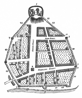
<span class="mw-page-title-main">Streets of Albany, New York</span> Streets of Albany, New York

The streets of Albany, New York have had a long history going back almost 400 years. Many of the streets have changed names over the course of time, some have changed names many times. Some streets no longer exist, others have changed course. Some roads existed only on paper. The oldest streets were haphazardly laid out with no overall plan until Simeon De Witt's 1794 street grid plan. The plan had two grids, one west of Eagle Street and the old stockade, and another for the Pastures District south of the old stockade.

Lisha Kill is a hamlet in the town of Colonie, Albany County, New York, United States. Lisha Kill lies on New York Route 5 in the western section of the town. The hamlet received its name from the creek of the same name, Lisha Kill, kill being Dutch for creek or stream. The stream is also referred to as Lisha's Kill and received its name from a local legend about a Native American woman who is buried along its banks.

Kenwood was a hamlet in the Town of Bethlehem, New York. The hamlet spanned both sides of the Normans Kill near the area where the Normans Kill flows into the Hudson River. In 1870, and again in 1910, northern portions of Kenwood were annexed by the City of Albany, New York.

South Bethlehem is a hamlet in the town of Bethlehem, Albany County, New York, United States. The hamlet sits on New York State Route 396 and lies southwest of the Selkirk Rail Yard and just north of the Coeymans town line.

New Salem is a hamlet in the town of New Scotland, Albany County, New York, United States. It is located in a valley at the foot of the Helderberg Escarpment along New York State Route 85. A local fair and car show is held every year in this small hamlet. It is also home to the town of New Scotland's community center and museum.

Clarksville is a hamlet in the town of New Scotland, Albany County, New York, United States. It is situated along Delaware Turnpike in the southern part of the town at the foot of the Helderberg Escarpment. It is the site of the Clarksville Cave and has an annual Clarksville Heritage Day and Car Show. It is in the Onesquethaw Volunteer Fire Company fire protection district.

<span class="mw-page-title-main">Normans Kill</span> River in New York, United States

The Normans Kill is a 45.4-mile-long (73.1 km) creek in New York's Capital District located in Schenectady and Albany counties. It flows southeasterly from its source in the town of Duanesburg near Delanson to its mouth at the Hudson River in the town of Bethlehem. In the town of Guilderland, the stream is dammed to create the Watervliet Reservoir, a drinking water source for the city of Watervliet and the Town of Guilderland. A one megawatt hydrolectric plant at the dam provides power to pump water to the filtration plant.

<span class="mw-page-title-main">Whipple Cast and Wrought Iron Bowstring Truss Bridge</span> Bridge in NY, U.S.

The Whipple Cast and Wrought Iron Bowstring Truss Bridge, is located near the entrance to Stevens Farm in southwestern Albany, New York, United States. It was built in 1867, but not moved to its present location until 1899. It is one of the oldest surviving iron bridges in the county, one of the few that use both cast and wrought iron and one of only two surviving examples of the Whipple bowstring truss type. In 1971 it was listed on the National Register of Historic Places, the only bridge in the city of Albany so far to be listed individually.

References

  1. 1 2 George Howell and Jonathan Tenney (1886). Bi-Centennial History of Albany: History of the County of Albany from 1609-1886; Volume 2. W.W. Munsell and Company. p. 790. Retrieved 2010-02-10.
  2. 1 2 3 4 5 George Howell and Jonathan Tenney (1886). Bi-Centennial History of Albany: History of the County of Albany from 1609-1886; Volume 2. W.W. Munsell and Company. pp. 781–2. Retrieved 2010-02-10.
  3. "Town of Bethlehem, NY History". Town of Bethlehem. Archived from the original on November 21, 2009. Retrieved 2010-02-25.
  4. Leath, Susan (2016). Historic Tales of Bethlehem, New York. The History Press. p. 144. ISBN   9781467118552.
  5. Leath, Susan (2016). Historic Tales of Bethlehem, New York. The History Press. p. 85. ISBN   9781467118552.
  6. William V.R. Erving (1920). Department Reports of the State of New York Containing the Messages of the Governor and the Decisions, Opinions and Rulings of the State Officers, Departments, Boards and Commissions; Volume 22. J.B. Lyon Company. pp. 300–301. Retrieved 2010-02-28.
  7. Julie Carr (April 6, 1994). "Trees and Faces Both Fall Over Bridge Construction". Albany Times Union. p. B3. Retrieved 2010-02-28.[ permanent dead link ]
  8. Barbara Hayden (September 24, 1989). "Normansville Resident Charts Past Hamlet Once Thriving Center of Homes, Commerce". Albany Times Union. p. B10. Retrieved 2010-02-28.[ permanent dead link ]
  9. "Normansville Group Against Span Reopening". Albany Times Union. October 28, 1987. p. 6A. Retrieved 2010-02-28.[ permanent dead link ]
  10. 1 2 Christopher Ringwald (July 10, 1996). "The Current Slows in Normansville". Albany Times Union. p. B1.[ permanent dead link ]
  11. 1 2 3 Barbara Hayden (February 17, 1990). "History or Economy Closed Bridge a Sore Spot in Normansville". Albany Times Union. p. B6. Retrieved 2010-02-28.[ permanent dead link ]
  12. 1 2 3 Rick Karlin (April 18, 1993). "A Bridges Moves Atop Tiny Normansville". Albany Times Union. p. H1. Retrieved 2010-02-28.[ permanent dead link ]
  13. "Some number of facts about the Normanskill".
  14. Deborah Gesensway (May 9, 1988). "Albany Grows on City Farmers". Albany Times Union. p. A1. Retrieved 2010-02-28.[ permanent dead link ]
  15. Brian Nearing (August 6, 2004). "Old Iron Bridge Showing its Age". Albany Times Union. p. B1. Retrieved 2010-02-28.[ permanent dead link ]
  16. Frances Ingraham (September 22, 2002). "Riding the Beat Albany's Mounted Police Form a Special Bond With Their Equine Partners". Albany Times Union. p. G1. Retrieved 2010-02-28.[ permanent dead link ]
  17. "Lake to be Drained to Fix Sewer Line". Albany Times Union. November 18, 1995. p. B4. Retrieved 2010-02-28.[ permanent dead link ]
  18. Padfield, Dawn (September 1, 2009). "The Yellow Brick Road". All Over Albany.
  19. Rick Karlin (July 6, 1995). "Bridge Legends Run Deep and Wide". Albany Times Union. p. C1. Retrieved 2010-02-28.[ permanent dead link ]