GRACE and GRACE-FO

Last updated
GRACE
GRACE spacecraft model 2.png
Illustration of the twin GRACE satellites
NamesGRACE-1 and GRACE-2 [1] [2]
Tom and Jerry [1] [2]
ESSP-2A and ESSP-2B [3]
Mission typeGravitational science
Operator NASA  · DLR
COSPAR ID
  • 2002-012A
  • 2002-012B
SATCAT no. 27391 and 27392
Website www.csr.utexas.edu/grace
Mission durationPlanned: 5 years
Final: 15 years, 7 months, 9 days
Spacecraft properties
Bus Flexbus [3]
Manufacturer Astrium
Launch mass487 kg (1,074 lb) each [4]
Dimensions1.942 × 3.123 × 0.72 m (6.4 × 10.2 × 2.4 ft) [4]
Start of mission
Launch date17 March 2002, 09:21 (2002-03-17UTC09:21) UTC [5]
Rocket Rokot-KM #2 [3]
Launch site Plesetsk LC-133/3 [3]
Contractor Eurockot
End of mission
Declared27 October 2017 (2017-10-28) [6]
Decay dateGRACE-1: 10 March 2018,
   06:09 UTC [7]

    45°54′S20°24′E / 45.9°S 20.4°E / -45.9; 20.4
GRACE-2: 24 December 2017,
   00:16 UTC [8]

    63°54′N160°54′W / 63.9°N 160.9°W / 63.9; -160.9
Orbital parameters
Reference system Geocentric
Semi-major axis 6,873.5 km (4,271.0 mi)
Eccentricity 0.00182
Perigee altitude 483 km (300 mi)
Apogee altitude 508 km (316 mi)
Inclination 89.0°
Period 94.5 minutes
Epoch 17 March 2002, 04:21  UTC [5]
 

The Gravity Recovery and Climate Experiment (GRACE) was a joint mission of NASA and the German Aerospace Center (DLR). Twin satellites took detailed measurements of Earth's gravity field anomalies from its launch in March 2002 to the end of its science mission in October 2017. The two satellites were sometimes called Tom and Jerry, a nod to the famous cartoon. The GRACE Follow-On (GRACE-FO) is a continuation of the mission on near-identical hardware, launched in May 2018. On March 19, 2024, NASA announced that the successor to GRACE-FO would be Gravity Recovery and Climate Experiment-Continuity (GRACE-C), to be launched in or after 2028. [9]

Contents

By measuring gravity anomalies, GRACE showed how mass is distributed around the planet and how it varies over time. Data from the GRACE satellites is an important tool for studying Earth's ocean, geology, and climate. GRACE was a collaborative endeavor involving the Center for Space Research at the University of Texas at Austin, NASA's Jet Propulsion Laboratory, the German Aerospace Center and Germany's National Research Center for Geosciences, Potsdam. [10] The Jet Propulsion Laboratory was responsible for the overall mission management under the NASA ESSP (Earth System Science Pathfinder) program.

The principal investigator is Byron Tapley of the University of Texas Center for Space Research, and the co-principal investigator is Christoph Reigber of the GeoForschungsZentrum (GFZ) Potsdam. [11]

The two GRACE satellites, GRACE-1 and GRACE-2, were launched from Plesetsk Cosmodrome, Russia, on a Rockot (SS-19 + Breeze upper stage) launch vehicle on 17 March 2002. The spacecraft were launched to an initial altitude of approximately 500 km at a near-polar inclination of 89°. During normal operations, the satellites were separated by 220 km along their orbit track. This system was able to gather global coverage every 30 days. [12] GRACE far exceeded its 5-year design lifespan, operating for 15 years until the decommissioning of GRACE-2 on 27 October 2017. [6] Its successor, GRACE-FO, was successfully launched on 22 May 2018.

In 2019, a glacier in West Antarctica was named after the GRACE mission. [13] [14]

Discoveries and applications

Gravity anomalies on Earth.jpg
Gravity anomaly map from GRACE
GRACE ocean bottom pressure.jpg
Variations in ocean bottom pressure measured by GRACE

The monthly gravity anomalies maps generated by GRACE are up to 1,000 times more accurate than previous maps, substantially improving the accuracy of many techniques used by oceanographers, hydrologists, glaciologists, geologists and other scientists to study phenomena that influence climate. [15]

From the thinning of ice sheets to the flow of water through aquifers and the slow currents of magma inside Earth, mass measurements provided by GRACE help scientists better understand these important natural processes.

Oceanography, hydrology, and ice sheets

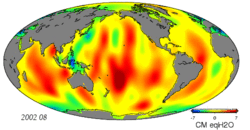
GRACE chiefly detected changes in the distribution of water across the planet. Scientists use GRACE data to estimate ocean bottom pressure (the combined weight of the ocean waters and atmosphere), which is as important to oceanographers as atmospheric pressure is to meteorologists. [16] For example, measuring ocean pressure gradients allows scientists to estimate monthly changes in deep ocean currents. [17] The limited resolution of GRACE is acceptable in this research because large ocean currents can also be estimated and verified by an ocean buoy network. [16] Scientists have also detailed improved methods for using GRACE data to describe Earth's gravity field. [18] GRACE data are critical in helping to determine the cause of sea level rise, whether it is the result of mass being added to the ocean – from melting glaciers, for example – or from thermal expansion of warming water or changes in salinity. [19] High-resolution static gravity fields estimated from GRACE data have helped improve the understanding of global ocean circulation. The hills and valleys in the ocean's surface (ocean surface topography) are due to currents and variations in Earth's gravity field. GRACE enables separation of those two effects to better measure ocean currents and their effect on climate. [20]

GRACE data have provided a record of mass loss within the ice sheets of Greenland and Antarctica. Greenland has been found to lose 280±58  Gt of ice per year between 2003 and 2013, while Antarctica has lost 67±44  Gt per year in the same period. [21] These equate to a total of 0.9 mm/yr of sea level rise. Increases in ocean heat content resulting from Earth's Energy Imbalance of about 0.8 W/m2 were similarly found spanning 2002 thru 2019. [22] [23]

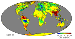
GRACE data have also provided insights into regional hydrology inaccessible to other forms of remote sensing: for example, groundwater depletion in India [24] and California. [25] The annual hydrology of the Amazon basin provides an especially strong signal when viewed by GRACE. [26] A University of California, Irvine-led study published in Water Resources Research on 16 June 2015 used GRACE data between 2003 and 2013 to conclude that 21 of the world's 37 largest aquifers "have exceeded sustainability tipping points and are being depleted" and thirteen of them are "considered significantly distressed." The most over-stressed is the Arabian Aquifer System, upon which more than 60 million people depend for water. [27]

Geophysics

GRACE uses precise measurements of the motions of two spacecraft in Earth's orbit to track the movement of water through the oceans, land, and atmosphere.
Change in mass of the Greenland and Antarctic ice sheets as measured by GRACE Greenland+Antarctica Mass Loss.png
Change in mass of the Greenland and Antarctic ice sheets as measured by GRACE

GRACE also detects changes in the gravity field due to geophysical processes. Glacial isostatic adjustment—the slow rise of land masses once depressed by the weight of ice sheets from the last ice age—is chief among these signals. GIA signals appear as secular trends in gravity field measurements and must be removed to accurately estimate changes in water and ice mass in a region. [28] GRACE is also sensitive to permanent changes in the gravity field due to earthquakes. For instance, GRACE data have been used to analyze the shifts in the Earth's crust caused by the earthquake that created the 2004 Indian Ocean tsunami. [29]

In 2006, a team of researchers led by Ralph von Frese and Laramie Potts used GRACE data to discover the 480-kilometer-wide (300 mi) Wilkes Land crater in Antarctica, which was probably formed about 250 million years ago. [30]

Geodesy

Data from GRACE has improved the current Earth gravitational field model, leading to improvements in the field of geodesy. This improved model has allowed for corrections in the equipotential surface which land elevations are referenced from. This more accurate reference surface allows for more accurate coordinates of latitude and longitude and for less error in the calculation of geodetic satellite orbits. [31]

Other signals

GRACE is sensitive to regional variations in the mass of the atmosphere and high-frequency variation in ocean bottom pressure. These variations are well understood and are removed from monthly gravity estimates using forecast models to prevent aliasing. [32] Nonetheless, errors in these models do influence GRACE solutions. [33]

GRACE data also contribute to fundamental physics. They have been used to re-analyze data obtained from the LAGEOS experiment to try to measure the relativistic frame-dragging effect. [34] [35]

Spacecraft

Diagrams illustrating the systems and instruments aboard the GRACE spacecraft GRACE schematics.png
Diagrams illustrating the systems and instruments aboard the GRACE spacecraft
Global Gravity Anomaly Animation over LAND.gif
Global Gravity Anomaly Animation over OCEANS.gif
Global gravity anomaly animations over land and oceans by GRACE

The spacecraft were manufactured by Astrium of Germany, using its "Flexbus" platform. The microwave RF systems, and attitude determination and control system algorithms were provided by Space Systems/Loral. The star cameras used to measure the spacecraft attitude were provided by Technical University of Denmark. The instrument computer along with a highly precise BlackJack GPS receiver and digital signal processing system was provided by JPL in Pasadena. The highly precise accelerometer that is needed to separate atmospheric and solar radiation pressure effects from the gravitation data was manufactured by ONERA.

Measurement principle

GRACE's key measurement, satellite gravimetry, is not derived from electromagnetic waves. Instead, the mission uses a microwave ranging system to accurately measure changes in the speed and distance between two identical spacecraft flying in a polar orbit about 220 kilometers (140 mi) apart, 500 kilometers (310 mi) above Earth. The ranging system is sensitive enough to detect separation changes as small as 10 micrometers (approximately one-tenth the width of a human hair) over a distance of 220 kilometers. [4] As the twin GRACE satellites circle the globe 15 times a day, they sense minute variations in Earth's gravitational pull. When the first satellite passes over a region of slightly stronger gravity, a gravity anomaly, it is pulled slightly ahead of the trailing satellite. This causes the distance between the satellites to increase. The first spacecraft then passes the anomaly, and slows down again; meanwhile the following spacecraft accelerates, then decelerates over the same point. By measuring the constantly changing distance between the two satellites and combining that data with precise positioning measurements from Global Positioning System (GPS) instruments, scientists can construct a detailed map of Earth's gravity anomalies.

Instruments

The two satellites (nicknamed "Tom" and "Jerry") constantly maintain a two-way, K-band microwave-ranging link between them. Fine distance measurements are made by comparing frequency shifts of the link. This is made possible due to the onboard Ultra Stable Oscillator (USO) which produces the frequencies for the K-band ranging system. [36] The micrometer-sensitivity of this measurement requires accordingly precise measurements of each spacecraft's position, motion, and orientation to be useful. To remove the effect of external, non-gravitational forces (e.g., drag, solar radiation pressure), the vehicles use sensitive Super STAR electrostatic accelerometers located near their respective centers of mass. GPS receivers are used to establish the precise positions of each satellite along the baseline between the satellites. The satellites use star cameras and magnetometers to establish attitude. The GRACE vehicles also have optical corner reflectors to enable laser ranging from ground stations using the Center of Mass Trim Assembly (MTA) which ensures the center of mass is modified throughout the flight accordingly. [36]

Data products

CSR, GFZ, and JPL process observations and ancillary data downloaded from GRACE to produce monthly geopotential models of Earth. [37] These models are distributed as spherical harmonic coefficients with a maximum degree of 60. Degree 90 products are also available. These products have a typical latency of 1–2 months. These geopotential coefficients may be used to compute geoid height, gravity anomalies, and changes in the distribution of mass on Earth's surface. [38] Gridded products estimating changes in mass in units of liquid water equivalent thickness are available at JPL's GRACE Tellus website.

End of mission

Following an age-related battery issue on GRACE-2 in September 2017, it became apparent that GRACE-2's remaining battery capacity would not be sufficient to operate. Therefore, it was decided in mid-October to decommission the GRACE-2 satellite and end GRACE's science mission. [6] Atmospheric reentry of GRACE-2 occurred on 24 December 2017 at approximately 00:16 UTC; [8] atmospheric reentry of GRACE-1 took place on 10 March 2018 around 06:09 UTC. [7]

GRACE Follow-On

GRACE-FO
GRACE-FO.jpg
Illustration of the twin GRACE-FO satellites
Names
Mission typeGravitational science
Operator NASA  · DLR [41]
COSPAR ID
  • 2018-047A
  • 2018-047B
SATCAT no. 43476 and 43477
Website nasa.gov/missions/grace-fo/
Mission durationPlanned: 5 years
Elapsed: 5 years, 9 months, 28 days
Spacecraft properties
Bus Flexbus [42]
Manufacturer Airbus Defence and Space (formerly Astrium) [43]
Launch mass600 kg (1,300 lb) each [44]
Dimensions1.943 × 3.123 × 0.78 m (6.4 × 10.2 × 2.6 ft) [44]
Start of mission
Launch date22 May 2018, 19:47:58 (2018-05-22UTC19:47:58) UTC
Rocket Falcon 9
Launch site Vandenberg AFB, California
Contractor SpaceX
Orbital parameters
Reference system Geocentric
Semi-major axis 6,872.2 km (4,270.2 mi)
Eccentricity 0.00179
Perigee altitude 481.7 km (299.3 mi)
Apogee altitude 506.3 km (314.6 mi)
Inclination 89.0°
Period 94.5 minutes
Epoch 29 September 2019, 15:36:45  UTC [45]
 

The GRACE-FO mission, a collaboration between NASA and GFZ, was launched on 22 May 2018 aboard a SpaceX Falcon 9 rocket from Vandenberg AFB, California, sharing the launch with five Iridium NEXT satellites. [46] [47] During in-orbit checks, an anomaly was discovered in the primary system component of the microwave instrument (MWI), and the system was temporarily powered down on 19 July 2018. [48] After a full investigation by an anomaly response team at JPL, the backup system in the MWI was powered up on 19 October 2018 and GRACE-FO resumed its in-orbit checks. [48] [49] GRACE-FO entered the science phase of its mission on 28 January 2019. [50]

The orbit and design of GRACE-FO is very similar to its predecessor. [51] GRACE-FO employs the same two-way microwave-ranging link as GRACE, which will allow for similar inter-satellite ranging precision. In addition, GRACE-FO employs laser-ranging interferometry (LRI) as a technological experiment in preparation for future satellites. [52] [53] [54] The LRI allows for more accurate inter-satellite ranging due to the shorter wavelength of light, and additionally allows the angle between the two spacecraft to be measured as well as their separation via differential wavefront sensing (DWS). [55] [56] [57] Using the LRI, scientists have improved the precision of the separation distance measurements by a factor of more than 20 relative to the GRACE mission. [51] [58] Each laser on the LRI has about the same power as four laser pointers. [59] These lasers must be detected by a spacecraft about 220 kilometres (140 mi) away. [59] This laser approach will generate much more accurate measurements than the previous GRACE satellite mission. [60]

The GRACE-FO satellites obtain electricity from gallium arsenide solar cell array panels covering the outside of each satellite. [61]

GRACE-FO will continue to monitor Earth's gravity and climate. The mission will track gravitational changes in global sea levels, glaciers, and ice sheets, as well as large lake and river water levels, and soil moisture. [55] In addition, each of the satellites will use GPS antennas to create at least 200 profiles per day of atmospheric temperature distribution and water vapor content, a first for the GRACE mission. [51]

GRACE-FO has a design life of 5 years. [51] [62]

See also

Related Research Articles

<span class="mw-page-title-main">Lunar Laser Ranging experiments</span> Measuring the distance between the Earth and the Moon with laser light

Lunar Laser Ranging (LLR) is the practice of measuring the distance between the surfaces of the Earth and the Moon using laser ranging. The distance can be calculated from the round-trip time of laser light pulses travelling at the speed of light, which are reflected back to Earth by the Moon's surface or by one of several retroreflectors installed on the Moon. Three were placed by the United States' Apollo program, two by the Soviet Lunokhod 1 and 2 missions, and one by India's Chandrayaan-3 mission.

<span class="mw-page-title-main">Mass concentration (astronomy)</span> Region of a planet or moons crust that contains a large positive gravitational anomaly

In astronomy, astrophysics and geophysics, a mass concentration is a region of a planet's or moon's crust that contains a large positive gravity anomaly. In general, the word "mascon" can be used as a noun to refer to an excess distribution of mass on or beneath the surface of an astronomical body, such as is found around Hawaii on Earth. However, this term is most often used to describe a geologic structure that has a positive gravitational anomaly associated with a feature that might otherwise have been expected to have a negative anomaly, such as the "mascon basins" on the Moon.

<span class="mw-page-title-main">LAGEOS</span> Scientific research satellites

LAGEOS, Laser Geodynamics Satellite or Laser Geometric Environmental Observation Survey, are a series of two scientific research satellites designed to provide an orbiting laser ranging benchmark for geodynamical studies of the Earth. Each satellite is a high-density passive laser reflector in a very stable medium Earth orbit (MEO).

<span class="mw-page-title-main">Satellite laser ranging</span>

In satellite laser ranging (SLR) a global network of observation stations measures the round trip time of flight of ultrashort pulses of light to satellites equipped with retroreflectors. This provides instantaneous range measurements of millimeter level precision which can be accumulated to provide accurate measurement of orbits and a host of important scientific data. The laser pulse can also be reflected by the surface of a satellite without a retroreflector, which is used for tracking space debris.

<span class="mw-page-title-main">Jason-1</span> Satellite oceanography mission

Jason-1 was a satellite altimeter oceanography mission. It sought to monitor global ocean circulation, study the ties between the ocean and the atmosphere, improve global climate forecasts and predictions, and monitor events such as El Niño and ocean eddies. Jason-1 was launched in 2001 and it was followed by OSTM/Jason-2 in 2008, and Jason-3 in 2016 – the Jason satellite series. Jason-1 was launched alongside the TIMED spacecraft.

<span class="mw-page-title-main">Gravimetry</span> Measurement of the strength of a gravitational field

Gravimetry is the measurement of the strength of a gravitational field. Gravimetry may be used when either the magnitude of a gravitational field or the properties of matter responsible for its creation are of interest. The study of gravity changes belongs to geodynamics.

<span class="mw-page-title-main">Satellite geodesy</span> Measurement of the Earth using satellites

Satellite geodesy is geodesy by means of artificial satellites—the measurement of the form and dimensions of Earth, the location of objects on its surface and the figure of the Earth's gravity field by means of artificial satellite techniques. It belongs to the broader field of space geodesy. Traditional astronomical geodesy is not commonly considered a part of satellite geodesy, although there is considerable overlap between the techniques.

<span class="mw-page-title-main">TOPEX/Poseidon</span> Satellite mission to map ocean surface topography

TOPEX/Poseidon was a joint satellite altimeter mission between NASA, the U.S. space agency; and CNES, the French space agency, to map ocean surface topography. Launched on August 10, 1992, it was the first major oceanographic research satellite. TOPEX/Poseidon helped revolutionize oceanography by providing data previously impossible to obtain. Oceanographer Walter Munk described TOPEX/Poseidon as "the most successful ocean experiment of all time." A malfunction ended normal satellite operations in January 2006.

<span class="mw-page-title-main">Gravity Field and Steady-State Ocean Circulation Explorer</span> ESA satellite intended to map in the Earths gravity field. Part of the Living Planet Programme

The Gravity Field and Steady-State Ocean Circulation Explorer (GOCE) was the first of ESA's Living Planet Programme heavy satellites intended to map in unprecedented detail the Earth's gravity field. The spacecraft's primary instrumentation was a highly sensitive gravity gradiometer consisting of three pairs of accelerometers which measured gravitational gradients along three orthogonal axes.

<span class="mw-page-title-main">CHAMP (satellite)</span> Geoscientific space mission

Challenging Minisatellite Payload (CHAMP) was a German satellite launched July 15, 2000 from Plesetsk, Russia and was used for atmospheric and ionospheric research, as well as other geoscientific applications, such as GPS radio occultation, gravity field determination, and studying the Earth's magnetic field.

<span class="mw-page-title-main">GRAIL</span> 2011–12 NASA mission to study the Moons geology

The Gravity Recovery and Interior Laboratory (GRAIL) was an American lunar science mission in NASA's Discovery Program which used high-quality gravitational field mapping of the Moon to determine its interior structure. The two small spacecraft GRAIL A (Ebb) and GRAIL B (Flow) were launched on 10 September 2011 aboard a single launch vehicle: the most-powerful configuration of a Delta II, the 7920H-10. GRAIL A separated from the rocket about nine minutes after launch, GRAIL B followed about eight minutes later. They arrived at their orbits around the Moon 25 hours apart. The first probe entered orbit on 31 December 2011 and the second followed on 1 January 2012. The two spacecraft impacted the Lunar surface on December 17, 2012.

<span class="mw-page-title-main">OSTM/Jason-2</span> International Earth observation satellite mission

OSTM/Jason-2, or Ocean Surface Topography Mission/Jason-2 satellite, was an international Earth observation satellite altimeter joint mission for sea surface height measurements between NASA and CNES. It was the third satellite in a series started in 1992 by the NASA/CNES TOPEX/Poseidon mission and continued by the NASA/CNES Jason-1 mission launched in 2001.

<span class="mw-page-title-main">Ocean surface topography</span> Shape of the ocean surface relative to the geoid

Ocean surface topography or sea surface topography, also called ocean dynamic topography, are highs and lows on the ocean surface, similar to the hills and valleys of Earth's land surface depicted on a topographic map. These variations are expressed in terms of average sea surface height (SSH) relative to Earth's geoid. The main purpose of measuring ocean surface topography is to understand the large-scale ocean circulation.

<span class="mw-page-title-main">Soil Moisture Active Passive</span> NASA earth monitoring satellite that measures global soil moisture

Soil Moisture Active Passive (SMAP) is a NASA environmental monitoring satellite that measures soil moisture across the planet. It is designed to collect a global 'snapshot' of soil moisture every 2 to 3 days. With this frequency, changes from specific storms can be measured while also assessing impacts across seasons of the year. SMAP was launched on 31 January 2015. It was one of the first Earth observation satellites developed by NASA in response to the National Research Council's Decadal Survey.

ICESat-2, part of NASA's Earth Observing System, is a satellite mission for measuring ice sheet elevation and sea ice thickness, as well as land topography, vegetation characteristics, and clouds. ICESat-2, a follow-on to the ICESat mission, was launched on 15 September 2018 onboard Delta II as the final flight from Vandenberg Air Force Base in California, into a near-circular, near-polar orbit with an altitude of approximately 496 km (308 mi). It was designed to operate for three years and carry enough propellant for seven years. The satellite orbits Earth at a speed of 6.9 kilometers per second (4.3 mi/s).

<span class="mw-page-title-main">GEOS-3</span> Satellite

GEOS-3, or Geodynamics Experimental Ocean Satellite 3, or GEOS-C, was the third and final satellite as part of NASA's Geodetic Earth Orbiting Satellite/Geodynamics Experimental Ocean Satellite program (NGSP) to better understand and test satellite tracking systems. For GEOS 1 and GEOS 2, the acronym stands for Geodetic Earth Orbiting Satellite; this was changed for GEOS-3.

<span class="mw-page-title-main">Europa Clipper</span> Planned NASA space mission to Jupiter

Europa Clipper is a space probe in development by NASA. Planned for launch in October 2024, the spacecraft is being developed to study the Galilean moon Europa through a series of flybys while in orbit around Jupiter.

<span class="mw-page-title-main">Michael M. Watkins</span>

Michael M. Watkins is an American engineer, scientist, and a Professor of Aerospace and Geophysics at the California Institute of Technology (Caltech). He previously served as the 9th director of NASA's Jet Propulsion Laboratory in Pasadena, California, and as a vice president of Caltech, which staffs and manages JPL for NASA. His directorial position was effective from July 1, 2016 to August 20, 2021.

<span class="mw-page-title-main">Jean Dickey</span> American geodesist and particle physicist

Jean O'Brien Dickey was an American scientist. Dickey was a pioneering geodesist and particle physicist with expertise in Earth rotation. After receiving a PhD from Rutgers University, she spent much of her career at NASA's Jet Propulsion Laboratory (JPL). Between 1994 and 1996, she served as President of the American Geophysical Union's geodesy section, the first woman to hold that position.

References

  1. 1 2 "GRACE 1". National Space Science Data Center . NASA. Retrieved 17 August 2016.
  2. 1 2 "GRACE 2". National Space Science Data Center . NASA. Retrieved 17 August 2016.
  3. 1 2 3 4 "GRACE (ESSP 2)". Gunter's Space Page. Retrieved 10 December 2017.
  4. 1 2 3 "GRACE Launch: Press Kit" (PDF). NASA. March 2002. Retrieved 11 December 2017.
  5. 1 2 "Trajectory Details: GRACE 1". National Space Science Data Center . NASA. Retrieved 23 May 2019.
  6. 1 2 3 NASA (27 October 2017). "Prolific Earth Gravity Satellites End Science Mission". Jet Propulsion Laboratory . Retrieved 31 October 2017.
  7. 1 2 "Decay Data: GRACE-1" . Space-Track. 10 March 2018. Retrieved 11 March 2018.
  8. 1 2 "Decay Data: GRACE-2" . Space-Track. 24 December 2017. Retrieved 13 February 2018.
  9. "US, Germany Partnering on Mission to Track Earth's Water Movement". NASA Jet Propulsion Laboratory (JPL). 19 March 2024. Retrieved 21 March 2024.
  10. "Grace Space Twins Set to Team Up to Track Earth's Water and Gravity". NASA/JPL. Archived from the original on 5 June 2011. Retrieved 14 August 2009.
  11. "Mission Overview". University of Texas. 19 November 2008. Archived from the original on 15 May 2009.
  12. "Gravity Anomaly Maps and The Geoid". Earth Observatory. NASA. 30 March 2004. Retrieved 14 March 2018.
  13. Amos, Jonathan (7 June 2019). "Antarctic glaciers to honour 'satellite heroes'". BBC News. Retrieved 29 September 2019.
  14. "Antarctic Glaciers Named After Satellites". European Space Agency. 7 June 2019. Retrieved 29 September 2019.
  15. "New Gravity Mission on Track to Map Earth's Shifty Mass". NASA/JPL. Retrieved 1 March 2023.
  16. 1 2 Rasmussen, Carol (1 November 2015). "NASA Finds New Way to Track Ocean Currents from Space". NASA/Jet Propulsion Laboratory. Retrieved 14 March 2018.
  17. Stillman, Dan (16 April 2007). "Measuring Gravity With GRACE". NASA. Retrieved 14 March 2018.
  18. Watkins, Michael M.; et al. (April 2015). "Improved methods for observing Earth's time variable mass distribution with GRACE using spherical cap mascons". Journal of Geophysical Research: Solid Earth. 120 (4): 2648–2671. Bibcode:2015JGRB..120.2648W. doi: 10.1002/2014JB011547 .
  19. Sullivant, Rosemary (14 June 2006). "NASA Missions Help Dissect Sea Level Rise". NASA/Jet Propulsion Laboratory. Retrieved 14 March 2018.
  20. Sullivant, Rosemary (26 August 2009). "Gravity data sheds new light on ocean, climate". NASA. Retrieved 14 March 2018.
  21. Velicogna, Isabella; Sutterly, T.C.; van den Broeke, M.R. (2014). "Regional acceleration in ice mass loss from Greenland and Antarctica using GRACE time-variable gravity data". J. Geophys. Res. Space Phys. 41 (119): 8130–8137. Bibcode:2014GeoRL..41.8130V. doi:10.1002/2014GL061052. hdl: 1874/308354 . S2CID   53062626.
  22. Marti, Florence; Blazquez, Alejandro; Meyssignac, Benoit; Ablain, Michaël; Barnoud, Anne; et al. (2021). "Monitoring the ocean heat content change and the Earth energy imbalance from space altimetry and space gravimetry". Earth System Science Data. doi: 10.5194/essd-2021-220 .
  23. Hakuba, M.Z.; Frederikse, T.; Landerer, F.W. (28 August 2021). "Earth's Energy Imbalance From the Ocean Perspective (2005–2019)". Geophysical Research Letters. 48 (16). Bibcode:2021GeoRL..4893624H. doi: 10.1029/2021GL093624 .
  24. Tiwari, V.M.; Wahr, J.; Swenson, S. (2009). "Dwindling groundwater resources in northern India, from satellite gravity observations". Geophysical Research Letters. 36 (18). L18401. Bibcode:2009GeoRL..3618401T. doi:10.1029/2009GL039401.
  25. Famiglietti, J (2011). "Satellites measure recent rates of groundwater depletion in California's Central Valley" (PDF). Geophys. Res. Lett. 38 (3). L03403. Bibcode:2011GeoRL..38.3403F. doi: 10.1029/2010GL046442 .
  26. Tapley, Byron D.; Bettadpur, Srinivas; Ries, John C.; Thompson, Paul F.; Watkins, Michael M. (2004). "GRACE Measurements of Mass Variability in the Earth System" (PDF). Science. 305 (5683): 503–505. Bibcode:2004Sci...305..503T. doi:10.1126/science.1099192. PMID   15273390. S2CID   7357519.
  27. "Study: Third of Big Groundwater Basins in Distress". NASA. 16 June 2015. Retrieved 26 June 2015.
  28. Tregoning; Ramillien; McQueen; Zwartz (2009). "Glacial isostatic adjustment and nonstationary signals observed by GRACE". J. Geophys. Res. 114 (B6): B06406. Bibcode:2009JGRB..114.6406T. doi: 10.1029/2008JB006161 . S2CID   15724840.
  29. Chang, Kenneth (8 August 2006). "Before the '04 Tsunami, an Earthquake So Violent It Even Shook Gravity". The New York Times. Retrieved 4 May 2010.
  30. "Big Bang in Antarctica—Killer Crater Found Under Ice". Ohio State University. Archived from the original on 6 March 2016.
  31. "GRACE – Gravity Recovery and Climate Experiment". University of Texas Center for Space Research. Retrieved 21 March 2018.
  32. "GRACE AOD1B". gfz-potsdam.de. GFZ German Research Centre for Geosciences . Retrieved 11 June 2015.
  33. Ge, Shengjie (2006). GPS radio occultation and the role of atmospheric pressure on spaceborne gravity estimation over Antarctica. Ohio State University. Retrieved 11 June 2015.
  34. Ciufolini, I.; Pavlis, E.C. (2004). "A confirmation of the general relativistic prediction of the Lense–Thirring effect" (PDF). Nature. 431 (7011): 958–960. Bibcode:2004Natur.431..958C. doi:10.1038/nature03007. PMID   15496915. S2CID   4423434. Archived from the original (PDF) on 13 June 2015.
  35. Ciufolini, I.; Pavlis, E.C.; Peron, R. (2006). "Determination of frame-dragging using Earth gravity models from CHAMP and GRACE". New Astron. 11 (8): 527–550. Bibcode:2006NewA...11..527C. doi:10.1016/j.newast.2006.02.001.
  36. 1 2 "Spacecraft". GRACE Mission. NASA. 6 June 2013. Retrieved 10 March 2019.
  37. "GRACE PO.DAAC". JPL Physical Oceanography and Distributed Active Archive Center. Retrieved 11 June 2015.
  38. Wahr, John; Molenaar, M.; Bryan, F. (1998). "Time variability of the Earth's gravity field: Hydrological and oceanic effects and their possible detection using GRACE". J. Geophys. Res. 103 (B12): 30205–30229. Bibcode:1998JGR...10330205W. doi: 10.1029/98JB02844 . S2CID   140194666.
  39. "GRACE-FO 1". National Space Science Data Center . NASA. Retrieved 23 May 2019.
  40. "GRACE-FO 2". National Space Science Data Center . NASA. Retrieved 23 May 2019.
  41. "Twin Spacecraft Launch to Track Earth's Water Movement". NASA. 22 May 2018. Retrieved 28 May 2019.
  42. "GRACE-FO". Gunter's Space Page. Retrieved 23 May 2019.
  43. "GRACE-FO". eoPortal. Retrieved 26 May 2019.
  44. 1 2 "GRACE-FO Launch Press Kit" (PDF). NASA. May 2018. Retrieved 23 May 2019.
  45. "GRACE-FO 1 – Orbit". Heavens-Above.com. 29 September 2019. Retrieved 29 September 2019.
  46. "GRACE-FO Mission". NASA/JPL. Retrieved 19 November 2017.
  47. Weitering, Hanneke (22 May 2018). "SpaceX Launches Twin NASA Probes to Track Earth's Water (and Satellites Hitch a Ride)". Space.com. Retrieved 22 May 2018.
  48. 1 2 Rasmussen, Carol (1 November 2018). "GRACE-FO Resumes Data Collection". NASA. Retrieved 2 November 2018.
  49. Smith, Esprit (14 September 2018). "GRACE-FO Satellite Switching to Backup Instrument Processing Unit". NASA/JPL. Retrieved 14 September 2018.
  50. Webb, Frank; et al. (January–March 2019). "GRACE Follow-On Science Team & Highlights" (PDF). Science Data System Newsletter (2).
  51. 1 2 3 4 "GRACE-FO: Tracking Earth's Mass in Motion" (PDF). NASA. 2017. NP-2017-4-002-GSFC.
  52. "Airbus Defence and Space to build two new research satellites for NASA" (Press release). Airbus Defence and Space. 29 November 2012. Archived from the original on 20 July 2014.
  53. "Spacecraft: Microwaves and Lasers". GRACE-FO. NASA/JPL. Retrieved 11 December 2017.
  54. "Laser Ranging Interferometer". GRACE-FO. NASA/JPL. Retrieved 29 September 2019.
  55. 1 2 "GRACE Tellus: GRACE-FO". GRACE Tellus. NASA/JPL. Retrieved 18 April 2018.
  56. "GRACE-FO". eoPortal. European Space Agency. Retrieved 7 May 2020.
  57. Abich, Klaus; et al. (11 May 2015). "GRACE-Follow On Laser Ranging Interferometer: German contribution". Journal of Physics: Conference Series. 610 (1). 012010. Bibcode:2015JPhCS.610a2010A. doi: 10.1088/1742-6596/610/1/012010 . hdl: 21.11116/0000-0003-655A-7 .
  58. Johnston, Hamish (23 July 2019). "Distance between spacecraft measured at the atomic scale". PhysicsWorld. Retrieved 29 September 2019.
  59. 1 2 "Lasers in Space: GRACE-FO Tests New Technology". GRACE-FO. NASA. 8 May 2018. Retrieved 5 March 2020.
  60. "Spacecraft Overview". GRACE-FO. NASA. Retrieved 5 March 2020.
  61. "Solar Cell Arrays". GRACE-FO. NASA. Retrieved 27 February 2020.
  62. "GRACE-FO" (PDF). NASA Facts. NASA. Retrieved 29 September 2019.