Gassville, Arkansas

Last updated

Gassville, Arkansas
Gassville, Arkansas logo 2021.png
Baxter County Arkansas Incorporated and Unincorporated areas Gassville Highlighted 0526050.svg
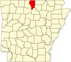
Location of Gassville in Baxter County, Arkansas.
Coordinates: 36°16′59″N92°29′24″W / 36.28306°N 92.49000°W / 36.28306; -92.49000
Country United States
State Arkansas
County Baxter
IncorporatedJanuary 20, 1903
Named for P. A. Cox, town founder and a talkative man nicknamed a "gasser" [1]
Government
  Type Mayor-city council
Area
[2]
  Total3.43 sq mi (8.89 km2)
  Land3.43 sq mi (8.89 km2)
  Water0.00 sq mi (0.00 km2)
Elevation
[3]
742 ft (226 m)
Population
 (2020)
  Total2,171
  Density632.76/sq mi (244.32/km2)
Time zone UTC-6 (Central (CST))
  Summer (DST) UTC-5 (CDT)
ZIP code
72635
Area code 870
FIPS code 05-26050
GNIS feature ID2403683 [3]
Website http://www.gassville.com/

Gassville (formerly Mount Pleasant and Turkey's Neck) is a city in Baxter County, Arkansas, United States. According to the 2020 census, the city population was 2,171.

Contents

Geography

Gassville is located at 36°16′59″N92°29′24″W / 36.28306°N 92.49000°W / 36.28306; -92.49000 (36.283160, -92.490124). [4]

According to the United States Census Bureau, the city has a total area of 3.6 square miles (9.3 km2), all land.

Major highways

Education

Gassville is served by the Cotter School District and students attend Cotter High School to graduate from public schooling. [5]

Demographics

Historical population
CensusPop.Note
1910 198
1920 191−3.5%
1930 22718.8%
1940 2280.4%
1950 27319.7%
1960 233−14.7%
1970 43486.3%
1980 85997.9%
1990 1,16735.9%
2000 1,70646.2%
2010 2,07821.8%
2020 2,1714.5%
U.S. Decennial Census [6]
2014 Estimate [7]

2020 census

Gassville racial composition [8]
RaceNumberPercentage
White (non-Hispanic)1,91188.02%
Black or African American (non-Hispanic)50.23%
Native American 100.46%
Asian 70.32%
Other/Mixed 1707.83%
Hispanic or Latino 683.13%

As of the 2020 United States census, there were 2,171 people, 942 households, and 627 families residing in the city.

2010 census

As of the census [9] of 2010, there were 2,158 people, 688 households, and 502 families residing in the city. The population density was 508.1 inhabitants per square mile (196.2/km2). There were 712 housing units at an average density of 208.3 per square mile (80.4/km2). The racial makeup of the city was 97.83% White, 0.18% Black or African American, 0.41% Native American, 0.29% Asian, 0.06% Pacific Islander, 0.35% from other races, and 0.88% from two or more races. 1.17% of the population were Hispanic or Latino of any race.

There were 653 households, out of which 34.5% had children under the age of 18 living with them, 56.0% were married couples living together, 12.7% had a female householder with no husband present, and 27.4% were non-families. 23.9% of all households were made up of individuals, and 11.3% had someone living alone who was 65 years of age or older. The average household size was 2.45 and the average family size was 2.89.

In the city, the population was spread out, with 26.8% under the age of 18, 6.8% from 18 to 24, 27.5% from 25 to 44, 20.2% from 45 to 64, and 18.6% who were 65 years of age or older. The median age was 37 years. For every 100 females, there were 84.8 males. For every 100 females age 18 and over, there were 78.5 males.

The median income for a household in the city was $25,478, and the median income for a family was $30,481. Males had a median income of $22,955 versus $17,267 for females. The per capita income for the city was $12,221. About 11.7% of families and 18.9% of the population were below the poverty line, including 25.4% of those under age 18 and 14.0% of those age 65 or over.

Notable events

On February 4, 2006, Gassville police officer Jim Sell was fatally shot when attempting to apprehend Jacob D. Robida, a fugitive wanted in connection with a Massachusetts hate crime.

On February 5, 2008, Gassville was devastated by a tornado. The town was sealed off, due to the possibility of gas leaks causing an explosion.

See also

Related Research Articles

<span class="mw-page-title-main">Van Buren County, Arkansas</span> County in Arkansas, United States

Van Buren County is a county located in the U.S. state of Arkansas. As of the 2020 census, the population was 15,796. The county seat is Clinton. The county was formed on November 11, 1833, and named for Martin Van Buren, President of the United States, who was Vice President at the time of the county's formation. Van Buren County was a dry county until November 3, 2020, as the county residents voted to make it a wet county.

<span class="mw-page-title-main">Sebastian County, Arkansas</span> County in Arkansas, United States

Sebastian County is a county located in the U.S. state of Arkansas. As of the 2020 census, the population was 127,799, making it the fourth-most populous county in Arkansas. The county has two county seats, Greenwood and Fort Smith.

<span class="mw-page-title-main">Searcy County, Arkansas</span> County in Arkansas, United States

Searcy County is a county located in the U.S. state of Arkansas. As of the 2020 census, the population was 7,828. The county seat is Marshall. The county was formed December 13, 1838, from a portion of Marion County and named for Richard Searcy, the first clerk and judge in the Arkansas Territory. The city of Searcy, Arkansas, some 70 miles away, shares the name despite having never been part of Searcy County. The county is an alcohol prohibition or dry county.

<span class="mw-page-title-main">Marion County, Arkansas</span> County in Arkansas, United States

Marion County is located in the Ozark Mountains in the U.S. state of Arkansas. The county is named for Francis Marion, the famous "Swamp Fox" of the Revolutionary War. Created as Arkansas's 35th county in 1836, Marion County is home to one incorporated town and four incorporated cities, including Yellville, the county seat. The county is also the site of numerous unincorporated communities and ghost towns. The county included part of what is now Searcy County, Arkansas, with many opposing to dividing them, which helped fueled the bloody Tutt-Everett War between 1844 and 1850.

<span class="mw-page-title-main">Izard County, Arkansas</span> County in Arkansas, United States

Izard County is a county located in the U.S. state of Arkansas. As of the 2020 census, the population was 13,577. The county seat is Melbourne. Izard County is Arkansas's 13th county, formed on October 27, 1825, and named for War of 1812 General and Arkansas Territorial Governor George Izard. It is an alcohol prohibition or dry county.

<span class="mw-page-title-main">Fulton County, Arkansas</span> County in Arkansas, United States

Fulton County is a county located in the U.S. state of Arkansas. As of the 2020 census, the population was 12,075. The county seat is Salem. Fulton County was formed on December 21, 1842, and named for William Fulton, the last governor of the Arkansas Territory. It is an alcohol prohibition or dry county.

<span class="mw-page-title-main">Dallas County, Arkansas</span> County in Arkansas, United States

Dallas County is a county located in the U.S. state of Arkansas. As of the 2020 census, the population was 6,482, making it the fourth-least populous county in Arkansas. The county seat is Fordyce. Dallas County is Arkansas's 49th county, formed on January 1, 1845; it was named for George M. Dallas, 11th Vice President of the United States.

<span class="mw-page-title-main">Baxter County, Arkansas</span> County in Arkansas, United States

Baxter County is a county in the Ozark Mountains of Arkansas. Created as Arkansas's 66th county on March 24, 1873, the county has eight incorporated municipalities, including Mountain Home, it's largest city and county seat. The county is named for Elisha Baxter, the tenth governor of Arkansas. It is coterminal with the Mountain Home Micropolitan Statistical Area.

<span class="mw-page-title-main">Big Flat, Arkansas</span> Town in Arkansas, United States

Big Flat is a town in Baxter and Searcy counties in the U.S. state of Arkansas. The population was 88 at the 2020 census.

<span class="mw-page-title-main">Briarcliff, Arkansas</span> City in Arkansas, United States

Briarcliff is a second-class city in Baxter County, Arkansas, United States. The population was 236 at the 2010 census.

<span class="mw-page-title-main">Cotter, Arkansas</span> City in Arkansas, United States

Cotter is a city in Baxter County, Arkansas, United States. The population was 886 at the 2020 census.

<span class="mw-page-title-main">Lakeview, Arkansas</span> Place in Arkansas, United States

Lakeview is a city in Baxter County, Arkansas, United States. The population was 741 at the 2010 census.

<span class="mw-page-title-main">Mountain Home, Arkansas</span> City in Arkansas, United States

Mountain Home is a city in and the county seat of Baxter County, Arkansas, United States, in the southern Ozark Mountains near the northern state border with Missouri. As of the 2010 census, the city had a population of 12,448. A total of 41,307 persons lived within the city and micropolitan area combined, which encompasses the majority of Baxter County.

<span class="mw-page-title-main">Norfork, Arkansas</span> City in Arkansas, United States

Norfork is a city in Baxter County, Arkansas, United States. The population was 550 at the 2010 census.

<span class="mw-page-title-main">Salesville, Arkansas</span> City in Arkansas, United States

Salesville is a city in Baxter County, Arkansas, United States. The population was 450 in 2010.

<span class="mw-page-title-main">Prairie Creek, Arkansas</span> CDP in Arkansas, United States

Prairie Creek is a census-designated place (CDP) in Benton County, Arkansas, United States. Per the 2020 census, the population was 2,217. It is a lakefront community adjacent to Beaver Lake and Rogers within the Northwest Arkansas region.

<span class="mw-page-title-main">Calico Rock, Arkansas</span> City in Arkansas, United States

Calico Rock is a city in Izard County, Arkansas, United States. The population was 1,545 at the 2010 census, up from 991 in 2000.

<span class="mw-page-title-main">Pineville, Arkansas</span> Town in Arkansas, United States

Pineville is a town in Izard County, Arkansas, United States. The population was 238 at the 2010 census.

<span class="mw-page-title-main">Coal Hill, Arkansas</span> City in Arkansas, United States

Coal Hill is a city in Johnson County, Arkansas, United States. The population was 1,012 at the 2010 census.

<span class="mw-page-title-main">Hartman, Arkansas</span> City in Arkansas, United States

Hartman is a city in Johnson County, Arkansas, United States. The population was 519 at the 2010 census.

References

  1. "Gassville, Arkansas". 2011. Retrieved November 10, 2011.
  2. "2020 U.S. Gazetteer Files". United States Census Bureau. Retrieved October 29, 2021.
  3. 1 2 U.S. Geological Survey Geographic Names Information System: Gassville, Arkansas
  4. "US Gazetteer files: 2010, 2000, and 1990". United States Census Bureau. February 12, 2011. Retrieved April 23, 2011.
  5. School District Reference Map (2010 Census) Baxter County, AR (PDF) (Map). US Census Bureau. Retrieved July 12, 2011.
  6. "Census of Population and Housing". Census.gov. Retrieved June 4, 2015.
  7. "Annual Estimates of the Resident Population for Incorporated Places: April 1, 2010 to July 1, 2014". Archived from the original on May 22, 2015. Retrieved June 4, 2015.
  8. "Explore Census Data". data.census.gov. Retrieved January 1, 2022.
  9. "U.S. Census website". United States Census Bureau . Retrieved January 31, 2008.