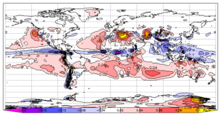
El Niño is the warm phase of the El Niño–Southern Oscillation (ENSO) and is associated with a band of warm ocean water that develops in the central and east-central equatorial Pacific, including the area off the Pacific coast of South America. The ENSO is the cycle of warm and cold sea surface temperature (SST) of the tropical central and eastern Pacific Ocean. El Niño is accompanied by high air pressure in the western Pacific and low air pressure in the eastern Pacific. El Niño phases are known to last close to four years; however, records demonstrate that the cycles have lasted between two and seven years. During the development of El Niño, rainfall develops between September–November. The cool phase of ENSO is Spanish: La Niña, lit. 'The Girl', with SSTs in the eastern Pacific below average, and air pressure high in the eastern Pacific and low in the western Pacific. The ENSO cycle, including both El Niño and La Niña, causes global changes in temperature and rainfall.
The mesopause is the point of minimum temperature at the boundary between the mesosphere and the thermosphere atmospheric regions. Due to the lack of solar heating and very strong radiative cooling from carbon dioxide, the mesosphere is the coldest region on Earth with temperatures as low as -100 °C. The altitude of the mesopause for many years was assumed to be at around 85 km (53 mi), but observations to higher altitudes and modeling studies in the last 10 years have shown that in fact the mesopause consists of two minima - one at about 85 km and a stronger minimum at about 100 km (62 mi).

Numerical climate models use quantitative methods to simulate the interactions of the important drivers of climate, including atmosphere, oceans, land surface and ice. They are used for a variety of purposes from study of the dynamics of the climate system to projections of future climate. Climate models may also be qualitative models and also narratives, largely descriptive, of possible futures.
Cloud feedback is the coupling between cloudiness and surface air temperature where a surface air temperature change leads to a change in clouds, which could then amplify or diminish the initial temperature perturbation. Cloud feedbacks can affect the magnitude of internally generated climate variability or they can affect the magnitude of climate change resulting from external radiative forcings.

La Niña is an oceanic and atmospheric phenomenon that is the colder counterpart of El Niño, as part of the broader El Niño–Southern Oscillation (ENSO) climate pattern. The name La Niña originates from Spanish for "the girl", by analogy to El Niño, meaning "the boy". In the past, it was also called an anti-El Niño and El Viejo, meaning "the old man".

El Niño–Southern Oscillation (ENSO) is an irregular periodic variation in winds and sea surface temperatures over the tropical eastern Pacific Ocean, affecting the climate of much of the tropics and subtropics. The warming phase of the sea temperature is known as El Niño and the cooling phase as La Niña. The Southern Oscillation is the accompanying atmospheric component, coupled with the sea temperature change: El Niño is accompanied by high air surface pressure in the tropical western Pacific and La Niña with low air surface pressure there. The two periods last several months each and typically occur every few years with varying intensity per period.

Global dimming is the reduction in the amount of global direct irradiance at the Earth's surface that has been observed since systematic measurements began in the 1950s. The effect varies by location, but worldwide it has been estimated to be of the order of a 4–20% reduction. However, after discounting an anomaly caused by the eruption of Mount Pinatubo in 1991, a very slight reversal in the overall trend has been observed.

Radiative forcing is the change in energy flux in the atmosphere caused by natural or anthropogenic factors of climate change as measured by watts / metre2. It is a scientific concept used to quantify and compare the external drivers of change to Earth's energy balance. System feedbacks and internal variability are related concepts, encompassing other factors that also influence the direction and magnitude of imbalance.

Earth's energy budget accounts for the balance between the energy that Earth receives from the Sun and the energy the Earth loses back into outer space. Smaller energy sources, such as Earth's internal heat, are taken into consideration, but make a tiny contribution compared to solar energy. The energy budget also accounts for how energy moves through the climate system. Because the Sun heats the equatorial tropics more than the polar regions, received solar irradiance is unevenly distributed. As the energy seeks equilibrium across the planet, it drives interactions in Earth's climate system, i.e., Earth's water, ice, atmosphere, rocky crust, and all living things. The result is Earth's climate.

Gavin A. Schmidt is a climatologist, climate modeler and Director of the NASA Goddard Institute for Space Studies (GISS) in New York, and co-founder of the award-winning climate science blog RealClimate.

The Pacific decadal oscillation (PDO) is a robust, recurring pattern of ocean-atmosphere climate variability centered over the mid-latitude Pacific basin. The PDO is detected as warm or cool surface waters in the Pacific Ocean, north of 20°N. Over the past century, the amplitude of this climate pattern has varied irregularly at interannual-to-interdecadal time scales. There is evidence of reversals in the prevailing polarity of the oscillation occurring around 1925, 1947, and 1977; the last two reversals corresponded with dramatic shifts in salmon production regimes in the North Pacific Ocean. This climate pattern also affects coastal sea and continental surface air temperatures from Alaska to California.
The iris hypothesis is a hypothesis proposed by Richard Lindzen et al. in 2001 that suggested increased sea surface temperature in the tropics would result in reduced cirrus clouds and thus more infrared radiation leakage from Earth's atmosphere. His study of observed changes in cloud coverage and modeled effects on infrared radiation released to space as a result supported the hypothesis. This suggested infrared radiation leakage was hypothesized to be a negative feedback in which an initial warming would result in an overall cooling of the surface. The consensus view is that increased sea surface temperature would result in increased cirrus clouds and reduced infrared radiation leakage and therefore a positive feedback.

The Hadley cell, named after George Hadley, is a global-scale tropical atmospheric circulation that features air rising near the equator, flowing poleward at a height of 10 to 15 kilometers above the earth's surface, descending in the subtropics, and then returning equatorward near the surface. This circulation creates the trade winds, tropical rain-belts and hurricanes, subtropical deserts and the jet streams. A Hadley cell's relatively low-altitude overturning circulation has air sinking at roughly 30 degrees latitude after traveling from near the equator.

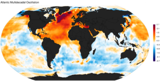
The Atlantic Multidecadal Oscillation (AMO), also known as Atlantic Multidecadal Variability (AMV), is the theorized variability of the sea surface temperature (SST) of the North Atlantic Ocean on the timescale of several decades.

The climate of Mars has been a topic of scientific curiosity for centuries, in part because it is the only terrestrial planet whose surface can be directly observed in detail from the Earth with help from a telescope.

The Antarctica cooling controversy was the result of an apparent contradiction in the observed cooling behavior of Antarctica between 1966 and 2000, which became part of the public debate in the global warming controversy, particularly between advocacy groups of both sides in the public arena including politicians, as well as the popular media. In his novel State of Fear, Michael Crichton asserted that the Antarctic data contradict global warming. The few scientists who have commented on the supposed controversy state that there is no contradiction, while the author of the paper whose work inspired Crichton's remarks has said that Crichton misused his results. There is no similar controversy within the scientific community, as the small observed changes in Antarctica are consistent with the small changes predicted by climate models, and because the overall trend since comprehensive observations began is now known to be one of warming.
In acoustics, microbaroms, also known as the "voice of the sea", are a class of atmospheric infrasonic waves generated in marine storms by a non-linear interaction of ocean surface waves with the atmosphere. They typically have narrow-band, nearly sinusoidal waveforms with amplitudes up to a few microbars, and wave periods near 5 seconds. Due to low atmospheric absorption at these low frequencies, microbaroms can propagate thousands of kilometers in the atmosphere, and can be readily detected by widely separated instruments on the Earth's surface.
Robert Donald Cess was a professor of atmospheric sciences at Stony Brook University. He was born in Portland, Oregon. Cess earned his bachelor of science degree in mechanical engineering from Oregon State University and his master's degree from Purdue University in Indiana in 1956. He received a Ph.D. from the University of Pittsburgh in 1959. He is a recognized leader in the fields of climate change and atmospheric radiation transfer. His research interests involve modeling of climate feedbacks that can either amplify or diminish global climate change, and interpreting surface and satellite remote sensing data.
The Arctic dipole anomaly is a pressure pattern characterized by high pressure on the arctic regions of North America and low pressure on those of Eurasia. This pattern sometimes replaces the Arctic oscillation and the North Atlantic oscillation. It was observed for the first time in the first decade of 2000s and is perhaps linked to recent climate change. The Arctic dipole lets more southern winds into the Arctic Ocean resulting in more ice melting. The summer 2007 event played an important role in the record low sea ice extent which was recorded in September. The Arctic dipole has also been linked to changes in arctic circulation patterns that cause drier winters in Northern Europe, but much wetter winters in Southern Europe and colder winters in East Asia, Europe and the eastern half of North America.

Patterns of solar irradiance and solar variation have been a main driver of climate change over the millions to billions of years of the geologic time scale, but their role in recent warming is insignificant. Evidence that this is the case comes from analysis on many timescales and from many sources, including: direct observations; composites from baskets of different proxy observations; and numerical climate models. On millennial timescales, paleoclimate indicators have been compared to cosmogenic isotope abundances as the latter are a proxy for solar activity. These have also been used on century times scales but, in addition, instrumental data are increasingly available and show that, for example, the temperature fluctuations do not match the solar activity variations and that the commonly-invoked association of the Little Ice Age with the Maunder minimum is far too simplistic as, although solar variations may have played a minor role, a much bigger factor is known to be Little Ice Age volcanism. In recent decades observations of unprecedented accuracy, sensitivity and scope have become available from spacecraft and show unequivocally that recent global warming is not caused by changes in the Sun.


