Hå is a municipality in Rogaland county, Norway. It is the southernmost municipality in the traditional district of Jæren. The administrative centre of the municipality is the village of Varhaug. Other villages in Hå include Brusand, Hæen, Nærbø, Obrestad, Ogna, Sirevåg, and Vigrestad.
The 258-square-kilometre (100 sq mi) municipality is the 281st largest by area out of the 356 municipalities in Norway. Hå is the 67th most populous municipality in Norway with a population of 19,649. The municipality's population density is 79.3 inhabitants per square kilometre (205/sq mi) and its population has increased by 11.4% over the previous 10-year period. [4] [5]
The parish of Haa was established as a municipality on 1 January 1838 (see formannskapsdistrikt law). In 1894, the municipality of Haa was dissolved and divided into two new municipalities: Nærbø (population: 1,806) and Varhaug (population: 1,801). During the 1960s, there were many municipal mergers across Norway due to the work of the Schei Committee. On 1 January 1964, the municipality of Hå was recreated by merging of the neighboring municipalities of Nærbø (population: 3,926), Varhaug (population: 3,454), and Ogna (population: 1,470). [6] In local politics, the divisions between the three previous municipalities remain very visible.
The municipality (originally the parish) is named after the old Hå farm (Old Norse : Háar or Háir) where the local church priest's parsonage was located. The river running past this farm is similarly named the Hååna, meaning the "Hå river". It is not known if the river is named after the farm or vice versa. The meaning of the original name is uncertain. It is possible that it comes from the plural dative case of the word há which means "aftergrass" (the grass that grows after the first crop has been cut down). Ti may also come from the word hár which means "rowlock" (possibly referring to the shape of the headland on which the farm is located). [7] On 21 December 1917, a royal resolution enacted the 1917 Norwegian language reforms. Prior to this change, the name was spelled Haa with the digraph "aa", and after this reform, the name was spelled Hå, using the letter å instead. [8] [9]
The coat of arms was granted on 5 July 1991. The official blazon is "Sable, a winch stand argent." (Norwegian : På svart grunn eit sølv vinsjestativ). This means the arms have a black field (background) and the charge is a winch stand. The winch stand has a tincture of argent which means it is commonly colored white, but if it is made out of metal, then silver is used. It is a special type of winch that has historically been used in this area to remove stones from the many farm fields. The arms were chosen to symbolize the hard living on the rocky soils of the municipality. A winch of this type (called a "steinbukk") is used locally for the removal of large stones from the soil for agricultural purposes. It's three legs also represent the three previous municipalities of Nærbø, Varhaug, and Ogna that were merged to creat Hå in 1964. The municipal flag has the same design as the coat of arms. [10] [11] [12]
The Church of Norway has three parishes (sokn) within the municipality of Hå. It is part of the Jæren prosti (deanery) in the Diocese of Stavanger.
Parish (sokn) | Church name | Location of the church | Year built |
---|---|---|---|
Nærbø | Nærbø Church | Nærbø | 2005 |
Old Nærbø Church | Nærbø | 1834 | |
Ogna | Ogna Church | Ogna | 1250 |
Varhaug | Varhaug Church | Varhaug | 1904 |
Hå Municipality is responsible for primary education (through 10th grade), outpatient health services, senior citizen services, welfare and other social services, zoning, economic development, and municipal roads and utilities. The municipality is governed by a municipal council of directly elected representatives. The mayor is indirectly elected by a vote of the municipal council. [13] The municipality is under the jurisdiction of the Sør-Rogaland District Court and the Gulating Court of Appeal.
The municipal council (Kommunestyre) of Hå is made up of 33 representatives that are elected to four year terms. The tables below show the current and historical composition of the council by political party.
Party name (in Norwegian) | Number of representatives | |
---|---|---|
Labour Party (Arbeiderpartiet) | 2 | |
Progress Party (Fremskrittspartiet) | 6 | |
Conservative Party (Høyre) | 7 | |
Industry and Business Party (Industri‑ og Næringspartiet) | 1 | |
The Conservatives (Konservativt) | 1 | |
Christian Democratic Party (Kristelig Folkeparti) | 8 | |
Centre Party (Senterpartiet) | 3 | |
Socialist Left Party (Sosialistisk Venstreparti) | 1 | |
Hå List (Hå-lista) | 4 | |
Total number of members: | 33 |
Party name (in Norwegian) | Number of representatives | |
---|---|---|
Labour Party (Arbeiderpartiet) | 3 | |
Progress Party (Fremskrittspartiet) | 3 | |
Conservative Party (Høyre) | 5 | |
Christian Democratic Party (Kristelig Folkeparti) | 7 | |
Centre Party (Senterpartiet) | 5 | |
Socialist Left Party (Sosialistisk Venstreparti) | 1 | |
Hå List (Hå-lista) | 9 | |
Total number of members: | 33 |
Party name (in Norwegian) | Number of representatives | |
---|---|---|
Labour Party (Arbeiderpartiet) | 3 | |
Progress Party (Fremskrittspartiet) | 3 | |
Conservative Party (Høyre) | 6 | |
Christian Democratic Party (Kristelig Folkeparti) | 7 | |
Centre Party (Senterpartiet) | 3 | |
Nærbø List (Nærbølista) | 10 | |
Common list for southern Hå (Samlingsliste for søre Hå) | 1 | |
Total number of members: | 33 |
Party name (in Norwegian) | Number of representatives | |
---|---|---|
Labour Party (Arbeiderpartiet) | 3 | |
Progress Party (Fremskrittspartiet) | 3 | |
Conservative Party (Høyre) | 7 | |
Christian Democratic Party (Kristelig Folkeparti) | 6 | |
Centre Party (Senterpartiet) | 3 | |
Nærbø List (Nærbølista) | 11 | |
Total number of members: | 33 |
Party name (in Norwegian) | Number of representatives | |
---|---|---|
Labour Party (Arbeiderpartiet) | 2 | |
Progress Party (Fremskrittspartiet) | 4 | |
Conservative Party (Høyre) | 3 | |
Christian Democratic Party (Kristelig Folkeparti) | 7 | |
Centre Party (Senterpartiet) | 4 | |
Socialist Left Party (Sosialistisk Venstreparti) | 1 | |
Nærbø List (Nærbølista) | 12 | |
Total number of members: | 33 |
Party name (in Norwegian) | Number of representatives | |
---|---|---|
Labour Party (Arbeiderpartiet) | 3 | |
Progress Party (Fremskrittspartiet) | 5 | |
Conservative Party (Høyre) | 4 | |
Christian Democratic Party (Kristelig Folkeparti) | 7 | |
Centre Party (Senterpartiet) | 6 | |
Socialist Left Party (Sosialistisk Venstreparti) | 2 | |
Nærbø List (Nærbølista) | 6 | |
Total number of members: | 33 |
Party name (in Norwegian) | Number of representatives | |
---|---|---|
Labour Party (Arbeiderpartiet) | 3 | |
Progress Party (Fremskrittspartiet) | 5 | |
Conservative Party (Høyre) | 6 | |
Christian Democratic Party (Kristelig Folkeparti) | 8 | |
Centre Party (Senterpartiet) | 7 | |
Socialist Left Party (Sosialistisk Venstreparti) | 2 | |
Nærbø List (Nærbølista) | 6 | |
Total number of members: | 37 |
Party name (in Norwegian) | Number of representatives | |
---|---|---|
Labour Party (Arbeiderpartiet) | 3 | |
Progress Party (Fremskrittspartiet) | 2 | |
Conservative Party (Høyre) | 4 | |
Christian Democratic Party (Kristelig Folkeparti) | 9 | |
Centre Party (Senterpartiet) | 10 | |
Socialist Left Party (Sosialistisk Venstreparti) | 1 | |
Nærbø List (Nærbølisten) | 8 | |
Total number of members: | 37 |
Party name (in Norwegian) | Number of representatives | |
---|---|---|
Labour Party (Arbeiderpartiet) | 3 | |
Progress Party (Fremskrittspartiet) | 1 | |
Conservative Party (Høyre) | 3 | |
Christian Democratic Party (Kristelig Folkeparti) | 8 | |
Centre Party (Senterpartiet) | 7 | |
Socialist Left Party (Sosialistisk Venstreparti) | 2 | |
Nærbø List (Nærbølisten) | 9 | |
Varhaug local list (Varhaug bygdeliste) | 2 | |
Vigrestad local list (Vigrestad bygdeliste) | 1 | |
Ogna local list (Ogna bygdeliste) | 1 | |
Total number of members: | 37 |
Party name (in Norwegian) | Number of representatives | |
---|---|---|
Labour Party (Arbeiderpartiet) | 3 | |
Progress Party (Fremskrittspartiet) | 1 | |
Conservative Party (Høyre) | 2 | |
Christian Democratic Party (Kristelig Folkeparti) | 7 | |
Centre Party (Senterpartiet) | 3 | |
Socialist Left Party (Sosialistisk Venstreparti) | 1 | |
Joint list of the Liberal Party (Venstre) and Liberal People's Party (Liberale Folkepartiet) | 1 | |
Nærbø List (Nærbølisten) | 10 | |
Varhaug local list (Varhaug bygdeliste) | 4 | |
Vigrestad local list (Vigrestad bygdeliste) | 2 | |
Ogna local list (Ogna bygdeliste) | 2 | |
Nærbø Non-partisan Common List (Nærbø Upolitiske Samlingsliste) | 1 | |
Total number of members: | 37 |
Party name (in Norwegian) | Number of representatives | |
---|---|---|
Labour Party (Arbeiderpartiet) | 3 | |
Conservative Party (Høyre) | 2 | |
Christian Democratic Party (Kristelig Folkeparti) | 6 | |
Liberal People's Party (Liberale Folkepartiet) | 1 | |
Socialist Left Party (Sosialistisk Venstreparti) | 1 | |
Nærbø List (Nærbølisten) | 10 | |
Varhaug local list (Varhaug bygdeliste) | 7 | |
Vigrestad local list (Vigrestad bygdeliste) | 4 | |
Ogna local list (Ogna bygdeliste) | 3 | |
Total number of members: | 37 |
Party name (in Norwegian) | Number of representatives | |
---|---|---|
Labour Party (Arbeiderpartiet) | 3 | |
Conservative Party (Høyre) | 5 | |
Christian Democratic Party (Kristelig Folkeparti) | 7 | |
Nærbø List (Nærbølisten) | 11 | |
Varhaug local list (Varhaug bygdeliste) | 5 | |
Vigrestad local list (Vigrestad bygdeliste) | 3 | |
Ogna local list (Ogna bygdeliste) | 3 | |
Total number of members: | 37 |
Party name (in Norwegian) | Number of representatives | |
---|---|---|
Labour Party (Arbeiderpartiet) | 1 | |
Conservative Party (Høyre) | 1 | |
Christian Democratic Party (Kristelig Folkeparti) | 5 | |
Nærbø List (Nærbølisten) | 14 | |
Varhaug local list (Varhaug bygdeliste) | 8 | |
Vigrestad local list (Vigrestad bygdeliste) | 5 | |
Ogna local list (Ogna bygdeliste) | 3 | |
Total number of members: | 37 |
Party name (in Norwegian) | Number of representatives | |
---|---|---|
Labour Party (Arbeiderpartiet) | 5 | |
Conservative Party (Høyre) | 1 | |
Christian Democratic Party (Kristelig Folkeparti) | 7 | |
Centre Party (Senterpartiet) | 9 | |
Liberal Party (Venstre) | 2 | |
Local List(s) (Lokale lister) | 13 | |
Total number of members: | 37 |
Party name (in Norwegian) | Number of representatives | |
---|---|---|
Labour Party (Arbeiderpartiet) | 3 | |
Christian Democratic Party (Kristelig Folkeparti) | 4 | |
Liberal Party (Venstre) | 4 | |
Local List(s) (Lokale lister) | 26 | |
Total number of members: | 37 |
Party name (in Norwegian) | Number of representatives | |
---|---|---|
Labour Party (Arbeiderpartiet) | 4 | |
Local List(s) (Lokale lister) | 33 | |
Total number of members: | 37 |
The mayors (Norwegian : ordfører) of Hå (incomplete list - missing 1838-1894): [27]
Historical population | |||||||||||||
---|---|---|---|---|---|---|---|---|---|---|---|---|---|
Year | 1855 | 1865 | 1875 | 1891 | 1894 | 1964 | 1970 | 1980 | 1990 | 2000 | 2010 | 2020 | 2023 |
Pop. | 2,859 | 3,004 | 3,218 | 3,409 | 3,607 | 8,850 | 9,978 | 12,290 | 13,034 | 13,921 | 16,342 | 18,991 | 19,649 |
±% p.a. | — | +0.50% | +0.69% | +0.36% | +1.90% | +1.29% | +2.02% | +2.11% | +0.59% | +0.66% | +1.62% | +1.51% | +1.14% |
Note: The municipality was dissolved in 1894 and it was recreated in 1964. Source: Statistics Norway [4] [29] and Norwegian Historical Data Centre [30] |
Hå municipality is located on the southwestern shore of Norway, along the North Sea. The municipality is located mostly in the very flat, coastal Jæren district. The southeastern part of the municipality begins to get a little hilly and rocky and it marks the border of the Dalane district (located to the south and east). Much of the land in Hå is used for agriculture because of its flat landscape. The river Hååna runs through the municipality. The shoreline of the municipality is marked by the Kvassheim Lighthouse and Obrestad Lighthouse. [31]
Name | Population | Area (km2) | Population density per km2 |
---|---|---|---|
Brusand | 428 | 0.2 | 2,140 |
Hæen | 588 | 0.43 | 1,367 |
Nærbø | 6,995 | 3.28 | 2,133 |
Ogna | 360 | 0.31 | 1,161 |
Sirevåg | 627 | 0.7 | 896 |
Varhaug | 3,114 | 1.57 | 1,983 |
Vigrestad | 2,116 | 1.18 | 1,793 |
Hå has a temperate oceanic climate (Cfb), also known as marine west coast climate. The average date for the last overnight freeze (low below 0 °C (32.0 °F)) in spring is 16 April [33] and average date for first freeze in autumn is 10 November [34] giving a frost-free season of 207 days (1981-2010 average).
Climate data for Obrestad Lighthouse in Hå 1991-2020 | |||||||||||||
---|---|---|---|---|---|---|---|---|---|---|---|---|---|
Month | Jan | Feb | Mar | Apr | May | Jun | Jul | Aug | Sep | Oct | Nov | Dec | Year |
Mean daily maximum °C (°F) | 4.4 (39.9) | 3.9 (39.0) | 5.2 (41.4) | 8.4 (47.1) | 11.5 (52.7) | 14 (57) | 16.8 (62.2) | 17.8 (64.0) | 15.1 (59.2) | 11.4 (52.5) | 7.9 (46.2) | 5.5 (41.9) | 10.2 (50.3) |
Daily mean °C (°F) | 2.8 (37.0) | 2 (36) | 3.1 (37.6) | 5.9 (42.6) | 9.1 (48.4) | 11.7 (53.1) | 14.3 (57.7) | 15.1 (59.2) | 12.9 (55.2) | 9.2 (48.6) | 5.9 (42.6) | 3.6 (38.5) | 8.0 (46.4) |
Mean daily minimum °C (°F) | 0.4 (32.7) | −0.3 (31.5) | 1 (34) | 3.4 (38.1) | 6.5 (43.7) | 9.5 (49.1) | 12.2 (54.0) | 12.7 (54.9) | 10.6 (51.1) | 6.9 (44.4) | 3.6 (38.5) | 1.1 (34.0) | 5.6 (42.2) |
Average precipitation mm (inches) | 132 (5.2) | 100 (3.9) | 88 (3.5) | 67 (2.6) | 64 (2.5) | 67 (2.6) | 88 (3.5) | 127 (5.0) | 130 (5.1) | 155 (6.1) | 152 (6.0) | 130 (5.1) | 1,309 (51.5) |
Average precipitation days (≥ 1 mm) | 15.0 | 11.2 | 13.3 | 11.2 | 11.5 | 10.7 | 11.4 | 13.9 | 16.6 | 17.5 | 18.3 | 16.6 | 167.2 |
Source 1: yr.no/Norwegian Meteorological Institute (mean, precipitation] [35] | |||||||||||||
Source 2: NOAA-WMO averages 91-2020 Norway [36] |
The Sørlandet Line runs through the municipality, making several stops. The stations in Hå include Brusand Station, Nærbø Station, Ogna Station, Sirevåg Station, Varhaug Station, and Vigrestad Station.
Bokn is a municipality in Rogaland county, Norway. It is located in the traditional district of Haugaland. The administrative centre of the municipality is the village of Føresvik, the only urban area in Bokn. Other villages in Bokn include Arsvågen, Trosnavåg, and Loten. The island municipality is mostly located on the three islands of Ognøya, Vestre Bokn, and Austre Bokn. All three main islands are connected to the mainland via a network of bridges.
Eigersund is a municipality in Rogaland county, Norway. It is in the traditional district of Dalane. The administrative centre of the municipality is the town of Egersund. The town was known for its pottery factory and it is among Norway's biggest fishing ports. The villages of Helleland, Hellvik, and Hestnes are also in Eigersund.
Sokndal is the southernmost municipality in Rogaland county, Norway. It is located in the traditional district of Dalane. The administrative centre of the municipality is the village of Hauge. Other villages in Sokndal include Li, Rekefjord, Sogndalsstranda, and Åna-Sira.
Lund is a municipality in Rogaland county, Norway. It is located in the traditional district of Dalane. The administrative centre of the municipality is the village of Moi. Other villages in Lund include Eik and, Heskestad. European route E39 and the Sørlandet Line both pass through Lund. Moi Station is a railway station in Lund.
Klepp is a municipality in Rogaland county, Norway. It is located in the traditional district of Jæren. The administrative centre of the municipality is the village of Kleppe. Other villages in Klepp include Klepp stasjon, Orre, Orstad, Pollestad, Verdalen, and Voll. Klepp is a flat and open agricultural landscape. The highest point, Tinghaug, is at 102 metres (335 ft) above sea level. There are long stretches of sand beaches along the North Sea coastline in the west.
Time is a municipality in Rogaland county, Norway. It is located in the traditional district of Jæren. The administrative centre of the municipality is the town of Bryne. Some villages in the municipality include Kvernaland, Lyefjell, Mossige, and Undheim. Most of Time is fairly flat and it is used for agriculture. The eastern portion of the municipality is more rugged moorland.
Gjesdal is a municipality in Rogaland county, Norway. It is located in the traditional district of Jæren. The administrative centre of the municipality is the village of Ålgård. Other villages in Gjesdal include Dirdal, Frafjord, Gilja, Gjesdal, and Oltedal. The municipality lies about 25 kilometres (16 mi) to the southwest of the city of Stavanger in southwestern Norway.
Sola is a municipality and a Seaside resort in Rogaland county, Norway. It is located in the traditional district of Jæren. The administrative centre of the municipality is the village of Solakrossen. Other villages include Tananger, Hålandsmarka, Sørnes, and Stenebyen. Stavanger Airport is located in Sola, just a short distance from the large Stavanger/Sandnes metropolitan area.
Randaberg is a municipality in Rogaland county, Norway. It is located in the traditional district of Jæren, at the northern end of the Stavanger Peninsula. The administrative centre of the municipality is the village of Randaberg.
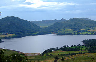
Suldal is a municipality in the northeast corner of Rogaland county, Norway. It is located in the traditional district of Ryfylke. Since 1965, the administrative centre of Suldal is the village of Sand i Ryfylke. Other villages in Suldal include Haugsland, Jelsa, Marvik, Nesflaten, and Suldalsosen.
Kvitsøy is an island municipality in Rogaland county, Norway. At only 6.29-square-kilometre (2.43 sq mi), it is the smallest municipality in Norway by area and one of the smallest by population. Kvitsøy is located in the traditional district of Ryfylke. The administrative centre of the municipality is the village of Ydstebøhamn on the island of Kvitsøy. The municipality is an archipelago located at the entrance to the large Boknafjorden. It sits about 2 nautical miles northwest of the mainland Stavanger peninsula.
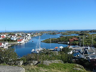
Tysvær is a municipality in Rogaland county, Norway. It is part of the Haugalandet region. The municipality is located on the Haugalandet peninsula on the northern side of the Boknafjorden, just east of the towns of Kopervik and Haugesund. The administrative centre of the municipality is the village of Aksdal. Other villages in the municipality include Dueland, Førre, Grinde, Hervik, Hindaråvåg, Nedstrand, Skjoldastraumen, Susort, Tysvær, and Yrke.
Masfjorden is a municipality in the central part of Vestland county in Norway. The municipality is located in the Nordhordland district of the county. The administrative centre of the municipality is the village of Masfjordnes. Other villages in the municipality include Frøyset, Hosteland, Matre, and Solheim.
Sande is a municipality in Møre og Romsdal county, Norway. It is part of the Sunnmøre region. The administrative centre is the village of Larsnes on the island of Gurskøya. Other villages in Sande include Gursken, Sandshamn, Bringsinghaug, and Voksa.
Iveland is a municipality in Agder County, Norway. It is located in the traditional district of Setesdal. The administrative centre of the municipality is the village of Birketveit. Other villages in the municipality include Bakken, Skaiå, and Vatnestrøm.
Strand is a municipality in Rogaland county, Norway. It is located in the traditional district of Ryfylke. The administrative centre of the municipality is the town of Jørpeland. The municipality lies across the fjord from the city of Stavanger. The Ryfast tunnel system connects Stavanger and Strand by a very long undersea tunnel.
Hamar Municipality is a municipality in Innlandet county, Norway. It is located in the traditional district of Hedemarken. The administrative centre of the municipality is the town of Hamar. Other settlements in Hamar include Hjellum, Slemsrud, Ridabu, Ingeberg, and Ilseng.
Ogna is a former municipality in Rogaland county, Norway. The 104-square-kilometre (40 sq mi) municipality existed from 1839 until its dissolution in 1964. The municipality encompassed roughly the southern third of the present-day municipality of Hå. The administrative centre of the municipality was the village of Ogna where the Ogna Church is located.
Nærbø is a former municipality in Rogaland county, Norway. The administrative centre of the municipality was the village of Nærbø where the Old Nærbø Church is located. The 65-square-kilometre (25 sq mi) municipality was located in the district of Jæren inside the northern part of the present-day municipality of Hå. The municipality existed from 1894 until its dissolution in 1964.
Varhaug is a former municipality in Rogaland county, Norway. The 85-square-kilometre (33 sq mi) municipality existed from 1894 until 1964. The administrative centre of the municipality was the village of Varhaug where Varhaug Church is located. The municipality encompassed the central part of the present-day Hå Municipality. It included the villages of Varhaug and Vigrestad as well as the surrounding countryside.