Kartabu"},"language":{"wt":"Neutral"},"coatofarms":{"wt":"Karmøy komm.svg"},"webpage":{"wt":"www.karmoy.kommune.no"},"mayor":{"wt":"Leiv Arne Marhaug"},"mayor_party":{"wt":"[[Conservative Party (Norway)|H]]"},"mayor_as_of":{"wt":"2023"},"area_rank":{"wt":"294"},"area_total_km2":{"wt":"229.99"},"area_land_km2":{"wt":"219.59"},"area_water_km2":{"wt":"10.40"},"area_water_percent":{"wt":"4.5"},"population_as_of":{"wt":"2023"},"population_rank":{"wt":"25"},"population_total":{"wt":"42903"},"population_density_km2":{"wt":"195.4"},"population_increase":{"wt":"4.3"},"coordinates":{"wt":"{{coord|59|15|23|N|05|14|57|E|region:NO|display=inline,title}}"},"utm_zone":{"wt":"32V"},"utm_northing":{"wt":"6574641"},"utm_easting":{"wt":"0286191"},"geo_cat":{"wt":"adm2nd"}},"i":0}}]}" id="mwBg">Municipality in Rogaland, Norway
Karmøy Municipality Karmøy kommune | |
---|---|
![]() View of the Låvesundet | |
![]() Rogaland within Norway | |
![]() Karmøy within Rogaland | |
Coordinates: 59°15′23″N05°14′57″E / 59.25639°N 5.24917°E | |
Country | Norway |
County | Rogaland |
District | Haugaland |
Established | 1 Jan 1965 |
Administrative centre | Kopervik |
Government | |
• Mayor (2023) | Leiv Arne Marhaug (H) |
Area | |
• Total | 229.99 km2 (88.80 sq mi) |
• Land | 219.59 km2 (84.78 sq mi) |
• Water | 10.40 km2 (4.02 sq mi) 4.5% |
• Rank | #294 in Norway |
Population (2023) | |
• Total | 42,903 |
• Rank | #25 in Norway |
• Density | 195.4/km2 (506/sq mi) |
• Change (10 years) | ![]() |
Demonyms | Karmøybu Kartabu [1] |
Official language | |
• Norwegian form | Neutral |
Time zone | UTC+01:00 (CET) |
• Summer (DST) | UTC+02:00 (CEST) |
ISO 3166 code | NO-1149 [3] |
Website | Official website |
Karmøy is a municipality in Rogaland county, Norway. It is southwest of the town of Haugesund in the traditional district of Haugaland. The administrative centre of the municipality is the town of Kopervik.
Most of the municipality lies on the island of Karmøy. The island is connected to the mainland by the Karmøy Tunnel and the Karmsund Bridge. It is known for its industries, as well as for fishing. Karmøy is also well known in Norway for its beautiful heather moors and the white sand surfing beaches.
The 230-square-kilometre (89 sq mi) municipality is the 294th largest by area out of the 356 municipalities in Norway. Karmøy is the 25th most populous municipality in Norway with a population of 42,903, making it one of the largest in the region. The municipality's population density is 195.4 inhabitants per square kilometre (506/sq mi) and its population has increased by 4.3% over the previous 10-year period. [4] [5] The island itself is the 4th most populated island in all of Norway.
The municipality of Karmøy is a recent creation. During the 1960s, there were many municipal mergers across Norway due to the work of the Schei Committee. On 1 January 1965, Karmøy municipality was created upon the merger of two towns and parts of five municipalities into one large municipality with 23,217 residents. The areas that were merged were: [6]
The municipality is named after the island of Karmøy (Old Norse : Kǫrmt), since the majority of the municipality is located on this island. The first element is derived from the word karmr which means "bargeboard", likely in the sense of a "sheltering island". The last element, øy which means "island", was added later. [7]
The coat of arms was granted on 18 April 1975. The official blazon is "Gules, a fret argent" (Norwegian : I rødt et sølv gitterkryss). This means the arms have a red field (background) and the ordinary is a fret (a diamond interwoven with a cross). The ordinary has a tincture of argent which means it is commonly colored white, but if it is made out of metal, then silver is used. The design is canting, as the central diamond shape stands for karm (which is Norwegian for a "frame"). The island forms a border (or frame) against the sea and protects the inland areas from its forces. The cross in the design symbolizes the local Avaldsnes Church that was the royal chapel here during the Middle Ages. The island is said to be a central location and medieval kings would often choose to stay there to be able to "get everywhere in haste" if needed. The arms were designed by Magnus Hardeland. The municipal flag has the same design as the coat of arms. [8] [9] [10]
The Church of Norway has eight parishes (sokn) within the municipality of Karmøy. It is part of the Karmøy prosti (deanery) in the Diocese of Stavanger.
Parish (sokn) | Church name | Location of the church | Year built |
---|---|---|---|
Avaldsnes | Avaldsnes Church | Avaldsnes | 1250 |
Falnes | Falnes Church | Skudeneshavn | 1851 |
Ferkingstad | Ferkingstad Church | Ferkingstad | 1854 |
Kopervik | Kopervik Church | Kopervik | c. 2017 |
Norheim | Norheim Church | Norheim | 1978 |
Torvastad | Torvastad Church | Torvastad | 1880 |
Vedavågen | Vedavågen Church | Veavågen | 2009 |
Åkra | Åkra Church | Åkrahamn | 1985 |
Old Åkra Church | Åkrahamn | 1821 |
There are several finds from the Stone Age, Bronze Age and Iron Age. Large burial mounds, stone monuments, and many other ancient monuments are found on the island. Karmøy is the site of the Storhaug, Grønhaug, and Flagghaugen burial mounds. [11]
Karmøy was known for sailing in the old times. The eddic poem Grímnismál says that Thor, the weather god, wades the Karmsundet strait every morning on his way to Yggdrasil, the tree of life. The ocean outside Karmøy is dangerous, filled with underwater currents and rocks. Thus the ships were forced into the narrow Karmsundet. Chieftains and kings controlled the ships passing up and down the coast and demanded taxes.
The Karmsundet strait was also the source of the name of the kingdom, at the time when the first king of the unified Norway, Harald Fairhair, lived on Karmøy. (See History of Norway.)
Avaldsnes is located on the northeastern coast of the island. King Augvald who has given his name to this ancient site is mentioned in the Old Norse sagas as having his home here. Later the residence of Harald Fairhair and other kings are mentioned. There is also a medieval church, St. Olav's church of Avaldsnes, located on this coast.
Visnes, a village in the northwest of Karmøy was once the site of an important copper mine. This mine was source of the copper used for the Statue of Liberty in New York City. [12]
In the 18th century, two girls from Uyea in Shetland rowed to Haaf Gruney to milk some of the cows grazing there. Unfortunately, their return was marred by a strong storm, and eventually they found their tiny boat blown to Karmøy. The Uyea girls ended up marrying Karmøy men, and their descendants still live there. The Dyrland family of Karmoy are believed to be the family that the two girls married into after they arrived on Karmøy. Sivert Dyrland was a member of the Norwegian government in the early 20th century. [13]
The majority of the municipality is located on the large island of Karmøy, but it also includes the mainland peninsula between the Karmsundet strait and Førresfjorden, plus the island of Feøy and several other small islands.
The natural and cultural landscape is highly heterogeneous, encompassing chalk-white sands, moorland, and several piers around the island. The landscape in the north is mainly agricultural, while large parts of the inland south are heather moors. The island has many white, sandy beaches facing the North Sea, attracting surfers as one of the top spots for windsurfing in Norway.
Towns and villages are mostly located along the coast. The three towns in Karmøy are all on the island, the administrative center Kopervik is on the east side, Åkrehamn is on the west side, while Skudeneshavn is on the southern tip. On the mainland part of Karmøy, the village of Norheim is contiguous with the neighboring town of Haugesund. To the south of Norheim is the village of Vormedal while the village of Kolnes is in the northeastern part of mainland Karmøy. Other villages in Karmøy include Avaldsnes, Eike, Ferkingstad, Sævelandsvik, Sandve, Veavågen, and Visnes.
Haugesund Airport is also located on the island rather than in the town of Haugesund proper. The Geitungen Lighthouse lies at the southern end of the municipality, marking the entrance to the Boknafjorden.
Karmøy has an oceanic climate (Cfb), also known as marine west coast climate, with rainy winters and warm or mild summers, and a long frost-free season for the latitude. The all-time high 31.2 °C (88.2 °F) was recorded July 2019, and the all-time low −16.6 °C (2.1 °F) was set in January 2010 (extremes since 2003). The wettest time of year is autumn and winter, while April–July is the driest season. Haugesund Airport is situated in Karmøy municipality and has been recording since 1975.
Climate data for Haugesund Airport Karmøy 1991–2020 (24 m, precipitation Haugesund-Rossabø, extremes 2003–2020) | |||||||||||||
---|---|---|---|---|---|---|---|---|---|---|---|---|---|
Month | Jan | Feb | Mar | Apr | May | Jun | Jul | Aug | Sep | Oct | Nov | Dec | Year |
Record high °C (°F) | 10.2 (50.4) | 11.5 (52.7) | 16.9 (62.4) | 20.8 (69.4) | 30.8 (87.4) | 29.4 (84.9) | 31.2 (88.2) | 29.6 (85.3) | 25.9 (78.6) | 20.2 (68.4) | 15.9 (60.6) | 11.6 (52.9) | 31.2 (88.2) |
Mean daily maximum °C (°F) | 4 (39) | 4 (39) | 6 (43) | 10 (50) | 13 (55) | 15 (59) | 18 (64) | 18 (64) | 15 (59) | 12 (54) | 8 (46) | 6 (43) | 11 (51) |
Daily mean °C (°F) | 3 (37) | 2.1 (35.8) | 3.3 (37.9) | 6.3 (43.3) | 9.4 (48.9) | 12 (54) | 14.9 (58.8) | 15.2 (59.4) | 12.9 (55.2) | 8.8 (47.8) | 5.9 (42.6) | 3.6 (38.5) | 8.1 (46.6) |
Mean daily minimum °C (°F) | 1 (34) | 0 (32) | 1 (34) | 4 (39) | 7 (45) | 10 (50) | 13 (55) | 13 (55) | 11 (52) | 7 (45) | 4 (39) | 2 (36) | 6 (43) |
Record low °C (°F) | −16.6 (2.1) | −13 (9) | −13.3 (8.1) | −5.9 (21.4) | −2.2 (28.0) | 1.6 (34.9) | 5.6 (42.1) | 4.9 (40.8) | 1.1 (34.0) | −3.4 (25.9) | −11.4 (11.5) | −14.9 (5.2) | −16.6 (2.1) |
Average precipitation mm (inches) | 160 (6.3) | 133 (5.2) | 123 (4.8) | 86 (3.4) | 76 (3.0) | 85 (3.3) | 97 (3.8) | 143 (5.6) | 172 (6.8) | 197 (7.8) | 199 (7.8) | 192 (7.6) | 1,663 (65.4) |
Source 1: yr.no/met.no/eklima [14] | |||||||||||||
Source 2: Weatheronline (avg highs/lows 1996–2020) [15] |
The municipality is divided into 79 circuits, grouped into 10 areas: [16]
Karmøy Municipality is responsible for primary education (through 10th grade), outpatient health services, senior citizen services, welfare and other social services, zoning, economic development, and municipal roads and utilities. The municipality is governed by a municipal council of directly elected representatives. The mayor is indirectly elected by a vote of the municipal council. [17] The municipality is under the jurisdiction of the Haugaland og Sunnhordland District Court and the Gulating Court of Appeal.
The municipal council (Kommunestyre) of Karmøy is made up of 45 representatives that are elected to four year terms. The tables below show the current and historical composition of the council by political party.
Party name (in Norwegian) | Number of representatives | |
---|---|---|
Labour Party (Arbeiderpartiet) | 7 | |
Progress Party (Fremskrittspartiet) | 9 | |
Green Party (Miljøpartiet De Grønne) | 1 | |
Conservative Party (Høyre) | 6 | |
Industry and Business Party (Industri‑ og Næringspartiet) | 4 | |
Christian Democratic Party (Kristelig Folkeparti) | 5 | |
Red Party (Rødt) | 1 | |
Centre Party (Senterpartiet) | 2 | |
Socialist Left Party (Sosialistisk Venstreparti) | 2 | |
Liberal Party (Venstre) | 1 | |
Karmøy List (Karmøylista) | 7 | |
Total number of members: | 45 |
Party name (in Norwegian) | Number of representatives | |
---|---|---|
Labour Party (Arbeiderpartiet) | 10 | |
Progress Party (Fremskrittspartiet) | 6 | |
Green Party (Miljøpartiet De Grønne) | 2 | |
Conservative Party (Høyre) | 9 | |
Christian Democratic Party (Kristelig Folkeparti) | 5 | |
Centre Party (Senterpartiet) | 4 | |
Socialist Left Party (Sosialistisk Venstreparti) | 2 | |
Liberal Party (Venstre) | 1 | |
Karmøy List (Karmøylista) | 6 | |
Total number of members: | 45 |
Party name (in Norwegian) | Number of representatives | |
---|---|---|
Labour Party (Arbeiderpartiet) | 15 | |
Progress Party (Fremskrittspartiet) | 9 | |
Green Party (Miljøpartiet De Grønne) | 1 | |
Conservative Party (Høyre) | 8 | |
The Christians Party (Partiet De Kristne) | 1 | |
Christian Democratic Party (Kristelig Folkeparti) | 7 | |
Centre Party (Senterpartiet) | 2 | |
Socialist Left Party (Sosialistisk Venstreparti) | 1 | |
Liberal Party (Venstre) | 1 | |
Total number of members: | 45 |
Party name (in Norwegian) | Number of representatives | |
---|---|---|
Labour Party (Arbeiderpartiet) | 11 | |
Progress Party (Fremskrittspartiet) | 11 | |
Conservative Party (Høyre) | 12 | |
Christian Democratic Party (Kristelig Folkeparti) | 7 | |
Pensioners' Party (Pensjonistpartiet) | 1 | |
Centre Party (Senterpartiet) | 1 | |
Socialist Left Party (Sosialistisk Venstreparti) | 1 | |
Liberal Party (Venstre) | 1 | |
Total number of members: | 45 |
Party name (in Norwegian) | Number of representatives | |
---|---|---|
Labour Party (Arbeiderpartiet) | 10 | |
Progress Party (Fremskrittspartiet) | 16 | |
Conservative Party (Høyre) | 5 | |
Christian Democratic Party (Kristelig Folkeparti) | 10 | |
Centre Party (Senterpartiet) | 1 | |
Socialist Left Party (Sosialistisk Venstreparti) | 1 | |
Liberal Party (Venstre) | 2 | |
Total number of members: | 45 |
Party name (in Norwegian) | Number of representatives | |
---|---|---|
Labour Party (Arbeiderpartiet) | 8 | |
Progress Party (Fremskrittspartiet) | 15 | |
Conservative Party (Høyre) | 5 | |
Christian Democratic Party (Kristelig Folkeparti) | 11 | |
Pensioners' Party (Pensjonistpartiet) | 1 | |
Centre Party (Senterpartiet) | 1 | |
Socialist Left Party (Sosialistisk Venstreparti) | 3 | |
Liberal Party (Venstre) | 1 | |
Total number of members: | 45 |
Party name (in Norwegian) | Number of representatives | |
---|---|---|
Labour Party (Arbeiderpartiet) | 14 | |
Progress Party (Fremskrittspartiet) | 13 | |
Conservative Party (Høyre) | 8 | |
Christian Democratic Party (Kristelig Folkeparti) | 17 | |
Pensioners' Party (Pensjonistpartiet) | 1 | |
Centre Party (Senterpartiet) | 2 | |
Socialist Left Party (Sosialistisk Venstreparti) | 3 | |
Liberal Party (Venstre) | 3 | |
Total number of members: | 61 |
Party name (in Norwegian) | Number of representatives | |
---|---|---|
Labour Party (Arbeiderpartiet) | 17 | |
Progress Party (Fremskrittspartiet) | 10 | |
Conservative Party (Høyre) | 7 | |
Christian Democratic Party (Kristelig Folkeparti) | 16 | |
Pensioners' Party (Pensjonistpartiet) | 1 | |
Centre Party (Senterpartiet) | 4 | |
Socialist Left Party (Sosialistisk Venstreparti) | 2 | |
Liberal Party (Venstre) | 4 | |
Total number of members: | 61 |
Party name (in Norwegian) | Number of representatives | |
---|---|---|
Labour Party (Arbeiderpartiet) | 13 | |
Progress Party (Fremskrittspartiet) | 5 | |
Conservative Party (Høyre) | 8 | |
Christian Democratic Party (Kristelig Folkeparti) | 15 | |
Pensioners' Party (Pensjonistpartiet) | 6 | |
Centre Party (Senterpartiet) | 5 | |
Socialist Left Party (Sosialistisk Venstreparti) | 3 | |
Liberal Party (Venstre) | 3 | |
Fatherland Party (Fedrelandspartiet) | 1 | |
Cross-party alternative (Tverrpolitisk alternativ) | 2 | |
Total number of members: | 61 |
Party name (in Norwegian) | Number of representatives | |
---|---|---|
Labour Party (Arbeiderpartiet) | 16 | |
Progress Party (Fremskrittspartiet) | 10 | |
Conservative Party (Høyre) | 12 | |
Christian Democratic Party (Kristelig Folkeparti) | 14 | |
Centre Party (Senterpartiet) | 2 | |
Socialist Left Party (Sosialistisk Venstreparti) | 1 | |
Liberal Party (Venstre) | 6 | |
Total number of members: | 61 |
Party name (in Norwegian) | Number of representatives | |
---|---|---|
Labour Party (Arbeiderpartiet) | 17 | |
Progress Party (Fremskrittspartiet) | 7 | |
Conservative Party (Høyre) | 15 | |
Christian Democratic Party (Kristelig Folkeparti) | 15 | |
Centre Party (Senterpartiet) | 2 | |
Socialist Left Party (Sosialistisk Venstreparti) | 1 | |
Liberal Party (Venstre) | 4 | |
Total number of members: | 61 |
Party name (in Norwegian) | Number of representatives | |
---|---|---|
Labour Party (Arbeiderpartiet) | 15 | |
Progress Party (Fremskrittspartiet) | 4 | |
Conservative Party (Høyre) | 19 | |
Christian Democratic Party (Kristelig Folkeparti) | 16 | |
Centre Party (Senterpartiet) | 3 | |
Socialist Left Party (Sosialistisk Venstreparti) | 1 | |
Liberal Party (Venstre) | 3 | |
Total number of members: | 61 |
Party name (in Norwegian) | Number of representatives | |
---|---|---|
Labour Party (Arbeiderpartiet) | 16 | |
Anders Lange's Party (Anders Langes parti) | 3 | |
Conservative Party (Høyre) | 9 | |
Christian Democratic Party (Kristelig Folkeparti) | 21 | |
New People's Party (Nye Folkepartiet) | 2 | |
Centre Party (Senterpartiet) | 5 | |
Socialist Left Party (Sosialistisk Venstreparti) | 2 | |
Liberal Party (Venstre) | 3 | |
Total number of members: | 61 |
Party name (in Norwegian) | Number of representatives | |
---|---|---|
Labour Party (Arbeiderpartiet) | 17 | |
Conservative Party (Høyre) | 7 | |
Christian Democratic Party (Kristelig Folkeparti) | 14 | |
Centre Party (Senterpartiet) | 6 | |
Socialist People's Party (Sosialistisk Folkeparti) | 1 | |
Liberal Party (Venstre) | 7 | |
Local List(s) (Lokale lister) | 9 | |
Total number of members: | 61 |
Party name (in Norwegian) | Number of representatives | |
---|---|---|
Labour Party (Arbeiderpartiet) | 20 | |
Conservative Party (Høyre) | 6 | |
Christian Democratic Party (Kristelig Folkeparti) | 9 | |
Centre Party (Senterpartiet) | 5 | |
Socialist People's Party (Sosialistisk Folkeparti) | 1 | |
Liberal Party (Venstre) | 11 | |
Local List(s) (Lokale lister) | 9 | |
Total number of members: | 61 |
The mayors (Norwegian : ordfører) of Karmøy: [31]
Norsk Hydro is a large aluminium smelter operator located on the island of Karmøy. The power supply of this facility is done by three overhead power lines, which cross the Karmsundet strait on 143.5-metre (471 ft) tall pylons. These pylons are the tallest electricity pylons in Norway.
Bauer-Nilsen design and produce high-pressure hydraulics located at Karmøy.
Karmøy has sister city agreements with the following places:
Rogaland is a county in Western Norway, bordering the North Sea to the west and the counties of Vestland to the north, Telemark to the east and Agder to the east and southeast. As of 1 January 2024, it had a population of 499,417 people.
Bokn is a municipality in Rogaland county, Norway. It is located in the traditional district of Haugaland. The administrative centre of the municipality is the village of Føresvik, the only urban area in Bokn. Other villages in Bokn include Arsvågen, Trosnavåg, and Loten. The island municipality is mostly located on the three islands of Ognøya, Vestre Bokn, and Austre Bokn. All three main islands are connected to the mainland via a network of bridges.
Haugesund ( ) is a municipality and town on the North Sea in Rogaland county, Norway. As of December 2023, the municipality of Haugesund has a population of 37,855. The vast majority of the population (37,008) live in the Haugesund urban area in the municipality's southwest. The Haugesund urban area also extends into neighboring Karmøy municipality and has a combined population of 46,359. Haugesund is the main commercial and economic centre of the Haugaland region in northern Rogaland and southern Vestland. The majority of the municipality outside this area is rural or undeveloped.
Sokndal is the southernmost municipality in Rogaland county, Norway. It is located in the traditional district of Dalane. The administrative centre of the municipality is the village of Hauge. Other villages in Sokndal include Li, Rekefjord, Sogndalsstranda, and Åna-Sira.
Lund is a municipality in Rogaland county, Norway. It is located in the traditional district of Dalane. The administrative centre of the municipality is the village of Moi. Other villages in Lund include Eik and, Heskestad. European route E39 and the Sørlandet Line both pass through Lund. Moi Station is a railway station in Lund.
Gjesdal is a municipality in Rogaland county, Norway. It is located in the traditional district of Jæren. The administrative centre of the municipality is the village of Ålgård. Other villages in Gjesdal include Dirdal, Frafjord, Gilja, Gjesdal, and Oltedal. The municipality lies about 25 kilometres (16 mi) to the southwest of the city of Stavanger in southwestern Norway.
Randaberg is a municipality in Rogaland county, Norway. It is located in the traditional district of Jæren, at the northern end of the Stavanger Peninsula. The administrative centre of the municipality is the village of Randaberg.
Finnøy is a former municipality in Rogaland county, Norway. The 104 square kilometres (40 sq mi) island municipality existed from 1838 until its dissolution in 2020 when it was merged into Stavanger Municipality. It was located in the traditional district of Ryfylke. The administrative centre of the municipality was the village of Judaberg.
Tysvær is a municipality in Rogaland county, Norway. It is part of the Haugalandet region. The municipality is located on the Haugalandet peninsula on the northern side of the Boknafjorden, just east of the towns of Kopervik and Haugesund. The administrative centre of the municipality is the village of Aksdal. Other villages in the municipality include Dueland, Førre, Grinde, Hervik, Hindaråvåg, Nedstrand, Skjoldastraumen, Susort, Tysvær, and Yrke.
Sveio is a municipality in Vestland county, Norway. Sveio is a border district that is sometimes considered to be located in the traditional district of Haugalandet since it is located on the Haugalandet peninsula, but it is also considered to be in the traditional district of Sunnhordland since it is located in southern Hordaland county. The administrative centre of the municipality is the village of Sveio. Other villages in the municipality include Auklandshamn, Førde, Våga, and Valevåg.
Eide is a former municipality in Møre og Romsdal county, Norway. It was part of the region of Nordmøre. It was located on the Romsdal peninsula, along the Kornstadfjorden and the Kvernesfjorden. The administrative centre of the municipality was the village of Eide. Other villages included Lyngstad, Vevang, and Visnes.
Kopervik is the largest town on the island of Karmøy in Rogaland county, Norway. It is also the administrative centre of the municipality of Karmøy. It is part of the traditional district of Haugaland. The town was also an independent municipality from 1866 until 1965.
is a town in Karmøy municipality in Rogaland county, Norway. It is located on the southernmost tip of the island of Karmøy at the entrance to the Boknafjorden and Karmsundet strait. The town is part of the traditional district of Haugaland. The town was an independent municipality due to its status as a ladested from 1858 until 1965.
or Åkrahamn is a small town in Karmøy municipality in Rogaland county, Norway. The town is located on the west side of the island of Karmøy in the traditional district of Haugaland. The town sits about 5 kilometres (3.1 mi) west of the town of Kopervik, about 12 kilometres (7.5 mi) north of the town of Skudeneshavn, and about 25 kilometres (16 mi) southwest of the town of Haugesund. The village of Veavågen lies immediately to the northeast of Åkrehamn.
Skudenes is a former municipality in Rogaland county, Norway. It was part of the traditional district of Haugaland. The 68-square-kilometre (26 sq mi) municipality existed from 1838 until its dissolution in 1965. The administrative centre was the town of Skudeneshavn. The municipality originally encompassed land that is now part of the municipalities of Bokn and Karmøy. It included the southern part of the island of Karmøy and the three islands to the east: Vestre Bokn, Austre Bokn, and Ognøya. In 1849, the three smaller islands were separated to form Bokn municipality.
Stangaland is a former municipality in Rogaland county, Norway. It was part of the traditional district of Haugaland. The municipality of Stangaland existed from 1909 until 1965 when it was merged into the newly created Karmøy Municipality. The 28-square-kilometre (11 sq mi) municipality encompassed the rural areas surrounding the coastal city of Kopervik on the island of Karmøy. The administrative centre was the village of Stangaland just outside the town of Kopervik.
Torvastad is a former municipality in Rogaland county, Norway. The municipality existed from 1838 until 1965. The administrative centre was the village of Haugesund, and after that it was the village of Torvastad on the island of Karmøy. Today, the area of Torvastad refers to the northern part of the municipality of Karmøy.
Åkra is a former municipality in the traditional district of Haugaland in Rogaland county, Norway. The 33-square-kilometre (13 sq mi) municipality existed from 1892 until 1965 and it encompassed the central part of the western coast of the island of Karmøy. The administrative centre was the village of Åkrehamn.
Avaldsnes is a former municipality in Rogaland county, Norway. The 126-square-kilometre (49 sq mi) municipality existed from 1838 until 1965 when it was dissolved. The area was an ancient centre of power on the west coast of Norway and is the site of one of Norway's more important areas of cultural history. The administrative centre of the municipality was the village of Avaldsnes. The municipality encompassed the area surrounding the Førresfjorden and the area surrounding the central part of the Karmsundet strait, plus the central part of the island of Karmøy. Today, the area is part of the municipalities of Tysvær and Karmøy.
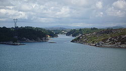
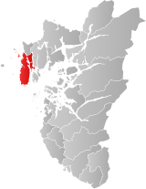
Karmøy is an island in the northwestern part of Rogaland county, Norway. The 176.8 square kilometres (68.3 sq mi) island makes up the majority of the municipality of Karmøy, along with the islands of Feøy, some smaller surrounding islands, and part of the mainland south of the municipality of Haugesund. It is the largest island in Rogaland county. The island is separated from the mainland by the Karmsundet strait. The Boknafjorden lies to the south and southeast of the island. The Sirafjorden lies to the west, separating Karmøy from the islands of Utsira and Feøy.