Central City is a home rule municipality located in Gilpin and Clear Creek counties, Colorado, United States. Central City is the county seat and the most populous municipality of Gilpin County. The city population was 779, all in Gilpin County, at the 2020 United States census. The city is a historic mining settlement founded in 1859 during the Pike's Peak Gold Rush and came to be known as the "Richest Square Mile on Earth". Central City and the adjacent city of Black Hawk form the federally designated Central City/Black Hawk Historic District. The city is now a part of the Denver–Aurora–Lakewood, CO Metropolitan Statistical Area and the Front Range Urban Corridor.

Black Hawk is a home rule municipality located in Gilpin County, Colorado, United States. The population was 127 at the 2020 United States Census, making it the least populous city in Colorado. It was a mining settlement founded in 1859 during the Pike's Peak Gold Rush and is now a part of the Denver-Aurora-Lakewood, CO Metropolitan Statistical Area and the Front Range Urban Corridor.

Ansted is a town in Fayette County in the U.S. state of West Virginia. The population was 1,404 at the 2010 census. It is situated on high bluffs along U.S. Route 60 on a portion of the Midland Trail near Hawks Nest overlooking the New River far below.

The Cherokee National Forest is a United States National Forest located in the U.S. states of Tennessee and North Carolina that was created on June 14, 1920. The forest is maintained and managed by the United States Forest Service. It encompasses an estimated area of 655,598 acres (2,653.11 km2).

The Dead Mountains are a mountain range in the southeastern Mojave Desert, in San Bernardino County, California. The range borders the tri-state intersection of Nevada, Arizona and California, and the Mohave Valley, with the Fort Mojave Indian Reservation bordering the range foothills on the east and northeast, in the three states.

Blue Mountain, Blue Mountain Ridge, or the Blue Mountains of Pennsylvania is a ridge of the Appalachian Mountains in eastern Pennsylvania. Forming the southern and eastern edge of the Ridge-and-Valley Appalachians physiographic province in Pennsylvania, Blue Mountain extends 150 miles (240 km) from the Delaware Water Gap on the New Jersey border in the east to Big Gap in Franklin County in south-central Pennsylvania at its southwestern end.
Lake Mason National Wildlife Refuge is located in the center of the U.S. state of Montana. The refuge has numerous lakes and extensive marshlands along Willow Creek, which provide nesting habitat for over a hundred bird species. The refuge is managed from the Charles M. Russell National Wildlife Refuge and is normally unstaffed and has few visitor improvements. The refuge consists of three discontinuous areas; the Lake Mason area which has seasonal wetlands, the North section consisting primarily of uplands and the Willow Creek section which was set aside to protect habitat for the mountain plover.

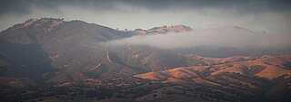
The Gabilan Range or Gabilán Range are a mountain range in the inner California Coast Ranges System, located in Monterey County and San Benito County of central California. Pinnacles National Park is located in the southern section of the range.

Hawk Mountain is a mountain ridge, part of the Blue Mountain Ridge in the Appalachian Mountain chain, located in central-eastern Pennsylvania near Reading and Allentown. The area includes 13,000 acres (5,300 ha) of protected private and public land, including the 2,600-acre (1,100 ha) Hawk Mountain Sanctuary.

Old Woman Mountains Wilderness is a wilderness area in the Old Woman Mountains of the eastern Mojave Desert. It is located south of Essex in San Bernardino County, California.

Schuylkill Gap is a water gap through Blue Mountain located about 3 miles north of Hamburg, Pennsylvania. The borough of Port Clinton, Pennsylvania resides within the gap itself.

The Central City/Black Hawk Historic District is a National Historic Landmark District that encompasses the developed areas of Central City and Black Hawk, Colorado, United States. They are adjacent former gold mining camps in the Front Range of the Rocky Mountains in Gilpin County, Colorado. For a time, the area was known as the Richest Square Mile on Earth, and was the largest urban area of the Colorado Territory in the 1870s.

Hawk Mountain Sanctuary is a wild bird sanctuary in Albany Township and East Brunswick Township, located along the Appalachian flyway in eastern Pennsylvania. The sanctuary is a prime location for the viewing of kettling and migrating raptors, known as hawkwatching, with an average of 20,000 hawks, eagles and falcons passing the lookouts during the late summer and fall every year.

Wapack National Wildlife Refuge is a National Wildlife Refuge of the United States located in southern New Hampshire. It was the state's first refuge and was established through a donation by Lawrence and Lorna Marshall in 1972. The 1,672-acre (677 ha) refuge is located about 20 miles (32 km) west of Nashua, New Hampshire and encompasses the 2,278-foot (694 m) North Pack Monadnock Mountain.
Eckville is an unincorporated community in far northern Berks County, Pennsylvania, United States. The town is located in an agricultural zone at the base of Blue Mountain, in northwestern Albany Township. Eckville is served by the Kutztown Area School District, and is approximately 17 miles (27 km) from the high school. It is near the head of the Pine Creek, which flows east-southeastward to the Maiden Creek.
Falls View is a census-designated place (CDP) in Fayette County, West Virginia, United States. Falls View is located 4 miles (6.4 km) southwest of Gauley Bridge, on the north bank of the Kanawha River. As of the 2010 census, its population was 238. Falls View was established in the early 20th century as a residential village for managers from the Electro Metallurgical Co., part of the Union Carbide and Carbon Corporation. Electro Metallurgical operated four ferroalloy plants in the area, powered by hydroelectricity generated at the dam on Kanawha Falls.
The Whipple Mountains Wilderness is a 76,122-acre (30,805 ha) wilderness administered by the Bureau of Land Management (BLM). Most of the Whipple Mountains are within the wilderness area. It is located in the northeastern Colorado Desert near the Colorado River. Lake Havasu and Lake Havasu City are 25 miles (40 km) to the North. Earp, California and Parker, Arizona are 20 miles (32 km) to the South. The Parker Dam is 8 miles (13 km) due east.

The fauna of the U.S. State of Nevada is mostly species adapted to desert, temperature extremes and to lack of moisture. With an average annual rainfall of only about 7 inches (180 mm), Nevada is the driest – and has the largest percentage of its total area classified as desert – of all states in the United States. Two-thirds of the state is located within the largest desert on the North American continent, the Great Basin Desert, while the lower one-third is the Mojave Desert.

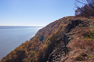
Hook Mountain State Park is a 676-acre (2.74 km2) undeveloped state park located in Rockland County, New York. The park includes a portion of the Hudson River Palisades on the western shore of the Hudson River, and is part of the Palisades Interstate Park system. Hook Mountain State Park is functionally part of a continuous complex of parks that also includes Rockland Lake State Park, Nyack Beach State Park, and Haverstraw Beach State Park.

Bake Oven Knob is a high point on the Blue Mountain ridge of the Appalachian Mountains near Germansville, Pennsylvania. Due to its location on the Appalachian Trail and proximity to many towns in the Lehigh Valley metropolitan area, it has become a popular spot for hiking.


