Indian Lake is a town in Hamilton County, New York, United States. The population was 1,352 at the 2010 census. The name is from a lake of the same name that is largely inside the town. There are no permanent stop lights in the town. Law enforcement is provided by New York State Troopers and Hamilton County Sheriff's Office.

Esneux is a Walloon municipality located in the Belgian province of Liège. On January 1, 2006, Esneux had a total population of 13,072. The total area is 34.05 km2 (13.15 sq mi) which gives a population density of 384 inhabitants per km².

Maubourguet is a commune in the Hautes-Pyrénées department in south-western France, in the Occitanie region.

Hwachae is a general term for traditional Korean punches, made with various fruits or edible flower petals. The fruits and flowers are soaked in honied water or honied magnolia berry juice. In modern South Korea, carbonated drinks and/or fruit juices are also commonly added to hwachae. Hwachae is often garnished with pine nuts before it is served.

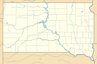
Hanna is a small unincorporated community in Lawrence County, South Dakota, United States. It is located along the Hanna Road in the Black Hills of South Dakota. The small settlement or village is south of the Hanna Campground and west-southwest of the Lead Country Club. The community is located about twelve miles southwest of Lead, South Dakota.

The Saalhausen Hills are a range of hills up to 687.7 m above sea level (NN) high in the Sauerland region within the districts of Olpe and Hochsauerlandkreis in the German state of North Rhine-Westphalia. They are part of the Rhine Massif and lie within the Süder Uplands.

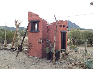
The Little Rincon Mountains are a small range of mountains, lying to the east of the Rincon Mountains, at Tucson, of eastern Pima County, Arizona. The range is located in northwest Cochise County and is part of the western border of the San Pedro River and Valley, the major valley and river of western Cochise County. The river is northward flowing to meet the Gila River; its headwaters are south of the US-Mexico border in northern Sonora. A small part of the Little Rincon range's southwest lies in Pima County.

The Black Hills of Greenlee County are a 20 mi (32 km) long mountain range of the extreme northeast Sonoran Desert bordering the south of the White Mountains of eastern Arizona's transition zone.

The Date Creek Mountains are a short, arid range in southwest Yavapai County, Arizona. Congress is on its southeast foothills, and Wickenburg lies 15 mi (24 km) southeast.

The New River Mountains are a small 14-mi (23 km) long, mountain range in central Arizona, and on the north border of the Phoenix valley; the range is located on the southwest perimeter of the Arizona transition zone. The range is a sub-part of landforms extending south from the Black Hills of Yavapai County. Rivers and canyons border east and west; the south of the range is located in Maricopa County, the location of much of the Phoenix metropolitan area.
Scenic Brook is a neighborhood located in southwest Austin, Texas. Scenic Brook is located in ZIP codes 78735 and 78736. The boundaries are the intersections of Highway 290 and Highway 71 to on the north, south, and east sides, and Covered Bridge Drive and Scenic Brook Drive on the west side. The Pinnacle Campus of Austin Community College is a landmark on the southeast side of the neighborhood.
Granada Hills is a neighborhood located in southwest Austin, Texas. Granada Hills is located in ZIP code 78737. The neighborhood boundaries are FM 1826 on the south and east sides, Highway 290 and the Scenic Brook neighborhood to the north, and Southview Road and the Belterra neighborhood on the west side. Granada Hills is located in the Austin Independent School District.
Hony Capital is a Chinese private equity firm, owned by Legend Holdings. Legend Holdings provided Hony, a pioneer in China's private equity industry, with its start-up capital. Hony has about US$10 billion under management. Hony also invests in overseas consumer brands in order to create value by expanding their presence in China.
The Ven. William Edward Hony, MA (Oxon), BD (Cantab) was an Anglican priest, Archdeacon of Sarum from 3 August 1846 until 31 December 1874.

Van Loan Hill is a mountain in Greene County, New York. It is located in the Catskill Mountains southwest of Maplecrest. Round Hill is located west, Elm Ridge is located north-northeast, and East Jewett Range is located south of Van Loan Hill.

Armlin Hill is a mountain in Schoharie County, New York. It is located south-southwest of Middleburgh. Gates Hill is located south and Hony Hill is located northeast of Armlin Hill.

Gates Hill is a mountain in Schoharie County, New York. It is located south-southwest of Middleburgh. Armlin Hill is located north and Hony Hill is located north-northeast of Gates Hill.

Windy Ridge is a mountain in Schoharie County, New York, USA, located southeast of Middleburgh. Hony Hill is to the west-northwest and East Hill is southeast of Windy Ridge.

The Cliff is a cliff in Schoharie County, New York. It is located northeast of Middleburgh. Rundy Cup Mountain is located northeast and Hony Hill is located south-southwest of The Cliff.
The following is a list of neighborhoods in Wichita, Kansas, United States.


