Related Research Articles

Swildon's Hole is an extensive cave in Priddy, Somerset. At 9,144 metres (30,000 ft) in length, it is the longest cave on the Mendip Hills. It has been found to be connected to Priddy Green Sink and forms part of the Priddy Caves Site of Special Scientific Interest (SSSI).
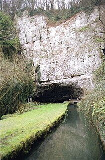
The River Axe is a river in South West England. The river is formed by water entering swallets in the limestone and rises from the ground at Wookey Hole Caves in the Mendip Hills in Somerset, and runs through a V-shaped valley. The geology of the area is limestone and the water reaches Wookey Hole in a series of underground channels that have eroded through the soluble limestone. The river mouth is in Weston Bay on the Bristol Channel.

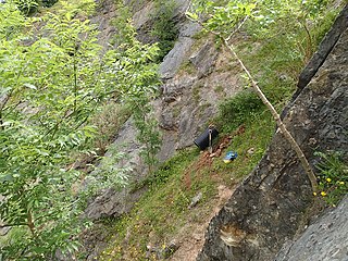
Burrington Combe is a Carboniferous Limestone gorge near the village of Burrington, on the north side of the Mendip Hills Area of Outstanding Natural Beauty, in North Somerset, England.
Lamb Leer is a 14.59 hectare geological Site of Special Scientific Interest between East Harptree and Priddy in the Mendip Hills, Somerset, notified in 1983. The cavern is a fragment of a very ancient major cave system which now contains one of the largest chambers in the Mendip Hills.

Priddy is a village in Somerset, England in the Mendip Hills, close to East Harptree and 4 miles (6 km) north-west of Wells. It is in the local government district of Mendip.
Priddy Caves is an Area: 67.6 hectare geological Site of Special Scientific Interest at Priddy in the Mendip Hills, Somerset, notified in 1965.
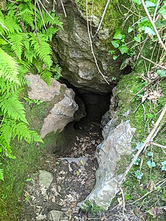
Thrupe Lane Swallet is a 0.5 hectares geological Site of Special Scientific Interest in Somerset, notified in 1992. It is also a Geological Conservation Review site.
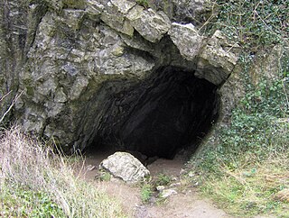
Aveline's Hole is a cave at Burrington Combe in the limestone of the Mendip Hills, in Somerset, England.

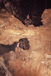
Eastwater Cavern is a cave near Priddy in the limestone of the Mendip Hills, in Somerset, England. It is also known as Eastwater Swallet. It was first excavated in April 1902 by a team led by Herbert E. Balch composed of paid labourers and volunteers from the Wells Natural History Society. Progress was initially slow, but by February 1903 Balch and Willcox had discovered substantial passage, following the streamway down to the bottom of the cave. Dolphin Pot was dug in 1940 by the Wessex Cave Club, with Primrose Pot following in 1950. West End series was the most recent significant discovery, in 1983.
GB Cave is a cave between Charterhouse and Shipham in the limestone of the Mendip Hills, in Somerset, England.

St Cuthbert's Swallet is the second longest, and most complex, cave on the Mendip Hills, in Somerset, England. It forms a major part of the Priddy Caves system and water entering this swallet re-emerges at Wookey Hole. St Cuthbert's Swallet is part of, and lies underneath, the Priddy Pools Site of Special Scientific Interest.

Shatter Cave is a cave in Fairy Cave Quarry, near Stoke St Michael in the limestone of the Mendip Hills, in Somerset, England. It falls within the St. Dunstan's Well Catchment Site of Special Scientific Interest.

Stoke Lane Slocker is a cave near Stoke St Michael, in the Carboniferous Limestone of the Mendip Hills, in the English county of Somerset.
Balch Cave is a cave in Fairy Cave Quarry, near Stoke St Michael in the limestone of the Mendip Hills, in Somerset, England. The cave is part of the complex of passages feeding to St. Dunstan's Well Catchment Site of Special Scientific Interest and an abandoned Bristol Water abstraction point.
Hillier's Cave is a cave in Fairy Cave Quarry, near Stoke St Michael in the limestone of the Mendip Hills, in Somerset, England.
Sidcot Swallet is a cave near Burrington Combe, in the Carboniferous Limestone of the Mendip Hills, in Somerset, England.
Rod's Pot is a limestone cave above Burrington Combe in the Mendip Hills, in Somerset, England.
Attborough Swallet is a cave in Chewton Mendip in Somerset, England.

Pierre's Pot is a karst cave in Burrington Combe on the Mendip Hills in Somerset, England.

W/L Cave is part of the Fairy Cave Quarry group of caves between Stoke St Michael and Oakhill in the limestone of the Mendip Hills, in Somerset, England.
References
- 1 2 Irwin & Knibbs, Mendip Underground: A Cavers Guide
- ↑ Witcombe, Richard (2009). Who was Aveline anyway?: Mendip's Cave Names Explained (2nd ed.). Priddy: Wessex Cave Club. p. 97. ISBN 978-0-9500433-6-4.
- ↑ "Priddy Caves" (PDF). SSSI citation sheet. English Nature. Archived from the original (PDF) on 19 March 2009. Retrieved 7 July 2009.
Coordinates: 51°14′46″N2°39′00″W / 51.246°N 2.650°W
| | This Somerset location article is a stub. You can help Wikipedia by expanding it. |