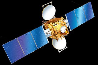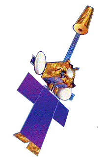
The Indian National Satellite System or INSAT, is a series of multipurpose geostationary satellites launched by ISRO to satisfy the telecommunications, broadcasting, meteorology, and search and rescue operations. Commissioned in 1983, INSAT is the largest domestic communication system in the Indo-Pacific Region. It is a joint venture of the Department of Space, Department of Telecommunications, India Meteorological Department, All India Radio and Doordarshan. The overall coordination and management of INSAT system rests with the Secretary-level INSAT Coordination Committee.
GSAT-3, also known as EDUSAT, was a communications satellite which was launched on 20 September 2004 by the Indian Space Research Organisation. EDUSAT is the first Indian satellite built exclusively to serve the educational sector. It is mainly intended to meet the demand for an interactive satellite-based distance education system for the country.
INSAT-4C was an Indian communications satellite which was lost in a launch failure in 2006. Had it reached orbit, it would have formed part of the Indian National Satellite System. Launched in 2007, it was intended to have operated in geostationary orbit at a longitude of 73.97° east. The INSAT-4CR satellite, launched in September 2007, replaced it.

The Master Control Facility (MCF) is a facility set up by the Indian Space Research Organisation (ISRO) in the city of Hassan in the Indian state of Karnataka. Established in 1982, this facility is responsible for monitoring and controlling geostationary and geosynchronous satellites launched by ISRO. This was the only Master Control Facility of ISRO till another one was established in Bhopal in 2005.

INSAT-1B was an Indian communications satellite which formed part of the Indian National Satellite System. Launched in 1983, it was operated in geostationary orbit at a longitude of 74 degrees east. At the end of its seven-year design life it was replaced by the newly launched INSAT-1D, dropping to backup status. In 1992, it was relocated to 93° east, before being decommissioned in August 1993.
INSAT-2E is an Indian geostationary communications and weather satellite which is operated by the Indian National Satellite System. It is positioned in geostationary orbit at a longitude of 83° East, from where it is used to provide communications services to Asia and Australia. It also carries two meteorological instruments; the Very High Resolution Radiometer, and a CCD camera capable of returning images with a resolution of one kilometre.
INSAT-3D is a meteorological, data relay and satellite aided search and rescue satellite developed by the Indian Space Research Organisation and was launched successfully on 26 July 2013 using an Ariane 5 ECA launch vehicle from French Guiana. The satellite has many new technology elements like star sensor, micro stepping Solar Array Drive Assembly (SADA) to reduce the spacecraft disturbances and Bus Management Unit (BMU) for control and telecom and telemetry function. It also incorporates new features of bi-annual rotation and Image and Mirror motion compensations for improved performance of the meteorological payloads.

INSAT 3E is a defunct communication satellite built by Indian Space Research Organisation. It was launched on September 28, 2003, from the European Space Agency's spaceport in French Guiana on board the Ariane rocket. The satellite had a launch mass of 2750 kilograms. It is the 4th satellite launched in the INSAT-3 series for INSAT. It was designed for providing high-speed communication, Television, VSAT & Tele-education services and was an important landmark in Indian Space Programme.

INSAT-3A, a multipurpose satellite built by ISRO was launched by Ariane in April 2003. It is located at 93.5 degree East longitude. It is third satellite in INSAT-3 series after INSAT-3B & INSAT-3C. Built at a cost of $53 mn, it provides communication, weather, and search and rescue services.

INSAT-4A was the first one in the INSAT-4 Satellites series, providing services in the Ku and C band frequency bands. At the time of launch, it was the heaviest satellite India had produced. The Ku transponders cover the Indian main land and C-Band transponders cover an extended area. It has a dozen Ku transponders and another dozen of C-band transponders. This spacecraft was placed at 83°E along with INSAT-2E and INSAT-3B, by Ariane launch vehicle (ARIANE5-V169).
GSAT-12 is communication satellite designed and developed by the Indian Space Research Organisation. It is the second satellite to be launched and placed on a GTO using PSLV.
INSAT-4CR was a communications satellite operated by ISRO as part of the Indian National Satellite System. Launched in September 2007, it replaced the INSAT-4C satellite which had been lost in a launch failure the previous year. The satellite was initially stationed in geostationary orbit at a longitude of 74 degrees east, with expected operational life of at least ten years, however this may have been reduced by the underperformance of the Geosynchronous Satellite Launch Vehicle which placed it into orbit. INSAT-4CR is planned to be replaced by GSAT-31, which was launched on February 6, 2019.

INSAT-4E, also known as GSAT-6, is a member of the INSAT family and is a multimedia communication satellite that will offer a Satellite Digital Multimedia Broadcasting (S-DMB) service across several digital multimedia terminals or consoles which can be used to provide information services to vehicles on the fly and to the mobile phones. The satellite can be used for other social and strategic applications.
INSAT-1A was an Indian communications satellite which formed part of the Indian National Satellite System. Launched in 1982, it was operated in geostationary orbit at a longitude of 74° east. Following a series of failures, the satellite was abandoned in September 1982, less than 6 months into a seven-year mission.
INSAT-2B was the second satellite in the INSAT 2 Series that was successfully launched for telecommunication and meteorological observation. This India satellite was launched on 23 July 1993 from Kourou, French Guiana and Ariane-4 being its launch vehicle. INSAT-2B is placed in the geostationary orbit at a longitude of 93.5 degree East. The satellites also carries a search and rescue(SAR) transponder, a data relay transponder and also high resolution radiometer. This radiometer has a resolution of 2 km (1.2 mi) in the normal visible band and of 8 km (5.0 mi) in the thermal infra red band.
I-1K is a satellite bus developed by the Indian Space Research Organisation (ISRO) and marketed by Antrix Corporation. The I-1K bus is designed to be compatible with lightweight geostationary satellites and is commonly used for meteorological satellites.

INSAT-1D was 4th and the concluding multipurpose geostationary satellite of the INSAT-1 (first-generation seven-year responsibility for the operation of the INSAT space segment.
INSAT-2D was an Indian communications satellite. Launched on 4 June 1997, and similar to INSAT-2C, INSAT-2D went out of order on October 4, 1997, because of a power inconsistency problem and was later replaced by INSAT-2DT, an in-orbit satellite which was previously known as ARABSAT-1C. The main aim of the satellite was improved communication. In the INSAT-2 series, INSAT-2D was the fourth consecutive communication satellite. The satellite was launched using an Ariane 4 rocket from French Guiana.
INSAT-2C was an Indian geostationary communications spacecraft. It is ISRO's third indigenous communications satellite.


