The Indian National Satellite SystemINSAT, is a series of multipurpose geostationary satellites launched by ISRO to satisfy telecommunications, broadcasting, meteorology, and search and rescue operations. Commissioned in 1983, INSAT is the largest domestic communication system in the Indo-Pacific Region. It is a joint venture of the Department of Space, Department of Telecommunications, India Meteorological Department, All India Radio and Doordarshan. The overall coordination and management of INSAT system rests with the Secretary-level INSAT Coordination Committee.

The Indian Space Research Organisation is the national space agency of India. It operates as the primary research and development arm of the Department of Space (DoS), which is directly overseen by the Prime Minister of India, while the Chairman of ISRO also acts as the executive of DoS. ISRO is primarily responsible for performing tasks related to space-based operations, space exploration, international space cooperation and the development of related technologies. ISRO is one of the six government space agencies in the world that possesses full launch capabilities, can deploy cryogenic engines, can launch extraterrestrial missions and operate a large fleet of artificial satellites. ISRO is one of the four government space agencies to have soft landing (uncrewed) capabilities.

A satellite navigation or satnav system is a system that uses satellites to provide autonomous geopositioning. A satellite navigation system with global coverage is termed global navigation satellite system (GNSS). As of 2023, four global systems are operational: the United States’s Global Positioning System (GPS), Russia's Global Navigation Satellite System (GLONASS), China's BeiDou Navigation Satellite System, and the European Union's Galileo.

The GSAT satellites are India's indigenously developed communications satellites, used for digital audio, data and video broadcasting. As of 5 December 2018, 20 GSAT satellites of ISRO have been launched out of which 14 satellites are in service.

Satish Dhawan Space Centre – SDSC, is the primary spaceport of the Indian Space Research Organisation (ISRO), located in Sriharikota, Andhra Pradesh.

The Launch Vehicle Mark-3 or LVM3 is a three-stage medium-lift launch vehicle developed by the Indian Space Research Organisation (ISRO). Primarily designed to launch communication satellites into geostationary orbit, it is also due to launch crewed missions under the Indian Human Spaceflight Programme. LVM3 has a higher payload capacity than its predecessor, GSLV.
The Indian Human Spaceflight Programme (IHSP) is an ongoing programme by the Indian Space Research Organisation (ISRO) to develop the technology needed to launch crewed orbital spacecraft into low Earth orbit. Two uncrewed flights, named Gaganyaan-1 and Gaganyaan-2 are scheduled to launch in 2024 followed by crewed flight in 2025 on an LVM3 rocket.

The Indian Regional Navigation Satellite System (IRNSS), with an operational name of NavIC, is an autonomous regional satellite navigation system that provides accurate real-time positioning and timing services. It covers India and a region extending 1,500 km (930 mi) around it, with plans for further extension. An extended service area lies between the primary service area and a rectangle area enclosed by the 30th parallel south to the 50th parallel north and the 30th meridian east to the 130th meridian east, 1,500–6,000 km (930–3,730 mi) beyond borders where some of the NavIC satellites are visible but the position is not always computable with assured accuracy. The system currently consists of a constellation of eight satellites, with two additional satellites on ground as stand-by.
The Integrated Space Cell was the nodal agency within the Government of India which oversees the security of its space based military and civilian hardware systems. It was to be jointly operated by all the three services of the Indian Armed Forces, the civilian Defence Research and Development Organisation and the Indian Space Research Organisation (ISRO). This agency was superseded by Defence Space Agency in 2019.[better source needed]

Chandrayaan-2, is the second lunar exploration mission developed by the Indian Space Research Organisation (ISRO), after Chandrayaan-1. It consists of a lunar orbiter, and formerly included the Vikram lander and the Pragyan rover, all of which were developed in India. The main scientific objective is to map and study the variations in lunar surface composition, as well as the location and abundance of lunar water.

RISAT (Radar Imaging Satellite) is a series of Indian radar imaging reconnaissance satellites built by the Indian Space Research Organization (ISRO). They provide all-weather surveillance using synthetic aperture radars (SAR).
GSAT-7 or INSAT-4F is a multi-band military communications satellite developed by the Indian Space Research Organisation. The Indian Navy is the user of the multi-band communication spacecraft, which has been operational since September 2013. According to defense experts, the satellite will enable the navy to extend its blue water capabilities and stop relying on foreign satellites like Inmarsat, which provide communication services to its ships.

Geo Imaging Satellite or GISAT is an Indian imaging satellite class for geostationary orbit with a high temporal resolution, meant for providing near real time imaging with fast revisit capability and real time monitoring. Two satellites will provide resolution in the range of 42 to 318 m. It will carry multi-spectral, multi-resolution imaging instruments.

GSAT-29 is a high-throughput communication satellite developed by the Indian Space Research Organisation (ISRO). The mission aims at providing high-speed bandwidth to Village Resource Centres (VRC) in rural areas. The two Ku and Ka operational payloads will provide communication services to Jammu and Kashmir and Northeast India under Digital India programme. At the time of launch GSAT-29 was the heaviest satellite, weighing 3,423 kg (7,546 lb), that was placed in orbit by an Indian launch vehicle. Approved cost of GSAT-29 is ₹175.63 crore (US$22 million).

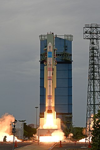
The Small Satellite Launch Vehicle (SSLV) is a small-lift launch vehicle developed by ISRO with payload capacity to deliver 500 kg (1,100 lb) to low Earth orbit or 300 kg (660 lb) to Sun-synchronous orbit for launching small satellites, with the capability to support multiple orbital drop-offs. SSLV is made keeping low cost, low turnaround time in mind with launch-on-demand flexibility under minimal infrastructure requirements.
RISAT-2B, or Radar Imaging Satellite-2B is an Indian radar reconnaissance satellite that is part of India's RISAT programme and the third satellite in the series. It is built by Indian Space Research Organisation (ISRO) to replace RISAT-2.
EOS-01 is an X-band, synthetic-aperture radar (SAR) based all weather Earth imaging satellite built by the Indian Space Research Organisation (ISRO) for tasks pertaining to forestry, agricultural and disaster management. It is a part of India's RISAT series of SAR imaging spacecraft and would be third satellite in the series including RISAT-2B, RISAT-2BR1 with 120° phasing. EOS-01 has been developed at the cost of roughly ₹125 crore.

India's Space Industry is predominantly driven by the national Indian Space Research Organisation (ISRO). The industry includes over 500 private suppliers and other various bodies of the Department of Space in all commercial, research and arbitrary regards. There are relatively few independent private agencies, though they have been gaining an increased role since the start of the 21st century. In 2019, the space industry of India accounted for $7 billion or 2% of the global space industry and employed more than 45,000 people. Antrix Corporation expects the industry to grow up to $50 billion by 2024 if provided with appropriate policy support.


