Irasburg, Vermont

Last updated

Irasburg, Vermont
Town
Irasburg vermont towns.png
Located in Orleans County, Vermont
Map of USA VT.svg
Location of Vermont with the U.S.A.
Coordinates: 44°48′22″N72°16′4″W / 44.80611°N 72.26778°W / 44.80611; -72.26778
CountryUnited States
State Vermont
County Orleans
CharteredFebruary 23, 1781
Area
  Total40.6 sq mi (105.1 km2)
  Land40.5 sq mi (105.0 km2)
  Water0.1 sq mi (0.2 km2)
Elevation
814 ft (313 m)
Population
 (2020)
  Total1,233
  Density30/sq mi (11.7/km2)
  Households
501
  Families
379
Time zone UTC-5 (EST)
  Summer (DST) UTC-4 (EDT)
ZIP code
05845
Area code 802
FIPS code 50-35575 [1]
GNIS feature ID1462124 [2]

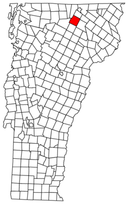
Irasburg is a town in Orleans County, Vermont, United States. Irasburg was established in 1781 when the land was granted to Ira Allen, Roger Enos, Jerusha Enos (wife of Roger Enos), Jerusha Enos, Jr. (wife of Ira Allen), Roger Enos, Jr. and others by the Vermont General Assembly. [3] Ira Allen later obtained the rights of the other proprietors, and he deeded the town to Jerusha Enos, Jr. as a wedding gift. [4]

Contents

The 2020 United States Census reported that there were 1,233 citizens living in Irasburg. [5] Irasburg has a total land area of 40.6 square miles (105 km2), 40.5 square miles (105 km2) being land and .1 square miles (0.26 km2) being water. The unincorporated village of Irasburg is in the center of the town.

On average, it snows 9 out of the 12 months of the year. [6]

History

The land now known as Irasburg was granted on February 23, 1781, to Ira Allen, by the General Assembly of Vermont. The lands of Vermont were then claimed by both New Hampshire and New York. The Continental Congress ordered that the land would not be distributed until the inhabitants of New York, New Hampshire, and the land known as "Vermont" had resolved the conflict of who truly owned the land. The General assembly of Vermont ignored this order, however, and Vermont was granted to 40–70 individuals. Ira Allen, the person known to have been granted the most land, was born in Colchester in 1790 and attended Middlebury College and the University of Vermont. The Allens leased the land that they had received to settlers. Although Ira Allen was the first to be granted land, Irasburg's first settler was Caleb Leach in 1798. No land was conveyed by deed, however, until Ira H. Allen, son of Ira Allen, became town resident in 1814 and served as town clerk. [3]

Captain James Richardson settled Irasburg in 1803 and is believed to have opened the first tavern in town. [3]

The production of salts and pearl-ashes was the primary industry in Irasburg for the early 19th century. Although there was an embargo, those goods were transported to Canada. There was a large amount of smuggling of the salts and pearl-ashes by the town's residents. [3]

Mills emerged in Irasburg as early as 1810. By the 1820s, the town had begun to prosper as industrial sites began to emerge, which included a woolen mill, tannery, and factory production of stoves and plows. [3]

The Old Heerman Mill was located here.

In 1812, the legislature voted to change the shire town of Orleans County to Irasburg. Supporting buildings were completed in 1816. [7]

In 1812, Irasburg became an Orleans County shire town, as it remained until 1886. [3] In 1886, the legislature moved the shire town to Newport. [8]

The first courthouse and jail were built in 1815, by Irasburg residents at their own expense. The original courthouse was moved in 1847, however, and a new one was built on the same site. The original jail was built of timber and was replaced by one that was made of stone in 1838. It was eventually made of granite in 1862. [3] In 1862, Company E of the 9th Vermont Infantry was recruited, in part, from Irasburg.

In 1877, the town was still spelled "Irasburgh." [9]

The original county courthouse burned, with all of its records, in 1910 or 1911. [10] A new Irasburg Town Hall was built in 1911 and remodeled in 1990. [11]

The town was in the national news in 2010 when it appeared that a moose was going to be destroyed for theoretically carrying disease but mostly because "tamed" wildlife is not allowed in Vermont. The Vermont Legislature crafted a law that spared the moose's life. [12] [13] [14]

Geography

According to the United States Census Bureau, the town has a total area of 40.6 square miles (105.1 km2), of which 40.5 square miles (105.0 km2) is land and 0.1 square mile (0.2 km2) (0.15%) is water.

The Black River flows through the town in a northerly direction, receiving a number of small streams. It enters east of Potters Pond. It continues northeast, then east to the village of Irasburg. Just upstream of the village, Lords Creek enters. This creek is about 10 miles (16 km) long and drains a watershed that is 17 square miles (44 km2). Downstream of Irasburg, the Black River continues north. It then flows into the town of Coventry. [15]

The Barton River, after leaving Orleans, flows through eastern Irasburg, and enters Coventry.

Climate

Record temperatures have never exceeded 98 °F (37 °C). July, the hottest month, has averaged just over 80 °F (27 °C). The record low occurred in December where temperatures reached −40 °F (−40 °C). On average it snows 9 out of the 12 months of the year. The majority of the snowfall occurs between the months of November and March. Each of these months average over 10 inches (250 mm). Irasburg averages about 103 inches (2,600 mm) of snow annually.

Climate data for Newport, Vermont
MonthJanFebMarAprMayJunJulAugSepOctNovDecYear
Record high °F (°C)64
(18)
62
(17)
83
(28)
87
(31)
92
(33)
95
(35)
98
(37)
95
(35)
96
(36)
84
(29)
74
(23)
66
(19)
98
(37)
Mean daily maximum °F (°C)26.3
(−3.2)
31.0
(−0.6)
41.0
(5.0)
54.2
(12.3)
69.0
(20.6)
76.8
(24.9)
80.9
(27.2)
78.8
(26.0)
69.5
(20.8)
57.0
(13.9)
43.1
(6.2)
31.0
(−0.6)
54.9
(12.7)
Mean daily minimum °F (°C)5.5
(−14.7)
7.8
(−13.4)
18.7
(−7.4)
31.3
(−0.4)
43.2
(6.2)
52.4
(11.3)
56.8
(13.8)
54.8
(12.7)
46.8
(8.2)
37.0
(2.8)
27.3
(−2.6)
13.0
(−10.6)
32.9
(0.5)
Record low °F (°C)−38
(−39)
−38
(−39)
−32
(−36)
−2
(−19)
20
(−7)
28
(−2)
36
(2)
32
(0)
20
(−7)
0
(−18)
−7
(−22)
−40
(−40)
−40
(−40)
Average precipitation inches (mm)2.96
(75)
2.16
(55)
2.96
(75)
2.93
(74)
3.67
(93)
3.93
(100)
4.19
(106)
4.18
(106)
3.76
(96)
3.45
(88)
3.47
(88)
3.12
(79)
40.78
(1,035)
Average snowfall inches (cm)24.7
(63)
17.2
(44)
18.8
(48)
6.9
(18)
0.1
(0.25)
0
(0)
0
(0)
0
(0)
01
(2.5)
1.1
(2.8)
11.0
(28)
23.1
(59)
102.9
(261)
Source: NOAA [6]

Demographics

Historical population
CensusPop.Note
1800 15
1810 2921,846.7%
1820 43247.9%
1830 86099.1%
1840 97112.9%
1850 1,0346.5%
1860 1,1319.4%
1870 1,085−4.1%
1880 1,064−1.9%
1890 999−6.1%
1900 939−6.0%
1910 9834.7%
1920 9991.6%
1930 924−7.5%
1940 852−7.8%
1950 711−16.5%
1960 7110.0%
1970 7759.0%
1980 87012.3%
1990 9074.3%
2000 1,07718.7%
2010 1,1638.0%
2020 1,2336.0%
U.S. Decennial Census [16]

As of the census of 2010, there were 1,096 people, 452 households, and 318 families residing in Irasburg. There were 545 housing units. The racial makeup of the town was 96.6% White, 1059 people, .5% black, 5 people, .1% Native American, 1 person, 0.5% Asian, 5 people, 0.5% from other races, 6 people, and 1.8% from two or more races, 20 people. Hispanic or Latino people of any race were 1.1% of the population, 12 people.

There were 452 households, out of which 27.9%, 127 households, had children under the age of 18 living with them, 56.4% were married couples living together, 255 households, 9.5% had a female householder with no husband present, 43 people, 4.4% were males with no family, 20 people, and 21.7% were non-families. 22.6% of all households were made up of individuals, 102, and 4.4%, 20 houses had someone living alone who was 65 years of age or older. The average household size was 2.42 and the average family size was 2.81.

The ages of people were found as follows. 54 people, or 4.9% of the population were from 5 to 9 years old. 74, or 6.8% were from 10 to 14 years. 70, or 6.4% were from 15 to 19 years old. 76, or 6.9% were from 20 to 24 years old. 49, or 4.5% were from 25 to 29 years old. 63 or 5.7% were from 30 to 34 years old. 62, or 5.7% were from 35 to 39 years old. 59, or 5.4% were from 40 to 44 years old. 71, or 6.5% were from 45 to 49 years old. 105, or 9.6% were from 50 to 54 years. 89, or 8.1% were from 55 to 59 years old. 86, or 7.8% were from 60 to 64 years old. 63, or 5.7%, were from 65 to 69 years old. 64, or 5.8% were from 70 to 74 years old. 45, or 4.1% were from 75 to 79 years old. 27, or 2.5%, were from 80 to 84 years old. 18, or 1.6% were 85 years and over.

At the time of the 2010 census, there were 574 males and 522 females living in Irasburg. The median age for males was 42, and the median age for females was 44.4. [17]

Government

Town

School district

There is only one elementary school (Irasburg Village School). The school consists of students in K through 8th grade, consisting of a total of 130 students. [19]

The school provides three seasons of intramural sports. It is located Irasburg village. [20]

Irasburg Village School is part of the Orleans Central Supervisory Union. 9th through 12th grade students attend the Lake Region Union High School. [21]

Cultural events

The Kingdom run annual foot race takes place each summer. The racecourse is a loop that starts and finishes in the Irasburg town commons. Runners may race 5 kilometres (3.1 mi), 10 kilometres (6.2 mi) or 20 kilometres (12 mi). [22]

The annual Irasburg Church Fair started 1952. The fair includes an auction and the sale of baked goods. [23] [24]

Landmarks

Lord's Creek Covered Bridge in Irasburg Lord's Creek Covered Bridge.jpg
Lord's Creek Covered Bridge in Irasburg

There was a round barn on Vermont Route 58 about 1.5 miles (2.4 km) west of the village of Irasburg. On August 23, 2016, this historic barn was destroyed by a fire. [25] [26] The Lord's Creek Covered Bridge was built in 1881. It is located on Covered Bridge Road. [27]

Notable people

Footnotes

  1. "U.S. Census website". United States Census Bureau . Retrieved January 31, 2008.
  2. "US Board on Geographic Names". United States Geological Survey. October 25, 2007. Retrieved January 31, 2008.
  3. 1 2 3 4 5 6 7 "Old Stone House Museum" . Retrieved October 19, 2012.
  4. Marjorie A. Orcutt, Edward S. Alexander, A History of Irasburg, Vermont, 1989, page 20
  5. "Census - Geography Profile: Irasburg town, Orleans County, Vermont" . Retrieved December 31, 2021.
  6. 1 2 "Climatography of the United States No. 20" (PDF). NOAA. Archived from the original (PDF) on August 21, 2014. Retrieved October 21, 2012.
  7. "Gazetteer". Rootsweb.ancestry.com. Retrieved November 1, 2012.
  8. Young, Darlene (1998). A history of Barton Vermont. Crystal Lake Falls Historical Association.
  9. "XX indexVermont". Rootsweb.ancestry.com. Retrieved November 1, 2012.
  10. Usatch, Brad (April 25, 2018). "Stately Irasburg homes enjoying a second life". The Chronicle. Barton, Vermont. pp. 1C.
  11. Old Stone House Museum (June 29, 2007). Big band dance to honor Korean War veterans. the Chronicle.
  12. "Targeted for death, Vt. moose gets a reprieve". Associated Press. May 25, 2010. Archived from the original on May 25, 2010. Retrieved November 1, 2012.
  13. Zezima, Katie (October 4, 2009). "NY Times". NY Times. Vermont. Retrieved November 1, 2012.
  14. "Targeted for death, Vt. moose gets a reprieve". News.Yahoo.com. May 25, 2010. Archived from the original on May 25, 2010. Retrieved November 1, 2012.
  15. Archived August 29, 2007, at the Wayback Machine
  16. "U.S. Decennial Census". United States Census Bureau. Retrieved June 19, 2015.
  17. "2010 Census Population for ZIP Code 05845". 2010 United States Census. Retrieved October 19, 2012.
  18. Small number of voters make some significant decisions,The Chronicle, March 7, 2007, page13
  19. "Irasburg Village School Enrollment 2010–2011" (PDF). Irasburg Town Report. Retrieved October 19, 2012.
  20. "Welcome To Irasburg Village School Website" . Retrieved October 18, 2012.
  21. "Lake Region Union High School" . Retrieved October 19, 2012.
  22. "Kingdom Run 2012". Kingdom Run. Retrieved October 24, 2012.
  23. Green Mountain Designs. "Irasburg Church Fair" . Retrieved October 24, 2012.
  24. "Vermont Church Listings". Vtcucc.org. Retrieved July 19, 2007.
  25. "Historic Barn Destroyed by Fire". WCAX News. August 23, 2016. Retrieved September 16, 2016.
  26. "Photo of Round Barn". Dalejtravis.com. Retrieved November 1, 2012.
  27. "Vermont Covered Bridges". Judy Leonard. October 10, 2012. Retrieved September 20, 2016.
  28. Baldwin, Frederick W. (1916). History of Bank of Orleans. Burlington, VT: Free Press Printing Company. p. 117.
  29. Ullery, Jacob G. (1894). Men of Vermont Illustrated. Brattleboro, VT: Transcript Publishing Company. p. 397.

Related Research Articles

<span class="mw-page-title-main">Orleans County, Vermont</span> County in Vermont, United States

Orleans County is a county located in the northeastern part of the U.S. state of Vermont. As of the 2020 census, the population was 27,393. Its shire town is the city of Newport. The county was created in 1792 and organized in 1799. As in the rest of New England, few governmental powers have been granted to the county. The county is an expedient way of grouping and distributing state-controlled governmental services.

<span class="mw-page-title-main">Essex County, Vermont</span> County in Vermont, United States

Essex County is a county located in the northeastern part of the U.S. state of Vermont. As of the 2020 census, the population was 5,920, making it the least-populous county in both Vermont and New England. Its shire town is the municipality of Guildhall. The county was created in 1792 and organized in 1800. Bordered by the Connecticut River next to New Hampshire, Essex County is south of the Canadian province of Quebec. It is the county with the lowest household-income in Vermont.

<span class="mw-page-title-main">Caledonia County, Vermont</span> County in Vermont, United States

Caledonia County is a county located in the northeastern part of the U.S. state of Vermont. As of the 2020 census, the population was 30,233. Its shire town is the town of St. Johnsbury. The county was created in 1792 and organized in 1796. It was given the Latin name for Scotland, in honor of the many settlers who claimed ancestry there.

<span class="mw-page-title-main">Lyndon, Vermont</span> Town in Vermont, United States

Lyndon is a town in Caledonia County, Vermont, United States. As of the 2020 census, the population was 5,491. Lyndon is the home of Lyndon State College. The town contains five unincorporated villages, Lyndonville just east of the geographic center of town, Lyndon Corner in the south, Lyndon Center in the center of town on the west side of Lyndonville, Little Egypt in the north, and East Lyndon in the southeast.

<span class="mw-page-title-main">Williston, Vermont</span> Town in Vermont, United States

Williston is a town in Chittenden County, Vermont, United States. Originally rural and laid out with many farms, in recent decades it has developed into a thriving suburb of Burlington, the largest city in the state of Vermont. As of the 2020 census, the population of Williston was 10,103, an increase of over 1,000 people since the 2010 census. Williston is one of the fastest-growing towns in Vermont, and while becoming more populated, it has also developed as a major retail center for the Burlington area as well as much of central and northern Vermont. The town has a National Register Historic District in its unincorporated central village.

<span class="mw-page-title-main">Enosburgh, Vermont</span> Town in Vermont, United States

Enosburgh is a town in Franklin County, Vermont, in the United States. The population was 2,810 at the 2020 census. Enosburgh includes the village of Enosburg Falls and the settlements of Bordoville, East Enosburgh, North Enosburgh, Sampsonville, West Enosburgh, and Enosburgh Center. Enosburgh was named for Roger Enos, who had been a commander of all the Vermont Forces in the American Revolution. He was also the father-in-law of Ira Allen, founder of Vermont. The spelling of Enosburgh differs from the spelling of Enosburg Falls.

<span class="mw-page-title-main">Eden, Vermont</span> Town in Vermont, United States

Eden is a town in Lamoille County, Vermont, United States. The population was 1,338 at the 2020 census.

<span class="mw-page-title-main">Brownington, Vermont</span> Town in Vermont, United States

Brownington is a town in Orleans County, Vermont, United States. The population was 1,042 as of the 2020 census.

<span class="mw-page-title-main">Charleston, Vermont</span> Town in Vermont, United States

Charleston is a town in Orleans County, Vermont, United States. The population was 1,021 at the 2020 census. The town contains two unincorporated villages: East Charleston and West Charleston.

<span class="mw-page-title-main">Coventry, Vermont</span> Town in Vermont, United States

Coventry is a town in Orleans County, Vermont, United States. The population was 1,100 at the 2020 census.

<span class="mw-page-title-main">Craftsbury, Vermont</span> Town in Vermont, United States

Craftsbury is a town in Orleans County, Vermont, United States. The population was 1,343 at the 2020 census. The town includes the unincorporated villages of Craftsbury, Craftsbury Common, Mill Village, and East Craftsbury.

<span class="mw-page-title-main">Derby, Vermont</span> Town in Vermont, United States

Derby is a town in Orleans County, Vermont, United States. The population was 4,579 at the 2020 census, making it the most populous community in Orleans County. The town contains four unincorporated villages: Beebe Plain, Clyde Pond, Lake Salem, and North Derby, and two incorporated villages: Derby Center and Derby Line.

<span class="mw-page-title-main">Glover, Vermont</span> Town in Vermont, United States

Glover is a town in Orleans County, Vermont, in the United States. As of the 2020 census, the town's population was 1,114. It contains two unincorporated villages, Glover and West Glover.

<span class="mw-page-title-main">Morgan, Vermont</span> Town in Vermont, United States

Morgan is the easternmost town in Orleans County, Vermont, United States. The population was 638 at the 2020 census. The town contains two villages: Morgan and Morgan Center.

Orleans is a village in the northwestern corner of Barton, Orleans County, Vermont, United States. With a population of 788 at the 2020 census, it is the largest village in the county.

<span class="mw-page-title-main">Ira, Vermont</span> Town in Vermont, United States

Ira is a town in Rutland County, Vermont, United States. The population was 368 at the 2020 census. It was named for Ira Allen, brother of Ethan Allen, who fought with the Green Mountain Boys of the Revolutionary War.

<span class="mw-page-title-main">Albany, Vermont</span> Town in Vermont, United States

Albany is a town in Orleans County, Vermont, United States. The population was 976 at the 2020 census. Albany contains four villages: the incorporated village of Albany, and the unincorporated villages of Albany Center, East Albany and South Albany.

<span class="mw-page-title-main">Barton, Vermont</span> Town in Vermont, United States

Barton is a town in Orleans County, Vermont, United States. The population was 2,872 at the 2020 census. The town includes two incorporated villages, Barton and Orleans. Approximately a quarter of the town's population lives in each of the villages, and approximately half lives outside the villages. Only four other towns in the state contain two incorporated villages.

<span class="mw-page-title-main">Ira Allen</span> American politician

Ira Allen was one of the founders of the U.S. state of Vermont and a leader of the Green Mountain Boys during the American colonial period. He was the younger brother of Ethan Allen.

The Black River is a tributary of Lake Memphremagog, over 30 miles (48 km) long, in northern Vermont in the United States. It is one of the four major rivers in Orleans County. It is the longer but least powerful of the two rivers contained solely within the county. There are no longer any damsites.