Glover, Vermont

Last updated

Glover, Vermont
Town
GloverVT GloverHall.jpg
Glover Hall
Glover vt highlight.png
Located in Orleans County, Vermont
Map of USA VT.svg
Location of Vermont with the U.S.A.
Coordinates: 44°41′39″N72°13′16″W / 44.69417°N 72.22111°W / 44.69417; -72.22111
Country United States
State Vermont
County Orleans
CharteredNovember 20, 1783
Named for John Glover
Area
  Total38.6 sq mi (100.0 km2)
  Land37.9 sq mi (98.1 km2)
  Water0.7 sq mi (1.9 km2)
Elevation
945 ft (507 m)
Population
 (2020)
  Total1,114
  Density30/sq mi (11.4/km2)
  Households
446
  Families
282
Time zone UTC-5 (EST)
  Summer (DST) UTC-4 (EDT)
ZIP code
05839
Area code 802
FIPS code 50-28075 [1]
GNIS feature ID1462103 [2]

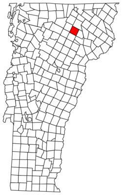
Glover is a town in Orleans County, Vermont, in the United States. As of the 2020 census, [3] the town's population was 1,114. It contains two unincorporated villages, Glover and West Glover.

Contents

The town is named for Brigadier General John Glover, [4] who served in the American Revolutionary War. He was the prime proprietor of the town.

Glover is home to three museums: the Bread & Puppet Museum, the Glover Historical Society museum, and The Museum of Everyday Life. [5]

Geography

According to the United States Census Bureau, the town has a total area of 38.6 square miles (100.0 km2), of which 37.9 square miles (98.1 km2) is land and 0.7 square mile (1.9 km2) (1.92%) is water.

The surface of the town is uneven, with hills and valleys. The highest elevation is Black Hills, at 2,258 feet (688 m), in the south part of town. [6] The town drains northward via the northern branches of the Barton River, and southward via branches of the Passumpsic, Lamoille, and Black Rivers, which have their sources here. Four ponds of considerable size also are found here, Parker Pond, in the north, Clark's pond, in the central, and Sweeney pond in the west, as well as Shadow Lake. [7] Shadow Lake was first called Chambers Pond, then Stone Pond about 1822. In 1922 it was given its current name. The Abenaki had called it Pekdabowk, or Smoke Pond. [8]

History

In 1802, the town decided to construct one school at the Parker settlement. Operating expenses were limited to $20 for that year. [8]

In the most cataclysmic natural catastrophe affecting Orleans County in post-Columbian times, the banks of Glover's Long Pond gave way on June 6, 1810, and flooded the Barton River valley. The hero of the day was laborer Spencer Chamberlain who ran ahead of the flood to warn people at the mill. The wayward pond was forever after known as "Runaway Pond".

By 1851, there were 450 grammar school students. In 2017, the number of students at that level had dropped to about 100. [8]

From about the 1820s to the 1930s, there was a settlement, Slab City, near the outlet from Shadow Lake, whose economy was dependent on the logging, and three sawmills in the area. The settlement also contained a lime kiln, butter tub factory, a cider mill, a one-room schoolhouse, a post office, a church, and other allied businesses. [9] In 1836, a suit against the height of the water retained in a dam to power the sawmills was successful. The suit was motivated in large part by the Runaway Pond catastrophe. The end of the dam power marked the beginning of the end for Slab City. [8]

The unincorporated village of West Glover had a municipal septic system which failed in 2008. [10] This was replaced in 2012. It connected to the main sewage line in Glover village, which in turns was connected to the wastewater treatment facility in adjacent Barton. This was funded by USDA Rural Development Agency. [11]

Demographics

Historical population
CensusPop.Note
1800 36
1810 387975.0%
1820 54941.9%
1830 90264.3%
1840 1,11924.1%
1850 1,1371.6%
1860 1,2449.4%
1870 1,178−5.3%
1880 1,055−10.4%
1890 970−8.1%
1900 891−8.1%
1910 9324.6%
1920 826−11.4%
1930 8604.1%
1940 788−8.4%
1950 727−7.7%
1960 683−6.1%
1970 649−5.0%
1980 84329.9%
1990 820−2.7%
2000 96617.8%
2010 1,12216.1%
2020 1,114−0.7%
U.S. Decennial Census [12]

As of the census [1] of 2000, there were 966 people, 384 households, and 269 families residing in the town. The population density was 25.5 inhabitants per square mile (9.8/km2). There were 677 housing units at an average density of 17.9 per square mile (6.9/km2). The racial makeup of the town was 96.38% White, 0.21% African American, 0.93% Native American, 0.21% Asian, 0.31% from other races, and 1.97% from two or more races. Hispanic or Latino of any race were 0.62% of the population.

There were 384 households, out of which 29.7% had children under the age of 18 living with them, 58.9% were married couples living together, 8.6% had a female householder with no husband present, and 29.9% were non-families. 23.2% of all households were made up of individuals, and 7.3% had someone living alone who was 65 years of age or older. The average household size was 2.40 and the average family size was 2.83.

In the town, the population was spread out, with 22.0% under the age of 18, 6.1% from 18 to 24, 23.2% from 25 to 44, 34.1% from 45 to 64, and 14.6% who were 65 years of age or older. The median age was 44 years. For every 100 females, there were 100.0 males. For every 100 females age 18 and over, there were 95.6 males.

Government

Town

School District

In 2009 and 2010, the Glover Community School stood highest in the county for averaged proficiency in reading and mathematics on the standardized NE-CAP test. [13] [14]

Economy

Personal Income

The median income for a household in the town was $46,167. Males had a median income of $25,977 versus $21,172 for females. The per capita income for the town was $15,112. About 10.8% of families and 11.9% of the population were below the poverty line, including 15.2% of those under age 18 and 14.9% of those age 65 or over.

The town is second in the county for the highest percentage of second home ownership. [15] [16]

Transportation

Major Routes

Town maintained roads

The town has 40 miles (64 km) of dirt roads. These lose an estimated 11,720 cubic yards (8,960 m3) of gravel annually which must be replaced. [17]

Notable people

Related Research Articles

<span class="mw-page-title-main">Orleans County, Vermont</span> County in Vermont, United States

Orleans County is a county located in the northeastern part of the U.S. state of Vermont. As of the 2020 census, the population was 27,393. Its shire town is the city of Newport. The county was created in 1792 and organized in 1799. As in the rest of New England, few governmental powers have been granted to the county. The county is an expedient way of grouping and distributing state-controlled governmental services.

<span class="mw-page-title-main">Essex County, Vermont</span> County in Vermont, United States

Essex County is a county located in the northeastern part of the U.S. state of Vermont. As of the 2020 census, the population was 5,920, making it the least-populous county in both Vermont and New England. Its shire town is the municipality of Guildhall. The county was created in 1792 and organized in 1800. Bordered by the Connecticut River next to New Hampshire, Essex County is south of the Canadian province of Quebec. It is the county with the lowest household-income in Vermont.

<span class="mw-page-title-main">Sheffield, Vermont</span> Town in Vermont, United States

Sheffield is a town in Caledonia County, Vermont, United States. The population was 682 at the 2020 census.

<span class="mw-page-title-main">Montgomery, Vermont</span> Town in Vermont, United States

Montgomery is a town in Franklin County, Vermont, United States. The population as of the 2020 census was 1,184. In 1963, part of Avery's Gore in Franklin County became part of Montgomery, with the other section becoming part of Belvidere in Lamoille County.

<span class="mw-page-title-main">Richford, Vermont</span> Town in Vermont, United States

Richford is a town in Franklin County, Vermont, United States, located along the Canada–United States border. The population was 2,346 at the 2020 census.

<span class="mw-page-title-main">Eden, Vermont</span> Town in Vermont, United States

Eden is a town in Lamoille County, Vermont, United States. The population was 1,338 at the 2020 census.

<span class="mw-page-title-main">Wolcott, Vermont</span> Town in Vermont, United States

Wolcott is a town in Lamoille County, Vermont, United States. The town was named for General Oliver Wolcott, a signer of the Declaration of Independence. The population was 1,670 at the 2020 census.

<span class="mw-page-title-main">Brownington, Vermont</span> Town in Vermont, United States

Brownington is a town in Orleans County, Vermont, United States. The population was 1,042 as of the 2020 census.

<span class="mw-page-title-main">Charleston, Vermont</span> Town in Vermont, United States

Charleston is a town in Orleans County, Vermont, United States. The population was 1,021 at the 2020 census. The town contains two unincorporated villages: East Charleston and West Charleston.

<span class="mw-page-title-main">Coventry, Vermont</span> Town in Vermont, United States

Coventry is a town in Orleans County, Vermont, United States. The population was 1,100 at the 2020 census.

<span class="mw-page-title-main">Craftsbury, Vermont</span> Town in Vermont, United States

Craftsbury is a town in Orleans County, Vermont, United States. The population was 1,343 at the 2020 census. The town includes the unincorporated villages of Craftsbury, Craftsbury Common, Mill Village, and East Craftsbury.

<span class="mw-page-title-main">Derby, Vermont</span> Town in Vermont, United States

Derby is a town in Orleans County, Vermont, United States. The population was 4,579 at the 2020 census, making it the most populous community in Orleans County. The town contains four unincorporated villages: Beebe Plain, Clyde Pond, Lake Salem, and North Derby, and two incorporated villages: Derby Center and Derby Line.

<span class="mw-page-title-main">Irasburg, Vermont</span> Town in Vermont, United States

Irasburg is a town in Orleans County, Vermont, United States. Irasburg was established in 1781 when the land was granted to Ira Allen, Roger Enos, Jerusha Enos, Jerusha Enos, Jr., Roger Enos, Jr. and others by the Vermont General Assembly. Ira Allen later obtained the rights of the other proprietors, and he deeded the town to Jerusha Enos, Jr. as a wedding gift.

<span class="mw-page-title-main">Morgan, Vermont</span> Town in Vermont, United States

Morgan is the easternmost town in Orleans County, Vermont, United States. The population was 638 at the 2020 census. The town contains two villages: Morgan and Morgan Center.

<span class="mw-page-title-main">Troy, Vermont</span> Town in Vermont, United States

Troy is a town in Orleans County, Vermont, United States. The population was 1,722 at the 2020 census. Troy contains two villages: the unincorporated village of Troy, and the incorporated village of North Troy.

<span class="mw-page-title-main">Westmore, Vermont</span> Town in Vermont, United States

Westmore is a town in Orleans County, Vermont, United States. The population was 357 at the 2020 census, making it the least populated and least densely populated town in the county. The town contains one unincorporated village clustered around Lake Willoughby.

<span class="mw-page-title-main">Albany, Vermont</span> Town in Vermont, United States

Albany is a town in Orleans County, Vermont, United States. The population was 976 at the 2020 census. Albany contains four villages: the incorporated village of Albany, and the unincorporated villages of Albany Center, East Albany and South Albany.

<span class="mw-page-title-main">Barton, Vermont</span> Town in Vermont, United States

Barton is a town in Orleans County, Vermont, United States. The population was 2,872 at the 2020 census. The town includes two incorporated villages, Barton and Orleans. Approximately a quarter of the town's population lives in each of the villages, and approximately half lives outside the villages. Only four other towns in the state contain two incorporated villages.

The Northeast Kingdom is the northeast corner of the U.S. state of Vermont, approximately comprising Essex, Orleans, and Caledonia counties and with a population of 64,764 at the 2010 census. The term "Northeast Kingdom" is attributed to George D. Aiken, former Governor of Vermont and a U.S. senator, who first used the term in a 1949 speech.

<span class="mw-page-title-main">Runaway Pond</span> Marsh in Glover, Vermont, US

Runaway Pond is a marsh at the former site of Long Pond in Glover, Vermont. The name arose from an environmental disaster in 1810, when a manual attempt to divert some of the water of Long Pond broke the bank, causing the entire lake to suddenly empty out into the Barton River, uncontrolled.

References

  1. 1 2 "U.S. Census website". United States Census Bureau . Retrieved January 31, 2008.
  2. "US Board on Geographic Names". United States Geological Survey. October 25, 2007. Retrieved January 31, 2008.
  3. "Census - Geography Profile: Glover town, Orleans County, Vermont" . Retrieved December 30, 2021.
  4. Gannett, Henry (1905). The Origin of Certain Place Names in the United States. Govt. Print. Off. p. 139.
  5. "Museum of Every Day Life" . Retrieved September 27, 2020.
  6. Orleans County Vermont Summits
  7. Gazetteer of Lamoille and Orleans Counties, VT.; 1883-1884, Compiled and Published by Hamilton Child; May 1887
  8. 1 2 3 4 Starr, Tena (February 1, 2017). "The fascinating story of a lost way of life". the chronicle. Barton, Vermont. pp. 1B, 16B.
  9. Ashe, Connie (January 9, 2013). "Info about Glover's "Slab City" sought". the chronicle. Barton, Vermont. pp. 16B.
  10. Braithwaite, Chris (March 5, 2008). Quilts soften mood at crowded Town Meeting. the Chronicle.
  11. "Wastewater treatment facility is upgraded". the chronicle. Barton, Vermont. February 27, 2013. p. 23.
  12. "U.S. Decennial Census". United States Census Bureau. Retrieved June 19, 2015.
  13. Braithwaite, Chris (February 3, 2010). "NECAP results show four standouts". Barton, Vermont: the Chronicle. p. 2.
  14. Starr, Tena (February 15, 2011). "Student test scores released by state". Barton, Vermont: the Chronicle. p. 14.
  15. The first is Westmore
  16. Starr, Tena (July 7, 2010). "Glover to study summer people's spending habits". Barton, Vermont: the Chronicle. pp. 10A.
  17. Creaser, Richard (May 2, 2007). Rough roads are the subject of special meeting. the Chronicle.
  18. Norton, Augustus Theodore (1879). History of the Presbyterian Church in the State of Illinois. Vol. I. St. Louis, MO: W. S. Bryan. pp. 77–79. ISBN   9780524021330 via Google Books.
  19. Samuel B. Hand, Anthony Marro, Stephen C. Terry, Philip Hoff: How Red Turned Blue in the Green Mountain State, 2011
  20. Davis, Henry Blaine Jr. (1998). Generals in Khaki. Raleigh, NC: Pentland Press, Inc. p. 199. ISBN   1571970886.
  21. Pollak, Sally (July 10, 2019). "At Bread and Puppet, a 'Memorial Village' Honors Departed Friends and Family". Vermont Seven Days. Burlington, VT.