
| Part of a series on |
| Jainism |
|---|
 |
Assam, a state in north eastern India has had a long association with Jainism. Today the state is home to a number of Jain monuments, such as Jain temples and Jain tirths.
| Part of a series on |
| Jainism |
|---|
| |
Assam, a state in north eastern India has had a long association with Jainism. Today the state is home to a number of Jain monuments, such as Jain temples and Jain tirths.
Surya Pahar in the Goalpara district of Assam has several Jain statues and relics. [1]
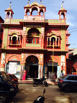
One of the oldest Jain temples in Guwahati was established in 1965 in the Fancy Bazar locality. [2]
Jainism is one of the smallest religions in Assam and constitutes 0.09% of the total population. [3] The Government of Assam has officially declared the Jain community in Assam as a minority community. [4]
The Assamese Jain community actively takes part in community service. They regularly organize free health camps. [5]
Major ancient Jain centers include:
| # | District | Total population | Jain population | % |
|---|---|---|---|---|
| 1 | Kamrup Metropolitan | 1,253,938 | 9,250 | 0.74% |
| 2 | Dhubri | 1,949,258 | 1,846 | 0.09% |
| 3 | Cachar | 1,736,617 | 1,673 | 0.10% |
| 4 | Kamrup | 1,517,542 | 1,330 | 0.09% |
| 5 | Nagaon | 2,823,768 | 1,162 | 0.04% |
| 6 | Dibrugarh | 1,326,335 | 1,055 | 0.08% |
| 7 | Nalbari | 771,639 | 1,004 | 0.13% |
| 8 | Sonitpur | 1,924,110 | 1,003 | 0.05% |
| 9 | Bongaigaon | 738,804 | 871 | 0.12% |
| 10 | Tinsukia | 1,327,929 | 837 | 0.06% |
| 11 | Darrang | 928,500 | 724 | 0.08% |
| 12 | Jorhat | 1,092,256 | 719 | 0.07% |
| 13 | Golaghat | 1,066,888 | 530 | 0.05% |
| 14 | Karimganj | 1,228,686 | 524 | 0.04% |
| 15 | Goalpara | 1,008,183 | 477 | 0.05% |
| 16 | Barpeta | 1,693,622 | 399 | 0.02% |
| 17 | Karbi Anglong | 956,313 | 397 | 0.04% |
| 18 | Kokrajhar | 887,142 | 396 | 0.04% |
| 19 | Sivasagar | 1,151,050 | 286 | 0.02% |
| 20 | Lakhimpur | 1,042,137 | 250 | 0.02% |
| 21 | Hailakandi | 659,296 | 247 | 0.04% |
| 22 | Morigaon | 957,423 | 244 | 0.03% |
| 23 | Baksa | 950,075 | 239 | 0.03% |
| 24 | Dhemaji | 686,133 | 167 | 0.02% |
| 25 | Chirang | 482,162 | 125 | 0.03% |
| 26 | Udalguri | 831,668 | 124 | 0.01% |
| 27 | Dima Hasao | 214,102 | 70 | 0.03% |
| Assam (Total) | 31,205,576 | 25,949 | 0.08% |

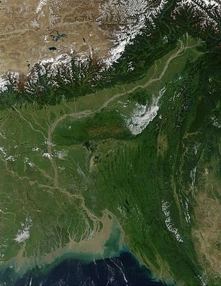
Assam is a state in northeastern India, south of the eastern Himalayas along the Brahmaputra and Barak River valleys. Assam covers an area of 78,438 km2 (30,285 sq mi). The state is bordered by Bhutan and Arunachal Pradesh to the north; Nagaland and Manipur to the east; Meghalaya, Tripura, Mizoram and Bangladesh to the south; and West Bengal to the west via the Siliguri Corridor, a 22-kilometre-wide (14 mi) strip of land that connects the state to the rest of India. Assamese and Boro are the official languages of Assam, while Bengali is an additional official language in the Barak Valley.

Guwahati is the biggest city of the Indian state of Assam and also the largest metropolis in northeastern India. Dispur, the capital of Assam, is in the circuit city region located within Guwahati and is the seat of the Government of Assam. A major riverine port city along with hills, and one of the fastest growing cities in India, Guwahati is situated on the south bank of the Brahmaputra. The city is known as the "gateway to North East India".

Dhubri District (Pron:ˈdʊbri) is an administrative district in the Indian state of Assam. The district headquarters are located at Dhubri town which is situated at ~290 km from Guwahati. This was also the headquarters of erstwhile undivided Goalpara district which was created in 1876 by the British government. In 1983, Goalpara district was divided into four districts and Dhubri is one among those. Dhubri district is one among the many Muslim-majority districts of Assam. In 2016, Dhubri was divided again to form South Salmara-Mankachar District.

Goalpara district is an administrative district of the Indian state of Assam.

Kamrup Rural district, or simply Kamrup district, is an administrative district in the state of Assam in India formed by dividing the old Kamrup district into two in the year 2003; other being Kamrup Metropolitan district, named after the region it constitutes. This district, along with Nalbari, Barpeta, Kamrup Metropolitan, Bajali and Baksa districts has been created from the Undivided Kamrup district.

Barpeta is a town in Barpeta district of the state of Assam in India and is district headquarters. The city is located 90 kilometres (56 mi) north west of Guwahati and is one of the major cities in Western Assam. It is also called Satra Nagari of Assam due to the presence of various Vaishnavite Satras in the vicinity.
Bongaigaon is a town in the Indian state of Assam. Its urban area spans across Bongaigaon and Chirang district. The town also serves as the gateway of the North-East Frontier Railway Zone with its New Bongaigaon Junction railway station, the second biggest railway station in North-East India. It also acts as the district headquarters of Bongaigaon district and commercial and industrial hub of the west part of the state of Assam. Bongaigaon is one of the most populated urban agglomerations in Assam, alongside Guwahati, Jorhat, Dibrugarh and Silchar.

Jainism is India's sixth-largest religion and is practiced throughout India. Per the 2011 census, there are 4,451,753 Jains in the 1.35 billion population of India, the majority living in Maharashtra, Rajasthan, Gujarat and Madhya Pradesh, Karnataka, however, the influence of Jainism has been far greater on the Indian population than these numbers suggest. Jains can be found in every states and union territories, varying from large societies to smaller. The state of Jharkhand, with a population of 16,301 Jains also contains the holy pilgrimage centre of Sammed Shikharji. Jains can be found throughout India and in many other countries throughout the world.
Biswanath Chariali is a city and a municipal board in Biswanath district in the state of Assam, India. This city is the district headquarters of Biswanath district, which was created on 15 August 2015. It derives its name from Biswanath Ghat.

Bokakhat is a town in Assam and a Municipality Board in Golaghat district in the state of Assam, India. It is about 23 km away from the world heritage site Kaziranga National Park. Bokakhat town is situated almost in the middle of Assam. It is the headquarters of Bokakhat subdivision. The town is base to many nearby tourist places and is well connected to other cities and towns by road. The Kaipho Langso waterfall, an important picnic spot surrounded with magnificent views, lies in Karbi Anglong 13 km away from Bokakhat. Other nearby attractions include the ruins of the ancient Numaligarh and the Deoparbat, the tea gardens of Hatikhuli, Methoni, Diffloo Behora and Borsapori and also the coffee and rubber plantations. The nearest airports are at Jorhat and Guwahati. The nearest railway stations are Badulipar and Furkating.
Jainism is considered to be a legally distinct religion in India. A section of scholars earlier considered it as a Hindu sect or a Buddhist heresy, but it is one of the three ancient Indian religions. On 27 January 2014, the Government of India explicitly awarded the status of a "minority religion" to the Jain community in India, as per Section 2(c) of the National Commission for Minorities (NCM) Act (NCM), 1992.
The Brahmaputra Valley is a region situated between hill ranges of the eastern and northeastern Himalayan range in Eastern India.
Indian Sikhs number approximately 21 million people and account for 1.7% of India's population as of 2011, forming the country's fourth-largest religious group. The majority of the nation's Sikhs live in the northern state of Punjab, which is the only Sikh-majority administrative division in the world.

Assam is the main and oldest state in the North-East Region of India and as the gateway to the rest of the Seven Sister States. The land of red river and blue hills, Assam comprises three main geographical areas: the Brahmaputra Valley which stretching along the length of the Brahmaputra river, the Barak Valley extending like a tail, and the intervening Karbi Plateau and North Cachar Hills. Assam shares its border with Meghalaya, Arunachal Pradesh, Nagaland, Manipur, Tripura, Mizoram and West Bengal; and there are National Highways leading to their capital cities. It also shares international borders with Bhutan and Bangladesh and is very close to Myanmar. In ancient times Assam was known as Pragjyotisha or Pragjyotishpura, and Kamarupa.
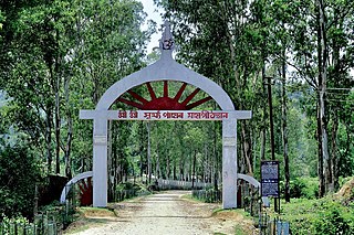
Sri Surya Pahar is located about 12 km southeast of Goalpara, about 132 km northwest of Guwahati, is a significant but relatively unknown archaeological site in Assam, India. Goalpara is the nearest city from the site. The site is a hilly terrain where several rock-cut Shivalingas, votive stupas and the deities of Hindu, Buddhist and Jain pantheon are scattered in an area of about one km. The site is centered on the hills (Pahar) of Sri Surya which is profusely filled up with Shiva Lingas (Lingam). People have found 99999 Shiva Lingas were engraved here by Vyasa in order to build up a second Kashi and once it was one of the holiest pilgrimage sites in the region. There is no historical evidence exactly how many Lingams once dotted in these hills, but still there are hundreds of them, from tiny to large in size, scattered everywhere at the foot of the hill and covering the extensive area after centuries of neglect and pilferage. The exact figure of the Lingas in the hill is yet to be counted scientifically.

Jain Canadians number 8,275, composing 0.02% of Canada's population. Adherents of Jainism first settled in Canada in small numbers in the late 19th century. The number of Jains in Canada later increased, leading to the establishment of Jain temples in Canada. The type of Jainism in Canada later exhibited several differences from Jainism in India.
Nagaland, a state in north eastern India has had a long association with Jainism. Today the state has two Jain temples and has become home to hundreds of Jain families living prosperously and peacefully.
Assam – 16th largest, 15th most populous and 26th most literate state of the 28 states of the democratic Republic of India. Assam is at 14th position in life expectancy and 8th in female-to-male sex ratio. Assam is the 21st most media exposed states in India. The Economy of Assam is largely agriculture based with 69% of the population engaged in it. Growth rate of Assam's income has not kept pace with that of India's during the Post-British Era; differences increased rapidly since the 1970s. While the Indian economy grew at 6 percent per annum over the period of 1981 to 2000, the same of Assam's grew only by 3.3 percent.

Hinduism in the state of Assam, in Northeast India is the home to some of the most complex and poorly understood traditions in Hinduism. People follow traditions belonging to Shaivism, Saktism, Tantricism and an indigenous form of Vaishnavism called Ekasarana dharma; and taken together the practitioners constitute around 61% of the state population as per the 2011 Census. Hindus form a majority in 17 out of the 29 districts of Assam. By region, there is a significant diversity among the ethnic groups that profess the Hindu faith, traditions and customs. As per as 2011 Census, In Brahmaputra valley of Assam, Hindus constitute 62% of the population, most being ethnic Assamese. In the autonomous Bodoland region of Assam, Hindus constitute 71.3% of the region's population, most being of the Bodo tribe. In the Barak valley region of southern Assam, Hindus constitute 50% of the region's population, most being ethnic Sylhetis, a subgroup of Bengalis. The Hill Tribes of Assam, particularly the Karbi people of Karbi Anglong and Dimasa people of Dima Hasao are mainly Hindus.
The population of Assam consist of tribal ethnic groups, and linguistic groups such as Assamese, Bengali, Hindi speakers and Nepali.
| Gods | |||||
|---|---|---|---|---|---|
| Philosophy | |||||
| Branches |
| ||||
| Practices | |||||
| Literature | |||||
| Symbols | |||||
| Ascetics | |||||
| Scholars | |||||
| Community | |||||
| Jainism in |
| ||||
| Jainism and | |||||
| Dynasties and empires | |||||
| Related | |||||
| Lists | |||||
| Navboxes | |||||
| | This Jainism-related article is a stub. You can help Wikipedia by expanding it. |