
Angamaly is a municipality in the Ernakulam district of Kerala, India. It is located 20 km (12.4 mi) north of the district collectorate in Thrikkakara and about 203 km (126.1 mi) north of the state capital Thiruvananthapuram. Angamaly is part of the Kochi metropolitan area and is located 24 km (14.9 mi) northeast of the Kochi city centre. As per the 2011 Indian census, Angamaly has a population of 33,465 people, and a population density of 1,633/km2 (4,230/sq mi).
Aluva, is a municipality in the Ernakulam district of Kerala, India. It is part of the Kochi metropolitan area, 15 km (9.3 mi) north of the Kochi city centre. As per the 2011 Indian census, Aluva has a population of 22,428.
Edappally is a ward of Kochi, Kerala. The name is also used to refer to adjacent wards of Kalamassery and Thrikkakkara municipalities. Edappally is a major commercial centre as well as a prominent residential region. Edappally junction is one of the busiest junctions in the city.

Ernakulam is the central business district of the city of Kochi, Kerala, India. It is the namesake of Ernakulam district. The eastern part of Kochi city is mainly known as Ernakulam, while the western part of it after the Venduruthy Bridge is called as Western Kochi. Many major establishments, including the Kerala High Court, the office of the Kochi Municipal Corporation and the Cochin Shipyard are situated in Ernakulam. It is also the most urbanized area in the city of Kochi. The Southern Naval Command (SNC) is in Kochi, Ernakulam district, Kerala. Established in 1958, it is the largest naval command of the Indian Navy, focusing on training and maritime security operations in the Arabian Sea and Indian Ocean.
Kochi is a major port city in the Indian state of Kerala. The city is widely known as the commercial or economic capital of the state of Kerala.

Maradu is a municipality and census town in the Ernakulam district of Kerala, India. Maradu is an inner suburb of the Kochi metropolitan area and is located 6 km (3.7 mi) south of the Kochi city centre. As per the 2011 Indian census, Maradu has a population of 44,704 people.

Kerala, a state in Southern India, has a network of 11 National Highways, 72 State Highways and many district roads.
National Highway 49 was a National Highway in southern India under former numbering system.. It traversed coast-to-coast linking Kochi in Kerala with Dhanushkodi in Tamil Nadu. It crosses the famous Pamban Bridge before crossing into Rameswaram island. The total length runs up to 440 km (270 mi). The 5 km road between Mukundarayar Chathiram and Dhanuskodi was destroyed during the 1963 cyclone and was rebuilt.
Thevara is a ward of Kochi, Kerala.
Nettoor is a region in the city of Kochi. It is around 5 km (3.1 mi) from Vytilla Junction and around 8 km (5.0 mi) from Ernakulam Junction Railway Station. Nettoor is located on Panangad Island and is a part of Maradu Municipality.
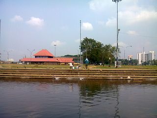
Vyttila, IPA:[ʋɐjt̺ːilɐ], is a ward in the city of Kochi, Kerala. It is a prominent are located in southern Kochi. The Vyttila junction is the busiest as well as the largest intersection in Kerala. This node intersects the main north–south artery of the state of Kerala, namely, the Kochi Bypass, with three city roads of Kochi viz, the S. A. Road, the Vyttila-Petta Road, and the Thammanam Road.

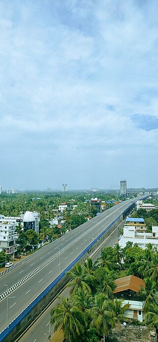
The Kochi Bypass is a segment of National Highway 66 that bypasses the CBD of the city of Kochi in Kerala, India. The highway stretches 17 km from Edapally in the Ernakulam district to Aroor in Alappuzha district, via Palarivattom, Vyttila, Kundannoor, Madavana and Kumbalam. The Government of Kerala began the preliminary works in 1973. After a slow progress, it was partially opened for traffic in the beginning years of the 1980s. The section between Edapally and Vyttila had four lanes from the beginning. The rest of the carriageway was also upgraded to different sections of 4 lane, 5 lane and 6 lanes by 2010.
Kundannoor is a region in the city of Kochi, in the state of Kerala, India. It is located around 3.5 km from Vytilla Junction and around 7 km from Ernakulam Junction Railway Station.Kundanoor is located on the busiest road of the city and state, the Kochi Bypass, at the junction of three National Highways, namely NH 66, NH 85 and NH 966B. NH 966B is the second shortest National highway in India.
National Highway 966B, also known as NH 966B, is part of India's National Highway network. Its old name was NH 47A. It covers a distance of 8 kilometres between Kundannoor and Willingdon Island in Kochi, in the state of Kerala. It starts from the junction of NH 66 at Kundannoor.

Kuthiran Tunnel is a twin-tube six-lane highway tunnel in the South Indian state of Kerala. The tunnel is located on the National Highway 544 and it is owned and operated by the National Highways Authority of India. This is Kerala's first-ever tunnel for road transport and South India's longest six-lane road tunnel. Construction of the tunnel started in 2016 and completed by December 2021.
Kazhakoottam flyover is a flyover, that is a part of the NH 66 in Kerala, India. The 2.7 km long four line flyover is the longest elevated highway in Kerala. The flyover runs above the Kazhakootam junction, where the original national highway intersects with the bypass road. Vehicles travelling from Kollam can enter the elevated highway near the CSI Mission Hospital in Kazhakootam.
Vyttila flyover is a flyover, that is a part of the NH 66 in Kerala, India. The six lane flyover runs above the Vyttila junction in Kochi, which is one of the busiest junctions in the state.
The Aroor–Thuravoor Elevated Expressway is a 12.75-kilometre-long (7.92 mi), six-lane, elevated highway under construction in Alappuzha district of Kerala, India. Upon completion, this would be the longest elevated highway in the country. It begins from Aroor and ends at Thuravoor.
The Angamaly-Kundannoor Bypass, also known as Ernakulam Bypass is a proposed partially-controlled-greenfield corridor or highway in the Ernakulam district, Kerala, India. The highway will pass through sparsely populated areas avoiding Kochi city completely and is expected to reduce the traffic on the NH 544 and NH 66. It will begin at Karayamparambu on the northern side of Angamaly on NH 544 and end at south of the NH 66 at Kundannoor.
The Kochi–Theni Greenfield Highway is a 151 kilometre-long planned greenfield controlled-access highway in India, connecting Kochi in Kerala with Theni in Tamil Nadu. The new six lane highway is part of the Kochi - Tuticorin economic corridor which aims at connecting these two major ports enabling smooth movement of cargo between the two. The highway, which will pass through the Western Ghats of Idukki district, will begin from Kundannoor in Kochi and reach Theni almost 67 kilometres lesser than the existing NH 85 alignment and is expected to decongest the 121-km Kochi–Munnar NH 85 stretch.