Related Research Articles

Jefferson County, is a county located in the U.S. state of Colorado. As of the 2010 census, the population was 534,543, making it the fourth-most populous county in Colorado. The county seat is Golden, and the most populous city is Lakewood.

Great Sand Dunes National Park and Preserve is an American national park that conserves an area of large sand dunes up to 750 feet (229 m) tall on the eastern edge of the San Luis Valley, and an adjacent national preserve in the Sangre de Cristo Range, in south-central Colorado, United States. The park was originally designated Great Sand Dunes National Monument on March 17, 1932, by President Herbert Hoover. The original boundaries protected an area of 35,528 acres. A boundary change and redesignation as a national park and preserve was authorized on November 22, 2000, and then established by an act of Congress on September 24, 2004. The park encompasses 107,342 acres while the preserve protects an additional 41,686 acres for a total of 149,028 acres. The recreational visitor total was 527,546 in 2019.

The Colorado Plateau, also known as the Colorado Plateau Province, is a physiographic and desert region of the Intermontane Plateaus, roughly centered on the Four Corners region of the southwestern United States. This province covers an area of 336,700 km2 (130,000 mi2) within western Colorado, northwestern New Mexico, southern and eastern Utah, northern Arizona, and a tiny fraction in the extreme southeast of Nevada. About 90% of the area is drained by the Colorado River and its main tributaries: the Green, San Juan, and Little Colorado. Most of the remainder of the plateau is drained by the Rio Grande and its tributaries.

The American Discovery Trail is a system of recreational trails and roads which collectively form a coast-to-coast hiking and biking trail across the mid-tier of the United States. Horses can also be ridden on most of this trail. It starts on the Delmarva Peninsula on the Atlantic Ocean and ends on the northern California coast on the Pacific Ocean. The trail has northern and southern alternates for part of its distance, passing through Chicago and St. Louis respectively. The total length of the trail including both the north and south routes is 6,800 miles (10,900 km). The northern route covers 4,834 miles (7,780 km) with the southern route covering 5,057 miles (8,138 km). It is the only non-motorized coast-to-coast trail.

Roxborough State Park is a state park of Colorado, United States, known for dramatic red sandstone formations. Located in Douglas County 20 miles (32 km) south of Denver, Colorado, the 3,339-acre (13.51 km2) park was established in 1975. In 1980 it was recognized as a National Natural Landmark.

Curecanti National Recreation Area is a National Park Service unit located on the Gunnison River in western Colorado. Established in 1965, Curecanti is responsible for developing and managing recreational facilities on three reservoirs, Blue Mesa Reservoir, Morrow Point Reservoir and Crystal Reservoir, constructed on the upper Gunnison River in the 1960s by the U.S. Bureau of Reclamation to better utilize the vital waters of the Colorado River and its major tributaries. A popular destination for boating and fishing, Curecanti offers visitors two marinas, traditional and group campgrounds, hiking trails, boat launches, and boat-in campsites. The state's premiere lake trout and Kokanee salmon fisheries, Curecanti is a popular destination for boating and fishing, and is also a popular area for ice-fishing in the winter months.

Pawnee National Grassland is a United States National Grassland located in northeastern Colorado on the Colorado Eastern Plains. The grassland is located in the South Platte River basin in remote northern and extreme northeastern Weld County between Greeley and Sterling. It comprises two parcels totaling 193,060 acres (78,130 ha) largely between State Highway 14 and the Wyoming border. The larger eastern parcel lies adjacent to the borders of both Nebraska and Wyoming. It is administered in conjunction with the Arapaho-Roosevelt National Forest from the U.S. Forest Service office in Fort Collins, with a local ranger district office in Greeley.

The Uncompahgre Plateau in western Colorado is a distinctive large uplift part of the Colorado Plateau. Uncompahgre is a Ute word that describes the water: "Dirty Water" or "Rocks that make Water Red".

San Isabel National Forest is located in central Colorado. The forest contains 19 of the state's 53 fourteeners, peaks over 14,000 feet (4,267 m) high, including Mount Elbert, the highest point in Colorado.
Castlewood Canyon State Park is a Colorado state park near Franktown, Colorado. The park retains a unique part of Colorado's history, the remains of Castlewood Canyon Dam. Visitors can still see the remnants and damage from that dam which burst in 1933. The event sent a 15-foot (5 m) wave of water all the way to downtown Denver resulting in a flood. Also contained within the park is the historic Cherry Creek Bridge.

Colorado Springs geography describes geographical topics regarding the city of Colorado Springs, Colorado in El Paso County, Colorado. With 194.87 sq mi (504.7 km2) of land, it is the state's largest-sized city. Denver is the most populated city.
The following is an alphabetical list of articles related to the U.S. state of Colorado.

Areas of Critical Environmental Concern (ACEC) is a conservation ecology program in the Western United States, managed by the Bureau of Land Management (BLM). The ACEC program was conceived in the 1976 Federal Lands Policy and Management Act (FLPMA), which established the first conservation ecology mandate for the BLM. The FLPMA mandate directs the BLM to protect important riparian corridors, threatened and endangered species habitats, cultural and archeological resources, as well as unique scenic landscapes that the agency assesses as in need of special management attention.

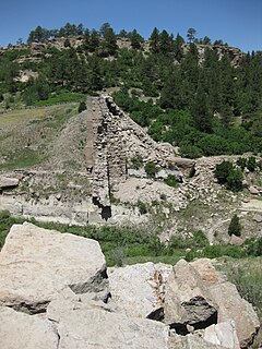
Dinosaur Ridge is a segment of the Dakota Hogback in the Morrison Fossil Area National Natural Landmark located in Jefferson County, Colorado, near the town of Morrison and just west of Denver.

The Colorado state wildlife areas are managed for hunting, fishing, observation, management, and preservation of wildlife. The Colorado Parks and Wildlife division of the U.S. State of Colorado manages more than 300 state wildlife areas with a total area of more than 860 square miles (2,230 km2) in the state.

There are a wide range of recreational areas and facilities in Colorado Springs, Colorado.
References
- ↑ "Colorado Natural Areas Program". Colorado Parks & Wildlife. Retrieved November 16, 2016.
- ↑ "Colorado Natural Area map" (PDF). cpw.state.co.us. Retrieved November 16, 2016.
- ↑ "Colorado Natural Areas Program". Colorado Parks & Wildlife. Retrieved November 16, 2016.
- ↑ "CNAP - All items". Colorado Parks and Wildlife. Retrieved November 17, 2016.