List
The Western Australian State Register of Heritage Places, as of 2023 [update] , lists the following 62 state registered places within the City of Kalgoorlie–Boulder:
| Place name | Place # | Street number | Street name | Suburb or town | Co-ordinates | Notes & former names | Photo |
|---|---|---|---|---|---|---|---|
| Masonic Temple | 175 | 134 | Burt Street | Boulder | 30°46′56″S121°29′05″E / 30.782238°S 121.484801°E | Masonic Hall | |
| Boulder Court House (former) | 179 | 72 | Burt Street | Boulder | 30°46′56″S121°29′17″E / 30.782137°S 121.487961°E | Court House |  |
| Boulder Town Hall & Offices | 184 | 118–120 | Burt Street | Boulder | 30°46′56″S121°29′12″E / 30.78224°S 121.48668°E |  | |
| Rosewood House | 190 | 49 | Moran Street | Boulder | 30°46′49″S121°29′07″E / 30.780287°S 121.485326°E | St Joseph's Convent | |
| District Education Office | 196 | 23–27 | Federal Street | South Kalgoorlie | 30°45′40″S121°29′16″E / 30.761107°S 121.487815°E | Eastern Goldfields Senior High School, Kalgoorlie Secondary School | |
| Cornwall Hotel | 201 | 25 | Hopkins Street | South Boulder | 30°47′20″S121°29′43″E / 30.788857°S 121.495333°E |  | |
| Boulder Primary School | 203 | 200 | Lane Street | Boulder | 30°46′48″S121°29′15″E / 30.780037°S 121.487532°E | Greater Boulder School, Boulder City School, Boulder Central School, Central Primary Sch | |
| Queen's Methodist Church, Boulder | 210 | 36–38 | Piesse Street | Boulder | 30°47′00″S121°29′24″E / 30.783461°S 121.489951°E | Residences (Units) 36–38 Piesse Street | |
| Kalgoorlie School of the Air | 212 | 253 | Piesse Street | Boulder | 30°46′58″S121°29′12″E / 30.782736°S 121.486798°E | Boulder Tech School, Boulder High School, Goldfieds Special Educ Centre (Lorna Mitchell Scl) | |
| Hannan's Club | 1266 | 46 | Brookman Street | Kalgoorlie | 30°44′42″S121°28′21″E / 30.745097°S 121.472381°E | ||
| St Mary's Roman Catholic Church | 1267 | 24 | Brookman Street | Kalgoorlie | 30°44′37″S121°28′26″E / 30.743713°S 121.4739°E | and original church site | |
| Original Roman Catholic Church site | 1268 | Corner | Brookman & Porter Streets | Kalgoorlie | 30°44′29″S121°28′33″E / 30.741485°S 121.475933°E | ||
| Hammond Park Rotunda | 1269 | Memorial Drive | Kalgoorlie | 30°44′30″S121°27′12″E / 30.74161°S 121.453216°E | Victoria Park Rotunda | ||
| Offices and Dental Surgery | 1270 | 45–47 | Dugan Street | Kalgoorlie | 30°44′44″S121°28′16″E / 30.74555°S 121.471102°E | Residences, 45 & 47 Dugan Street | |
| Kalgoorlie Primary School | 1272 | 24 | Dugan Street | Kalgoorlie | 30°44′43″S121°28′13″E / 30.745272°S 121.470186°E | ||
| Chamber of Mines Building | 1273 | 115–145 | Egan Street | Kalgoorlie | 30°44′54″S121°28′29″E / 30.748382°S 121.474645°E | Museum, includes School of Mines and Mines | |
| Masonic Lodge | 1275 | 26 | Egan Street | Kalgoorlie | 30°44′42″S121°28′37″E / 30.744907°S 121.476962°E | ||
| Railway Institute, Kalgoorlie | 1278 | 81 | Forrest Street | Kalgoorlie | 30°44′52″S121°28′00″E / 30.747822°S 121.466593°E | ||
| Kalgoorlie Railway Station | 1279 | Forrest Street | Kalgoorlie | 30°44′46″S121°28′01″E / 30.746°S 121.4669°E |  | ||
| District Superintendent's House (former) | 1280 | 2 | Forrest Street | Kalgoorlie | 30°44′37″S121°28′12″E / 30.743566°S 121.470018°E | District Engineer's Residence | |
| Paddy Hannan's Statue, Town Hall | 1282 | 316 | Hannan Street | Kalgoorlie | 30°44′56″S121°28′14″E / 30.748795°S 121.470679°E |  | |
| Western Australian Bank (former), Kalgoorlie | 1284 | 106 | Hannan Street | Kalgoorlie | 30°44′42″S121°28′29″E / 30.744959°S 121.474617°E | Ministry of Housing Regional Office, Bank of New South Wales – (NSW) | |
| Cohn's Buildings & Tattersall's Hotel (former) | 1286 | 63–71 | Hannan Street | Kalgoorlie | 30°44′42″S121°28′33″E / 30.745046°S 121.475825°E | Cohn's Buildings, Savoy Hotel, Great Western Hotel | |
| Exchange Hotel, Kalgoorlie | 1289 | 135 | Hannan Street | Kalgoorlie | 30°44′46″S121°28′29″E / 30.746051°S 121.474732°E |  | |
| Government Buildings, Kalgoorlie | 1291 | 208–222 | Hannan Street | Kalgoorlie | 30°44′48″S121°28′22″E / 30.746547°S 121.472874°E | Registrars Office, Kalgoorlie Post/Telegraph Office, Wardens Court |  |
| Kalgoorlie Miner Building | 1292 | 119–127 | Hannan Street | Kalgoorlie | 30°44′45″S121°28′30″E / 30.745903°S 121.474894°E | Miner & Western Argus Offices |  |
| McKenzie's Buildings | 1295 | 140–144 | Hannan Street | Kalgoorlie | 30°44′46″S121°28′24″E / 30.746133°S 121.473328°E |  | |
| Mechanics' Institute (former) | 1296 | 202 | Hannan Street | Kalgoorlie | 30°44′45″S121°28′25″E / 30.745864°S 121.473624°E | Home Building Society, Kalgoorlie Miners' Institute |  |
| City Markets | 1297 | 272–280 | Hannan Street | Kalgoorlie | 30°44′52″S121°28′17″E / 30.747906°S 121.471383°E |  | |
| Park Buildings | 1299 | 139–147 | Hannan Street | Kalgoorlie | 30°44′48″S121°28′27″E / 30.746557°S 121.474166°E | Windsor Chambers, Hannans Chambers, Kalgoorlie Diamonds, Hot Spot Burger bar | |
| Shop | 1301 | 260 | Hannan Street | Kalgoorlie | 30°44′52″S121°28′18″E / 30.747708°S 121.4716°E | ||
| Semaphore Chambers | 1303 | 77–79 | Hannan Street | Kalgoorlie | 30°44′43″S121°28′32″E / 30.745161°S 121.475585°E |  | |
| Kalgoorlie Town Hall & Council Chambers | 1306 | 316 | Hannan Street | Kalgoorlie | 30°44′55″S121°28′14″E / 30.748696°S 121.470515°E | HMAS Kalgoorlie Memorial, 16th Battalion Memorial |  |
| York Hotel | 1307 | 259 | Hannan Street | Kalgoorlie | 30°44′54″S121°28′19″E / 30.74828°S 121.47204°E |  | |
| Christian Brothers College (former) Kalgoorlie | 1310 | 103 | MacDonald Street | Kalgoorlie | 30°45′05″S121°28′22″E / 30.751383°S 121.472752°E | Curtin University of Technology Williams Hous | |
| Commonwealth Health Laboratory (former) | 1313 | 31 | Maritana Street | Kalgoorlie | 30°44′31″S121°28′13″E / 30.74204°S 121.470176°E | Eastern Goldfields Medical Division of Genera, WA Centre for Remote & Rural Medicine | |
| North Kalgoorlie Primary School | 1320 | 80–84 | Campbell Street | Lamington | 30°44′19″S121°27′36″E / 30.738513°S 121.460011°E | ||
| British Arms Hotel (former) | 1321 | 13–19 | Hannan Street, 22 Outridge Terrace | Kalgoorlie | 30°44′38″S121°28′40″E / 30.74389°S 121.477776°E | Golden Mile Museum | |
| Trades Hall | 1325 | 30 | Porter Street | Kalgoorlie | 30°44′46″S121°28′39″E / 30.746219°S 121.477418°E | ||
| Kalgoorlie Racecourse and Buildings | 1326 | Meldrum Avenue | Kalgoorlie | 30°45′44″S121°28′05″E / 30.76214°S 121.468002°E | |||
| King Battery | 3311 | 47 km SSE of | Kalgoorlie, White Hope Mine access road via Wollubar Station | Kambalda | 31°04′35″S121°38′30″E / 31.076483°S 121.641594°E | ||
| The Palms | 3427 | 68 | Piccadilly Street | Kalgoorlie | 30°44′26″S121°28′06″E / 30.740532°S 121.468355°E | ||
| Cremorne Theatre (former) | 3468 | 46 | Hannan Street | Kalgoorlie | 30°44′37″S121°28′34″E / 30.743527°S 121.476192°E |  | |
| Lord Forrest Olympic Pool | 3511 | MacDonald Street | Kalgoorlie | 30°45′01″S121°28′28″E / 30.750192°S 121.474479°E | Lord Forrest Youth Facility |  | |
| Station Masters House (former), Kalgoorlie | 3791 | 14 | Forrest Street | Kalgoorlie | 30°44′49″S121°27′58″E / 30.747031°S 121.466182°E | 12–14 Forrest Street, Forrest Houses | |
| Railway Worker's Cottage | 3792 | 22 | Forrest Street | Kalgoorlie | 30°44′51″S121°27′56″E / 30.747625°S 121.465426°E | 22 Forrest Street: Plate Layer's Cottage, Per Way Cottage | |
| Boulder Railway Station, Subway & Loopline | 4639 | Hamilton Street | Boulder | 30°46′58″S121°29′32″E / 30.7827°S 121.4923°E |  | ||
| North Kalgoorlie Fire Station | 7508 | 1 | Hare Street | Kalgoorlie | 30°44′10″S121°27′57″E / 30.736224°S 121.465904°E | Lamington Fire Station | |
| Railway House | 15718 | 3 | Wittenoom Street | Kalgoorlie | 30°44′35″S121°28′10″E / 30.743063°S 121.469358°E | Part of Wittenoom Street Railway Houses (15865) | |
| Rawlinna Townsite | 15722 | 378 km West of Kalgoorlie on Trans Australian Railway | Rawlinna | 31°00′32″S125°19′51″E / 31.008931°S 125.330729°E |  | ||
| Mount Charlotte Reservoir | 15727 | Sutherland Street | Kalgoorlie | 30°44′00″S121°29′00″E / 30.733333°S 121.483333°E | |||
| Railway Water Tower, Broad Arrow | 15828 | Railway Street | Broad Arrow | 30°26′56″S121°19′44″E / 30.448856°S 121.328904°E | |||
| The Kalgoorlie Club | 15840 | 108–110 | Egan Street | Kalgoorlie | 30°44′50″S121°28′28″E / 30.747125°S 121.474325°E | The Kalgoorlie Country Club | |
| Wittenoom Street Railway Houses | 15865 | 1–5 | Wittenoom Street | Piccadilly | 30°44′35″S121°28′10″E / 30.743063°S 121.469358°E | ||
| Kalgoorlie Railway Housing Group | 15867 | 44–46 | Wittenoom Street | Piccadilly | 30°44′52″S121°27′45″E / 30.747702°S 121.462619°E | Piccadilly House, Trainmen's Barracks | |
| Goldfields Water Supply Scheme | 16610 | Listed under the Coolgardie, Cunderdin, Kellerberrin, Kalgoorlie–Boulder, Merredin, Mundaring, Northam, Tammin and Yilgarn State Heritage lists | Stretches from Mundaring Weir in Perth to the Eastern Goldfields, particularly Coolgardie and Kalgoorlie | 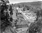 | |||
| Boulder CWA Hall | 16652 | Hamilton Street | Boulder | 30°46′54″S121°29′33″E / 30.78171°S 121.49245°E | |||
| Curtin University of Technology (School of Mines) | 24919 | 117–145 | Egan Street | Kalgoorlie | 30°44′54″S121°28′29″E / 30.748382°S 121.474645°E | ||
| Curtin University of Technology (School of Mines Museum) | 24920 | 117–145 | Egan Street | Kalgoorlie | 30°44′54″S121°28′29″E / 30.748382°S 121.474645°E | ||
| Boulder Subway Bridge | 24921 | Lot 3603 | Burt Street | Boulder | 30°46′53″S121°29′29″E / 30.78146°S 121.491508°E | Subway Bridge | |
| Chamber of Mines Building | 24924 | 115 | Egan Street | Kalgoorlie | 30°44′54″S121°28′29″E / 30.748382°S 121.474645°E | ||
| Red Post Boxes Group | 25501 | Kalgoorlie, Busselton, Bassendean |  |