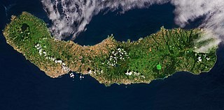
São Miguel Island, nicknamed "The Green Island", is the largest and most populous island in the Portuguese archipelago of the Azores. The island covers 760 km2 (290 sq mi) and has around 140,000 inhabitants, with 45,000 people residing in Ponta Delgada, the archipelago's largest city.

Flores Island is an island of the Western Group of the Azores.
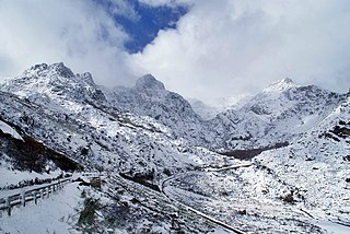
Serra da Estrela is the highest mountain range in Continental Portugal. Together with the Serra da Lousã it is the westernmost constituent range of the Sistema Central and also one of the highest in the system. It includes mainland Portugal's highest point at 1,993 metres above mean sea level. This point is not a distinctive mountain summit, but rather the highest point in a plateau, being known as Torre. Torre is an unusual summit in that it is accessible by a paved road. The peak has a topographic prominence of 1,204 m (3,950 ft) and its parent peak is Pico Almanzor, in Spain.

Ribeira Seca is a freguesia in the municipality of Calheta in the Portuguese Azores. The population in 2011 was 1,025, in an area of 53.77 km2. It contains the localities Aveiro, Caldeira de Cima, Caminhos Novos, Canada de Baixo, Faja da Entre Ribeiras, Fajã da Figueira, Fajã da Fonte Nicolau, Fajã das Cubres, Fajã de Além, Fajã do Belo, Fajã do Sanguinhal, Fajã do Santo Cristo, Fajã dos Bodes, Fajã dos Vimes, Fajã Redonda, Grotão Fundo, Loiral de Baixo, Loiral de Cima, Lomba, Pojal, Portal, Ribeira Seca, São Bartolomeu and Silveira.

Fajã Grande is a rural civil parish in the municipality of Lajes das Flores in the Portuguese archipelago of the Azores. The population in 2021 was 220, in an area of 12.97 km2. Although it is a relatively small population, it is one of the largest centers in the municipality of Lajes das Flores, about 17 kilometres (11 mi) from the municipal seat, and the westernmost settlement in Europe; the closest North American settlement is St. John's, Newfoundland and Labrador, being about 2,000 km (1,200 mi) away. It contains the localities Cuada, Ponta and Fajã.

Fajãzinha is a civil parish in the municipality of Lajes das Flores located 15 kilometres (9.3 mi) from the main town of Lajes das Flores, on the western coast of Portuguese island of Flores. The population in 2021 was 71, in an area of 6.16 square kilometres (2.38 sq mi). It contains the localities Fajãzinha and Ladeiras.
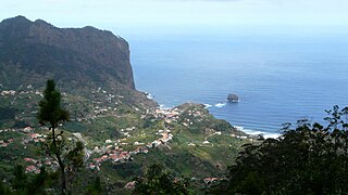
Porto da Cruz (Portuguese pronunciation:[ˈpoɾtuðɐˈkɾuʃ], is a civil parish in the municipality of Machico in the northeastern corner of Madeira. The population in 2011 was 2,597, in an area of 25.22 km2.

Picos is a municipality in the state of Piauí in the Northeast region of Brazil. Picos is the state's third-largest city, located in the south-central region of Piauí and is the most economically developed city in the region. The city's financial prosperity, combined with its geographical location, gives Picos a "commercial hub" status, especially for fuel and honey. As of 2020, the population was approximately 78,431.
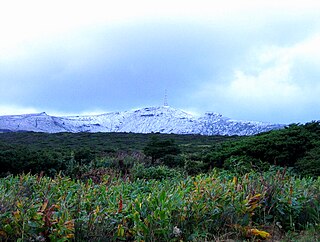
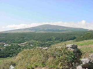
Morro Alto is the highest mountain of Flores, Azores, Portugal. It is part of a trachytic process represented by the Pico da Sé, forming an imposing volcanic apparatus embedded between two deep erosion valleys, product of the Badanela and Fazenda rivers.

The Fajã dos Cubres is a permanent debris field, known as a fajã, built from the collapsing cliffs on the northern coast of the civil parish of Ribeira Seca, in the municipality of Calheta, island of São Jorge, in the Portuguese archipelago of the Azores.

Lajes das Flores is an Azorean civil parish, and municipal seat of the municipality of Lajes das Flores. The population in 2021 was 562, in an area of 18.79 km2.
The Nature Park of Terceira, or simply the Terceira Nature Park (PNTER) developed from the intention of better managing the protected areas of the island of Terceira, and was instituted by the "Secretaria Regional do Ambiente e do Mar", of the Autonomous Regional Government of the Azores. It includes an area of approximately 22% of the island classified under the International Union for Conservation of Nature's Nature Reserve designation.

The Nature Park of Flores, or simply Flores Nature Park (PNF), developed from the intention of better managing the protected areas of the island of Flores, and was instituted by the Secretaria Regional do Ambiente e do Mar, of the Autonomous Regional Government of the Azores. Although there are several ecosystems and environmentally distinct, this nature reserve includes three principal areas, in addition to several protected areas.

The Azores Geopark is a network of 121 geographically-dispersed sites of geographic heritage and marine areas that covers the nine volcanic islands of the archipelago of the Azores. This network is managed by the Azores Geopark Association, a non-profit association, with its headquarters in Horta on the island of Faial, established 19 May 2010. It is part of the European Geoparks Network and the UNESCO Global Geoparks Network. The Association's mission is to ensure the geological conservation, environmental education and sustainable development, while promoting the well-being of the population and a respect for the environment.

Covão dos Conchos is an artificial lake in the Serra da Estrela mountains in Portugal that is famous for its Bell-mouth spillway.


