Pacific Ocean
China Seas
Some 25 TSS schemes are in operation in and around the China Seas. Shipping is very busy around Hong Kong, the mainland of South-East China and around Taiwan.
Some of the most important TSS schemes in this area:
Japan
In Japan there are 5 TSS's all governed by the Japanese government. Apart from these mandatory schemes there are also voluntary and recommended schemes. These are not shown on Admiralty Charts and (thus) not shown in this overview
Korea and Russia (Pacific Coast)
In (North) Korean and Pacific Russian waters some 35 schemes are in operation with only 5 of them being governed by the IMO. All major ports in this area have a TSS in operation. In North Korea none of the TSS schemes are IMO schemes; only locally governed by the North Korean central government. Below an overview of the IMO schemes and some of the most important locally governed schemes:
Philippines, Borneo and Indonesia
There are six TSS's around the Philippines and one in Malaysia. None of them are governed by the IMO:
Australia and Papua New Guinea
In this area there are four TSS's governed by the IMO:
There are also two leading to Australian ports, governed by Australia:
There was one other TSS, which has now been revoked:
Aleutian Islands, Alaska, US West Coast, Canada and Mexico
On the East side of the Pacific Ocean the TSS's are divided in two groups. The North side includes the West coast of Mexico and everything to its North. The other group are formed by the West coast of Central and South America.
The TSS's in the far North around the Aleutian Islands and Alaska are not put in place because of the high density of shipping but the nature of the ships and the vulnerability of the area.
The TSS schemes are:
Pacific: Central and South America
The IMO governs 16 TSS schemes on the Pacific side of Central and South America:
- landfall and approaches to Talara Bay, Peru
- landfall and approaches to Bahia de Paita, Peru
- landfall of Puerto Salaverry, Peru
- landfall and approaches to Chimbote or Ferrol Bay, Peru
- approaches to Callao, Peru
- landfall and approaches to San Martín
- landfall and approaches to San Nicolas Bay
- landfall and approaches to Puerto Ilo
- landfall and approaches to Arica
- landfall and approaches to Iquique
- landfall and approaches to Antofagasta
- in the approaches to Quintero Bay
- in the approaches to Valparaíso
- in the approaches to Bay of Concepción
- in the approaches to Bahía San Vicente, Chile
- in the approaches to Puntas Arenas
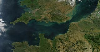
The English Channel, also known as the Channel, is an arm of the Atlantic Ocean that separates Southern England from northern France. It links to the southern part of the North Sea by the Strait of Dover at its northeastern end. It is the busiest shipping area in the world.

The Strait of Malacca is a narrow stretch of water, 800 kilometres (500 mi) long and from 65 to 250 km wide, between the Malay Peninsula to the northeast and the Indonesian island of Sumatra to the southwest, connecting the Andaman Sea and the South China Sea. As the main shipping channel between the Indian and Pacific oceans, it is one of the most important shipping lanes in the world.
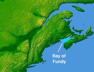
The Bay of Fundy is a bay between the Canadian provinces of New Brunswick and Nova Scotia, with a small portion touching the U.S. state of Maine. It is an arm of the Gulf of Maine. Its tidal range is the highest in the world. The name is probably a corruption of the French word fendu, meaning 'split'.

The Gulf of St. Lawrence fringes the shores of the provinces of Quebec, New Brunswick, Nova Scotia, Prince Edward Island, Newfoundland and Labrador, in Canada, plus the islands Saint-Pierre and Miquelon, possessions of France, in North America.

The Golden Gate is a strait on the west coast of North America that connects San Francisco Bay to the Pacific Ocean. It is defined by the headlands of the San Francisco Peninsula and the Marin Peninsula, and, since 1937, has been spanned by the Golden Gate Bridge. The entire shoreline and adjacent waters throughout the strait are managed by the Golden Gate National Recreation Area.

The Lombok Strait is a strait of the Bali Sea connecting to the Indian Ocean, and is located between the islands of Bali and Lombok in Indonesia. The Gili Islands are on the Lombok side.

Poole Harbour is a large natural harbour in Dorset, southern England, with the town of Poole on its shores. The harbour is a drowned valley (ria) formed at the end of the last ice age and is the estuary of several rivers, the largest being the Frome. The harbour has a long history of human settlement stretching to pre-Roman times. The harbour is extremely shallow, with one main dredged channel through the harbour, from the mouth to Holes Bay.
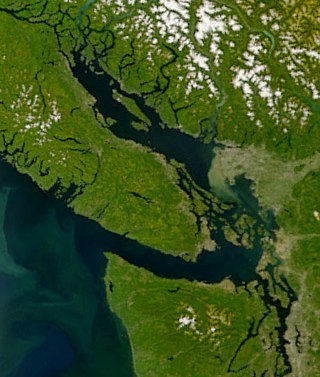
The Strait of Georgia or the Georgia Strait is an arm of the Salish Sea between Vancouver Island and the extreme southwestern mainland coast of British Columbia, Canada, and the extreme northwestern mainland coast of Washington, United States. It is approximately 240 kilometres (150 mi) long and varies in width from 20 to 58 kilometres. Along with the Strait of Juan de Fuca and Puget Sound, it is a constituent part of the Salish Sea.

Land reclamation, often known as reclamation, and also known as land fill, is the process of creating new land from oceans, seas, riverbeds or lake beds. The land reclaimed is known as reclamation ground, reclaimed land, or land fill.

Western Port, commonly but unofficially known as Western Port Bay, is a large tidal bay in southern Victoria, Australia, opening into Bass Strait. It is the second largest bay in the state. Geographically, it is dominated by two large islands; French Island and Phillip Island. At the time it was renamed, its position was west of other known ports and bays, but Western Port has become something of a misnomer as it lies just to the east of the larger Port Phillip and the city of Melbourne. It is visited by Australian fur seals, whales and dolphins, as well as many migratory waders and seabirds. It is listed under the Ramsar Convention as a wetland of international significance.

HMS Hydra was a Royal Navy deep ocean hydrographic survey vessel, the third of the original three of the Hecla class. The ship was laid down as yard number 2258 on 14 May 1964 at Yarrow Shipbuilders, at Scotstoun on the River Clyde and launched on 14 July 1965 by Mary Lythall, wife of the then Chief Scientist, Basil W Lythall CB (1919–2001). She was completed and first commissioned on 4 May 1966 and, as the replacement for the survey ship HMS Owen, her commanding officer and many of her ship's company formed the first commission of HMS Hydra. She was decommissioned and sold to the Indonesian Navy in 1986 and renamed KRI Dewa Kembar ; she was still in service in 2019.
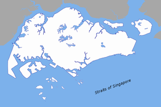
The Singapore Strait is a 113 km-long (70 mi), 19 km-wide (12 mi) strait between the Strait of Malacca in the west and the South China Sea in the east. Singapore is on the north of the channel, and the Indonesian Riau Islands are on the south. The two countries share a maritime border along the strait.
Captain Charles Bampfield Yule, R.N. was an explorer and author of the Admiralty Australia Directory.

The Bohai Sea is a gulf/inland sea approximately 77,000 km2 (30,000 sq mi) in area on the east coast of Mainland China. It is the northwestern and innermost extension of the Yellow Sea, to which it connects via the Bohai Strait. It has a mean depth of approximately 18 meters (59 ft), with a maximum depth of about 80 meters (260 ft) located in the northern part of the Bohai Strait.
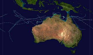
The 1984–85 Australian region cyclone season was one of the most active seasons on record. It officially started on 1 November 1984, and officially ended on 30 April 1985.

A traffic separation scheme or TSS is a maritime traffic-management route-system ruled by the International Maritime Organization or IMO. It consists of two (outer) lines, two lanes, and a separation zone. The traffic-lanes indicate the general direction of the ships in that lane; ships navigating within a lane all sail in the same direction or they cross the lane in an angle as close to 90 degrees as possible.
St. Georges Bay is a bay with shore on the Nova Scotia peninsula and Cape Breton Island, Canada, thus comprising a sub-basin of the Gulf of St. Lawrence.


