This is a list of urban areas in Finland by population, with the 100 largest localities or urban areas in Finland on 31 December 2019. [1] The list is based on data from Statistics Finland that defines an urban area as a cluster of dwellings with at least 200 inhabitants. [2]
| Rank | Urban area | Population | Area (km²) | Density (pop. per km²) |
|---|---|---|---|---|
| 1 | Helsinki | 1,305,893 | 682.91 | 1,912.2 |
| 2 | Tampere | 341,696 | 279.37 | 1,223.1 |
| 3 | Turku | 277,677 | 283.27 | 980.3 |
| 4 | Oulu | 205,137 | 203.25 | 1,009.3 |
| 5 | Jyväskylä | 128,911 | 111.22 | 1,159.1 |
| 6 | Lahti | 119,469 | 116.32 | 1,027.1 |
| 7 | Kuopio | 91,243 | 53.20 | 1,715.1 |
| 8 | Pori | 83,479 | 120.42 | 693.2 |
| 9 | Joensuu | 72,621 | 80.82 | 898.6 |
| 10 | Vaasa | 67,789 | 69.73 | 972.2 |
| 11 | Lappeenranta | 56,075 | 55.12 | 1,017.3 |
| 12 | Rovaniemi | 53,604 | 60.08 | 892.2 |
| 13 | Seinäjoki | 51,300 | 56.45 | 908.8 |
| 14 | Hämeenlinna | 50,975 | 49.19 | 1,036.3 |
| 15 | Porvoo | 50,610 | 48.04 | 806.5 |
| 16 | Kotka | 50,400 | 70.94 | 710.5 |
| 17 | Kouvola | 47,391 | 61.21 | 774.2 |
| 18 | Hyvinkää | 43,262 | 36.94 | 1,171.1 |
| 19 | Mikkeli | 37,218 | 42.99 | 865.7 |
| 20 | Kokkola | 36,887 | 49.55 | 744.4 |
| 21 | Rauma | 33,380 | 53.78 | 620.7 |
| 22 | Lohja | 32,603 | 46.01 | 708.6 |
| 23 | Kajaani | 29,582 | 28.62 | 1,033.6 |
| 24 | Salo | 28,680 | 37.46 | 765.6 |
| 25 | Riihimäki | 27,785 | 31.46 | 883.2 |
| 26 | Imatra | 27,338 | 56.29 | 485.7 |
| 27 | Kemi | 26,176 | 50.04 | 523.1 |
| 28 | Forssa | 21,008 | 38.65 | 543.5 |
| 29 | Jakobstad | 20,691 | 28.00 | 739.0 |
| 30 | Savonlinna | 20,681 | 22.95 | 901.1 |
| 31 | Kirkkonummi | 20,181 | 39.45 | 511.6 |
| 32 | Raahe | 18,891 | 42.31 | 446.5 |
| 33 | Varkaus | 18,616 | 31.55 | 590.0 |
| 34 | Valkeakoski | 16,960 | 20.25 | 837.5 |
| 35 | Tornio | 16,655 | 36.18 | 460.3 |
| 36 | Hamina | 15,380 | 34.85 | 441.3 |
| 37 | Iisalmi | 15,223 | 18.32 | 830.9 |
| 38 | Mariehamn | 14,631 | 21.35 | 685.3 |
| 39 | Nummela | 14,472 | 19.56 | 739.9 |
| 40 | Heinola | 14,231 | 16.58 | 858.3 |
| 41 | Ilmajoki—Kurikka | 13,411 | 57.42 | 233.6 |
| 42 | Pieksämäki | 12,895 | 19.12 | 674.4 |
| 43 | Ylivieska | 12,431 | 28.19 | 441.0 |
| 44 | Jämsä | 12,265 | 31.25 | 392.5 |
| 45 | Nastola | 11,688 | 23.93 | 488.4 |
| 46 | Mäntsälä | 11,548 | 17.69 | 652.8 |
| 47 | Siilinjärvi | 11,387 | 23.18 | 491.2 |
| 48 | Lapua | 10,775 | 29.13 | 369.9 |
| 49 | Uusikaupunki | 10,221 | 19.24 | 531.2 |
| 50 | Vammala | 10,057 | 20.59 | 488.4 |
| 51 | Söderkulla | 9,421 | 39.15 | 240.6 |
| 52 | Pargas | 9,389 | 27.10 | 346.5 |
| 53 | Orimattila | 9,039 | 17.25 | 524.0 |
| 54 | Loimaa | 8,753 | 17.54 | 499.0 |
| 55 | Ekenäs | 8,583 | 12.53 | 685.0 |
| 56 | Kauhajoki | 8,528 | 32.97 | 258.7 |
| 57 | Äänekoski | 8,477 | 10.72 | 790.8 |
| 58 | Paimio | 8,467 | 17.34 | 488.3 |
| 59 | Toijala | 8,365 | 16.43 | 509.1 |
| 60 | Kuusamo | 8,285 | 16.34 | 507.0 |
| 61 | Laukaa | 8,225 | 19.40 | 424.0 |
| 62 | Karis | 7,811 | 14.12 | 553.2 |
| 63 | Kankaanpää | 7,787 | 16.05 | 485.2 |
| 64 | Nurmijärvi | 7,576 | 11.27 | 672.2 |
| 65 | Turenki | 7,466 | 13.80 | 541.0 |
| 66 | Mänttä | 7,438 | 18.93 | 392.9 |
| 67 | Karkkila | 7,365 | 15.87 | 464.1 |
| 68 | Hanko | 7,329 | 13.61 | 538.5 |
| 69 | Rajamäki | 7,169 | 15.07 | 475.7 |
| 70 | Muurame | 7,115 | 12.91 | 551.1 |
| 71 | Muhos | 7,072 | 25.45 | 277.9 |
| 72 | Loviisa | 6,955 | 12.71 | 547.2 |
| 73 | Lieksa | 6,874 | 15.38 | 446.9 |
| 74 | Joutseno | 6,766 | 16.19 | 417.9 |
| 75 | Kyröskoski | 6,750 | 16.30 | 414.1 |
| 76 | Parola | 6,662 | 16.98 | 392.3 |
| 77 | Lauttakylä | 6,613 | 22.17 | 298.3 |
| 78 | Laihia | 6,598 | 23.24 | 283.9 |
| 79 | Kalajoki | 6,548 | 22.80 | 287.2 |
| 80 | Iin Hamina | 6,506 | 21.35 | 304.7 |
| 81 | Jokela | 6,471 | 10.89 | 594.2 |
| 82 | Eura | 6,327 | 21.71 | 291.4 |
| 83 | Orivesi | 6,239 | 14.75 | 423.0 |
| 84 | Veikkola | 6,214 | 18.01 | 345.0 |
| 85 | Kyläsaari—Pihlava | 6,207 | 18.78 | 330.5 |
| 86 | Vuokatti | 6,181 | 13.71 | 450.8 |
| 87 | Keuruu | 5,953 | 9.11 | 653.5 |
| 88 | Valkeala | 5,863 | 10.87 | 539.4 |
| 89 | Myllykoski | 5,714 | 16.07 | 355.6 |
| 90 | Kiiminki | 5,617 | 15.55 | 361.2 |
| 91 | Laitila | 5,596 | 16.89 | 331.3 |
| 92 | Toivala—Vuorela | 5,594 | 10.50 | 532.8 |
| 93 | Kauhava | 5,451 | 21.43 | 254.4 |
| 94 | Vuores | 5,355 | 3.03 | 1,767.3 |
| 95 | Nivala | 5,267 | 17.83 | 295.4 |
| 96 | Oulainen | 5,206 | 14.27 | 364.8 |
| 97 | Kuhmo | 5,200 | 9.05 | 574.6 |
| 98 | Liminka | 5,190 | 11.12 | 466.7 |
| 99 | Viiala | 5,087 | 11.47 | 443.5 |
| 100 | Suonenjoki | 5,070 | 12.23 | 414.6 |

Helsinki is the capital and most populous city in Finland. It is located on the shore of the Gulf of Finland and serves as the seat of the Uusimaa region in southern Finland. Approximately 0.67 million people live in the municipality, with 1.25 million in the capital region, and 1.58 million in the metropolitan area. As the most populous urban area in Finland, it is the country's most significant centre for politics, education, finance, culture, and research. Helsinki is situated 80 kilometres (50 mi) to the north of Tallinn, Estonia, 360 kilometres (220 mi) to the north of Riga, Latvia, 400 kilometres (250 mi) to the east of Stockholm, Sweden, and 300 kilometres (190 mi) to the west of Saint Petersburg, Russia. Helsinki has significant historical connections with these four cities.

Alajärvi is a town and municipality of Finland. It is located in the South Ostrobothnia region. The town has a population of 9,114 and covers an area of 1,056.74 square kilometres (408.01 sq 2 (18.53 sq mi) is water. The population density is 9.03 inhabitants per square kilometre (23.4/sq mi). The town is unilingually Finnish; there are few immigrants.

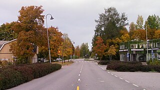
Alavus is a town and municipality of Finland. It is located in the province of Western Finland and is part of the Southern Ostrobothnia region, 52 kilometres (32 mi) southeast of Seinäjoki, 138 kilometres (86 mi) north of Tampere and 319 kilometres (198 mi) north of Helsinki. The town has a population of 10,935 and covers an area of 1,151.46 square kilometres (444.58 sq mi) of which 52.31 km2 (20.20 sq mi) is water. The population density is 10.06 inhabitants per square kilometre (26.1/sq mi). Neighbouring municipalities are Alajärvi, Kuortane, Seinäjoki, Virrat and Ähtäri.
Asikkala is a municipality of Finland. Its seat is in Vääksy, at the shores of the Lake Päijänne. It is located in the province of Southern Finland and is part of the Päijänne Tavastia region. Asikkala's neighboring municipalities are Hämeenlinna, Heinola, Hollola, Lahti, Padasjoki and Sysmä.

Brändö is an island municipality of Åland, Finland. Characteristics of Brändö are the numerous assembly of islands and islets, most important of which are linked by bridges and causeways. The municipality has a population of 436 and covers an area of 1,643.21 square kilometres of which 1,540.41 km2 (594.76 sq mi) is water. The population density is 4.03 inhabitants per square kilometre (10.4/sq mi). The municipality is unilingually Swedish and 70.2% of the population are Swedish speakers.
Askola is a municipality of Finland. It is located in the Uusimaa region. The municipality has a population of 4,703 and covers an area of 218.03 square kilometres (84.18 sq mi) of which 5.61 km2 (2.17 sq mi) is water. The population density is 22.14 inhabitants per square kilometre (57.3/sq mi). Monninkylä is the largest village of the municipality in terms of population. Neighbouring municipalities are Myrskylä, Mäntsälä, Pornainen, Porvoo and Pukkila.

Aura is a municipality of Finland. The name derives from the river Aura and the plough reminiscent shape of the municipality. The municipality was established in 1917 from parts of Lieto and Pöytyä.

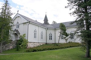
Kankaanpää is a town and municipality of Finland. Kankaanpää was founded in 1865, became a township in 1967 and finally a town in 1972. It is located in the crossroads of Hämeenkangas and Pohjankangas ridges. It belongs to the region of Satakunta. Kankaanpää has a population of about 12,400 inhabitants, which make it the third largest municipality in the Satakunta region in terms of population, after the city of Pori and the town of Rauma. Pori is located 53 kilometres (33 mi) southwest of Kankaanpää.

Valkeakoski is a town and municipality in Finland. It is located 35 kilometres (22 mi) south of Tampere, 45 km (28 mi) north of Hämeenlinna and 150 km (93 mi) north of Helsinki in the Pirkanmaa region. The municipality has a population of 20,701 (31 December 2023) and covers an area of 372.03 square kilometres (143.64 sq mi) of which 100.06 km2 (38.63 sq mi) is water. The population density is 76.09 inhabitants per square kilometre (197.1/sq mi).

South Ostrobothnia is one of the 19 regions of Finland. It borders the regions of Ostrobothnia, Central Ostrobothnia, Central Finland, Pirkanmaa, and Satakunta. Among the Finnish regions, South Ostrobothnia is the ninth largest in terms of population. Seinäjoki is the regional centre and by far the largest city in the area.
Vihti is a municipality in Finland, located in the southern interior of the country. Vihti is situated in the Uusimaa region. The population of Vihti is approximately 29,000. It is the 37th most populous municipality in Finland. Vihti is part of the Helsinki Metropolitan Area, which has approximately 1.58 million inhabitants.
Hausjärvi is a municipality of Finland. Its seat is in Oitti.

Järvenpää is a town in Finland, located in the southern interior of the country. Järvenpää is situated in the centre of the Uusimaa region. The population of Järvenpää is approximately 46,000. It is the 24th most populous municipality in Finland. Järvenpää is part of the Helsinki Metropolitan Area, which has approximately 1.58 million inhabitants.

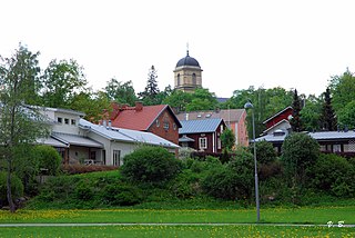
Orivesi is a town and a municipality of Finland. It is part of the Pirkanmaa region. The municipality has a population of 8,842 and covers an area of 960.09 square kilometres (370.69 sq mi) of which 160.53 km2 (61.98 sq mi) is water. The population density is 11.06 inhabitants per square kilometre (28.6/sq mi). The municipality official language is monolingually Finnish.
Siuntio is a municipality in the Uusimaa region of Southern Finland. Its neighboring municipalities are Ingå to the west, Kirkkonummi, to the east, Lohja to the north-west, and Vihti to the north. It is 46 kilometres (29 mi) west of Helsinki.

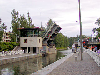
Akaa is a town and a municipality in Pirkanmaa, Finland. It was created on January 1, 2007 when the town of Toijala and the town of Viiala were united into a single Municipality. The municipality of Kylmäkoski was consolidated with Akaa on 1 January 2011.

An urban area in Finland is defined as a cluster of dwellings with at least 200 inhabitants. The Finnish term for this is a taajama. Because of the strict definition of a taajama, these areas exist both inside and outside of city and municipal borders.
Dutch speakers, or Batavophones, are globally concentrated in the Netherlands, Belgium, and Suriname. Dutch is also spoken in minority areas through Europe and in many immigrant communities in all over the world. Afrikaans is a daughter language of Dutch, but is regarded as a separate language and will not be analyzed in this article.
| ||||||||||||||||||||||||||||||||||||||||||||||||||||||||||||||||||||||||||||||||||||||||||||||||