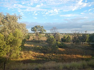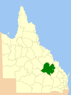
Mackenzie River is a locality in the Isaac Region, Queensland, Australia. In the 2016 census, Mackenzie River had a population of 71 people.

Comet is a rural town and locality in the Central Highlands Region, Queensland, Australia. Yamala is a neighbourhood in the west of the locality. In the 2016 census, Comet had a population of 498 people.

Top Camp is a locality in the Toowoomba Region, Queensland, Australia. In the 2016 census, Top Camp had a population of 852 people.

Rocksberg is a locality in the Moreton Bay Region, Queensland, Australia. In 2016 census, Rocksberg had a population of 300.

Nandowrie is a locality in the Central Highlands Region, Queensland, Australia. In the 2016 census, Nandowrie had a population of 45 people.

Alsace is a rural locality in the Central Highlands Region, Queensland, Australia. In the 2016 census, Alsace had a population of 3 people.

Mount Debateable is a rural locality in the North Burnett Region, Queensland, Australia. In the 2016 census, Mount Debateable had a population of 54 people.

Campbell Creek is a locality in the North Burnett Region, Queensland, Australia. In the 2016 census, Campbell Creek had a population of 7 people.

Albinia is a locality in the Central Highlands Region, Queensland, Australia. In the 2016 census, Albinia had a population of 112 people.

Tyrconnel is a rural locality split between the Maranoa Region and the Shire of Murweh, both in Queensland, Australia. In the 2016 census, Tyrconnel had a population of 30 people.

Eungella Hinterland is a rural locality in the Mackay Region, Queensland, Australia. In the 2016 census, Eungella Hinterland had a population of 3 people.

Eungella Dam is a locality in the Mackay Region, Queensland, Australia. In the 2016 census, Eungella Dam had a population of 12 people.

Duingal is a locality in the Bundaberg Region, Queensland, Australia. In the 2016 census, Duingal had a population of 77 people.

Leslie Dam is a locality in the Southern Downs Region, Queensland, Australia. In the 2016 census, Leslie Dam had a population of 163 people.

Mount Mackay is a locality in the Cassowary Coast Region, Queensland, Australia. In the 2016 census, Mount Mackay had a population of 0 people.

Glen Esk is a locality in the Somerset Region, Queensland, Australia. In the 2016 census, Glen Esk had a population of 54 people.

Boulder Creek is a locality in the Rockhampton Region, Queensland, Australia. In the 2016 census, Boulder Creek had a population of 12 people.

Dirnbir is a rural locality in the North Burnett Region, Queensland, Australia. In the 2016 census, Dirnbir had a population of 49 people.

Sedgeford is a locality in the Barcaldine Region, Queensland, Australia. In the 2016 census, Sedgeford had a population of 0 people.

Wallaroo is a rural locality split between the Central Highlands Region and the Aboriginal Shire of Woorabinda, Queensland, Australia. In the 2016 census, Wallaroo had a population of 10 people.


