
The Mohs scale of mineral hardness is a qualitative ordinal scale characterizing scratch resistance of various minerals through the ability of harder material to scratch softer material. Created in 1812 by German geologist and mineralogist Friedrich Mohs, it is one of several definitions of hardness in materials science, some of which are more quantitative. The method of comparing hardness by observing which minerals can scratch others is of great antiquity, having been mentioned by Theophrastus in his treatise On Stones, c. 300 BC, followed by Pliny the Elder in his Naturalis Historia, c. 77 AD. While greatly facilitating the identification of minerals in the field, the Mohs scale does not show how well hard materials perform in an industrial setting.

An ore is a natural occurrence of rock or sediment that contains sufficient minerals with economically important elements, typically metals, that can be economically extracted from the deposit. The ores are extracted at a profit from the earth through mining; they are then refined to extract the valuable element, or elements.
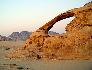
Weathering is the breaking down of rocks, soil, and minerals as well as wood and artificial materials through contact with the Earth's atmosphere, water, and biological organisms. Weathering occurs in situ, that is, in the same place, with little or no movement, and thus should not be confused with erosion, which involves the movement of rocks and minerals by agents such as water, ice, snow, wind, waves and gravity and then being transported and deposited in other locations.

Alton is a city on the Mississippi River in Madison County, Illinois, United States, about 15 miles (24 km) north of St. Louis, Missouri. The population was 27,865 at the 2010 census. It is a part of the Metro-East region of the Greater St. Louis metropolitan area. It is famous for its limestone bluffs along the river north of the city, for its role preceding and during the American Civil War, and as the home town of jazz musician Miles Davis and Robert Wadlow, the tallest known person in history. It was the site of the last Abraham Lincoln and Stephen Douglas debate in October 1858. The former state penitentiary in Alton was used during the Civil War to hold up to 12,000 Confederate prisoners of war.

Mineral Wells is a city in Palo Pinto and Parker counties in the U.S. state of Texas. The population was 16,788 at the 2010 census. The city is named for mineral springs in the area, which were highly popular in the early 1900s. Mineral Wells is most famous for its Baker Hotel. Mineral Wells also hosts a variety of paranormal hauntings and ghost tours including the Baker Hotel, the Crazy Water Hotel, close by the Whispering Cottage built in 1926.

In mineralogy, crystal habit is the characteristic external shape of an individual crystal or crystal group. A single crystal's habit is a description of its general shape and its crystallographic forms, plus how well developed each form is.
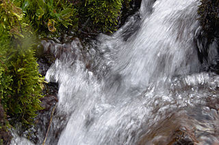
Mineral water is water from a mineral spring that contains various minerals, such as salts and sulfur compounds. Mineral water may be classified as "still" or "sparkling" (carbonated/effervescent) according to the presence or absence of added gases.

Galena, also called lead glance, is the natural mineral form of lead(II) sulfide. It is the most important ore of lead and an important source of silver.

Petrified wood is the name given to a special type of fossilized remains of terrestrial vegetation. It is the result of a tree or tree-like plants having completely transitioned to stone by the process of permineralization. All the organic materials have been replaced with minerals, while retaining the original structure of the stem tissue. Unlike other types of fossils which are typically impressions or compressions, petrified wood is a three-dimensional representation of the original organic material.

Saratoga Spa State Park is a 2,379-acre (9.63 km2) state park located in Saratoga County, New York in the United States. The park is in the City of Saratoga Springs, near US 9 and NY 50.

The Southeast Missouri Lead District, commonly called the Lead Belt, is a lead mining district in the southeastern part of Missouri. Counties in the Lead Belt include Saint Francois; Crawford; Dent; Iron; Madison: Reynolds; and Washington. Philip Francois Renault of France led a large exploratory mission in 1719 and started mining operations in Old Mines and Mine La Motte in 1720. The town of Sainte Genevieve was founded as a river port for transportation of lead out of the area. Moses Austin started large-scale mining and smelting at Potosi, originally known as Mine a Breton, and founded Herculaneum as his shipping point on the Mississippi. This lead was originally used as a roofing material. Bonne Terre has large subterranean mines, now used commercially for recreational scuba diving.
Mineral rights are property rights to exploit an area for the minerals it harbors. Mineral rights can be separate from property ownership.

Carbonate-hosted lead-zinc ore deposits are important and highly valuable concentrations of lead and zinc sulfide ores hosted within carbonate formations and which share a common genetic origin.

The Mississippi Canyon is an undersea canyon, part of the Mississippi Submarine Valley in the North-central Gulf of Mexico, south of Louisiana. According to the U.S. Geological Survey GLORIA Mapping Program, it is the dominant feature of the north-central Gulf of Mexico. According to GCAGS Transactions, it has an average width of 8 kilometres (5.0 mi), and a length of 120 kilometres (75 mi). The US Minerals Management Service (MMS) applies the name Mississippi Canyon to numbered federal oil and gas lease blocks over a large offshore area centered on, but mostly outside, the submarine canyon.

Tocowa is a Ghost town located just outside Batesville in Panola County, Mississippi, United States.

Touissit is a town in Jerada Province, Oriental, Morocco. According to the 2004 census it has a population of 3429.
The Macondo Prospect is an oil and gas prospect in the United States Exclusive Economic Zone of the Gulf of Mexico, off the coast of Louisiana. The prospect was the site of the Deepwater Horizon drilling rig explosion in April 2010 that led to a major oil spill in the region.
The Stafford Mineral Springs and Stafford's Wells Hotel are the site of a historic mineral springs hotel resort property in Montgomery County, Mississippi. The property was built in 1890 by Dr. Thomas Washborn and was visited for its supposed curative properties. The property was then developed by Edward Stafford and his partners, who formed Stafford Mineral Springs Company, Limited, and incorporated in Louisiana on May 19, 1892. Prior to 1916 it had well houses, bath houses, guest cottages, a dance pavilion, and gambling hall. Later the Stafford Springs Motor Lodge was developed in the area. The springs were listed on the National Register of Historic Places on September 8, 2000.

Leggo is a ghost town in Yalobusha County, Mississippi, United States.
The geology of Arkansas includes deep 1.4 billion year old igneous crystalline basement rock from the Proterozoic known only from boreholes, overlain by extensive sedimentary rocks and even some volcanic rocks. The region was a shallow marine, riverine and coastal environment for much of the early Paleozoic as multi-cellular life became commonplace. At the end of the Paleozoic in the Permian the region experienced coal formation and extensive faulting and uplift related to the Ouachita orogeny mountain building event. Extensive erosion of new highlands created a mixture of continental and marine sediments and much of the state remained flooded even into the last 66 million years of the Cenozoic. In recent Pleistocene and Holocene time, glacial sediments poured into the region from the north, down major rivers, forming dunes and sedimentary ridges. Today, Arkansas has an active oil and gas industry, although hydraulic fracturing related earthquake swarms have limited extraction and the state also has mining of brines, sand, gravel and other industrial minerals.


