
Mount Ouray is a high and prominent mountain summit in the far southern Sawatch Range of the Rocky Mountains of North America. The 13,961-foot (4255.4 m) thirteener is located in San Isabel National Forest, 7.5 miles (12.0 km) west of Poncha Pass, Colorado, United States, on the boundary between Chaffee and Saguache counties. The mountain was named in honor of Ute Chief Ouray.

Mount Frissell, 2,454 feet (748 m), located on the border of southwest Massachusetts and northwest Connecticut, is a prominent peak of the Taconic Range.
Mount Franklin is a mountain located in Coös County, New Hampshire. The mountain is named after Benjamin Franklin, and is part of the Presidential Range of the White Mountains. Note that Ben Franklin was not a president. Mount Franklin is flanked to the northeast by Mount Monroe, and to the southwest by Mount Eisenhower.
Mount Weeks, formerly Round Mountain, is a mountain located in Coos County, New Hampshire. Mt. Weeks is the northeasternmost of the Pliny Range of the White Mountains and the highest point within the city limits of Berlin, New Hampshire. Mount Weeks is flanked to the southwest by South Weeks, and faces Terrace Mountain to the northwest across Willard Notch.

Zoar Valley is an area of deep gorges along the Main and South branches of Cattaraugus Creek in western New York, United States. The valley is located along the border of Erie County and Cattaraugus County, roughly between the villages of Gowanda to the west and Springville to the east.
Mount Redfield is a mountain located in Essex County, New York. The mountain is part of the Marcy Group of the Great Range of the Adirondack Mountains. Mount Redfield is flanked to the northwest by Cliff Mountain, and to the northeast by Mount Skylight.
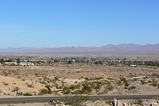
The Black Mountains of northwest Arizona are an extensive, mostly linear, north-south 75-mile (121 km) long mountain range. It forms the north-south border of southwest Mohave County as it borders the eastern shore of the south-flowing Colorado River from Hoover Dam.
Round Mountain, 2,296 feet (700 m), located on the border of southwest Massachusetts and northwest Connecticut, is a prominent peak of the Taconic Range. The peak and southern slopes of the mountain are within Connecticut; the northern slope lies within Massachusetts.
Zoar State Forest is a state forest located in King William County, Virginia, near the town of Aylett. It is used to grow timber and agricultural crops, maintain habitat for various species of wildlife, and to provide educational and recreational opportunities. All state forests are managed by the VDOF for multiple-use purposes, including watershed protection, recreation, timber production, fishing, and applied forest research. The state forests are self-supporting. In addition, one-fourth of all income is returned to King William County. Income is received from the sale of forest products.
Mount Clarke is a mountain in southwestern British Columbia, Canada, located 21 km (13 mi) northwest of Hemlock Valley and 6 km (4 mi) south of Grainger Peak. It is part of the Douglas Ranges, the southernmost subdivision of the Pacific Ranges which in turn form part of the Coast Mountains.

Zoar is an unincorporated community located in Sussex County, Delaware. It is near Mount Joy, Delaware.
Mount Joy is an unincorporated community located in Sussex County, Delaware. It is near the community of Zoar.

Zoar is a hamlet in the town of Collins in Erie County, New York, United States. Though it is in Collins, mail is postmarked to the Gowanda ZIP code of 14070. It is located on the northern side of Zoar Valley.

The Zoar Trail is a 6.5-mile (10.5 km) Blue-Blazed hiking trail "system" in the lower Housatonic River valley in Fairfield County and is entirely in the Sandy Hook section of Newtown in the lower block of Paugussett State Forest.
The Pomperaug Trail is a 4.6-mile (7.4 km) Blue-Blazed hiking trail "system" in the lower Housatonic River valley in Fairfield County and is entirely in the Sandy Hook section of Newtown in the lower block of Paugussett State Forest.
Mount Peter is a 1,220-foot (370 m) mountain located in the New York – New Jersey Highlands, Bellvale Mountain, in the U.S. state of New York. The peak is located along the Appalachian Trail in the Town of Warwick, just south of New York State Route 17A, 38 miles (61 km) northwest of New York City, 2 miles (3.2 km) east of Bellvale, New York and north northwest of Greenwood Lake, New York.

Zoar is a historic farmstead and national historic district located within Zoar State Forest near Aylett, King William County, Virginia. It is also known as Mount Zoar, Upper Zoar, and Lower Zoar. The district encompasses 6 contributing buildings and 2 contributing sites. The main house was built in 1901, and is a 1 1/2-story Queen Anne style single-family frame dwelling. Associated with the house are the contributing smokehouse, kitchen / servant's quarters, dairy, corn crib and barn, horsefield, and family cemetery.

Ginseng Mountain is a mountain located in the Catskill Mountains of New York northeast of Windham. Elm Ridge is located south, Mount Zoar is located east-southeast, and Mount Hayden is located northwest of Ginseng Mountain.
Mount Pisgah is a mountain located in the Catskill Mountains of New York north of Windham. Steenburg Mountain is located northwest, Richtmyer Peak is located west, and Mount Nebo is located southeast of Mount Pisgah.
Kate Hill is a mountain in Greene County, New York. It is located in the Catskill Mountains southeast of East Windham. Mount Zoar is located west, and Windham High Peak is located south-southeast of Kate Hill.


