
Deoband is a town and a municipality in Saharanpur district in the state of Uttar Pradesh, India, about 150 km from Delhi. Darul Uloom Deoband, an Islamic seminary and one of the largest Islamic Institutions of India is located there.
Quetta is a district in the northwestern part of the Balochistan province of Pakistan, on the border with Kandahar province, Afghanistan.

Jind is one of the largest and oldest city in Jind district in the Indian state of Haryana. It is administrative headquarter of Jind district. Rani Talab is the main destination for tourists while Pandu Pindara and Ramrai are the main religious spots, attracting devotees for the holy bath during Amavasya.
Baghpat, historically known as Vyaghraprastha, is a city in the Indian state of Uttar Pradesh. It is the administrative headquarters of Bagpat district, which was established in 1997. It is part of the National Capital Region, surrounding New Delhi.
Budhana is a town, block, tehsil, nagar panchayat, and one of the constituencies of the Uttar Pradesh Legislative Assembly in Muzaffarnagar district in Uttar Pradesh, India.
Charthawal is a city and a nagar panchayat in Muzaffarnagar district in the state of Uttar Pradesh, India. It acts as the administrator of 59 surrounding villages.
Chhaprauli is a town and a nagar panchayat in Baghpat district in the state of Uttar Pradesh, India.
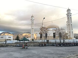
Gangoh is a town and a municipal board in Saharanpur district in the state of Uttar Pradesh, India. It lies about 40 km south-west of Saharanpur city. Other nearby towns are Karnal, Haryana, which is about 35 km south-west of Gangoh; Yamunanagar, Haryana, about 50 km to the north-west; and Shamli, Uttar Pradesh, about 50 km to the south. The town lies about 150 km north-east of the national capital, Delhi.
Jhinjhana is a town and a nagar panchayat in Shamli district in the Indian state of Uttar Pradesh.
Khatauli is a city and nagar palika in Muzaffarnagar district in the Indian state of Uttar Pradesh. A part of National Capital Region, the town is situated 100 km away from the national capital New Delhi.
Manglaur Riyasat is a town with municipal board in Haridwar district in the Indian state of Uttarakhand. Pin code of Manglaur is 247656. Manglaur is located on national highway-58 (Delhi–Haridwar). It is 175 km away from Delhi and about 10 km from Roorkee.

Safipur is a town and nagar panchayat in Unnao district in the Indian state of Uttar Pradesh. Located 27 km northwest of the city of Unnao, Safipur serves as a tehsil headquarters and is well-connected by roads to nearby towns. Founded in the 1300s and originally called Saipur, the town's present name of Safipur is in honour of the 16th-century Muslim saint Makhdum Shah Safi, whose dargah is located here. Important commodities manufactured in Safipur today include steel boxes and almirahs, furniture, and incense sticks. As of 2011, Safipur's population is 25,688, in 4,288 households.
Sarsawa is a town at the border of Haryana and a municipal board in Saharanpur district in the Indian state of Uttar Pradesh.
Shergarh is a town and a nagar panchayat in Bareilly district in the Indian state of Uttar Pradesh. It is a small town known for rice and sugarcane.
Titron, also known as Durraj Pur, is a town and a nagar panchayat in Saharanpur district in the Indian state of Uttar Pradesh.
Shahi is a town and a nagar panchayat in Bareilly district in the Indian state of Uttar Pradesh.Shahi is the one of most old British town areas First Chairman of Town Shahi is Haji Nadir Shah khan in 1868 after him his Son Khan bahadur Mohammed Raza Khan is Chairman and M.L.A of bareilly he is also Chairman of district Board Bareilly, after Mohammed Raza Khan death his son Hamid Raza Khan is also became Chairman and M.L.A of Bhojipura Constituency he is a Famous politician after his death in 1989 Son of Hamid Raza Khan, Shahid Raza khan Became Chairman of Town Area Shahi for Almost 50 years
Loni is a town, near Ghaziabad city in Ghaziabad district in the state of Uttar Pradesh, India and Loni town is governed by Loni Municipal Council which comes under Ghaziabad Metropolitan Region.

Barwala is a town situated 30 km northeast of Hisar city. It is one of the 4 sub-division of Hisar district in the state of Haryana, India.
Agwanhera is a village in the Saharanpur district of Uttar Pradesh, India. It is located in the Nakur tehsil. The nearest post office is Sarsawa.
Saluni is a village in the Saharanpur district of Uttar Pradesh, India. It is located in the Saharanpur tehsil. The nearest post office is Sarsawa. It comes under Saluni Panchayath and belongs to Saharanpur Division. It is located 14 km towards west from District headquarters Saharanpur. 576 km from State capital Lucknow.

