National Register of Historic Places listings in Houston Heights, Houston, Texas

Last updated

Map all coordinates using: OpenStreetMap  
Download coordinates as: KML

This is intended to be a complete list of properties and districts listed on the National Register of Historic Places that are located in the Houston Heights neighborhood of Houston. The "Houston Heights" neighborhood borders are, approximately, Interstate 10 on the South, I-610 on the North, Interstate 45 on the East and Durham on the West.

Contents

The locations of National Register properties and districts (at least for all showing latitude and longitude coordinates below) may be seen in a map by clicking on "Map of all coordinates." [1]

Contents: NRHP listings by area in Harris County  
downtown Houston - Houston Heights - inner Harris County - outer Harris County


    This National Park Service list is complete through NPS recent listings posted April 21, 2023. [2]

Current listings

[3] Name on the RegisterImageDate listed [4] Location City or townDescription
1 All Saints Roman Catholic Church
All Saints Roman Catholic Church All Saints Catholic Church, Houston - Jujutacular.jpg
All Saints Roman Catholic Church
June 22, 1983
(#83004425)
201 E. 10th St.
29°47′21″N95°23′46″W / 29.78912°N 95.39612°W / 29.78912; -95.39612 (All Saints Roman Catholic Church)
Houston
2 Allbach House
Allbach House Allbach House.JPG
Allbach House
June 22, 1983
(#83004426)
2023 Arlington St.
29°48′18″N95°23′41″W / 29.80489°N 95.39480°W / 29.80489; -95.39480 (Allbach House)
Houston
3 John W. Anderson House
John W. Anderson House John W. Anderson House, Houston, Texas.jpg
John W. Anderson House
January 15, 1988
(#87002241)
711 Columbia
29°47′02″N95°23′36″W / 29.78390°N 95.39322°W / 29.78390; -95.39322 (John W. Anderson House)
Houston
4 Banta House
Banta House Banta House, Houston, Texas.jpg
Banta House
June 22, 1983
(#83004427)
119 E. 20th St.
29°48′12″N95°23′50″W / 29.803333°N 95.397222°W / 29.803333; -95.397222 (Banta House)
Houston
5 Otto H. Baring House
Otto H. Baring House Otto H. Baring House (HDR).jpg
Otto H. Baring House
January 15, 1988
(#87002242)
1030 Rutland
29°47′23″N95°24′02″W / 29.789722°N 95.400556°W / 29.789722; -95.400556 (Otto H. Baring House)
Houston
6 Barker House
Barker House Barker House, 121 E. 16th St Houston.jpg
Barker House
May 14, 1984
(#84001754)
121 E. 16th St.
29°47′58″N95°23′49″W / 29.799444°N 95.396944°W / 29.799444; -95.396944 (Barker House)
Houston
7 Borgstrom House
Borgstrom House Borgstrom House (HDR).jpg
Borgstrom House
May 14, 1984
(#84001755)
1401 Cortlandt St.
29°47′46″N95°23′44″W / 29.796111°N 95.395556°W / 29.796111; -95.395556 (Borgstrom House)
Houston
8 Burge House
Burge House Burge House (HDR).jpg
Burge House
June 22, 1983
(#83004430)
1801 Heights Blvd.
29°48′06″N95°23′54″W / 29.801667°N 95.398333°W / 29.801667; -95.398333 (Burge House)
Houston
9 George L. Burlingame House
George L. Burlingame House George L. Burlingame House, 1238 Harvard St, Houston (HDR).jpg
George L. Burlingame House
January 15, 1988
(#87002243)
1238 Harvard
29°47′37″N95°23′45″W / 29.793611°N 95.395833°W / 29.793611; -95.395833 (George L. Burlingame House)
Houston
10 Burnett House
Burnett House Burnett House, Houston, TX.jpg
Burnett House
August 20, 2004
(#83004671)
219 W. Eleventh St.
29°47′27″N95°23′59″W / 29.790969°N 95.399851°W / 29.790969; -95.399851 (Burnett House)
Houston
11 David A. Carden House
David A. Carden House David Carden House, Houston, TX.jpg
David A. Carden House
July 17, 1990
(#90001048)
718 W. 17th Ave.
29°48′02″N95°24′39″W / 29.800476°N 95.410844°W / 29.800476; -95.410844 (David A. Carden House)
Houston
12 Moses A. Clanton House
Moses A. Clanton House Moses A. Clanton House, Houston, Texas.jpg
Moses A. Clanton House
July 17, 1990
(#90001040)
1025 Arlington
29°47′23″N95°23′39″W / 29.789722°N 95.394167°W / 29.789722; -95.394167 (Moses A. Clanton House)
Houston
13 J. H. Clare House January 15, 1988
(#87002244)
939 Arlington
29°47′18″N95°23′40″W / 29.788462°N 95.394395°W / 29.788462; -95.394395 (J. H. Clare House)
Houston
14 Austin Copeland House I January 15, 1988
(#87002248)
921 Arlington
29°47′15″N95°23′39″W / 29.7875°N 95.394167°W / 29.7875; -95.394167 (Austin Copeland House I)
Houston
15 Austin Copeland House II January 15, 1988
(#87002245)
925 Arlington
29°47′16″N95°23′39″W / 29.787778°N 95.394167°W / 29.787778; -95.394167 (Austin Copeland House II)
Houston
16 Charles E. Coombs House
Charles E. Coombs House Charles Coombs House, Houston, TX.jpg
Charles E. Coombs House
July 17, 1990
(#90001041)
1037 Columbia
29°47′25″N95°23′36″W / 29.790164°N 95.393334°W / 29.790164; -95.393334 (Charles E. Coombs House)
Houston
17 Dr. B. F. Coop House
Dr. B. F. Coop House Dr. B. F. Coop House, 1536 Heights Blvd Houston.jpg
Dr. B. F. Coop House
May 14, 1984
(#84001757)
1536 Heights Blvd.
29°47′56″N95°23′51″W / 29.798889°N 95.3975°W / 29.798889; -95.3975 (Dr. B. F. Coop House)
Houston
18 Countryman House June 22, 1983
(#83004431)
402 E. 9th St.
29°47′13″N95°23′38″W / 29.786832°N 95.393914°W / 29.786832; -95.393914 (Countryman House)
Houston
19 Cummings House
Cummings House Cummings House, 1418 Heights Blvd Houston.jpg
Cummings House
June 22, 1983
(#83004432)
1418 Heights Blvd.
29°47′47″N95°23′51″W / 29.796389°N 95.3975°W / 29.796389; -95.3975 (Cummings House)
Houston
20 Dexter House May 14, 1984
(#84001761)
224 W. 17th St.
29°48′02″N95°23′59″W / 29.800556°N 95.399722°W / 29.800556; -95.399722 (Dexter House)
Houston Demolished.
21 Lula J. Doughty House
Lula J. Doughty House Lula J. Doughty House (HDR).jpg
Lula J. Doughty House
July 17, 1990
(#90001046)
1233 Yale St.
29°47′35″N95°23′57″W / 29.793056°N 95.399167°W / 29.793056; -95.399167 (Lula J. Doughty House)
Houston
22 Jay L. Durham House
Jay L. Durham House Jay L. Durham House 921 Heights Blvd Houston (HDR).jpg
Jay L. Durham House
January 15, 1988
(#87002246)
921 Heights Blvd.
29°47′17″N95°23′11″W / 29.788056°N 95.386389°W / 29.788056; -95.386389 (Jay L. Durham House)
Houston
23 Eaton House
Eaton House Eaton House (HDR).jpg
Eaton House
June 22, 1983
(#83004433)
510 Harvard St.
29°46′47″N95°23′45″W / 29.779722°N 95.395833°W / 29.779722; -95.395833 (Eaton House)
Houston
24 Elkins House June 22, 1983
(#83004434)
602 E. 9th St.
29°47′13″N95°23′30″W / 29.786871°N 95.391737°W / 29.786871; -95.391737 (Elkins House)
Houston
25 Dr. Billie V. Ellis House
Dr. Billie V. Ellis House Dr. Billie V. Ellis House (HDR).jpg
Dr. Billie V. Ellis House
June 22, 1983
(#83004435)
1515 Heights Blvd.
29°47′54″N95°23′54″W / 29.798333°N 95.398333°W / 29.798333; -95.398333 (Dr. Billie V. Ellis House)
Houston
26 Ezzell House
Ezzell House Ezzell House (1236 Rutland).jpg
Ezzell House
May 14, 1984
(#84001762)
1236 Rutland St.
29°47′37″N95°24′03″W / 29.793611°N 95.400833°W / 29.793611; -95.400833 (Ezzell House)
Houston
27 William F. Fluegel House
William F. Fluegel House William Fluegel House, Houston, TX.jpg
William F. Fluegel House
January 15, 1988
(#87002247)
1327 Ashland
29°47′45″N95°24′13″W / 29.795704°N 95.403709°W / 29.795704; -95.403709 (William F. Fluegel House)
Houston Significantly altered and expanded since initial listing.
28 Gerloff House
Gerloff House Gerloff House, Houston, TX.jpg
Gerloff House
July 17, 1990
(#90001047)
221 E. 12th Ave.
29°47′34″N95°23′45″W / 29.792766°N 95.395827°W / 29.792766; -95.395827 (Gerloff House)
Houston
29 Gillette House
Gillette House Gillette House (HDR).jpg
Gillette House
May 14, 1984
(#84001764)
301–303 E. 15th St.
29°47′52″N95°23′43″W / 29.797778°N 95.395278°W / 29.797778; -95.395278 (Gillette House)
Houston
30 Hartley House
Hartley House Hartley House, Houston, TX.jpg
Hartley House
June 22, 1983
(#83004437)
315 W. 17th St.
29°48′04″N95°24′08″W / 29.801129°N 95.402184°W / 29.801129; -95.402184 (Hartley House)
Houston
31 Hawkins House
Hawkins House Hawkins House (1015 Heights Blvd) HDR.jpg
Hawkins House
May 14, 1984
(#84001765)
1015 Heights Blvd.
29°47′22″N95°23′53″W / 29.789444°N 95.398056°W / 29.789444; -95.398056 (Hawkins House)
Houston
32 Heights Boulevard Esplanade
Heights Boulevard Esplanade Heights Boulevard Esplanade (HDR).jpg
Heights Boulevard Esplanade
May 14, 1984
(#84001766)
Heights Boulevard from White Oak Bayou to 20th St.
29°46′10″N95°23′50″W / 29.769444°N 95.397222°W / 29.769444; -95.397222 (Heights Boulevard Esplanade)
Houston
33 Heights Christian Church
Heights Christian Church Heights Christian Church (HDR).jpg
Heights Christian Church
June 22, 1983
(#83004438)
1703 Heights Blvd.
29°48′03″N95°23′54″W / 29.800833°N 95.398333°W / 29.800833; -95.398333 (Heights Christian Church)
Houston
34 Heights Theater
Heights Theater HeightsTheaterHoustonTX.JPG
Heights Theater
July 24, 2017
(#100001375)
339 W. 19th St.
29°48′11″N95°24′10″W / 29.803145°N 95.402872°W / 29.803145; -95.402872 (Heights Theater)
Houston
35 House at 112 W. 4th Street
House at 112 W. 4th Street 112 W. 4th St. (HDR).jpg
House at 112 W. 4th Street
May 14, 1984
(#84001771)
112 W. 4th St.
29°46′40″N95°23′52″W / 29.777778°N 95.397778°W / 29.777778; -95.397778 (House at 112 W. 4th Street)
Houston
36 House at 122 East Fifth Street
House at 122 East Fifth Street 122 E. 5th St. (HDR).jpg
House at 122 East Fifth Street
May 14, 1984
(#84001776)
122 E. 5th St.
29°46′46″N95°23′47″W / 29.779444°N 95.396389°W / 29.779444; -95.396389 (House at 122 East Fifth Street)
Houston
37 House at 201 W. 15th Street
House at 201 W. 15th Street House at 201 W. 15th St. Houston Heights.jpg
House at 201 W. 15th Street
June 22, 1983
(#83004460)
201 W. 15th St.
29°47′51″N95°23′57″W / 29.7975°N 95.399167°W / 29.7975; -95.399167 (House at 201 W. 15th Street)
Houston
38 House at 217 E. 5th Street
House at 217 E. 5th Street 217 E. 5th St. (HDR).jpg
House at 217 E. 5th Street
May 14, 1984
(#84001786)
217 E. 5th St.
29°46′46″N95°23′44″W / 29.779444°N 95.395556°W / 29.779444; -95.395556 (House at 217 E. 5th Street)
Houston
39 House at 402 E. 11th Street
House at 402 E. 11th Street 402 E. 11th Street, Houston, TX.jpg
House at 402 E. 11th Street
June 22, 1983
(#83004447)
402 E. 11th Street
29°47′26″N95°23′38″W / 29.790541°N 95.394002°W / 29.790541; -95.394002 (House at 402 E. 11th Street)
Houston
40 House at 444 West 24th Street
House at 444 West 24th Street House at 444 W. 24th St. Houston Heights (HDR).jpg
House at 444 West 24th Street
May 14, 1984
(#84001788)
444 W. 24th St.
29°48′28″N95°24′12″W / 29.807778°N 95.403333°W / 29.807778; -95.403333 (House at 444 West 24th Street)
Houston
41 House at 505 W. 18th Street
House at 505 W. 18th Street 505 W. 18th Street, Houston, TX.jpg
House at 505 W. 18th Street
May 14, 1984
(#84001791)
505 W. 18th St.
29°48′07″N95°24′22″W / 29.8020°N 95.4062°W / 29.8020; -95.4062 (House at 505 W. 18th Street)
Houston
42 House at 532 Harvard Street June 22, 1983
(#83004448)
532 Harvard St.
29°46′51″N95°23′46″W / 29.7808°N 95.3960°W / 29.7808; -95.3960 (House at 532 Harvard Street)
Houston
43 House at 828 Heights Boulevard
House at 828 Heights Boulevard House at 828 Heights Blvd (HDR).jpg
House at 828 Heights Boulevard
June 22, 1983
(#83004451)
828 Heights Blvd.
29°47′07″N95°23′50″W / 29.7853°N 95.3972°W / 29.7853; -95.3972 (House at 828 Heights Boulevard)
Houston
44 House at 844 Columbia Street June 22, 1983
(#83004445)
844 Columbia St.
29°47′13″N95°23′34″W / 29.7869°N 95.3928°W / 29.7869; -95.3928 (House at 844 Columbia Street)
Houston
45 House at 844 Cortlandt June 22, 1983
(#83004444)
844 Cortlandt
29°47′12″N95°23′42″W / 29.7868°N 95.3950°W / 29.7868; -95.3950 (House at 844 Cortlandt)
Houston
46 House at 917 Heights Boulevard
House at 917 Heights Boulevard House at 917 Heights Blvd Houston (HDR).jpg
House at 917 Heights Boulevard
May 14, 1984
(#84001793)
917 Heights Blvd.
29°47′14″N95°23′53″W / 29.7872°N 95.3981°W / 29.7872; -95.3981 (House at 917 Heights Boulevard)
Houston
47 House at 943½ Cortlandt Street January 7, 1993
(#84003972)
943½ Cortlandt St.
29°47′19″N95°23′44″W / 29.7886°N 95.3955°W / 29.7886; -95.3955 (House at 943½ Cortlandt Street)
Houston
48 Houses at 1217 and 1219 Tulane Street December 9, 2020
(#100005898)
1217 Tulane St.
29°47′36″N95°24′09″W / 29.7932°N 95.4024°W / 29.7932; -95.4024 (Houses at 1217 and 1219 Tulane Street)
Houston
49 House at 1227 Rutland Street
House at 1227 Rutland Street House at 1227 Rutland St (HDR).jpg
House at 1227 Rutland Street
May 14, 1984
(#84001777)
1227 Rutland St.
29°47′35″N95°24′04″W / 29.7931°N 95.4011°W / 29.7931; -95.4011 (House at 1227 Rutland Street)
Houston
50 House at 1237 Rutland Street
House at 1237 Rutland Street House at 1237 Rutland St (HDR).jpg
House at 1237 Rutland Street
June 22, 1983
(#83004456)
1237 Rutland St.
29°47′37″N95°24′04″W / 29.7936°N 95.4011°W / 29.7936; -95.4011 (House at 1237 Rutland Street)
Houston
51 House at 1111 Heights Boulevard
House at 1111 Heights Boulevard 1111 Heights Boulevard, Houston, TX.jpg
House at 1111 Heights Boulevard
May 14, 1984
(#84001768)
1111 Heights Blvd.
29°47′28″N95°23′53″W / 29.7912°N 95.3981°W / 29.7912; -95.3981 (House at 1111 Heights Boulevard)
Houston
52 House at 1210 Harvard Street
House at 1210 Harvard Street House at 1210 Harvard St., Houston (HDR).jpg
House at 1210 Harvard Street
May 14, 1984
(#84001774)
1210 Harvard St.
29°47′34″N95°23′46″W / 29.7928°N 95.3961°W / 29.7928; -95.3961 (House at 1210 Harvard Street)
Houston
53 House at 1217 Harvard
House at 1217 Harvard House at 1217 Harvard St., Houston (HDR).jpg
House at 1217 Harvard
January 15, 1988
(#87002249)
1217 Harvard
29°47′35″N95°23′48″W / 29.7931°N 95.3967°W / 29.7931; -95.3967 (House at 1217 Harvard)
Houston
54 House at 1220 Harvard
House at 1220 Harvard 1220 Harvard St., Houston (HDR).jpg
House at 1220 Harvard
January 15, 1988
(#87002250)
1220 Harvard
29°47′35″N95°23′45″W / 29.7931°N 95.3958°W / 29.7931; -95.3958 (House at 1220 Harvard)
Houston
55 House at 1222 Harvard Street
House at 1222 Harvard Street House at 1222 Harvard St., Houston (HDR).jpg
House at 1222 Harvard Street
July 17, 1990
(#90001043)
1222 Harvard St.
29°47′35″N95°23′45″W / 29.7931°N 95.3958°W / 29.7931; -95.3958 (House at 1222 Harvard Street)
Houston
56 House at 1230 Oxford Street
House at 1230 Oxford Street 1230 Oxford St IMG 0060.jpg
House at 1230 Oxford Street
May 14, 1984
(#84001780)
1230 Oxford St.
29°47′37″N95°23′32″W / 29.7936°N 95.3922°W / 29.7936; -95.3922 (House at 1230 Oxford Street)
Houston
57 House at 1304 Cortlandt Street
House at 1304 Cortlandt Street 1304 Cortlandt Street, Houston, TX.jpg
House at 1304 Cortlandt Street
May 14, 1984
(#84001784)
1304 Cortlandt St.
29°47′41″N95°23′42″W / 29.7946°N 95.3951°W / 29.7946; -95.3951 (House at 1304 Cortlandt Street)
Houston
58 House at 1343 Allston Street
House at 1343 Allston Street 1343 Allston Street, Houston, TX.jpg
House at 1343 Allston Street
June 22, 1983
(#83004443)
1343 Allston St.
29°47′46″N95°24′01″W / 29.7960°N 95.4004°W / 29.7960; -95.4004 (House at 1343 Allston Street)
Houston Significantly altered and expanded since initial listing.
59 House at 1421 Harvard St.
House at 1421 Harvard St. 1421 Harvard St (HDR).jpg
House at 1421 Harvard St.
June 22, 1983
(#83004449)
1421 Harvard St.
29°47′48″N95°23′48″W / 29.7967°N 95.3967°W / 29.7967; -95.3967 (House at 1421 Harvard St.)
Houston
60 House at 1421 Heights Boulevard
House at 1421 Heights Boulevard 1421 Heights Boulevard, Houston, TX.jpg
House at 1421 Heights Boulevard
June 22, 1983
(#83004452)
1421 Heights Blvd.
29°47′49″N95°23′54″W / 29.7970°N 95.3983°W / 29.7970; -95.3983 (House at 1421 Heights Boulevard)
Houston
61 House at 1435 Heights Boulevard
House at 1435 Heights Boulevard House at 1435 Heights Blvd (HDR).jpg
House at 1435 Heights Boulevard
January 15, 1988
(#87002251)
1435 Heights Blvd.
29°47′50″N95°23′53″W / 29.7972°N 95.3981°W / 29.7972; -95.3981 (House at 1435 Heights Boulevard)
Houston
62 House at 1437 Waverly Street
House at 1437 Waverly Street 1437 Waverly (HDR).jpg
House at 1437 Waverly Street
June 22, 1983
(#83004458)
1437 Waverly St.
29°47′49″N95°24′16″W / 29.796944°N 95.404444°W / 29.796944; -95.404444 (House at 1437 Waverly Street)
Houston
63 House at 1437 Heights Boulevard
House at 1437 Heights Boulevard 1437 Heights Blvd (HDR).jpg
House at 1437 Heights Boulevard
June 22, 1983
(#83004453)
1437 Heights Blvd.
29°47′50″N95°23′54″W / 29.797222°N 95.398333°W / 29.797222; -95.398333 (House at 1437 Heights Boulevard)
Houston
64 House at 1443 Allston Street
House at 1443 Allston Street 1443 Allston Street, Houston, TX.jpg
House at 1443 Allston Street
June 22, 1983
(#83004442)
1443 Allston St.
29°47′52″N95°24′02″W / 29.797751°N 95.400441°W / 29.797751; -95.400441 (House at 1443 Allston Street)
Houston
65 House at 1509 Allston Street
House at 1509 Allston Street 1509 Allston Street, Houston, TX.jpg
House at 1509 Allston Street
June 22, 1983
(#83004441)
1509 Allston St.
29°47′55″N95°24′02″W / 29.798486°N 95.400520°W / 29.798486; -95.400520 (House at 1509 Allston Street)
Houston
66 House at 1515 Allston Street
House at 1515 Allston Street 1515 Allston Street, Houston, TX.jpg
House at 1515 Allston Street
June 22, 1983
(#83004440)
1515 Allston St.
29°47′55″N95°24′02″W / 29.798631°N 95.400468°W / 29.798631; -95.400468 (House at 1515 Allston Street)
Houston
67 House at 1517 Cortland Street June 22, 1983
(#83004446)
1517 Cortland St.
29°47′56″N95°23′45″W / 29.798826°N 95.395767°W / 29.798826; -95.395767 (House at 1517 Cortland Street)
Houston
68 House at 1537 Tulane Street
House at 1537 Tulane Street 1537 Tulane (HDR).jpg
House at 1537 Tulane Street
June 22, 1983
(#83004457)
1537 Tulane Street
29°47′56″N95°24′08″W / 29.798889°N 95.402222°W / 29.798889; -95.402222 (House at 1537 Tulane Street)
Houston
69 House at 1640 Harvard Street
House at 1640 Harvard Street 1640 Harvard Street, Houston, TX.jpg
House at 1640 Harvard Street
June 22, 1983
(#83004450)
1640 Harvard St.
29°48′05″N95°23′47″W / 29.801511°N 95.396361°W / 29.801511; -95.396361 (House at 1640 Harvard Street)
Houston House modified and expanded significantly since initial listing.
70 House at 2035 Rutland Street
House at 2035 Rutland Street 2035 Rutland Street, Houston, TX.jpg
House at 2035 Rutland Street
June 22, 1983
(#83004455)
2035 Rutland St.
29°48′17″N95°24′06″W / 29.804722°N 95.401722°W / 29.804722; -95.401722 (House at 2035 Rutland Street)
Houston
71 House at 1421–1423 Waverly Street
House at 1421-1423 Waverly Street 1421-23 Waverly.jpg
House at 1421–1423 Waverly Street
June 22, 1983
(#83004459)
1421–1423 Waverly St.
29°47′47″N95°24′16″W / 29.796389°N 95.404444°W / 29.796389; -95.404444 (House at 1421–1423 Waverly Street)
Houston
72 House at 2402 Rutland Street
House at 2402 Rutland Street 2402 Rutland Street, Houston, TX.jpg
House at 2402 Rutland Street
June 22, 1983
(#83004454)
2402 Rutland St.
29°48′29″N95°24′05″W / 29.808161°N 95.401298°W / 29.808161; -95.401298 (House at 2402 Rutland Street)
Houston
73 Houston Public Library
Houston Public Library Houston Public Library Heights.jpg
Houston Public Library
May 14, 1984
(#84001795)
1302 Heights Blvd.
29°47′39″N95°23′51″W / 29.794167°N 95.3975°W / 29.794167; -95.3975 (Houston Public Library)
Houston
74 Houston Heights Fire Station
Houston Heights Fire Station Houston Heights Fire Station (HDR).jpg
Houston Heights Fire Station
June 22, 1983
(#83004461)
Yale and 12th Sts.
29°47′33″N95°23′56″W / 29.7925°N 95.398889°W / 29.7925; -95.398889 (Houston Heights Fire Station)
Houston
75 Houston Heights Waterworks Reservoir
Houston Heights Waterworks Reservoir Houston Heights Waterworks Reservoir (HDR).jpg
Houston Heights Waterworks Reservoir
June 22, 1983
(#83004462)
W. 20 and Nicolson Sts.
29°48′15″N95°24′23″W / 29.804167°N 95.406389°W / 29.804167; -95.406389 (Houston Heights Waterworks Reservoir)
Houston
76 Houston Heights Woman's Club
Houston Heights Woman's Club Houston Heights Woman's Clubhouse Facade,February 2016.jpeg
Houston Heights Woman's Club
June 22, 1983
(#83004463)
1846 Harvard St
29°48′13″N95°23′47″W / 29.803677°N 95.396438°W / 29.803677; -95.396438 (Houston Heights Woman's Club)
Houston
77 Immanuel Lutheran Church
Immanuel Lutheran Church Immanuel Lutheran Church.jpg
Immanuel Lutheran Church
June 22, 1983
(#83004464)
1448 Cortlandt St.
29°47′52″N95°23′42″W / 29.797778°N 95.395°W / 29.797778; -95.395 (Immanuel Lutheran Church)
Houston
78 Isbell House
Isbell House Isbell House 639 Heights Blvd Houston (HDR).jpg
Isbell House
June 22, 1983
(#83004465)
639 Heights Blvd.
29°46′56″N95°23′52″W / 29.782222°N 95.397778°W / 29.782222; -95.397778 (Isbell House)
Houston
79 James L. Jensen House July 17, 1990
(#90001039)
721 Arlington
29°47′03″N95°23′39″W / 29.784085°N 95.394260°W / 29.784085; -95.394260 (James L. Jensen House)
Houston
80 Jones House June 22, 1983
(#83004466)
1115–1117 Allston St.
29°47′29″N95°24′02″W / 29.791433°N 95.400447°W / 29.791433; -95.400447 (Jones House)
Houston
81 Keller House
Keller House Keller House, 1448 Heights Blvd Houston.jpg
Keller House
May 14, 1984
(#84001797)
1448 Heights Blvd.
29°47′51″N95°23′51″W / 29.7975°N 95.3975°W / 29.7975; -95.3975 (Keller House)
Houston
82 Marshall W. Kennedy House
Marshall W. Kennedy House Marshall W. Kennedy House, Houston (HDR).jpg
Marshall W. Kennedy House
January 15, 1988
(#87002252)
1122 Harvard
29°47′28″N95°23′45″W / 29.791111°N 95.395833°W / 29.791111; -95.395833 (Marshall W. Kennedy House)
Houston
83 Kleinhaus House June 22, 1983
(#83004467)
803 Yale St.
29°47′07″N95°23′57″W / 29.785355°N 95.399132°W / 29.785355; -95.399132 (Kleinhaus House)
Houston
84 Knittel House
Knittel House Knittel House 1601 Ashland Houston(HDR).jpg
Knittel House
June 22, 1983
(#83004468)
1601 Ashland St.
29°47′59″N95°24′10″W / 29.799722°N 95.402778°W / 29.799722; -95.402778 (Knittel House)
Houston
85 Kronenberger House
Kronenberger House Kronenberger House Houston Heights (HDR).jpg
Kronenberger House
June 22, 1983
(#83004469)
612 W. 26th St.
29°48′34″N95°24′18″W / 29.809444°N 95.405°W / 29.809444; -95.405 (Kronenberger House)
Houston
86 Emil Lindenburg House
Emil Lindenburg House Emil Lindenburg House (HDR).jpg
Emil Lindenburg House
January 15, 1988
(#87002253)
1445 Harvard
29°47′52″N95°23′48″W / 29.797778°N 95.396667°W / 29.797778; -95.396667 (Emil Lindenburg House)
Houston
87 Fayette C. Lowry House
Fayette C. Lowry House Fayette Lowry House, Houston, TX.jpg
Fayette C. Lowry House
July 19, 1990
(#90001045)
2009 Harvard
29°48′16″N95°23′49″W / 29.804580°N 95.396945°W / 29.804580; -95.396945 (Fayette C. Lowry House)
Houston
88 Lund House
Lund House Lund House.jpg
Lund House
June 22, 1983
(#83004470)
301 E. 5th St.
29°46′46″N95°23′42″W / 29.779444°N 95.395°W / 29.779444; -95.395 (Lund House)
Houston
89 Mansfield House
Mansfield House Mansfield House (HDR).jpg
Mansfield House
June 22, 1983
(#83004472)
1802 Harvard St.
29°48′06″N95°23′47″W / 29.801667°N 95.396389°W / 29.801667; -95.396389 (Mansfield House)
Houston
90 Henry Hicks McCain House January 15, 1988
(#87002254)
1026 Allston
29°47′23″N95°23′59″W / 29.789852°N 95.399845°W / 29.789852; -95.399845 (Henry Hicks McCain House)
Houston
91 D. C. McCollum House
D. C. McCollum House D. C. McCollum House Houston Heights (HDR).jpg
D. C. McCollum House
July 17, 1990
(#90001049)
433 W. 24th St.
29°48′29″N95°24′16″W / 29.808056°N 95.404444°W / 29.808056; -95.404444 (D. C. McCollum House)
Houston
92 McDonald House June 22, 1983
(#83004473)
1801 Ashland St.
29°48′06″N95°24′10″W / 29.801667°N 95.402778°W / 29.801667; -95.402778 (McDonald House)
Houston Demolished [5]
93 Meitzen House May 14, 1984
(#84001813)
725 Harvard St.
29°47′04″N95°23′48″W / 29.784331°N 95.396536°W / 29.784331; -95.396536 (Meitzen House)
Houston
94 Miller House
Miller House Miller House (HDR).jpg
Miller House
May 14, 1984
(#84001814)
1245 Yale St.
29°47′37″N95°23′57″W / 29.793611°N 95.399167°W / 29.793611; -95.399167 (Miller House)
Houston
95 John Milroy House
John Milroy House John Milroy House, Houston, TX.jpg
John Milroy House
November 12, 1980
(#80004131)
1102 Heights Blvd.
29°47′28″N95°23′50″W / 29.790997°N 95.397269°W / 29.790997; -95.397269 (John Milroy House)
Houston Second duplicate listing approved in 1983 (#83004474).
96 Milroy-Muller House
Milroy-Muller House Milroy-Muller House, 1602 Harvard St Houston.jpg
Milroy-Muller House
May 14, 1984
(#84001816)
1602 Harvard St.
29°47′59″N95°23′46″W / 29.799722°N 95.396111°W / 29.799722; -95.396111 (Milroy-Muller House)
Houston
97 Glenn W. Morris House
Glenn W. Morris House Glenn Morris House, Houston, TX.jpg
Glenn W. Morris House
July 17, 1990
(#90001044)
1611 Harvard St.
29°48′01″N95°23′49″W / 29.800414°N 95.396824°W / 29.800414; -95.396824 (Glenn W. Morris House)
Houston
98 Morton Brothers Grocery
Morton Brothers Grocery Morton Brothers Grocery (HDR).jpg
Morton Brothers Grocery
January 15, 1988
(#87002255)
401 W. Ninth
29°47′13″N95°24′04″W / 29.786944°N 95.401111°W / 29.786944; -95.401111 (Morton Brothers Grocery)
Houston
99 Mulcahy House
Mulcahy House Mulcahy House, Houston, TX.jpg
Mulcahy House
May 14, 1984
(#84001819)
1046 Harvard St.
29°47′26″N95°23′46″W / 29.790514°N 95.396188°W / 29.790514; -95.396188 (Mulcahy House)
Houston
100 Forrest A. Nairn House
Forrest A. Nairn House Forrest Nairn House, Houston, TX.jpg
Forrest A. Nairn House
November 12, 1991
(#87002256)
1148 Heights Blvd.
29°47′33″N95°23′51″W / 29.792404°N 95.397388°W / 29.792404; -95.397388 (Forrest A. Nairn House)
Houston
101 Joseph Ogle House June 22, 1983
(#83004475)
530 Harvard St.
29°46′50″N95°23′46″W / 29.780639°N 95.395985°W / 29.780639; -95.395985 (Joseph Ogle House)
Houston
102 Oriental Textile Mill
Oriental Textile Mill Oriental Textile Mill Houston Heights (HDR).jpg
Oriental Textile Mill
June 22, 1983
(#83004476)
2201 Lawrence St.
29°48′22″N95°24′30″W / 29.806083°N 95.408472°W / 29.806083; -95.408472 (Oriental Textile Mill)
Houston
103 Otto House
Otto House Otto House (HDR).jpg
Otto House
May 14, 1984
(#84001820)
835 Rutland St.
29°47′09″N95°24′03″W / 29.785833°N 95.400833°W / 29.785833; -95.400833 (Otto House)
Houston
104 Perry-Swilley House
Perry-Swilley House Perry-Swilley House, Houston, TX.jpg
Perry-Swilley House
June 22, 1983
(#83004477)
1101 Heights Blvd.
29°47′28″N95°23′53″W / 29.791075°N 95.398054°W / 29.791075; -95.398054 (Perry-Swilley House)
Houston
105 Thomas B. Reed House
Thomas B. Reed House Thomas B. Reed House (HDR).jpg
Thomas B. Reed House
July 17, 1990
(#90001038)
933 Allston St.
29°47′17″N95°24′01″W / 29.788056°N 95.400278°W / 29.788056; -95.400278 (Thomas B. Reed House)
Houston
106 Charles Roessler House January 15, 1988
(#87002257)
736 Cortland
29°47′05″N95°23′42″W / 29.784641°N 95.394922°W / 29.784641; -95.394922 (Charles Roessler House)
Houston
107 Ghent W. Rogers House
Ghent W. Rogers House Ghent Rogers House, Houston, TX.jpg
Ghent W. Rogers House
July 17, 1990
(#90001042)
1150 Cortlandt
29°47′33″N95°23′42″W / 29.792419°N 95.395129°W / 29.792419; -95.395129 (Ghent W. Rogers House)
Houston
108 St. Mark's Methodist Church July 7, 2022
(#100007914)
600 Pecore St.
29°47′26″N95°22′40″W / 29.7905°N 95.3778°W / 29.7905; -95.3778 (St. Mark's Methodist Church)
Houston
109 Schlesser-Burrows House
Schlesser-Burrows House Schlesser-Burrows House, Houston, TX.jpg
Schlesser-Burrows House
May 14, 1984
(#84001823)
1123 Harvard St.
29°47′30″N95°23′48″W / 29.791547°N 95.396682°W / 29.791547; -95.396682 (Schlesser-Burrows House)
Houston
110 John H. Shoaf House
John H. Shoaf House John Shoaf House, Houston, TX.jpg
John H. Shoaf House
January 15, 1988
(#87002258)
2030 Arlington
29°48′19″N95°23′39″W / 29.805169°N 95.394210°W / 29.805169; -95.394210 (John H. Shoaf House)
Houston
111 Dr. Penn B. Thornton House
Dr. Penn B. Thornton House Dr. Penn B. Thornton House (HDR).jpg
Dr. Penn B. Thornton House
June 22, 1983
(#83004480)
1541 Tulane St.
29°47′57″N95°24′08″W / 29.799167°N 95.402222°W / 29.799167; -95.402222 (Dr. Penn B. Thornton House)
Houston
112 Upchurch House
Upchurch House Upchurch House (HDR).jpg
Upchurch House
June 22, 1983
(#83004482)
301 E. 14th St.
29°47′45″N95°23′43″W / 29.795833°N 95.395278°W / 29.795833; -95.395278 (Upchurch House)
Houston
113 Ward House
Ward House Ward House 323 W 17th St.jpg
Ward House
June 22, 1983
(#83004483)
323 W. 17th St.
29°48′01″N95°24′04″W / 29.800278°N 95.401111°W / 29.800278; -95.401111 (Ward House)
Houston
114 Webber House
Webber House Webber House corner (Houston, Texas).JPG
Webber House
May 14, 1984
(#84001829)
1011 Heights Blvd.
29°47′26″N95°23′53″W / 29.790556°N 95.398056°W / 29.790556; -95.398056 (Webber House)
Houston
115 Samuel H. Webber House June 22, 1983
(#83004484)
407 Heights Blvd.
29°46′42″N95°23′52″W / 29.778249°N 95.397839°W / 29.778249; -95.397839 (Samuel H. Webber House)
Houston
116 Wilkins House
Wilkins House 1541 Ashland (HDR).jpg
Wilkins House
May 14, 1984
(#84001831)
1541 Ashland St.
29°47′57″N95°24′12″W / 29.799167°N 95.403333°W / 29.799167; -95.403333 (Wilkins House)
Houston
117 Williams-Brueder House
Williams-Brueder House Williams-Brueder House, Houston, TX.jpg
Williams-Brueder House
June 22, 1983
(#83004485)
245 W. 18th St.
29°48′08″N95°24′04″W / 29.802129°N 95.401147°W / 29.802129; -95.401147 (Williams-Brueder House)
Houston
118 Wilson House
Wilson House Wilson House, Houston, TX.jpg
Wilson House
May 14, 1984
(#84001841)
1206 Cortlandt St.
29°47′34″N95°23′42″W / 29.792785°N 95.395118°W / 29.792785; -95.395118 (Wilson House)
Houston
119 Wimberly House
Wimberly House ZANONE JOSEPH MASON.JPG
Wimberly House
May 14, 1984
(#84001843)
703 Harvard St.
29°46′28″N95°23′46″W / 29.774444°N 95.396111°W / 29.774444; -95.396111 (Wimberly House)
Houston
120 Wisnoski House
Wisnoski House Wishoski House.jpg
Wisnoski House
May 14, 1984
(#84001844)
1651 Columbia St.
29°47′59″N95°23′36″W / 29.799722°N 95.393333°W / 29.799722; -95.393333 (Wisnoski House)
Houston
121 Woodard House
Woodard House Woodard House (HDR).jpg
Woodard House
May 14, 1984
(#84001847)
740 Rutland St.
29°47′04″N95°24′02″W / 29.784444°N 95.400556°W / 29.784444; -95.400556 (Woodard House)
Houston
122 Woodward House
Woodward House Woodward House, Houston, TX.jpg
Woodward House
June 22, 1983
(#83004486)
1605 Heights Blvd.
29°48′01″N95°23′54″W / 29.800401°N 95.398304°W / 29.800401; -95.398304 (Woodward House)
Houston
123 Yale Street Bridge over White Oak Bayou
Yale Street Bridge over White Oak Bayou Yale Street Bridge over White Oak Bayou.jpg
Yale Street Bridge over White Oak Bayou
December 30, 2011
(#11000981)
Yale St. at White Oak Bayou
29°46′32″N95°23′55″W / 29.77553°N 95.3987°W / 29.77553; -95.3987 (Yale Street Bridge over White Oak Bayou)
Houston

Former listings

[3] Name on the RegisterImageDate listedDate removedLocationCity or townDescription
1 Building at 430 Harvard Street June 22, 1983
(#83004429)
October 22, 1992430 Harvard St.
29°46′44″N95°23′45″W / 29.778960°N 95.395944°W / 29.778960; -95.395944 (Building at 430 Harvard Street)
Houston Also known as the Heights Telephone Company Building. Demolished in 1992.
2 Schauer Filling Station June 22, 1983
(#83004478)
June 14, 20171400 Oxford St.
29°47′46″N95°23′32″W / 29.796111°N 95.392222°W / 29.796111; -95.392222 (Schauer Filling Station)
Houston Demolished in June, 2013. [6] [7]

Related Research Articles

This is intended to be a complete list of properties and districts listed on the National Register of Historic Places on Manhattan Island below 14th Street, which is a significant portion of the New York City borough of Manhattan. In turn, the borough of Manhattan is coterminous with New York County, New York. For properties and districts in other parts of Manhattan Island, the mainland neighborhood of Marble Hill, and the other islands of New York County, see National Register of Historic Places listings in Manhattan. The locations of National Register properties and districts may be seen in an online map by clicking on "Map of all coordinates".

This is intended to be a complete list of properties and districts listed on the National Register of Historic Places on Manhattan Island, the primary portion of the New York City borough of Manhattan, from 14th to 59th Streets. For properties and districts in other parts of Manhattan, whether on Manhattan Island, other islands within the borough, or the neighborhood of Marble Hill on the North American mainland, see National Register of Historic Places listings in Manhattan. The locations of National Register properties and districts may be seen in an online map by clicking on "Map of all coordinates".

List of the National Register of Historic Places listings in Manhattan above 110th Street

National Register of Historic Places listings in the city of Baltimore, Maryland

National Register of Historic Places listings in the city of Baltimore, Maryland

NRHP listings in South and Southeast Baltimore

This is a list of National Register of Historic Places properties and districts in downtown Baltimore, Maryland, United States. Many other properties are located in other parts of the city; for these, see National Register of Historic Places listings in Baltimore, Maryland.

<span class="mw-page-title-main">National Register of Historic Places listings in Alamance County, North Carolina</span>

This list includes properties and districts listed on the National Register of Historic Places in Alamance County, North Carolina. Click the "Map of all coordinates" link to the right to view an online map of all properties and districts with latitude and longitude coordinates in the table below.

<span class="mw-page-title-main">National Register of Historic Places listings in Craven County, North Carolina</span>

This list includes properties and districts listed on the National Register of Historic Places in Craven County, North Carolina. Click the "Map of all coordinates" link to the right to view an online map of all properties and districts with latitude and longitude coordinates in the table below.

<span class="mw-page-title-main">National Register of Historic Places listings in Warren County, North Carolina</span>

This list includes properties and districts listed on the National Register of Historic Places in Warren County, North Carolina. Click the "Map of all coordinates" link to the right to view a Google map of all properties and districts with latitude and longitude coordinates in the table below.

<span class="mw-page-title-main">National Register of Historic Places listings in Chowan County, North Carolina</span>

This list includes properties and districts listed on the National Register of Historic Places in Chowan County, North Carolina. Click the "Map of all coordinates" link to the right to view a Google map of all properties and districts with latitude and longitude coordinates in the table below.

<span class="mw-page-title-main">National Register of Historic Places listings in Bertie County, North Carolina</span>

This list includes properties and districts listed on the National Register of Historic Places in Bertie County, North Carolina. Click the "Map of all coordinates" link to the right to view an online map of all properties and districts with latitude and longitude coordinates in the table below.

<span class="mw-page-title-main">National Register of Historic Places listings in Northampton County, North Carolina</span>

This list includes properties and districts listed on the National Register of Historic Places in Northampton County, North Carolina. Click the "Map of all coordinates" link to the right to view an online map of all properties and districts with latitude and longitude coordinates in the table below.

<span class="mw-page-title-main">National Register of Historic Places listings in Union County, North Carolina</span>

This list includes properties and districts listed on the National Register of Historic Places in Union County, North Carolina. Click the "Map of all coordinates" link to the right to view a Google map of all properties and districts with latitude and longitude coordinates in the table below.

<span class="mw-page-title-main">National Register of Historic Places listings in Greene County, North Carolina</span>

This list includes properties and districts listed on the National Register of Historic Places in Greene County, North Carolina. Click the "Map of all coordinates" link to the right to view a Google map of all properties and districts with latitude and longitude coordinates in the table below.

<span class="mw-page-title-main">National Register of Historic Places listings in Alexander County, North Carolina</span>

This list includes properties and districts listed on the National Register of Historic Places in Alexander County, North Carolina, United States. Click the "Map of all coordinates" link to the right to view an online map of all properties and districts with latitude and longitude coordinates in the table below.

<span class="mw-page-title-main">National Register of Historic Places listings in Colonial Heights, Virginia</span>

This is a list of the National Register of Historic Places listings in Colonial Heights, Virginia.

This is a list of the National Register of Historic Places in downtown Houston, Texas. It is intended to be a complete list of properties and districts listed on the National Register of Historic Places in the Downtown Houston neighborhood, defined as the area enclosed by Interstate 10, Interstate 45, and Interstate 69.

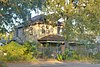
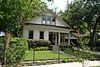
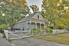
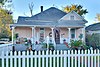
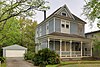
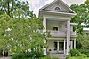
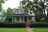
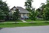
This is a list of the National Register of Historic Places in outer Harris County, Texas. It is intended to be a complete list of properties and districts listed on the National Register of Historic Places in outer portion of Harris County, Texas, United States, defined as outside the I-610 loop. The locations of National Register properties and districts may be seen in a map by clicking on "Map of all coordinates."

<span class="mw-page-title-main">National Register of Historic Places listings in inner Harris County, Texas</span>

This is a list of the National Register of Historic Places in inner Harris County, Texas, defined as within the I-610 loop within Harris County, Texas, but excluding those places in Downtown Houston and those in Houston Heights, which are listed separately.

References

  1. The latitude and longitude information provided in this table was derived originally from the National Register Information System, which has been found to be fairly accurate for about 99% of listings. Some locations in this table may have been corrected to current GPS standards.
  2. National Park Service, United States Department of the Interior, "National Register of Historic Places: Weekly List Actions", retrieved April 21, 2023.
  3. 1 2 Numbers represent an alphabetical ordering by significant words. Various colorings, defined here, differentiate National Historic Landmarks and historic districts from other NRHP buildings, structures, sites or objects.
  4. The eight-digit number below each date is the number assigned to each location in the National Register Information System database, which can be viewed by clicking the number.
  5. Allison Wollam (26 February 2006). "Ashland House demolition tees off preservationists". Houston Business Journal. Retrieved 25 April 2023. (subscription required)
  6. "Another historic building dozed: Heights landmark disappears over the weekend". Culture Map Houston. 2 July 2013.
  7. "The End for the Historic Heights Schauer Filling Station?". Swamplot. 28 June 2013.