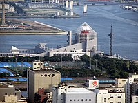
The Port of Hong Kong located by the South China Sea, is a deepwater seaport dominated by trade in containerised manufactured products, and to a lesser extent raw materials and passengers. A key factor in the economic development of Hong Kong, the natural shelter and deep waters of Victoria Harbour provide ideal conditions for berthing and the handling of all types of vessels. It is one of the busiest ports in the world, in the three categories of shipping movements, cargo handled and passengers carried. This makes Hong Kong a Large-Port Metropolis.

Jurong Port Pte Ltd is a port operator headquartered in Singapore. Jurong Port, which operates the only multi-purpose port in Singapore, handles bulk, break-bulk and containerised cargo. It handled over 40,000 vessel-calls annually in 2019.

Chennai Port, formerly known as Madras Port, is the second largest container port of India, behind Mumbai's Jawaharlal Nehru Port also known as Nhava Sheva. The port is the largest one in the Bay of Bengal. It is the third-oldest port among the 12 major ports of India with official port operations beginning in 1881, although maritime trade started much earlier in 1639 on the undeveloped shore. It is an artificial and all-weather port with wet docks. Once a major travel port, it became a major container port in the post-Independence era. An established port of trade of British India since the 1600s, the port remains a primary reason for the economic growth of Tamil Nadu, especially for the manufacturing boom in South India, and has contributed greatly to the development of the city of Chennai. It is due to the existence of the port that the city of Chennai eventually became known as the Gateway of South India.

Belfast Harbour is a major maritime hub in Belfast, Northern Ireland, handling 67% of Northern Ireland's seaborne trade and about 25% of the maritime trade of the entire island of Ireland. It is a vital gateway for raw materials, exports and consumer goods, and is also Northern Ireland's leading logistics and distribution hub.

The Port of Haydarpaşa, also known as the Port of Haidar Pasha or the Port of Istanbul, is a general cargo seaport, ro-ro and container terminal, situated in Haydarpaşa, Istanbul, Turkey at the southern entrance to the Bosphorus, near Haydarpaşa Station. It is operated by the Turkish State Railways (TCDD) and serves a hinterland which includes the country's most industrialised areas.

Great Yarmouth Outer Harbour is a port constructed on the east coast of England at Great Yarmouth. Construction work on the Outer Harbour began in June 2007. The harbour which is built in the South Denes area was planned to bring trade to the area. The plans included a container terminal and a passenger ferry terminal, but with no confirmed contracts these were not built.
The Port of Constanța is located in Constanța, Romania, on the western coast of the Black Sea, 179 nautical miles (332 km) from the Bosphorus Strait and 85 nmi (157 km) from the Sulina Branch, through which the Danube river flows into the sea. It covers 3,926 ha, of which 1,313 ha is land and the rest, 2,613 ha is water. The two breakwaters located northwards and southwards shelter the port, creating the safest conditions for port activities. The present length of the north breakwater is 8,344 m (5.185 mi) and the south breakwater is 5,560 m (3.45 mi). The Port of Constanța is the largest on the Black Sea and the 17th largest in Europe.

The Port of Iloilo is a seaport located in Iloilo City, Philippines. It serves the city, province of Iloilo, and the entire island of Panay in the Western Visayas region of the Philippines. It is located away from the older port facilities in Iloilo City Proper, on the southeastern coast of Panay, in Iloilo Strait, and one of the country’s safest and most natural harbors.

V. O. Chidambaranar Port is a port in Thoothukudi, Tamil Nadu, and is one of the 12 major ports in India. It was declared to be a major port on 11 July 1974. It is the second largest port in Tamil Nadu and third largest container terminal in India. V.O. Chidambaranar Port is an artificial port. This is the third international port in Tamil Nadu and it is second all-weather port. All V.O. Chidambaranar Port Authority's traffic handling has crossed 10 million tons from 1 April to 13 September 2008, registering a growth rate of 12.08 per cent, surpassing the corresponding previous year handling of 8.96 million tons. It has services to USA, China, Europe, Sri Lanka and Mediterranean countries. The Station Commander, Coast Guard Station Thoothukudi is located at V.O. Chidambaranar Port Authority, Tamil Nadu under the operational and administrative control of the Commander, Coast Guard Region (East), Chennai. The Coast Guard Station V.O. Chidambaranar Port Authority was commissioned on 25 April 1991 by Vice Admiral SW Lakhar, NM, VSM the then Director General Coast Guard. The Station Commander is responsible for Coast Guard operations in this area of jurisdiction in Gulf of Mannar. V.O. Chidambaranar Port Authority Thoothukudi is an ISO 9001:2008, ISO 14001:2004 and International Ship and Port Facility Security (ISPS) Code compliant port.

The Port of Odesa or Odesa Sea Port, located near Odesa, is the largest Ukrainian seaport and one of the largest ports in the Black Sea basin, with a total annual traffic capacity of 40 million tonnes, the only port of Ukraine capable of accepting Panamax class vessels. The port has an immediate access to railways allowing quick transfer of cargo from sea routes to ground transportation. Along with its younger satellite ports of Chornomorsk (1958) and Yuzhne (1973), the Port of Odesa is a major freight and passenger transportation hub of Ukraine.

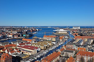
The Port of Copenhagen is the largest Danish seaport and one of the largest ports in the Baltic Sea basin. It extends from Svanemølle Beach in the north to Hvidovre in the south. Along with Malmö harbour, Copenhagen Port is operated by Copenhagen Malmö Port (CMP) and By & Havn.

The Port of Naples, a port located on the Western coast of Italy, is the 11th largest seaport in Italy having an annual traffic capacity of around 25 million tons of cargo and 500,000 TEU's. It is also serves as a tourist hub, servicing an estimated 10 million people annually transiting through the port.

The Port of Livorno is one of the largest Italian seaports and one of the largest seaports in the Mediterranean Sea, with an annual traffic capacity of around 30 million tonnes of cargo and 700,000 TEU's.
The Port of Cagliari is one of the largest Italian seaports and one of the largest seaports in the Mediterranean Sea basin, with an annual traffic capacity of around 50 million tonnes of cargo and 1,000,000 TEU's.

Port of Tanjung Priok is the busiest and most advanced seaport in Indonesia, handling more than 50% of Indonesia's trans-shipment cargo traffic. The port is located at Tanjung Priok, North Jakarta, which is operated by Indonesian state owned PT Pelindo. The port has 20 terminals for accommodating general cargo, liquid bulk, dry bulk, containers, etc. It has specialised facilities cater to oil tankers, chemical-laden ships, metal scrap and passengers.

The Port of Colombo Sinhala: කොළඹ වරාය, Tamil: கொழும்பு துறைமுகம் is the largest and busiest port in Sri Lanka and the Indian Ocean. Located in Colombo, on the southwestern shores on the Kelani River, it serves as an important terminal in Asia due to its strategic location in the Indian Ocean. During the 1980s, the port underwent rapid modernization with the installation of cranes, gantries and other modern-day terminal requirements.

Port of Baku is a sea port located in the Bay of Baku, on the coast of the city of Baku, Azerbaijan. The main entrance faces the Neftchiler Avenue.

Mundra Port is India's first private port, largest container port and largest commercial port, located on the northern shores of the Gulf of Kutch near Mundra, Kutch district, Gujarat. Formerly operated by Mundra Port and Special Economic Zone Limited (MPSEZ) owned by Adani Group, it was later expanded into Adani Ports & SEZ Limited (APSEZ) managing several ports. In FY 2020–21, Mundra Port handled 144.4 million tonnes of cargo. The port currently handles over 155 MT, which constitutes nearly 11 per cent of India’s maritime cargo. The port also handles nearly 33 per cent of India’s container traffic.

Marsa Maroc is the main operator of ports in Morocco. Its legal status is a Société Anonyme (Plc.) with an Executive board chaired by Mohammed Abdeljalil and a supervisory board chaired by the Minister of Equipment and Transport. The official company name is Société d'Exploitation des Ports while Marsa Maroc is its trading name.
Apapa Port Complex also known as the Lagos Port Complex is Nigeria's largest and busiest port complex. The complex consist of a number of facilities including Apapa quays, Third Apapa Wharf Extension, Apapa Dockyard, Apapa Petroleum Wharf, Bulk Vegetable Oil Wharf, Ijora Wharf, Kirikiri Lighter Terminal, and Lily pond inland container terminal. Financed and built by the colonial government of Nigeria, It became the nation's busiest port for exporting agricultural produce from the provinces of Western and Northern Nigeria in the late 1920s. Administration was transferred to the Nigerian government upon the granting of self-government and In 2005, the complex was divided into terminals and contracted out to private operators with NPA acting as the landlord and regulator.


