
Caloocan, officially the City of Caloocan, is a 1st class highly urbanized city in Metropolitan Manila, Philippines. According to the 2020 census, it has a population of 1,661,584 people making it the fourth-most populous city in the Philippines.

Doroteo Jose station is a station on the Manila Light Rail Transit System Line 1. Like all other Line 1 stations, Doroteo Jose station is above-ground. The station is located in Santa Cruz in Manila, on Rizal Avenue and slightly past Doroteo Jose Street. The station is named after Doroteo Jose Street, which is in turn named after a Filipino who was arrested by Spanish authorities in 1898 for leading a movement against a corrupt archbishop.

España Boulevard is an 8–lane major thoroughfare in Manila, the capital city of the Philippines, named after Spain, the country that formerly held the Philippines as an overseas territory. True to its name, several Spanish names abound the street. It starts at the Welcome Rotonda near the boundary of Quezon City and Manila and ends with a Y-intersection with Lerma and Nicanor Reyes Streets in Manila.

Santa Cruz is a district in the northern part of the City of Manila, Philippines, located on the right bank of the Pasig River near its mouth, bordered by the districts of Tondo, Binondo, Quiapo, and Sampaloc, and Grace Park (Caloocan) and La Loma. The district belongs to the 3rd congressional district of Manila in the Philippines.

R. Papa station is a station on the Manila Light Rail Transit System Line 1. Like all other Line 1 stations, R. Papa station is above-ground. The station serves Tondo in Manila and is located on Rizal Avenue Extension in Barangay Obrero, Tondo. The station is named after Ricardo Papa Street. The station is the first station in Rizal Avenue Extension going north and the last station in the city of Manila.

The MacArthur Highway, officially the Manila North Road, is a 500-kilometer (310 mi), two-to-six lane, national primary highway in Luzon, Philippines, it connects Caloocan in Metro Manila to Laoag in Ilocos Norte. It is the second longest road in the Philippines, after Maharlika Highway.

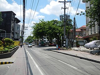
Rizal Avenue, also known as Avenida or Avenida Rizal, is one of Manila's main thoroughfares running from its Santa Cruz and Quiapo districts to the Bonifacio Monument (Monumento) Circle in Caloocan. Named after the national hero José Rizal, it is a part of Radial Road 9 (R-9). The LRT Line 1 elevated railroad is built above the street in its entire length, and several jeepneys ply the area taking passengers from Caloocan, Quezon City, and Valenzuela. Most of the street is within Santa Cruz, Manila. By the 1960s, economic activities shifted from Binondo to Makati. The avenue forms part of National Route 150 (N150) of the Philippine highway network.

Radial Road 8, more commonly referred to as R-8, is a network of roads and bridges that altogether form the eighth radial road of Manila in the Philippines. It runs north-south through northern Metro Manila linking the City of Manila with Quezon City, Caloocan, and Valenzuela into the northern provinces of Bulacan, Pampanga, Tarlac, Pangasinan, and La Union. The portion of R-8 between Guiguinto and Balintawak is also designated a component of the Pan-Philippine Highway network (AH26). It also has a spur segment in Quirino Highway from NLEX to its junction with R-7 at Commonwealth Avenue, both in Quezon City.

Circumferential Road 3 (C-3), informally known as the C-3 Road, is a network of roads and bridges that all together form the third beltway of Metro Manila in the Philippines. Spanning some 32.5 kilometers (20.2 mi), it connects the cities of Caloocan, Makati, Navotas, Pasay, Quezon City, and San Juan.
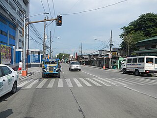
Samson Road is a major east–west street in Caloocan, northern Metro Manila, Philippines. The road is a continuation of Epifanio de los Santos Avenue (EDSA), linked to it via the Bonifacio Monument Roundabout (Monumento) to form a single through route. These roads form part of Circumferential Road 4 (C-4) of the Metro Manila Road Network.

Paterio Aquino Avenue is the main street in Malabon, northern Metro Manila, Philippines. It runs from Caloocan beginning at the intersection with C-4 Road and terminating at F. Sevilla Boulevard at the Malabon City Hall roundabout. It is named for Paterio Aquino who served as municipal mayor of Malabon from 1946-1951 and 1956–1959. The street is sometimes called Letre Road, named for the old barrio in Malabon through which it passes. The section west of Tonsuya Bridge in Barangays San Agustin and Tañong in Malabon is alternatively named as Rizal Avenue Extension.

Blumentritt Road is a major road in Manila, Philippines. It runs through the border of the City of Manila with Quezon City from Rizal Avenue in Santa Cruz district to G. Tuazon Street in Sampaloc district. The road also forms the southern boundary of the Manila North Cemetery. It is named after Bohemian professor and filipinologist, Ferdinand Blumentritt.

Abad Santos Avenue is a major north–south arterial road located in the district of Tondo in northern Manila, Philippines. It is a divided roadway with four lanes in each direction running through the eastern edge of Tondo from the intersection with Rizal Avenue near the Manila Chinese Cemetery at its north end to Recto Avenue near the Tutuban railway station at the district boundary of Tondo and Binondo at the south.
Maysan Road is one of the main east–west thoroughfares of Valenzuela, Philippines. It is a narrow street with only one lane in each direction making it one of the most congested streets in northern Metro Manila. It runs for approximately 4.5 kilometers (2.8 mi) from MacArthur Highway in barangay Malinta, past the North Luzon Expressway intersection, into North Caloocan. The road connects the central Valenzuela barangays of Malinta, Maysan, Paso de Blas, and Bagbaguin. It was the main access road for vehicles going to Valenzuela and the Manila North Harbor from the North Luzon Expressway prior to the construction of NLEX Segment 9, which parallels it to the south.

San Lazaro Tourism and Business Park is the marketing name given to the 16-hectare (40-acre) multiple use site under development by the Manila Jockey Club Investments Corp. in Manila, Philippines. It takes its name from the old San Lazaro Hippodrome, a horse racetrack that stood on the site from 1912 to 2003. Currently, the site includes the SM City San Lazaro shopping center, the two-tower Vertex office complex, the three-tower Celadon Park and Celadon Residences, and the five-tower Avida Towers San Lazaro condominium complex. It has been declared a tourism economic zone with information technology component in 2009.
The Andres Bonifacio Avenue, also known as A. Bonifacio Avenue, is a 3.784-kilometer (2.351 mi), national secondary road connecting the North Luzon Expressway and Epifanio de los Santos Avenue at Balintawak Interchange in Quezon City and Blumentritt Road at the city's boundary with Manila in a north–south direction.

Glorieta Park, sometimes spelled Glorietta Park, is an urban park in Caloocan, northern Metro Manila, the Philippines. It is situated at the border between the villages of Barangay 187 and Barangay 188 in the former Tala Estate in North Caloocan close to the boundary with San Jose del Monte, Bulacan. The park is one of three city-owned parks in Caloocan under the management of the Caloocan Parks Administration Services, the others being the Buena Park and Sports Complex in South Caloocan and the Caloocan Amparo Nature Park in eastern Tala, North Caloocan.

Governor Pascual railway station is a railway station of the Philippine National Railways (PNR), the current terminus of the Metro North Commuter and the North Shuttle line. It is located and situated adjacent to Governor Pascual Avenue, Barangay Acacia in Malabon, Metro Manila.

Barangay BF Homes Caloocan or Barangay 169 is a barangay of Caloocan, Metro Manila, Philippines. The barangay is known for having jurisdiction of the larger portions of the Banco Filipino-developed real estate projects in Northern Manila, and is considered the most affluent barangay in Caloocan.

10th Avenue, formerly known as Macario Asistio Sr. Avenue or simply Asistio Avenue, is an undivided four-lane street in Caloocan, Metro Manila, Philippines that stretches east–west, bisecting south Caloocan. Like most avenues in the Grace Park area, it crosses a grid system of numbered streets that run from north to south, with other numbered avenues running from east to west. 10th Avenue was formally renamed as "Asistio Avenue" prior to the reversion of its current name, owing to it being the tenth avenue running east–west from the city's border with Manila in the south. The former renaming was done in 1984 to honor the former Mayor of Caloocan who served from 1962 to 1971 and the father of another Caloocan mayor Boy Asistio, but has since been disregarded and reverted.
