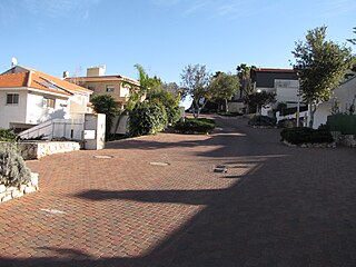
Kfar Vradim is a town in northern Israel, with a population of 5,562 in 2022. It is situated south of Ma'alot-Tarshiha and about 14 kilometres (8.7 mi) south of the border with Lebanon. Kfar Vradim is close to Ma'alot-Tarshiha, Karmiel and Nahariya. In 2018 it had a population of 5800.

Highway 5 or the Trans-Samaria Highway, is one of Israel's main highways, connecting the Mediterranean coast immediately north of Tel Aviv with the central Sharon plain and eastwards to Ariel and other Israeli settlements in the northern West Bank.
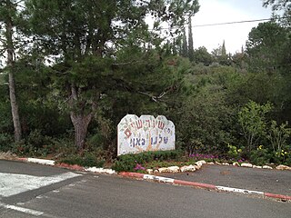
Shorashim is a community settlement in northern Israel. Located in the lower Galilee and affiliated with the Conservative movement, it falls under the jurisdiction of Misgav Regional Council. In 2022 its population was 599.

Highway 10 is a road in the South District of Israel. It is one of the longest routes in Israel, extending for nearly the entire border of Israel with Egypt from the Gaza Strip in the north to Sayarim junction in the south. Under a military security advisory, its entire 113-mile length is almost permanently off-limits to civilian traffic.
Highway 31 is an inter-city highway in southern Israel. It begins at Lakiya Interchange with Highway 6 at Lakiya. It passes through Hura, Kuseife, Arad, and it terminates at Zohar Junction with Highway 90 south of Neve Zohar just west of the Dead Sea.

Highway 92 is a north-south highway in northeastern Israel. It follows the eastern edge of the Kinneret from Ma'agan junction in the south at Highway 98 to Yehudiya junction in the north at Highway 87. It is 26.15 km long.

The Petroleum Road or Tapline Road is a 47 km (29 mi) long, privately owned north-south asphalt road in the Golan Heights. The name Petroleum Road derives from the now defunct oil pipeline of the Trans-Arabian Pipeline Company, which the road runs adjacent to. It begins near Mount Peres on the east edge of the central Golan and ends in the northern Golan near the Israeli-occupied Golan-Lebanese frontier, nearby Ghajar.

Highway 85 is an east-west highway in Northern Israel. It is one of the most important roads through the Galilee, connecting western and eastern Galilee. The road begins in Akko on the west coast of Israel and ends in the east just north of Lake Kinneret.

Highway 67 is a highway, 76 km in length, running through the Western Galilee region in the Northern District of Israel. It connects the Mount Carmel region east of Zikhron Ya'akov to the Lower Galilee, Kiryat Ata, and Shlomi near Israel's border with Lebanon. The highway runs concurrently with Highway 6 for 2.5 km between Ein Tut Interchange and Elyakim Interchange and for 4 km between Tel Qashish and Ha'Amakim Interchange, then with Highway 75 for 4 km between Ha'Amakim Interchange and Yagur Junction, then again with Highway 6 for 5 km between Givot Alonim Interchange and Somekh Interchange.

Highway 73 is a highway in the Jezreel Valley in northern Israel. It proceeds from the Nahalal junction in the west toward the Adashim junction in the east. It is 12 km long.
Route 899 is an east-west regional highway in the Upper Galilee in northern Israel. For almost its entire length of 63 km, it proceeds parallel to the nearby border between Israel and Lebanon. In Israel, Route 899 is commonly known as the "northern route".
Route 866 is a north-south regional highway in northern Israel. It begins at Hananya junction with Highway 85 in the south and ends at Meron junction with Highway 89 in the north.

Route 505 is a regional Israeli highway in the West Bank.

Migdal Tefen is an industrial council in the Upper Galilee, which contains only industrial plants. Within the council's area, there is a light industry and high-tech industry zone, an industrial park, the Tefen Open Museum, a rehabilitation center called Gesher, and also several restaurants. The jurisdiction area of the council extends over 2,700 dunams. It is located about 6 kilometers from Ma'alot-Tarshiha and about 17 kilometers from Karmiel, between the moshav Lapidot to the south and the community settlement Kfar Vradim to the north, and Druze villages that are located to its west and east. The head of the council, as of July 2023, is Faiz Hana.
Highway 989 is a regional route in the northern Golan, connecting Sa'ar on Highway 99 with Majdal Shams on Highway 98.
Route 204 is a regional road in the Negev, Israel. It starts at the Halukim junction with Highway 40, passes by the town of Yeruham and ends at the Dimona junction on Highway 25, near Dimona.

The Petroleum Road or Tapline Road is a transverse road that was paved in 1941 by the Iraq Petroleum Company, hence its name. Today the route is marked as Route 224 in the western part connecting the Negev junction to Yeruham, a short section on Route 204 in the middle, and Route 225 in the eastern part, from Yeruham to HaMakhtesh HaGadol. Added to these is a dirt road about two kilometres long inside HaMakhtesh HaGadol.
Route 222 is a regional arterial road in the Negev that connects the Mash'abim Junction within the Ramat Negev Regional Council and the Gvulot Junction within the Eshkol Regional Council. The length of the road is 46 km (29 mi).

Route 234 is a regional highway in the western part of the northern Negev leading from the Tze'elim junction to the Re'im junction in the Gaza Envelope. Its length is about 23.5 km (14.6 mi).


