
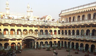
Deoband is a town and a municipality in Saharanpur district in the state of Uttar Pradesh, India, about 150 km from Delhi. Darul Uloom Deoband, an Islamic seminary and one of the largest Islamic Institutions of India is located there.
Muzaffarnagar is a city under Muzaffarnagar district in the Indian State of Uttar Pradesh. It is situated midway on the Delhi - Haridwar/Dehradun National Highway and is also well connected with the national railway network. It is known as the sugarbowl of Uttar Pradesh.

Yamunanagar, is a city and a municipal corporation in Yamunanagar district in the Indian state of Haryana. This town is known for the cluster of plywood units and paper factories. It provides timber to larger industries. The older town is called Jagadhri. The Yamunanagar-Jagadhri railway station (YJUD) services the city. Despite its name, Jagadhri Railway is situated in Yamunanagar. There is also another railway station called Jagadhri Workshop in Yamunanagar.
Saharanpur is a city and a municipal corporation in Uttar Pradesh, India. It is also the administrative headquarters of Saharanpur district.

Khalilabad is a city and a municipal board in Sant Kabir Nagar district in the Indian state of Uttar Pradesh. It is the district headquarters of Sant Kabir Nagar district.
Baghpat is a city in the Indian state of Uttar Pradesh. It is the administrative headquarters of Bagpat district, which was established in 1997. It is part of the National Capital Region, surrounding New Delhi.

Robertsganj also known as Sonbhadra City is a city and a municipal board in Sonbhadra district in the Indian state of Uttar Pradesh.
Chandpur is a town and a municipal board in Bijnor district in the Indian state of Uttar Pradesh, India.
Chhibramau is a "Nagar Palika Parishad" and a Subdivision(Tehsil) of Kannauj district in the northern state of Uttar Pradesh, India.
Chhutmalpur is a town in Saharanpur district in the state of Uttar Pradesh, India.
Gursarai is a city and municipal board in the Jhansi district of the Indian state of Uttar Pradesh. Gursarai is situated in the Garautha Tehsil. An emerging city in Jhansi District With having an old and established market, it's a lifeline for the nearby village people who come and sell their farm produces.
Kandhla is a town, near Shamli City and municipal board in Shamli District in the Indian state of Uttar Pradesh.
Maudaha is a city and a Municipal Board in Hamirpur district, Uttar Pradesh, India.
Noorpur is a City and a Municipal Board in Bijnor District in the Indian State of Uttar Pradesh.

Shamli is a city and the headquarters of Shamli district, in the Indian state of Uttar Pradesh. It is a part of Delhi NCR and is an administrative subdivision under Saharanpur division.
Tundla is a town and a municipal board in Firozabad district in the Indian state of Uttar Pradesh.
Loni is a town, near Ghaziabad city in Ghaziabad district in the state of Uttar Pradesh, India and Loni town is governed by Loni Municipal Council which comes under Ghaziabad Metropolitan Region.
Ghatampur is a town and a municipal board in Kanpur Nagar district in the state of Uttar Pradesh, India. It is just 45 minutes away from the main industrial and educational hub of the state Kanpur at a distance of 40 km.
Civil Aviation Department, Haryana is a Ministry and department of the Government of Haryana in India.
Saluni is a village in the Saharanpur district of Uttar Pradesh, India. It is located in the Saharanpur tehsil. The nearest post office is Sarsawa. It comes under Saluni Panchayath and belongs to Saharanpur Division. It is located 14 km towards west from District headquarters Saharanpur. 576 km from State capital Lucknow.


