
Kahurangi National Park in the northwest of the South Island of New Zealand is the second largest of the thirteen national parks of New Zealand. It was gazetted in 1996 and covers 5,193 km2 (2,005 sq mi), ranging from the Buller River near Murchison in the south, to the base of Farewell Spit in Golden Bay in the north. The park has no single dominant landform, but includes an unusually wide variety of landscapes, including mountain ranges, rivers, gorges, raised peneplains and karst features such as caves and arches. Many of the landforms within the park are considered to be nationally or internationally significant.

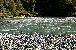
The Aorere River is in the Tasman District of the South Island of New Zealand that flows from headwaters in the alpine regions of the Kahurangi National Park. It has a catchment area of 573 km2 (221 sq mi), representing around 11% of the total area of Kahurangi National Park. The river flows generally northwards for 40 km (25 mi) before draining into Golden Bay at the town of Collingwood. The Heaphy Track's northeastern end is in the upper valley of the Aorere.

The Heaphy Track is a popular tramping and mountain biking track in the north west of the South Island of New Zealand. It is located within the Kahurangi National Park and classified as one of New Zealand's ten Great Walks by the Department of Conservation. Named after Charles Heaphy, the track is 78.4 kilometres (48.7 mi) long and is usually walked in four or five days. The track is open for shared use with mountain bikers in the winter season from 1 May to 30 September each year. The southern end of the track is at Kōhaihai, north of Karamea on the northern West Coast, and the northern end is in the upper valley of the Aorere River, Golden Bay.
Mount Owen is in the Tasman District of the South Island of New Zealand. It stands at 1875 metres (6150 feet) above sea level and is part of the Marino Mountains. Mount Owen is the tallest mountain found in Kahurangi National Park.

The Owen River is located in the northwest of New Zealand's South Island. This short river is an upper tributary of the Buller River. It flows 20 km (12 mi) south from its headwaters on the slopes of Mount Owen in Kahurangi National Park, and then into the Buller at the small settlement of Owen River 18 km (11 mi) northeast of Murchison.
Kahurangi Point is a headland on the West Coast of New Zealand's South Island, overlooking the Tasman Sea. It is located in Kahurangi National Park between Karamea and Farewell Spit.

The Tākaka River lies in the northwest of New Zealand's South Island. It runs north for 70 kilometres, entering Golden Bay near the town of Tākaka.
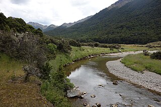
Lake Matiri is a lake adjoining Kahurangi National Park in the northwest corner of New Zealand's South Island. The lake is part of the Matiri River.
The Mōkihinui River is a river located on the West Coast of New Zealand's South Island, about 40 kilometres north of Westport. Meridian Energy had proposed the Mokihinui Hydro project on the river in 2007 but it was cancelled in May 2012. In 2019, it was announced that 64,400 ha of land in the Mōkihinui River catchment, including 15 km (9.3 mi) of river bed, would be added to Kahurangi National Park.

Kahurangi Taylor is a New Zealand model and beauty pageant titleholder who represented New Zealand at Miss World 2008 in South Africa.
The Cobb River is a river in the Tasman Region of New Zealand. It flows southeast from Lake Cobb on the northern slopes of Mount Cobb, in Kahurangi National Park, in the northwestern South Island. The river's waters are captured behind a dam to become the Cobb Reservoir; the outflow continues to join with the Tākaka River. The river is named for J.W. Cobb, a local mill owner.
The Kahurangi River is a short river in the northwest of New Zealand's South Island. It flows through the northwest of the Kahurangi National Park, reaching the Tasman Sea just to the south of Kahurangi Point.

The Wangapeka River is a river of the Tasman Region of New Zealand's South Island. It rises in two branches, the North Branch and the South Branch, in the Matiri Range within Kahurangi National Park, meeting some 25 kilometres southeast of Karamea. It flows generally northeast to reach the Motueka River 30 kilometres south of Motueka.
The Rocky River is a minor river in Kahurangi National Park in the South Island of New Zealand.
The Waingaro River is a river of the Tasman Region of New Zealand's South Island.

The Cobb Reservoir is a hydro storage lake fed by the Cobb River in the Tasman District of the South Island of New Zealand. The reservoir feeds the Cobb Power Station and is 819 metres (2,687 ft) above sea level but drops significantly with low rainfall. Cobb Reservoir is the highest hydro storage lake in New Zealand, and is entirely surrounded by Kahurangi National Park.

The Lewis River is a tributary of the Heaphy River in New Zealand's Kahurangi National Park.

Kahurangi Marine Reserve is a marine reserve administered by the Department of Conservation, covering 8,419 hectares offshore of Kahurangi National Park in the Buller District of New Zealand's West Coast Region.
Westhaven Marine Reserve is a marine reserve covering an area of 536 hectares in the Whanganui Inlet at the top of New Zealand's South Island. It was established in 1994 and is administered by the Department of Conservation.

The Wangapeka Track is a tramping track in the north-west of the South Island of New Zealand. It is one of the main tramping tracks in the Kahurangi National Park, a protected area managed by the Department of Conservation. The route traverses the southern end of the park, from the historic Wangapeka goldfields area west of Tapawera, to the coastal plains of the West Coast at Little Wanganui. The route is 59 km (37 mi) long, and crosses the Wangapeka and Little Wanganui saddles, each over 1,000 m (3,300 ft) in elevation. The track passes through the valleys of the Wangapeka River, Karamea River, Taipō River and Little Wanganui River. The majority of the track is in river valleys and under forest cover, with small sections in tussock land at Stag Flat and the Little Wanganui Saddle. It typically takes walkers 4–6 days to complete the route.


