
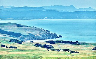
Karamea is a town on the West Coast of the South Island of New Zealand. It is the northernmost settlement of any real size on the West Coast, and is located 96 kilometres (60 mi) northeast by road from Westport. Apart from a narrow coastal strip, the town of Karamea and its local area are completely surrounded to the south, east and north by Kahurangi National Park.

The Ahaura River is in the South Island of New Zealand. This river drains the western flanks of the Southern Alps and flows into the Grey River.

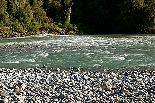
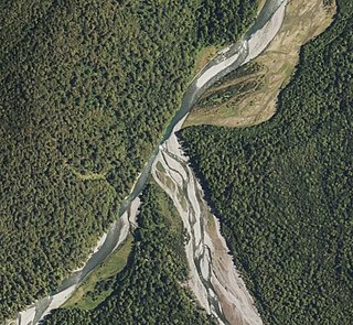
The Buller River is a river in the South Island of New Zealand. The Buller has the highest flow of any river in the country during floods, though it is only the 13th longest river; it runs for 177 km (110 mi) from Lake Rotoiti through the Buller Gorge and into the Tasman Sea near the town of Westport. A saddle at 710 m (2,330 ft) separates the Buller from the Motupiko River and that is divided from the Wairau River by a 695 m (2,280 ft) saddle, both aligned along the Alpine Fault, as is the top of the Buller valley.

The Heaphy Track is a popular tramping and mountain biking track in the north west of the South Island of New Zealand. It is located within the Kahurangi National Park and classified as one of New Zealand's ten Great Walks by the Department of Conservation. Named after Charles Heaphy, the track is 78.4 kilometres (48.7 mi) long and is usually walked in four or five days. The track is open for shared use with mountain bikers in the winter season from 1 May to 30 September each year. The southern end of the track is at Kōhaihai, north of Karamea on the northern West Coast, and the northern end is in the upper valley of the Aorere River, Golden Bay.

The Taieri River is the fourth-longest river in New Zealand and is in Otago in the South Island. Rising in the Lammerlaw Range, it initially flows north, then east around the Rock and Pillar range before turning southeast, reaching the sea 30 kilometres (19 mi) south of Dunedin.

The Ōhikanui River is a tributary of the Buller River in New Zealand's South Island. It flows north for 30 km (19 mi), joining the Buller 20 km (12 mi) from its outflow into the Tasman Sea. It and its smaller neighbour the Ōhikaiti River are often called the Big Ohika River and Little Ohika River respectively. Another variation is Ohika-nui. Ōhikanui River has been the official name since 21 June 2019.
The Waihou River is located in the northern North Island of New Zealand. Its former name, Thames River, was bestowed by Captain James Cook in November 1769, when he explored 14 mi (23 km) of the river from the mouth. An older Māori name was "Wai Kahou Rounga". A 1947 Geographic Board enquiry ruled that the official name would be Waihou.

The Manawatū River is a major river of the lower North Island of New Zealand. The river flows from the Ruahine Ranges, through both the Manawatū Gorge and the city of Palmerston North, and across the Manawatū Plains to the Tasman Sea at Foxton.
The Mōkihinui River is a river located on the West Coast of New Zealand's South Island, about 40 kilometres north of Westport. Meridian Energy had proposed the Mokihinui Hydro project on the river in 2007 but it was cancelled in May 2012. In 2019, it was announced that 64,400 ha of land in the Mōkihinui River catchment, including 15 km (9.3 mi) of river bed, would be added to Kahurangi National Park.

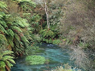
The Gunner River is a river on the West Coast of New Zealand. It rises in the Domett Range in the Kahurangi National Park and flows north-west into the Heaphy River, which flows into the Tasman Sea.

The Hāpuku River begins in the Seaward Kaikōura Range of New Zealand and flows south-east to enter the South Pacific at Hapuka, between Clarence and Kaikōura. The name comes from the Māori word hāpuku or hāpuka, a deep-water marine fish. Its main tributary is the Puhi Puhi River.
The Hinemoatū / Howard River is a river of the northern South Island of New Zealand. A tributary of the Buller River, the Hinemoatū/Howard starts at the confluence of the Hodgson and Tier Streams in the Travers Range of Nelson Lakes National Park, flowing north between Lakes Rotoroa and Rotoiti, before reaching the Buller between Kawatiri and Saint Arnaud. Close to its confluence with the Buller, the river is bridged by State Highway 63 and further up by Howard Valley Road.

The Mangapōike River is a river beginning in the Gisborne Region of New Zealand's North Island. It flows generally southwest from sources south of Waingake, reaching the Wairoa River in Hawke's Bay 10 kilometres (6 mi) northeast of Frasertown. Mangapōike River was Gazetted as an official name on 28 November 2022.

The Tangahoe River is a river of the Taranaki Region of New Zealand's North Island. It flows generally southwest from its origins in hill country to the east of Lake Rotorangi, reaching the Tasman Sea in the South Taranaki Bight 5 km (3.1 mi) southeast of Hāwera.

The Waitangitāhuna River are two rivers in the West Coast region of New Zealand's South Island. It was a single river until an avulsion in March 1967, when it became two rivers. Since then, the southern portion of the river has flowed into Lake Wahapo, while the northern section discharges into the Tasman Sea north of Ōkārito Lagoon.
The Stanley River is a river of the Tasman Region of New Zealand's South Island. It flows southeast from its sources in the Douglas and Anatoki Ranges, reaching the Waingaro River 12 kilometres west of Upper Takaka.
The Waingaro River is a river of the Tasman Region of New Zealand's South Island.

The Lewis River is a tributary of the Heaphy River in New Zealand's Kahurangi National Park.
Herangi Range is a range of hills south of Marokopa and north of Awakino, in the Waikato region of New Zealand, reaching to the Tasman Sea at Tapirimoko, Tirua, Taungaururoa, Te Mauku and Ngarupupu Points. Just to the south of Ngarupupu, the Waikawau River enters the sea. Other rivers draining the range are Mangaotaki River, Awakino River and Manganui River. Herangi is part of the Whareorino conservation area.
The Tūtaekurī River starts near the Hope Pass, in the Southern Alps and flows north-west to join the Ahaura River. The Ahaura joins the Grey River which flows to the Tasman Sea at Greymouth. Tūtaekurī River has been its official name since 21 June 2019. Tūtae kurī is a grass with the latin name agropyron multiflorum.


