
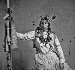
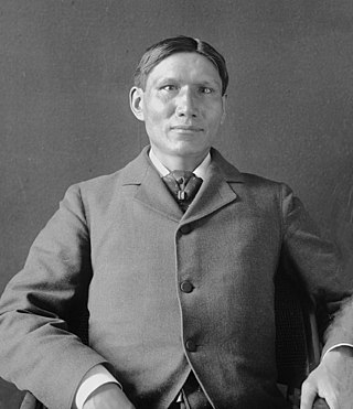
The Crow, whose autonym is Apsáalooke, also spelled Absaroka, are Native Americans living primarily in southern Montana. Today, the Crow people have a federally recognized tribe, the Crow Tribe of Montana, with an Indian reservation, the Crow Indian Reservation, located in the south-central part of the state.

The Battle of the Little Bighorn, known to the Lakota and other Plains Indians as the Battle of the Greasy Grass, and commonly referred to as Custer's Last Stand, was an armed engagement between combined forces of the Lakota Sioux, Northern Cheyenne, and Arapaho tribes and the 7th Cavalry Regiment of the United States Army. It took place on June 25–26, 1876, along the Little Bighorn River in the Crow Indian Reservation in southeastern Montana Territory. The battle, which resulted in the defeat of U.S. forces, was the most significant action of the Great Sioux War of 1876.

Crow Agency is a census-designated place (CDP) in Big Horn County, Montana, United States and is near the actual location for the Little Bighorn National Monument and re-enactment produced by the Real Bird family known as Battle of the Little Bighorn Reenactment. The population was 1,616 at the 2010 census. It is the governmental headquarters of the Crow Native Americans. It is also the location of the "agency offices" where the federal Superintendent of the Crow Indian Reservation and his staff interacts with the Crow Tribe, pursuant to federal treaties and statutes.

The Little Bighorn River is a 138-mile-long (222 km) tributary of the Bighorn River in the United States in the states of Montana and Wyoming. The Battle of the Little Bighorn, also known as the Battle of the Greasy Grass, was fought on its banks on June 25–26, 1876, as well as the Battle of Crow Agency in 1887.

The Bighorn Mountains are a mountain range in northern Wyoming and southern Montana in the United States, forming a northwest-trending spur from the Rocky Mountains extending approximately 200 mi (320 km) northward on the Great Plains. They are separated from the Absaroka Range, which lie on the main branch of the Rockies to the west, by the Bighorn Basin. Much of the land is contained within the Bighorn National Forest.

Arthur's Pass National Park is located in the South Island of New Zealand and covers 1,185 km2 of mostly mountainous terrain. Adjacent to it lies Craigieburn Forest Park. The park is administered by the Department of Conservation.
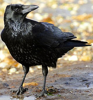
A crow is a bird of the genus Corvus, or more broadly, a synonym for all of Corvus. The word "crow" is used as part of the common name of many species. The related term "raven" is not linked scientifically to any certain trait but is rather a general grouping for larger-sized species of Corvus.
Little Crow III was a Mdewakanton Dakota chief who led a faction of the Dakota in a five-week war against the United States in 1862.

The Hunkpapa are a Native American group, one of the seven council fires of the Lakota tribe. The name Húŋkpapȟa is a Lakota word, meaning "Head of the Circle". By tradition, the Húŋkpapȟa set up their lodges at the entryway to the circle of the Great Council when the Sioux met in convocation. They speak Lakȟóta, one of the three dialects of the Sioux language.

The Crow River is a tributary of the Mississippi River in south-central Minnesota in the United States. It drains a watershed of 2,756 square miles (7,140 km2).

The Crow Indian Reservation is the homeland of the Crow Tribe. Established 1868, the reservation is located in parts of Big Horn, Yellowstone, and Treasure counties in southern Montana in the United States. The Crow Tribe has an enrolled membership of approximately 11,000, of whom 7,900 reside in the reservation. 20% speak Crow as their first language.

Kaposia or Kapozha was a seasonal and migratory Dakota settlement, also known as "Little Crow's village," once located on the east side of the Mississippi River in present-day Saint Paul, Minnesota. The Kaposia band of Mdewakanton Dakota was established in the late 18th century and led by a succession of chiefs known as Little Crow or "Petit Corbeau." After a flood in 1826, the band moved to the west side of the river, about nine miles below Fort Snelling.
The Dakota are a Native American tribe and First Nations band government in North America. They compose two of the three main subcultures of the Sioux people, and are typically divided into the Eastern Dakota and the Western Dakota.
The Anti Crow River is a small river located in Arthur's Pass National Park, Canterbury, New Zealand. It is a tributary of the Waimakariri River and is named because its valley is opposite that of the Crow River. Mount Damfool is at the head of the Anti Crow River valley.
The Crow River is a river in Arthur's Pass National Park, Canterbury, New Zealand. It arises near Mount Rolleston and flows south into the Waimakariri River.
The Crow River is a river located in Kahurangi National Park in the West Coast Region of New Zealand. It arises in the Wharepapa / Arthur Range and flows south-west and then north-west into the Karamea River. The river may be named after the South Island kōkako, sometimes called the orange-wattled crow.


