
Tasman District is a local government district in the northwest of the South Island of New Zealand. It borders the Canterbury Region, West Coast Region, Marlborough Region and Nelson City. It is administered by the Tasman District Council, a unitary authority, which sits at Richmond, with community boards serving outlying communities in Motueka and Golden Bay / Mohua. The city of Nelson has its own unitary authority separate from Tasman District, and together they comprise a single region in some contexts, but not for local government functions or resource management (planning) functions.

Motueka is a town in the South Island of New Zealand, close to the mouth of the Motueka River on the western shore of Tasman Bay. It is the second largest in the Tasman Region, with a population of 8,320 as of June 2023.

The Otago Gold Rush was a gold rush that occurred during the 1860s in Central Otago, New Zealand. This was the country's biggest gold strike, and led to a rapid influx of foreign miners to the area – many of them veterans of other hunts for the precious metal in California and Victoria, Australia.
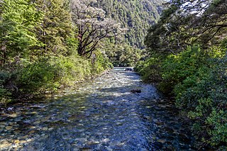
The Motueka River is located in the north of the South Island of New Zealand and is a popular tourist destination for watersports and fishing. The Motueka flows 116 kilometres (72 mi) from the mountains 40 km west of the city of Nelson in the southeast of the catchment and flows north to the Tasman Bay.

Tapawera is a small town in the Tasman District of New Zealand's South Island. It is located 76 km southwest of Nelson and 48 km southeast of Motueka. It is situated on the Motueka Valley Highway by the banks of the Motueka River.

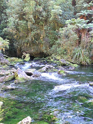
The Riuwaka River, formerly known as the Riwaka River, is located in the Nelson region in the northwest of New Zealand's South Island. It flows for 20 kilometres, entering Tasman Bay close to the town of Riwaka, 10 kilometres north of Motueka.
Tasman Bay, originally known in English as Blind Bay, is a large V-shaped bay at the north end of New Zealand's South Island. Located in the centre of the island's northern coast, it stretches along 120 kilometres (75 mi) of coastline and is 70 kilometres (43 mi) across at its widest point. It is an arm of the Tasman Sea, lying on the western approach to Cook Strait.
The Little Pokororo River is a river of the Tasman Region of New Zealand's South Island. Like its neighbour the Pokororo River it is a tributary of the Motueka River, which it meets 15 kilometres southwest of Motueka.
The Motupiko River is a river of the Tasman Region of New Zealand's South Island. A major tributary of the Motueka River, it flows north from its origins southeast of the Hope Saddle, meeting the Motueka at Kohatu Junction, 15 kilometres west of Wakefield. The Motupiko's tributaries include the Rainy River.
The Pearse River is a river of the Tasman Region of New Zealand's South Island. It flows east from sources in the Wharepapa / Arthur Range, reaching the Motueka River 20 kilometres southwest of Motueka.
The Pokororo River is a river of the Tasman Region of New Zealand's South Island. It flows southeast from the Wharepapa / Arthur Range to reach the Motueka River 15 kilometres southwest of the town of Motueka.
The Rolling River is a short river of the Tasman Region of New Zealand's South Island. It is formed by the confluence of several streams - Nuggety Creek, Blue Creek, and Granity Creek - and flows north to reach the Wangapeka River 12 kilometres north of Mount Owen.
The Sherry River is a river in New Zealand's Tasman Region. It flows north from its origins in the Hope Range to meet the Wangapeka River eight kilometres from the latter's outflow into the Motueka River.
The Dart River arises in the Kahurangi National Park between the Lookout and Hope Ranges in the Tasman Region of New Zealand. It flows northward to join the Wangapeka River, which is a tributary of the Motueka River.
The Taipō River is a river of the northern West Coast Region of New Zealand's South Island. It flows east from its sources at Mount Zetland, fed by many streams draining the north side of the Allen Range to reach the Karamea River 25 kilometres southeast of Karamea.

State Highway 60 is a state highway servicing the far northwest of the South Island of New Zealand. Running between the settlements of Richmond and Collingwood, it is 116 kilometres (72 mi) long and lies entirely within the Tasman District. It is the northernmost highway in the South Island and is a popular tourist route, servicing Motueka, Abel Tasman National Park, Golden Bay, and Farewell Spit.

Little Wanganui is a dairy-farming village on the West Coast of the South Island of New Zealand, on the Little Wanganui River. It is 77 kilometres (48 mi) north of Westport and 21 kilometres (13 mi) south of Karamea, at the opposite end of the Karamea Beach. The settlement has a pub, community hall, and volunteer fire brigade, and in 2013 the population was 207. There is a surfing beach, and the Little Wanganui River is popular for whitebaiting and fishing for brown trout.
State Highway 61 (SH 61) is a former New Zealand state highway in the Tasman Region of the South Island. It links the coastal town of Motueka with SH 6, the main route to the South Island's West Coast. Along with several other state highways, its status was revoked at the beginning of the 1990s. The route is now usually referred to as the Motueka Valley Highway.
Woodstock is a small settlement in the Tasman District of the northern South Island of New Zealand. It is located on the Motueka Valley Highway, close to the eastern bank of the Motueka River, some 20 kilometres southwest of Motueka, at the junction of the Motueka River and its small tributary, the Dove River.

The Wangapeka Track is a tramping track in the north-west of the South Island of New Zealand. It is one of the main tramping tracks in the Kahurangi National Park, a protected area managed by the Department of Conservation. The route traverses the southern end of the park, from the historic Wangapeka goldfields area west of Tapawera, to the coastal plains of the West Coast at Little Wanganui. The route is 59 km (37 mi) long, and crosses the Wangapeka and Little Wanganui saddles, each over 1,000 m (3,300 ft) in elevation. The track passes through the valleys of the Wangapeka River, Karamea River, Taipō River and Little Wanganui River. The majority of the track is in river valleys and under forest cover, with small sections in tussock land at Stag Flat and the Little Wanganui Saddle. It typically takes walkers 4–6 days to complete the route.


