The Monongahela National Forest is a national forest located in the Allegheny Mountains of eastern West Virginia, USA. It protects over 921,000 acres of federally owned land within a 1,700,000 acres proclamation boundary that includes much of the Potomac Highlands Region and portions of 10 counties.
The Potomac Heritage Trail, also known as the Potomac Heritage National Scenic Trail or the PHT, is a designated National Scenic Trail corridor spanning parts of the mid-Atlantic and upper southeastern regions of the United States that will connect various trails and historic sites in the states of Virginia, Maryland, and Pennsylvania and the District of Columbia. The trail network includes 710 miles (1,140 km) of existing and planned sections, tracing the outstanding natural, historical, and cultural features of the Potomac River corridor, the upper Ohio River watershed in Pennsylvania and western Maryland, and a portion of the Rappahannock River watershed in Virginia. The trail is managed by the National Park Service.
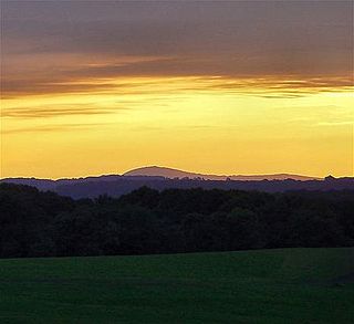
Sugarloaf Mountain is a small mountain and park about 10 miles (16 km) south of Frederick, Maryland, USA. The closest village is Barnesville, located just over one mile from the foot of the mountain. The peak of this relatively low mountain is approximately 800 feet higher than the surrounding farmland. It is visible from many parts of northern Montgomery County and southern Frederick County, notably from I-270 north of the town of Germantown. Because of its geological and natural history interest, it was designated a National Natural Landmark in 1969. It is a notable example of an admission-free, privately owned scenic park.

Cass Scenic Railroad State Park is a state park located in Cass, Pocahontas County, West Virginia.

The Bluestone River is a tributary of the New River, 77 mi (124 km) long, in southwestern Virginia and southern West Virginia in the United States. Via the New, Kanawha and Ohio rivers, it is part of the watershed of the Mississippi River. An 11 mi (18 km) portion of its lower course in West Virginia is designated as the Bluestone National Scenic River.
The Potomac Highlands of West Virginia centers on five West Virginian counties in the upper Potomac River watershed in the western portion of the state's Eastern Panhandle, bordering Maryland and Virginia. Because of geographical proximity, similar topography and landscapes, and shared culture and history, the Potomac Highlands region also includes Pocahontas, Randolph, and Tucker counties, even though they are in the Monongahela River or New River watersheds and not that of the Potomac River.
The Washington Heritage Trail is a 136.0-mile (218.9 km) National Scenic Byway through the easternmost counties of West Virginia's Eastern Panhandle. The trail forms a loop through the three counties and traces the footsteps of George Washington and the marks his family left in the Eastern Panhandle. In addition to homes and sites related to the Washingtons, the Washington Heritage Trail also includes various museums, historic districts, parks, and other sites of historic significance in the area.
West Virginia Route 150 is a 22.5-mile (36.2 km) long north–south scenic state highway in the Marlinton and Gauley Ranger Districts of the Monongahela National Forest in southeast West Virginia. The southern terminus of the route is at West Virginia Route 39 and West Virginia Route 55 northwest of Mill Point. The northern terminus is at U.S. Route 219 and WV 55 north of Edray, near Marlinton.

Cass is a census-designated place (CDP) on the Greenbrier River in Pocahontas County, West Virginia, USA. As of the 2010 census, its population was 52. The town, founded in 1901, was named for Joseph Kerr Cass, vice president and cofounder of the West Virginia Pulp and Paper Company.

The Bluestone National Scenic River protects a 10.5-mile (16.9 km) section of the Bluestone River in Summers and Mercer counties of southern West Virginia. It was created 26 October 1988 under the Wild and Scenic Rivers Act and is protected by the National Park Service.
The Great Eastern Trail is a north-south hiking route that runs roughly 1,600 miles (2,600 km) through the Appalachian Mountains west of the Appalachian Trail in the eastern United States. As of 2019, it is still under development. From south to north, it runs from Flagg Mountain through Alabama, Georgia, Tennessee, Kentucky, West Virginia, Virginia, Maryland, and Pennsylvania, ending in western New York state. A connection from Flagg Mountain south to the Florida-Georgia border is considered "Phase II Development".

The Durbin and Greenbrier Valley Railroad is a heritage and freight railroad in the U.S. states of Virginia and West Virginia. It operates the West Virginia State Rail Authority-owned Durbin Railroad and West Virginia Central Railroad, as well as the Shenandoah Valley Railroad in Virginia. Beginning in 2015, DGVR began operating the historic geared steam-powered Cass Scenic Railroad, which was previously operated by the West Virginia Division of Natural Resources as part of Cass Scenic Railroad State Park.

Glen Jean is a census-designated place (CDP) in Fayette County, West Virginia, United States, near Oak Hill. As of the 2010 census, its population is 210.

Copper Hill is an unincorporated community in Floyd County, Virginia, United States.
U.S. Route 40 Scenic (US 40 Scenic) is a scenic route of US 40 in the U.S. state of Maryland. US 40 Scenic, which is known for most of its route as National Pike, is the old alignment of US 40 over Town Hill in eastern Allegany County and Sideling Hill in far western Washington County. The highway was originally constructed as part of a turnpike connecting Baltimore with the eastern end of the National Road at Cumberland in the early 19th century. The highway was paved as a modern road in the mid-1910s and designated US 40 in the late 1920s. US 40 was relocated over Sideling Hill in the early 1950s and over Town Hill in the mid-1960s. The US 40 Scenic designation was first applied to the old highway over Town Hill in 1965. Following the completion of Interstate 68 (I-68) at Sideling Hill, US 40 Scenic was extended east along old US 40's crossing of the mountain in the late 1980s. US 40 Scenic is the only scenic route in the U.S. Highway System; formerly, there was a second, US 412 Scenic in Oklahoma, but this has since been redesignated to a more conventional "Alternate" route.
A National Scenic Area in the United States is a federally designated area of outstanding natural and scenic value that receives a level of protection that is less stringent than wilderness designation. Scenic areas are typically occupied or used in some manner by people and either cannot be considered for wilderness designation, or are seen as suitable for a wider range of uses than those permitted under wilderness designation.
Scenic Brook is a neighborhood located in southwest Austin, Texas. Scenic Brook is located in ZIP codes 78735 and 78736. The boundaries are the intersections of Highway 290 and Highway 71 to on the north, south, and east sides, and Covered Bridge Drive and Scenic Brook Drive on the west side. The Pinnacle Campus of Austin Community College is a landmark on the southeast side of the neighborhood.