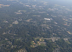
Severn | |
---|---|
Coordinates: 39°7′58″N76°41′38″W / 39.13278°N 76.69389°W | |
Country | United States |
State | Maryland |
County | Anne Arundel |
Area | |
• Total | 18.34 sq mi (47.50 km2) |
• Land | 18.34 sq mi (47.50 km2) |
• Water | 0.00 sq mi (0.00 km2) |
Elevation | 161 ft (49 m) |
Population (2020) | |
• Total | 57,118 |
• Density | 3,114.39/sq mi (1,202.48/km2) |
Time zone | UTC−5 (EST) |
• Summer (DST) | UTC−4 (EDT) |
ZIP code | 21144 |
Area code(s) | 410, 443, and 667 |
FIPS code | 24-71150 |
GNIS feature ID | 0591249 |
Severn is a census-designated place (CDP) in Anne Arundel County, Maryland, United States. According to the 2020 U.S. census, the population of Severn is 57,118, [2] a 22.6% increase from 44,231 in 2010. The zip code is 21144.
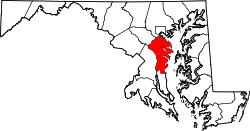
Severn is located at 39°7′58″N76°41′38″W / 39.13278°N 76.69389°W (39.132841, −76.694002) [3] in northwestern Anne Arundel County. It is bordered by Hanover to the north, Glen Burnie to the east, Odenton and Millersville to the south, and Fort George G. Meade to the west. The Baltimore–Washington Parkway (Maryland Route 295) forms the northwestern edge of the CDP, Maryland Route 176 (Dorsey Road) forms the northern edge, and Interstate 97 forms the eastern edge. Part of the southern boundary of the CDP is formed by the non-tidal portion of the Severn River. The Maryland Route 100 freeway runs through the northern part of the CDP, connecting the B-W Parkway and I-97.
According to the United States Census Bureau, the CDP has a total area of 17.7 square miles (45.9 km2), all of it land. [4]
Climate data for Severn, MD | |||||||||||||
---|---|---|---|---|---|---|---|---|---|---|---|---|---|
Month | Jan | Feb | Mar | Apr | May | Jun | Jul | Aug | Sep | Oct | Nov | Dec | Year |
Average high °F (°C) | 42 (6) | 45 (7) | 54 (12) | 65 (18) | 74 (23) | 82 (28) | 86 (30) | 84 (29) | 77 (25) | 67 (19) | 56 (13) | 46 (8) | 65 (18) |
Average low °F (°C) | 27 (−3) | 29 (−2) | 36 (2) | 45 (7) | 55 (13) | 63 (17) | 68 (20) | 66 (19) | 59 (15) | 48 (9) | 39 (4) | 32 (0) | 47 (8) |
Source: WeatherSpark [5] |
Census | Pop. | Note | %± |
---|---|---|---|
1980 | 20,147 | [6] | — |
1990 | 24,499 | [7] | 21.6% |
2000 | 35,076 | [7] | 43.2% |
2010 | 44,231 | [8] | 26.1% |
2020 | 57,118 | [9] | 29.1% |
In 2021, ACS estimated that 53,955 people lived in Severn, the racial breakdown of which is 46.8% White alone, 31.2% Black, 8.8% Asian, 7.6% Hispanic (of any race), 0.1% Native American, and 5.8% two or more races. [10] The population density is 3,114.39 inhabitants per square mile (1,202.47/km2).
It was also estimated (as of 2021) that there are 21,106 housing units in Severn, with an average density of 1,150.82 per square mile (444.33/km2). The median household income is $115,481. [11]
Students who live in Severn may attend any public high school in the Anne Arundel County Public Schools district. The high school feeder districts in Severn include Glen Burnie High School, Old Mill High School and Meade High School. [12]
Anne Arundel County, also notated as AA or A.A. County, is located in the U.S. state of Maryland. As of the 2020 United States census, its population was 588,261, an increase of just under 10% since 2010. Its county seat is Annapolis, which is also the capital of the state. The county is named for Anne Arundell, Lady Baltimore, a member of the ancient family of Arundells in Cornwall, England, and the wife of Cecilius Calvert, 2nd Baron Baltimore (1605–1675), founder and first lord proprietor of the colony Province of Maryland.
Arden on the Severn is a census-designated place (CDP) in Anne Arundel County, Maryland. The population was 1,880 at the 2020 census. Its homes offer residents private waterfront beaches including private docks and boat slips as well as access to four private community beaches.
Arnold, a census-designated place (CDP) in Anne Arundel County, Maryland, United States, located just outside of the state's capital, Annapolis. It is located 18.78 miles south of Baltimore, and 29.97 miles east of Washington, D.C. The population was 23,106 at the 2010 census. Neighborhoods straddle College Parkway and Maryland Route 2. Arnold is located on the scenic Broadneck Peninsula. The ZIP code is 21012. It is bordered by Severna Park to the northwest, Cape Saint Claire to the southeast, Annapolis to the southwest, and Lake Shore to the northeast.
Brooklyn Park is a census-designated place (CDP) in Anne Arundel County, Maryland, United States. The population was 14,373 at the 2010 census.
Crownsville is a census-designated place (CDP) in Anne Arundel County, Maryland, United States. The population was 1,757 at the 2010 census. It hosts the Anne Arundel County Fair each September, as well as the annual Maryland Renaissance Festival for several summer weekends. A state psychiatric hospital was formerly in Crownsville. The area offers waterfront scenery and easy access to urban metropolitan areas and culture.
Ferndale is a census-designated place (CDP) in Anne Arundel County, Maryland, United States. At the 2010 census, the population was 16,746.
Fort Meade is a census-designated place (CDP) in Anne Arundel County, Maryland, United States. The population was 9,327 at the 2010 census. It is the home to the National Security Agency, Central Security Service, United States Cyber Command and the Defense Information Systems Agency, which are located on the U.S. Army post Fort George G. Meade.
Glen Burnie is an unincorporated town and census-designated place (CDP) in Anne Arundel County, Maryland, United States. It is a suburb of Baltimore. The population was 72,891 at the 2020 census.
Herald Harbor is a census-designated place and an unincorporated community in Anne Arundel County, Maryland, United States. As of the 2010 census, the population was 2,603. It is a quiet residential area with a scenic view of the Severn River and is near the community of Crownsville and Interstate 97. Herald Harbor is known for its area immediately along the Severn River known as Long Point on the Severn, a fairly affluent neighborhood composed mainly of retired and wealthy land owners.
Lake Shore is a census-designated place and unincorporated community in Anne Arundel County, Maryland, United States, located east of Pasadena. The population of Lake Shore was 19,477 at the 2010 census.
Linthicum is a census-designated place (CDP) and unincorporated community in Anne Arundel County, Maryland, United States. The population was 10,324 at the 2010 census. It is located directly north of Baltimore–Washington International Thurgood Marshall Airport (BWI).
Maryland City is a census-designated place (CDP) in Anne Arundel County, Maryland, United States. The population was 16,093 at the 2010 census. It is located east of Laurel, just over the border with Prince George's County, and it has a Laurel ZIP Code. Maryland City mostly consists of an older, compact housing development and is adjacent to Fort Meade army base. A large newer development on the north side of Maryland Route 198 is known as Russett and is included within the Maryland City CDP.
Odenton is a census-designated place (CDP) in Anne Arundel County, Maryland, United States, located approximately 10–20 minutes from the state capital, Annapolis. The population was 37,132 at the 2010 census, up from 20,534 at the 2000 census. The town's population growth rate of 80.8% between 2000 and 2010 was the greatest of any town in western Anne Arundel County. Odenton is located west of Annapolis, south of Baltimore, and northeast of Washington.
Parole, a suburb of Annapolis, is a census-designated place (CDP) in Anne Arundel County, Maryland, United States. The population was 15,922 at the 2010 census. It has several major roads intersect at the western edge of the state capital, Annapolis, and it contains the Annapolis Mall, a number of other large shopping centers, and the Anne Arundel Medical Center. It is generally considered to be part of Annapolis, rather than a separate town. The neighborhood was named because it was a parole camp, where Union and Confederate prisoners of war were brought for mutual exchange and eventual return to their respective homes.
Pasadena is a census-designated place (CDP) in Anne Arundel County, Maryland, United States. The population was 24,287 at the 2010 census.
Severna Park is a census-designated place (CDP) in Anne Arundel County, Maryland, United States. Severna Park is part of the Baltimore-Washington Metropolitan Area, and is located approximately 8 miles (13 km) north of Annapolis, 17 miles (27 km) south of Baltimore and 39 miles (63 km) east of Washington, D.C. Severna Park's population was 39,933 at the 2020 census.
South Gate was a census-designated place (CDP) in Anne Arundel County, Maryland, United States, for the 2000 census, at which time its population was 28,672. It was added primarily to the Glen Burnie CDP for the 2010 census.
Arbutus is an unincorporated community and a census-designated place in Baltimore County, Maryland, United States. The population was 20,483 at the 2010 census. The census area also contains the communities of Halethorpe and Relay, in which all three names were used during the 1960 census when the area had a population of 22,402.
Baltimore Highlands is a census-designated place (CDP) in Baltimore County, Maryland, United States, directly south of the city of Baltimore. The population was 7,019 at the 2010 census. At the 2000 census and earlier, the area was delineated as part of the Lansdowne-Baltimore Highlands CDP.
Anne Arundel County Public Schools is the public school district serving Anne Arundel County, Maryland. With over 80,000 students, the AACPS school system is the 4th largest in Maryland and the 39th largest in the United States. The district has over 5,000 teachers supporting a comprehensive curriculum from Pre-K through 12th grade.