
The Mohawk River is a 149-mile-long (240 km) river in the U.S. state of New York. It is the largest tributary of the Hudson River. The Mohawk flows into the Hudson in Cohoes, New York, a few miles north of the city of Albany. The river is named for the Mohawk Nation of the Iroquois Confederacy. It is a major waterway in north-central New York. The largest tributary, the Schoharie Creek, accounts for over one quarter (26.83%) of the Mohawk River's watershed. Another main tributary is the West Canada Creek which makes up for 16.33% of the Mohawk's watershed.

The Catskill Mountains, also known as the Catskills, are a physiographic province of the larger Appalachian Mountains, located in southeastern New York. As a cultural and geographic region, the Catskills are generally defined as those areas close to or within the borders of the Catskill Park, a 700,000-acre (2,800 km2) forest preserve forever protected from many forms of development under New York state law.

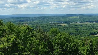
North Mountain is a peak in the Catskill Mountains of New York, on the border between the towns of Catskill and Hunter, in Greene County. It is part of the Catskill Escarpment. Cairo Round Top is located northeast and Artists Rock is located southeast of North Mountain.
Taconic State Park is located in Columbia and Dutchess County, New York abutting Massachusetts and Connecticut within the Taconic Mountains. The state park is located off New York State Route 344 south of Interstate 90 and 110 miles (180 km) north of New York City. It features camping, hiking, bicycling, hunting, cross county skiing and other recreational opportunities.

Esther Mountain is a mountain located in Essex County, New York. The mountain is the northernmost of the High Peaks of the Adirondack Mountains and its 28th highest peak. It was the only High Peak named for a woman until 2014, having been named in honor of Esther McComb, who made the first recorded climb to the summit in 1839, at age 15; at the time she was attempting to climb Whiteface Mountain from the north.

Hough Peak is a mountain located in Essex County, New York. The mountain, part of the Dix Range, is named after Franklin B. Hough (1822–1885), the first chief of the United States Division of Forestry, and sometimes called the "father of American forestry". Hough Peak is flanked to the north by Dix Mountain, and to the south by South Dix.

Table Top Mountain is a mountain located in Essex County in the U.S. State of New York. Table Top Mtn. is flanked to the north by Phelps Mountain, and to the south by Mount Marcy. Table Top has three summits; the southernmost is the highest, followed by the middle peak at 4,308 ft (1,313 m) and the north peak at 4,216 ft (1,285 m).

Gore Mountain is a mountain located near the village of North Creek in Warren County, New York, of which its peak is the highest point. Gore is flanked to the north by South Mountain, and to the southwest by Height of Land Mountain. The mountain is the site of the popular Gore Mountain ski resort.

Vly Mountain is a mountain located in the town of Halcott, New York, United States in Greene County. The mountain is part of the Catskill Mountains. Vly Mountain is flanked to the northwest by Bearpen Mountain, to the east by Vinegar Hill, to the northeast by Kipp Hill, and to the southeast by Beech Ridge.

Eagle Mountain is a mountain located in Ulster County, New York. The mountain is part of the Catskill Mountains. Eagle Mountain is flanked to the north by Haynes Mountain, to the southwest by Doubletop Mountain and Graham Mountain, and to the southeast by Big Indian Mountain.

Table Mountain is located in Ulster County, New York. The mountain is part of the Catskill Mountains. Table Mountain is flanked to the south by Peekamoose Mountain, and to the northeast by Lone Mountain.
Mount Raimer, 2,572 feet (784 m), is a prominent peak in the Taconic Mountains of western Massachusetts and adjacent New York. The west side and summit are located in New York; the east slopes lie within Massachusetts. The summit ridge is part meadow and part wooded with red spruce, balsam fir, and northern hardwood tree species. It is notable for its views of the Hoosic River valley and Hudson River Valley. The 35 mi (56 km) Taconic Crest Trail traverses the mountain. Much of the upper slopes and summit are within protected conservation land. The mountain is the location of a defunct ski area.
Rounds Mountain, 2,257 feet (688 m), is a prominent peak in the Taconic Mountains of western Massachusetts and adjacent New York. The west side of the mountain and summit are located in New York; the east side is located within Massachusetts. The summit a bald; the slopes are wooded with northern hardwood tree species. It is notable for its views of the Hudson River Valley to the west and the Green River and Kinderhook Creek valleys of Hancock, Massachusetts to the east. The 35 mi (56 km) Taconic Crest Trail traverses the mountain. Much of the upper slopes and summit are within protected conservation land.

Brace Mountain is the peak of a ridge in the southern Taconic Mountains, near the tripoint of the U.S. states of New York, Connecticut and Massachusetts. Its 2,311-foot (704 m) main summit is located in New York; it is the highest point in that state's Dutchess County.
White Rock, 2,550 feet (780 m), is the high point on a 7 mi (11 km) ridgeline in the Taconic Mountains. The ridge is located in the tri-state corner of New York, Massachusetts, and Vermont in the towns of Petersburgh, Williamstown, and Pownal. The ridge has several distinct knobs; those with names are, from south to north: White Rocks, 2,365 feet (721 m); Smith Hill, 2,330 feet (710 m); White Rock, the high point 2,550 feet (780 m); and Bald Mountain 2,485 feet (757 m). The Snow Hole, located along the ridgeline between Bald Mountain and the White Rock, is a crevasse in which snow can be found well into the summer.
Mount Peter is a 1,250-foot (380 m) mountain located in the New York – New Jersey Highlands, Bellvale Mountain, in the U.S. state of New York. The peak is located along the Appalachian Trail in the Town of Warwick, just south of New York State Route 17A, 38 miles (61 km) northwest of New York City, 2 miles (3.2 km) east of Bellvale, New York and north northwest of Greenwood Lake, New York.

Jay Mountain is the 79th highest peak of the Adirondack Mountains. It is located in Essex County, New York, in the Jay Mountain Wilderness Area, within the towns of Jay and Lewis.
Evergreen Mountain is a mountain located in Greene County, New York north of Spruceton, New York. Herdman Brook drains the southeastern portion of the mountain and flows south before converging with West Kill. West Kill flows westwards, south of Evergreen Mountain and the Schoharie Creek flows eastwards, north of the mountain.

Huntersfield Mountain is a mountain located in the Catskill Mountains of New York north-northwest of Ashland. Ashland Pinnacle is located east, and Tower Mountain is located south-southeast of Huntersfield Mountain. It is the highest point in Schoharie County and it is ranked 9 of 62 on the list of New York County High Points.
Richmond Mountain is a mountain located in the Catskill Mountains of New York east-northeast of Hunter. Richtmyer Peak is located northeast, Bump Mountain is located south, Steenburg Mountain is located north, and Ashland Pinnacle is located west-southwest of Richmond Mountain.


