St Austell Clay Pits

Last updated
St Austell Clay Pits
Site of Special Scientific Interest
Cornwall UK mainland location map.svg
Red pog.svg
Location within Cornwall
England location map.svg
Red pog.svg
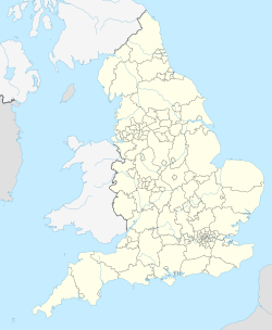
St Austell Clay Pits (England)
Area of Search Cornwall
Grid reference SW996587
Coordinates 50°23′37″N4°49′12″W / 50.3935°N 4.8201°W / 50.3935; -4.8201 Coordinates: 50°23′37″N4°49′12″W / 50.3935°N 4.8201°W / 50.3935; -4.8201
InterestBiological
Area0.6 hectares (0.006 km2; 0.002 sq mi)
Notification 2000 (2000)
Natural England website

St Austell Clay Pits, (Cornwall, England, UK,) are a group of locations within active china clay quarries that form a single Site of Special Scientific Interest (SSSI) and Special Area of Conservation, noted for its biological characteristics. In particular, the site is known for the rare western rustwort, a plant that grows only at two other sites in the UK.

Contents

Geography

The 0.6-hectare (1.5-acre) SSSI, notified in 2000, comprises three separate sites that are all about 4 miles (6.4 km) north of the town of St Austell. [1] [2] They all lie within china clay workings which are still active and are situated on either pits, spoil tips or vegetation-covered granitic debris. [3] The combined site is also designated a Special Areas of Conservation (SAC). [4]

Wildlife and ecology

The SSSI owes its importance to a rare liverwort, the western rustwort ( Marsupella profunda ), which in the UK can be found only at this site and at two others: Lower Bostraze and Leswidden and Tregonning Hill SSSIs, both within Cornwall, to the west. It is mostly found growing in moist conditions on micaceous or clay waste substrates with no or little sloping, as well as on soft or crumbling granite rocks. [3] [5]

Lansalon Pit, within St Austell Clay Pits Important Plant Area Lansalon Pit - geograph.org.uk - 974096.jpg
Lansalon Pit, within St Austell Clay Pits Important Plant Area

Owing to the presence of the rare western rustwort, Plantlife has designated a large area of active and disused mine workings in the St Austell area as an Important Plant Area, with the same name as the SSSI. [6] This area includes all the SSSI sites, as well as many others. [7] It is thought that the protected areas will act as a source for colonisation for the western rustwort to other locations in the surrounding china clay area. [5]

See also

Related Research Articles

River Camel river in the United Kingdom

The River Camel is a river in Cornwall, England, United Kingdom. It rises on the edge of Bodmin Moor and with its tributaries its catchment area covers much of North Cornwall. The river flows into the eastern Celtic Sea between Stepper Point and Pentire Point having covered about 30 miles. The river is tidal upstream to Egloshayle and is popular for sailing, birdwatching and fishing. The name Camel comes from the Cornish language for 'the crooked one', a reference to its winding course. Historically the river was divided into three named stretches. Heyl was the name for the estuary up to Egloshayle, the River Allen was the stretch between Egloshayle and Trecarne, whilst the Camel was reserved for the stretch of river between its source and Trecarne.

River Fal river in Cornwall, England

The River Fal flows through Cornwall, England, rising at Pentevale on Goss Moor and reaching the English Channel at Falmouth. On or near the banks of the Fal are the castles of Pendennis and St Mawes as well as Trelissick Garden. The River Fal separates the Roseland peninsula from the rest of Cornwall. Like most of its kind on the south coast of Cornwall and Devon, the Fal estuary is a classic ria, or drowned river valley. The Fal estuary from Tregony to the Truro River was originally called Hafaraell.

Porthleven town, civil parish and fishing port near Helston in Cornwall, England

Porthleven is a town, civil parish and fishing port near Helston in Cornwall, England. It is the most southerly port on the island of Great Britain, and was originally developed as a harbour of refuge, when this part of the Cornish coastline was recognised as a black spot for wrecks in the days of sail. The South West Coast Path, which follows the coast from Somerset to Dorset passes through the town. An electoral ward called Porthleven and Helston South also exists. The population at the 2011 census was 3,059.

Par, Cornwall small fishing port in Cornwall,UK

Par is a village and fishing port with a harbour on the south coast of Cornwall, England, United Kingdom. The village is situated in the civil parish of Tywardreath and Par, although West Par and the docks lie in the parish of St Blaise.

Lower Bostraze and Leswidden SSSI

Lower Bostraze And Leswidden SSSI is a biological Site of Special Scientific Interest, located on the Penwith Peninsula, Cornwall, England, a little to the east of St Just, approximately 8 km west of Penzance.

Marsupella profunda, the western rustwort, is a liverwort endemic to Europe and known only from Portugal,, Spain and Great Britain (Cornwall).

St Dennis, Cornwall village and civil parish in Cornwall, England

St Dennis is a civil parish and village in Cornwall, England, United Kingdom. The village is situated on the B3279 between Newquay and St Austell.

St Stephen-in-Brannel village in the United Kingdom

St Stephen-in-Brannel is a civil parish and village in mid Cornwall, England, United Kingdom. St Stephen village is four miles (6.5 km) west of St Austell on the southern edge of Cornwall's china clay district. Other settlements in the parish include Whitemoor, Currian Vale and Nanpean. The population of the civil ward at the 2011 census was 7,119. An electoral ward also exists simply bearing the name St. Stephen. The population at the same census was 4,772 only. It follows therefore that the ward is not as big as the parish.

Treverbyn human settlement in United Kingdom

Treverbyn is a civil parish and village in mid-Cornwall, England, United Kingdom.

Redlake Meadows & Hoggs Moor

Redlake Meadows & Hoggs Moor is a Site of Special Scientific Interest (SSSI), noted for its biological characteristics, in Cornwall, England, UK. Within the SSSI is Redlake Cottage Meadows nature reserve owned by the Cornwall Wildlife Trust.

Tregonning Hill hill in the United Kingdom

Tregonning Hill is the westerly of two granite hills overlooking Mount's Bay in west Cornwall, England, United Kingdom, the other being Godolphin Hill. They are approximately 6 kilometres (3.7 mi) west of the town of Helston. The Plymouth chemist William Cookworthy mixed china stone with kaolin, mined from the hill to make Plymouth porcelain; which was the first time porcelain was made in Europe. Part of the hill is designated as a Site of Special Scientific Interest (SSSI) and at the date of notification (1994) was the only known site of western rustwort in Great Britain.

St Austell River river in the United Kingdom

The St Austell River properly known as the River Vinnick, but historically called The White River, is a 12 kilometres (7.5 mi) long river located in south Cornwall, England, United Kingdom. 50.337°N 4.793°W. The river has also been known as the "red river" due to tin streaming and mining activity upstream.

Godrevy Head to St Agnes

Godrevy Head to St Agnes is a coastal Site of Special Scientific Interest (SSSI) in north Cornwall, England, UK, noted for both its biological and geological characteristics. A number of rare and scarce plant species can be found on the site, along with many breeding seabirds.

Kennack to Coverack

Kennack to Coverack is a coastal Site of Special Scientific Interest (SSSI) on the Lizard Peninsula in Cornwall, England, UK, noted for both its biological and geological interest. It is of botanical importance, with 8 Red Data Book of rare and endangered plant species being found on the site as well as other nationally scarce varieties.

Polruan to Polperro human settlement in United Kingdom

Polruan to Polperro is a coastal Site of Special Scientific Interest (SSSI) and Special Area of Conservation (SAC) in south-east Cornwall, England, UK, noted for its biological interest. It contains a wide variety of plant species and is a site for populations of breeding birds.

Penhale Sands

Penhale Sands, or Penhale Dunes, is a complex of sand dunes and a protected area for its wildlife, on the north Cornwall coast in England, UK. It is the most extensive system of sand dunes in Cornwall and is believed to be the landing site of Saint Piran. Dating from the 6th century, St Piran's Oratory is thought to be one of the oldest Christian sites in Britain. The remains were discovered in the late 18th century, and in 2014 the covering sand was removed to reveal a building more than a thousand years old, in a reasonable state of preservation. A restricted military area dating from 1939, Penhale Camp, is found on the northern part of the dunes.

Phoenix United Mine mine in the United Kingdom

Phoenix United Mine is a disused 19th century copper and tin mine in Cornwall, England, UK. Heavy metals left over in the soil from the mining operations have allowed mosses and lichens to flourish, and today the site is a Site of Special Scientific Interest (SSSI), noted for its biological characteristics.

Mulberry Downs Quarry is a disused opencast quarry, mining tin, in Cornwall, England, UK. The site is a Site of Special Scientific Interest (SSSI), noted for its geological characteristics.

West Cornwall Bryophytes Site of Special Scientific Interest Seven locations of former mining activity in western Cornwall, England

The West Cornwall Bryophytes Site of Special Scientific Interest is a group of seven locations of former mining activity, that form a single SSSI and Important Plant Area in western Cornwall, England, United Kingdom. The site is noted for its biological characteristics and derives its name from the rare bryophyte species found there.

References

  1. "St Austell Clay Pits map". Natural England . Retrieved 10 January 2012.
  2. Ordnance Survey: Landranger map sheet 200 Newquay & Bodmin ISBN   978-0-319-22938-5
  3. 1 2 "St Austell Clay Pits" (PDF). Natural England. 2000. Retrieved 10 January 2012.
  4. "St Austell Clay Pits". Joint Nature Conservation Committee . Retrieved 12 January 2012.
  5. 1 2 "1390 Western rustwort". Joint Nature Conservation Committee . Retrieved 12 January 2012.
  6. "St Austell Clay Pits". Plantlife . Retrieved 12 January 2012.
  7. "St Austell Clay IPA map" (PDF). Plantlife. 2010. Retrieved 12 January 2012.