Site of Special Scientific Interest | |
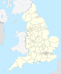
Location | Cornwall |
---|---|
Grid reference | SW771572 |
Coordinates | 50°22′22″N5°08′07″W / 50.3728°N 5.1353°W Coordinates: 50°22′22″N5°08′07″W / 50.3728°N 5.1353°W |
Interest | Biological |
Area | 1,070.4 hectares (2,650 acres) |
Notification | 1953 |
Natural England website |
Penhale Sands (Cornish : Peran Treth, meaning St Piran's sands), or Penhale Dunes, is a complex of sand dunes and a protected area for its wildlife, on the north Cornwall coast in England, UK. It is the most extensive system of sand dunes in Cornwall and is believed to be the landing site of Saint Piran. Dating from the 6th century, St Piran's Oratory is thought to be one of the oldest Christian sites in Britain. The remains were discovered in the late 18th century, and in 2014 the covering sand was removed to reveal a building more than a thousand years old, in a reasonable state of preservation. [1] A restricted military area dating from 1939, Penhale Camp, is found on the northern part of the dunes.
The area has been designated as a Site of Special Scientific Interest (SSSI) since 1953 and became a Special Area of Conservation (SAC) in 2004. [2] [3] The South West Coast Path runs through the dunes.
The sands are located 5 miles (8.0 km) south-west of the town of Newquay, in the civil parish of Perranzabuloe, stretching for over 2.5 miles (4.0 km) between Perranporth in the south and Holywell to the north, with the Atlantic Ocean and Perran Beach to the west. The Cornish sand dunes are thought to have formed over 5,000 years ago as sea levels rose to approximately their present levels. [4] Penhale Sands are the largest dune system within Cornwall and has a maximum depth of 48 metres (157 ft) of sand. [2] The system, of over 650 hectares (1,600 acres), extends for more than 1 mile (1.6 km) inland and includes Reen Sands, Gear Sands and Perransands. [4] [5]
The South West Coast Path runs through the dunes. [5]
Penhale Sands and Perran Beach are believed to be the 6th century landing site of Saint Piran from Ireland, regarded the bringer of Christianity to, and the patron saint of Cornwall. [6] On this site, situated in a hollow, St Piran's Oratory was built around this time. It is thought to be the oldest Christian site in Cornwall and one of the oldest in Britain. The church was abandoned in the tenth century due to the encroachment of sand. A replacement church was built further inland and abandoned in 1795. [7] The oratory site was excavated in 1835 and 1843 before the remains were encased in a large concrete structure in 1910. The concrete structure was removed in 1980 and the delicate site buried in sand for its protection. [8] In 2014 the sand was removed to reveal the remains of the church. [1]
Penhale Camp was established in 1939, to the north of the dunes, as a World War II emergency measure to train anti-aircraft gunners. There still remains evidence of the gun sites, searchlight batteries and defensive positions such as pillboxes and trenches. [9] On 7 June 1940 the camp was bombed by a single German bomber, probably looking for the nearby St Eval airfield; twenty-two British soldiers were killed in the raid, most were subsequently buried in nearby Perranporth. [10] In 1943 the camp was occupied by the United States Army Corps of Engineers [11] as part of the buildup to Operation Overlord, the D-Day landings. The engineers built the fourteen Nissen huts on the Camp; still used today as accommodation for training units. In 1955, three Royal Artillery men drowned while swimming in the sea at Perran Corner. These dangerous waters, with treacherous rip tides, have also claimed the lives of at least two civilians.
The sand dunes have for many years been used by naturists, as an unofficial naturist beach. Over the years, the Ministry of Defence have complained about nude sunbathers, but a compromise was reached with the land owner in 2007 [12]
In April 2010, the camp was closed by the Ministry of Defence [13] and was sold in September that year for £1.5million. [9] [14] However, the area is still governed by Ministry of Defence Byelaws [15] [16] Today, Penhale Camp and the associated training area are available to all Arms and Services wishing to carry out low level infantry skills training, cadre courses, communications and CPX training. The surrounding area provides opportunities for all recognised adventurous training activities and the newer extreme sports such as power kiting and coasteering. Now established in Penhale Camp is EBO Adventure Centre which provides a diverse range of training activities including Military Resettlement.[ citation needed ]
In 1953 the area was designated as the Perran Dunes Site of Special Scientific Interest (SSSI), changed to Penhale Dunes in 1967 after a site expansion. It is designated because it is an outstanding example of a sand dune system and has a rich flora, including four very rare species of plants and other rarities. [2] In 2004 it was designated as a Special Area of Conservation (SAC). [3] The SSSI is contiguous with Kelsey Head SSSI, to the north. [17]
The dune soil is calcareous because of the high percentage of seashell fragments which leads to a flora with lime-loving plants that are otherwise rare in Cornwall. The flora also includes at least sixty-six species of moss, making it one of richest sites in Cornwall. A number of rare plant species have been recorded on the site, these include Babington's leek ( Allium babingtonii ), brackish water buttercup ( Ranunculus baudotii ), Cornish gentian ( Gentianella anglica subsp. cornubiensis), fragrant evening-primrose ( Oenothera stricta ), Italian lords-and-ladies ( Arum italicum ), Portland spurge ( Euphorbia portlandica ), shore-dock ( Rumex rupestris ), slender spike rush ( Eleocharis acicularis ), variegated horsetail ( Equisetum variegatum ) and wild leek ( Allium ampeloprasum ). [2] Due to its importance as a site for lichens and rare plant species, Plantlife has designated the dunes an Important Plant Area. [18]
It is also an important site for its insect fauna, especially Lepidoptera, with the silver-studded blue butterfly sometimes counted in thousands. Twenty-seven species of butterfly and one hundred and seven species of moth have been recorded on the dunes. [2] [19] The exclusion of the public in the restricted military area of Penhale Camp has protected the nature conservation interest of this area. [20]
Penhale Sands is home to a high frequency receiver station forming part of the Defence High Frequency Communications Service. The station is operated by Babcock International Group on behalf of the Ministry of Defence. [21]
Penhale Sands is said to be the site of the legendary sunken town of Langarroc. On stormy nights the bells of Langarroc's seven churches are still heard to toll beneath the dunes. [22]
Saint Piran or Pyran, died c. 480, was a 5th-century Cornish abbot and saint, possibly of Irish origin. He is the patron saint of tin-miners, and is also generally regarded as the patron saint of Cornwall, although Saint Michael and Saint Petroc also have some claim to this title.
The South West Coast Path is England's longest waymarked long-distance footpath and a National Trail. It stretches for 630 miles (1,014 km), running from Minehead in Somerset, along the coasts of Devon and Cornwall, to Poole Harbour in Dorset. Because it rises and falls with every river mouth, it is also one of the more challenging trails. The total height climbed has been calculated to be 114,931 ft (35,031 m), almost four times the height of Mount Everest. It has been voted 'Britain's Best Walking route' twice in a row by readers of The Ramblers' Walk magazine, and regularly features in lists of the world's best walks.
Perranporth is a seaside resort town on the north coast of Cornwall, England, United Kingdom. It is 1 mile east of the St Agnes Heritage Coastline, and around 8 miles south-west of Newquay. Perranporth and its 2 miles (3 km) long beach face the Atlantic Ocean. It has a population of 3,066, and is the largest settlement in the civil parish of Perranzabuloe. It has an electoral ward in its own name, whose population was 4,270 in the 2011 census.
St Erth is a civil parish and village in Cornwall, England.
Lower Bostraze And Leswidden SSSI is a biological Site of Special Scientific Interest, located on the Penwith Peninsula, Cornwall, England, a little to the east of St Just, approximately 8 km west of Penzance.
Gwithian is a coastal village in west Cornwall, England. It is three miles (5 km) north-east of Hayle and four miles (6.5 km) east of St Ives, Cornwall across St Ives Bay. Gwithian is in the civil parish of Gwinear-Gwithian.
Braunton Burrows is a sand dune system on the North Devon coast. It is privately owned and forms part of the Christie Devon Estates Trust. Braunton Burrows is a prime British sand dune site, the largest sand dune system (psammosere) in England. It is particularly important ecologically because it includes the complete successional range of dune plant communities, with over 470 vascular plant species. The short turf communities are very rich in lichens and herbs, and the dune slacks are also rich. The many rare plants and animals include 14 with UK Biodiversity Action Plans. For example, this is one of only two sites in the UK for the Amber Sandbowl Snail Catinella arenaria, which is found on the wet dune slacks.
Constantine Bay is a village and beach on the Atlantic coast of north Cornwall, England, United Kingdom. It is situated approximately three miles (5 km) west of Padstow and is in the parish of St Merryn. The beach is sandy and is popular with surfers and has lifeguard patrols in the summer. Historically the sand was removed by local farmers by horse and cart to spread on the land to lighten and fertilise the heavy soil.
March 4 - Eastern Orthodox liturgical calendar - March 6
Breage is a civil parish and village in Cornwall, United Kingdom. The village is three miles (5 km) west of Helston.
St Agnes is a civil parish and a large village on the north coast of Cornwall, UK. The village is about five miles (8 km) north of Redruth and ten miles (16 km) southwest of Newquay. An electoral ward exists stretching as far south as Blackwater. The population at the 2011 census was 7,565.
Perranarworthal is a civil parish and village in Cornwall, England. The village is about four miles (6.5 km) northwest of Falmouth and five miles (8 km) southwest of Truro. The parish population at the 2011 census was 1,496.
Perranzabuloe is a coastal civil parish and a hamlet in Cornwall, England, United Kingdom. Perranzabuloe parish is bordered to the west by the Atlantic coast and St Agnes parish, to the north by Cubert parish, to the east by St Newlyn East and St Allen parishes and to the south by Kenwyn parish. The hamlet is situated just over a mile (2 km) south of the principal settlement of the parish, Perranporth; the hamlet is also seven miles (11 km) south-southwest of Newquay. Other settlements in the parish include Perrancoombe, Goonhavern, Mount and Callestick. The parish population was 5,382 in the 2001 census, increasing to 5,486 at the 2011 census.
Cornwall is the county that forms the tip of the southwestern peninsula of England; this area has a mild and warm climate regulated by the Gulf Stream. The mild climate allows rich plant cover, such as palm trees in the far south and west of the county and in the Isles of Scilly, due to sub-tropical conditions in the summer.
Many different symbols are associated with Cornwall, a region which has disputed constitutional status within the United Kingdom . Saint Piran's Flag, a white cross on a black background is often seen in Cornwall. The Duchy of Cornwall shield of 15 gold bezants on a black field is also used. Because of these two symbols black, white and gold are considered colours symbolic of Cornwall.
Ellenglaze is a hamlet near the village of Cubert north of Perranporth in Cornwall, England. It lies close to the edge of Penhale Sands (dunes).
Godrevy Head to St Agnes is a coastal Site of Special Scientific Interest (SSSI) in north Cornwall, England], noted for both its biological and geological characteristics. A number of rare and scarce plant species can be found on the site, along with many breeding seabirds.
A plen-an-gwarry or plain-an-gwary, is a "playing-place" or round, a medieval amphitheatre found in Cornwall. A circular outdoor space used for plays, sports, and public events, the plen-an-gwary was a Cornish variant of a construction style found across Great Britain. Formerly common across Cornwall, only two survive nearly complete today: the Plain in St Just in Penwith and Saint Piran's Round near Perranporth.
Perran Round is an amphitheatre in the hamlet of Rose, midway between the villages of Goonhavern and Perranporth, Cornwall, UK. It is described as the best surviving example of a plen-an-gwary, a medieval amphitheatre used for performing the Ordinalia, or Cornish miracle plays.