Ventongimps Moor

Last updated
Ventongimps Moor
Site of Special Scientific Interest
Cornwall UK mainland location map.svg
Red pog.svg
Location within Cornwall
England location map.svg
Red pog.svg
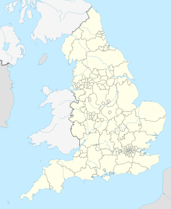
Ventongimps Moor (England)
Area of Search Cornwall
Grid reference SW781510
Coordinates 50°19′05″N5°07′05″W / 50.3181°N 5.1181°W / 50.3181; -5.1181 Coordinates: 50°19′05″N5°07′05″W / 50.3181°N 5.1181°W / 50.3181; -5.1181
InterestBiological
Area8.2 hectares (0.082 km2; 0.032 sq mi)
Notification 1951 (1951)
Natural England website

Ventongimps Moor is a moorland nature reserve and Site of Special Scientific Interest (SSSI), noted for its biological characteristics, in mid Cornwall, England, United Kingdom. The site, important for the occurrence of the plant Dorset heath, was the first reserve to be purchased by the Cornwall Wildlife Trust.

Contents

History

The moor was mentioned in 1311, being called "Funtenvaes", meaning well or spring. [1]

Ventongimps Moor was the first nature reserve to be bought by the newly founded Cornwall Wildlife Trust in 1966. The site was spotted by a Trust volunteer, Dr Frank Smith, and purchased because it was under threat from intensive agriculture activities. [2] [3]

A Second World War bomber was discovered on the site in 1977 and subsequently removed for restoration, leaving behind a new pond on the moor. [1]

Geography

The 8.2-hectare (20-acre) SSSI, notified in 1951, is located within Perranzabuloe civil parish, near the hamlet of Ventongimps, 5 miles (8.0 km) north-west of the city of Truro. [4] [5]

The nature reserve is currently owned and managed by the Cornwall Wildlife Trust. [1]

Wildlife and ecology

The moor's predominant habitat is wet dwarf shrub heath, although others include bogland, marshland, mixed deciduous woodland and open water. The Cornwall Wildlife Trust utilises periodic burning and partial removal of scrub to manage the site. [6]

Of particular interest to the site are two Red Data Book plants, Dorset Heath ( Erica ciliaris ) and Cornish eyebright ( Euphrasia vigursii ). Other flora found on the site include Cornish Moneywort ( Sibthorpia europaea ), the hybrid heath 'Dawn' ( Erica x watsonii ), [7] Hay-scented Buckler Fern ( Dryopteris aemula ), Wavy-leaved St John's Wort ( Hypericum undulatum ), Yellow Bartsia ( Parentucellia viscosa ) and Yellow Centaury ( Cicendia filiformis ). [6]

The nationally rare Scarce Blue-tailed Damselfly (Ischnura pumilio) is one of the 13 species of dragonfly and damselfly that the ponds on the moor supports. The site also supports 99 recorded species of Lepidoptera. [1] [6]

Related Research Articles

Cotswold Water Park

The Cotswold Water Park is the United Kingdom's largest marl lake system, straddling the Wiltshire–Gloucestershire border, northwest of Cricklade and south of Cirencester. The lakes were created in the second half of the 20th century by extraction of glacial Jurassic limestone gravel, which had eroded from the Cotswold Hills, and these filled naturally after working began to cease in the early 1970s.

Goonhilly Downs

Goonhilly Downs is a Site of Special Scientific Interest (SSSI) that forms a raised plateau in the central western area of the Lizard peninsula in southern Cornwall, England, UK. Situated just south of Helston and the Royal Naval Air Station RNAS Culdrose, it is famous for its Goonhilly Satellite Earth Station, at one time the largest in the world. The large satellite dishes are an iconic landmark, and can be seen for miles.

Aire Point to Carrick Du SSSI

Aire Point to Carrick Du SSSI is a Site of Special Scientific Interest on the Penwith Peninsula, Cornwall, England. It is 5.98 square kilometres in extent, stretching from grid reference SW360279 to grid reference SW513410. The site is designated both for its biological and its geological interest.

Coombe Hill Canal

Coombe Hill Canal lies in the Vale of Gloucester, south west England, north of Leigh and runs west 2.75 miles (4.43 km) from Coombe Hill Basin to the River Severn near Wainlode Hill. It opened in 1796 and closed 80 years later in 1876, after the only lock was damaged by flooding. The Gloucestershire Wildlife Trust purchased the Coombe Hill Canal nature reserve in 1985 and the area is managed by the trust. Adjacent to the Coombe Hill Canal is a large area of wet meadowland situated midway between Gloucester and Tewkesbury to the west of the A38, which was purchased by the trust in 1999. There is a north and a south meadow. This land and the Canal itself often flood in winter, which attracts hundreds of wildfowl.

Goss Moor

Goss Moor is a national nature reserve in Cornwall, England, 12 kilometres (7.5 mi) south-west of Bodmin in the parishes of St Dennis, St Columb Major, Roche and St Enoder. It is the largest continuous mire complex in south-west Britain and consists of mainly peatland and lowland heath. Together with the neighbouring moor to the east, it forms the Goss And Tregoss Moors Site of Special Scientific Interest (SSSI), as well as the Breney Common and Goss and Tregoss Moors Special Area of Conservation (SAC).

Catcott, Edington and Chilton Moors

Catcott, Edington and Chilton Moors SSSI is a 1083 hectare biological Site of Special Scientific Interest in Somerset, England notified in 1967. It is close to the villages of Edington and Catcott.

Shapwick Heath

Shapwick Heath is a 394.0-hectare biological Site of Special Scientific Interest and national nature reserve between Shapwick and Westhay in Somerset, notified in 1967. It is part of the Brue Valley Living Landscape conservation project. The project commenced in January 2009 and aims to restore, recreate and reconnect habitat. It aims to ensure that wildlife is enhanced and capable of sustaining itself in the face of climate change while guaranteeing farmers and other landowners can continue to use their land profitably. It is one of an increasing number of landscape scale conservation projects in the UK.

Broadmoor to Bagshot Woods and Heaths

Broadmoor to Bagshot Woods and Heaths is a 1,696.3-hectare (4,192-acre) biological Site of Special Scientific Interest (SSSI) in Berkshire and Surrey that extend from a minority of the parish of Crowthorne including around Broadmoor Hospital in the west to Bagshot south-east, Bracknell north-east, and Sandhurst, south. It is part of the Thames Basin Heaths Special Protection Area. Two nature reserves which are managed by the Surrey Wildlife Trust are in the SSSI, Barossa nature reserve and Poors Allotment. Broadmoor Bottom, which is part of Wildmoor Heath, also falls within the SSSI; this reserve is managed by the Berkshire, Buckinghamshire and Oxfordshire Wildlife Trust.

Redlake Meadows & Hoggs Moor

Redlake Meadows & Hoggs Moor is a Site of Special Scientific Interest (SSSI), noted for its biological characteristics, in Cornwall, England, UK. Within the SSSI is Redlake Cottage Meadows nature reserve owned by the Cornwall Wildlife Trust.

Sandhurst to Owlsmoor Bogs and Heaths

Sandhurst to Owlsmoor Bogs and Heaths is an 85.8-hectare (212-acre) biological Site of Special Scientific Interest (SSSI) on the northern outskirts of Sandhurst in Berkshire. Part of the SSSI is Wildmoor Heath nature reserve, which is managed by the Berkshire, Buckinghamshire and Oxfordshire Wildlife Trust. and the SSSI is part of Thames Basin Heaths Special Protection Area.

Decoy Pit, Pools and Woods

Decoy Pit, Pools and Woods is a 17.7-hectare (44-acre) biological Site of Special Scientific Interest south of Aldermaston in Berkshire. An area of 8 hectares is a nature reserve called Decoy Heath, which is managed by the Berkshire, Buckinghamshire and Oxfordshire Wildlife Trust.

Red Moor (nature reserve)

Red Moor is a nature reserve and Site of Special Scientific Interest (SSSI), noted for its biological characteristics, near Lanlivery in mid Cornwall, England, UK.

Caerthillian to Kennack

Caerthillian to Kennack is a coastal Site of Special Scientific Interest (SSSI) on the Lizard Peninsula in Cornwall, UK, noted for both its biological and geological characteristics. It is of great botanical importance, with several Red Data Book of rare and endangered plant species being found on the site, as well as a breeding site for Cornish choughs.

Steeple Point to Marsland Mouth

Steeple Point to Marsland Mouth is a coastal Site of Special Scientific Interest (SSSI) in Cornwall, England, UK, noted for its biological characteristics.

Godrevy Head to St Agnes

Godrevy Head to St Agnes is a coastal Site of Special Scientific Interest (SSSI) in north Cornwall, England, UK, noted for both its biological and geological characteristics. A number of rare and scarce plant species can be found on the site, along with many breeding seabirds.

Rosenannon Downs

Rosenannon Downs is a nature reserve in mid Cornwall, England, UK, being designated Rosenannon Bog and Downs Site of Special Scientific Interest (SSSI), noted for its biological characteristics. The site supports a wide variety of flora and fauna and includes Bronze Age barrows. Conservation work is carried out on the site by the owners, the Cornwall Wildlife Trust.

Ferndown Common

Ferndown Common is a Site of Special Scientific Interest (SSSI) on the edge of Ferndown in Dorset, England. It is currently owned by the Wimborne Estate and leased to the Amphibian and Reptile Conservation Trust (ARC), who manage it to preserve the site's rare wildlife. The site was notified as an SSSI in 1984.

Hartland Moor

Hartland Moor is a Site of Special Scientific Interest (SSSI) on the south side of Poole Harbour near the town of Wareham in Dorset, England. It consists of lowland heathland.

Chyenhal Moor Site of Special Interest in Cornwall

Chyenhal Moor is a poorly drained shallow valley, 2 miles (3.2 km) to the south-west of Penzance, Cornwall. Due to several rare plants in a diverse range of habitats, it was notified as a Site of Special Scientific Interest (SSSI) in 1951.

Ripon Parks Site of Special Scientific Interest in North Yorkshire, England

Ripon Parks is a Site of Special Scientific Interest, or SSSI, situated north of Ripon, to the west of the River Ure and to the east of the village of North Stainley, in North Yorkshire, England. It was once part of the land held since the Middle Ages as a deer park by the archbishops of York and the canons of Ripon. The site was designated as an SSSI in 1983, because its varied habitats are valued for their breeding birds, amphibians and varied flora. The woods here are "of note" for the parasitic flowers of common toothwort and yellow star-of-Bethlehem. A small part of the site is accessible via public footpaths; there are no public facilities or dedicated car parks. The site incorporates the High Batts Nature Reserve, which is privately run for training, recording and educational purposes, and accessible to members only, except for its annual open day. Ripon Parks is now owned by the Ministry of Defence, and parts of the site are used as military training areas.

References

  1. 1 2 3 4 "Ventongimps Moor Nature Reserve". Cornwall Wildlife Trust . Retrieved 29 January 2012.
  2. "Trust members celebrate five decades of protecting wildlife and habitats". this is Cornwall. 23 January 2012. Retrieved 30 January 2012.
  3. "A 'golden' year for Cornwall Wildlife Trust". Cornwall Wildlife Trust. 20 January 2012. Retrieved 30 January 2012.
  4. "Ventongimps Moor map". Natural England . Retrieved 29 January 2012.
  5. Ordnance Survey: Explorer Map 104 Redruth & St Agnes ISBN   978-0-319-23705-2
  6. 1 2 3 "Ventongimps Moor" (PDF). Natural England. 1984. Retrieved 29 January 2012.
  7. "Erica × watsonii 'Dawn'". The Plant Finder's Encyclopedia. Plant Press. Retrieved 29 January 2012.